This page is not an official page of the app or its developer, but an independent editorial publication created for informational and commentary purposes. Unless expressly stated otherwise, neither the app nor its developer is affiliated with, endorsed by, sponsored by, authorized by, or otherwise officially connected with MWM, Apple, Google Play, the app publisher, or the app's developer, and nothing on this page implies that the app was developed using MWM's services. Any trademarks, logos, screenshots, and other content remain the property of their respective owners.

Agro Measure Map Pro
Transform your iPad or iPhone into a professional-grade GIS tool. Calculate field areas, generate seedling grids, and create buffer zones with laser-sharp accuracy to optimize your operations and maximize ROI.
Downloads
28K+User Rating
Total Ratings
0Publisher
Category
UtilitiesLocales
10Latest Version
8.10.5Size
239.1 MBFirst Released
Jan 29, 2015Precision Mapping for Professional Land Management
Streamline your field operations with laser-sharp measurements and advanced planning tools designed for farmers, engineers, and land developers.
Professional-Grade Accuracy
Calculate areas and perimeters with earth-curvature compensation, ensuring pinpoint precision for seed, fertilizer, and fencing budgets.
Smart Grid & Buffer Planning
Optimize your yield with automated seedling grid generators and create precise spray buffer zones to reduce chemical waste and costs.
The following screenshots and description are sourced directly from the app's official store listing and are the property of the app developer.
App Store
Screenshots
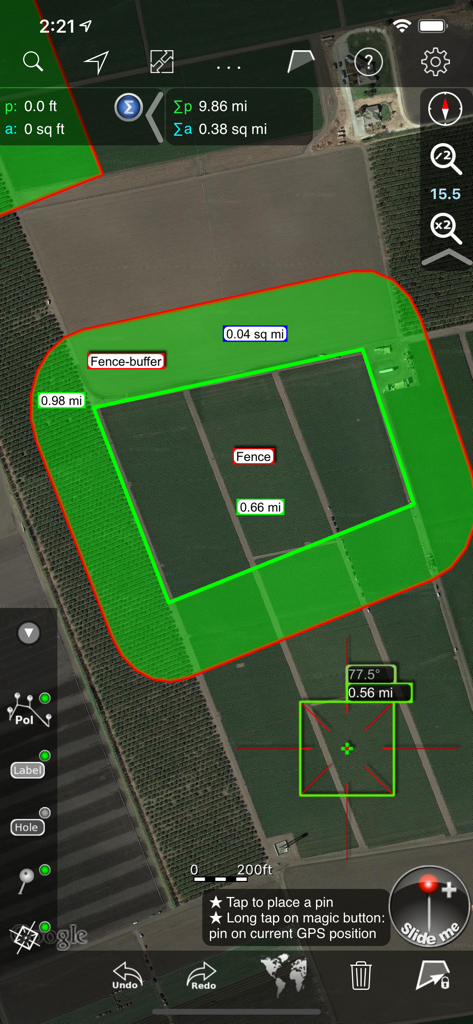
Agro Measure Map Pro interface displaying satellite imagery of agricultural land with a calculated fence buffer area and field measurements.
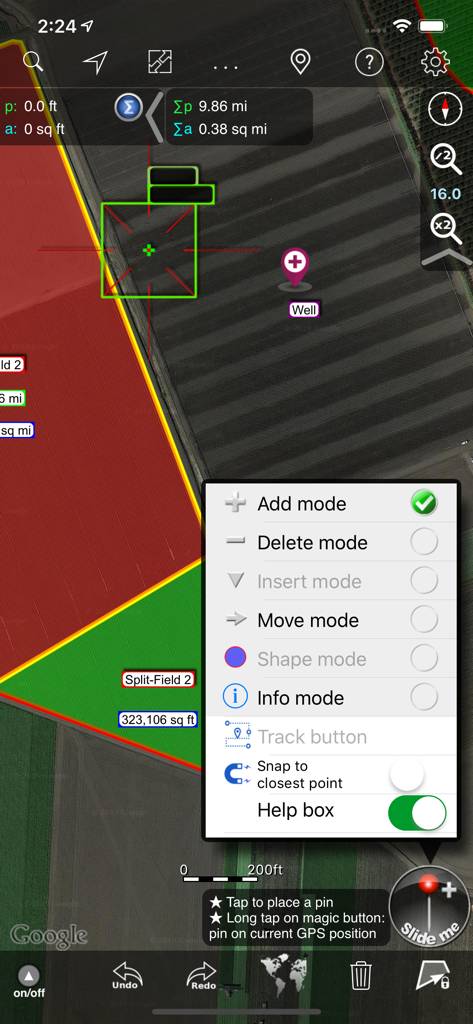
Agro Measure Map Pro interface showing field measurement tools and editing mode selection on a satellite map.
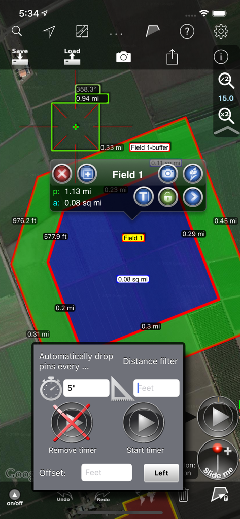
Agro Measure Map Pro interface with field measurement and automated GPS tracking options
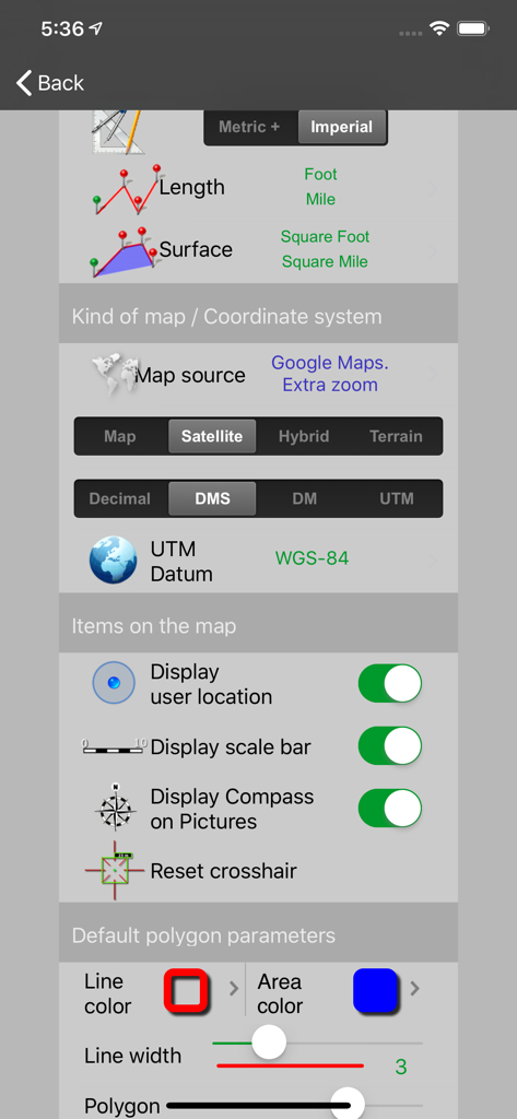
Settings screen of Agro Measure Map Pro showing configuration for units map sources coordinate systems and display options
Description
Download
More Like This
Top-ranked apps in the same category

Google LLC

Google Chrome
Google LLC

中国移动(手机营业厅)
China Mobile Online Services Co., Ltd.

Google Authenticator
Google LLC

CNH do Brasil
Servicos e Informacoes do Brasil

Cleanup: Phone Storage Cleaner
DEEP FLOW SOFTWARE SERVICES - FZCO

gov.br
Servicos e Informacoes do Brasil

中国电信-全国统一官方服务平台
CHINA TELECOM Corporation Ltd.

Microsoft Edge: AI Browser
Microsoft Corporation
This page is not an official page of the app or its developer, but an independent editorial publication created for informational and commentary purposes. Unless expressly stated otherwise, neither the app nor its developer is affiliated with, endorsed by, sponsored by, authorized by, or otherwise officially connected with MWM, Apple, Google Play, the app publisher, or the app's developer, and nothing on this page implies that the app was developed using MWM's services. Any trademarks, logos, screenshots, and other content remain the property of their respective owners.