This page is not an official page of the app or its developer, but an independent editorial publication created for informational and commentary purposes. Unless expressly stated otherwise, neither the app nor its developer is affiliated with, endorsed by, sponsored by, authorized by, or otherwise officially connected with MWM, Apple, Google Play, the app publisher, or the app's developer, and nothing on this page implies that the app was developed using MWM's services. Any trademarks, logos, screenshots, and other content remain the property of their respective owners.

Altimeter GPS & Barometer
Conquer the backcountry with the ultimate offline survival toolkit. Access high-accuracy altitude readings, barometric data, and reliable navigation tools designed for serious mountaineers—no internet connection required.
Downloads
799K+User Rating
Total Ratings
5K+Publisher
Category
NavigationLocales
14Latest Version
7.2Size
98.0 MBFirst Released
Nov 8, 2012Master Every Peak with Unmatched Precision
Professional-grade navigation tools built for the backcountry, functioning perfectly even when you're completely offline.
Zero-Signal Reliability
Navigate remote wilderness using internal GPS and barometric sensors—no cellular data or Wi-Fi required.
Pro-Grade Altitude Data
Experience surgical precision with our Pure Altitude Algorithm, combining GPS, Aster, and barometric inputs.
Frequently Asked Questions
Everything you need to know about Altimeter GPS & Barometer
Does Altimeter GPS require an internet connection to function?
Yes, Altimeter GPS is designed for offline use. It directly reads your iPhone's GPS and barometer data with advanced algorithms, making an internet connection unnecessary for core altitude and speedometer functions.
What features are included in the Altimeter GPS app?
Altimeter GPS offers accurate altimeter, speedometer, barometer, pedometer, sunrise/sunset calculator, position finder, flashlight, compass, chronometer, and multiple map types.
How does Altimeter GPS determine altitude readings?
Altimeter GPS measures precise altitude using its "Pure Altitude Algorithm." It utilizes GPS, Aster, or barometric data from your iPhone's sensors without needing an internet connection.
Can I use Altimeter GPS to track my steps?
Yes, Altimeter GPS includes a Pedometer/Step Counter. It utilizes the M7 co-processor in iPhone 5s/6/6 Plus models to count steps automatically without requiring any setup.
Does Altimeter GPS offer different types of maps?
Yes, Altimeter GPS provides multiple map types for navigation, including Open Street Map, Hike Map, Stamen Map, and Open Cycle Map. It also allows saving locations and finding directions.
How do I manage my Altimeter GPS subscription and auto-renewal?
You can manage your Altimeter GPS subscriptions and turn off auto-renewal from your iTunes Account Settings after purchase. Auto-renewal must be turned off at least 24 hours before the current period ends.
Does Altimeter GPS provide sunrise and sunset times?
Yes, Altimeter GPS includes a Sunrise/Sunset Calculator. This feature uses a proprietary algorithm based on your GPS coordinates to help plan outdoor activities precisely.
What are the subscription options for Altimeter GPS?
Altimeter GPS offers weekly, monthly, and yearly subscription lengths. Payment is charged to your iTunes Account upon confirmation of purchase.
Can Altimeter GPS track hiking trails?
Yes, Altimeter GPS allows users to track hiking trails. The app can display waymarked trails, their length, and elevation profiles, as shown in the Trails feature.
Can I use Altimeter GPS to find my way back to a starting point?
Yes, Altimeter GPS features a Position Finder. This allows you to mark your starting point and then determine the shortest route back to that location.
The following screenshots and description are sourced directly from the app's official store listing and are the property of the app developer.
App Store
Screenshots
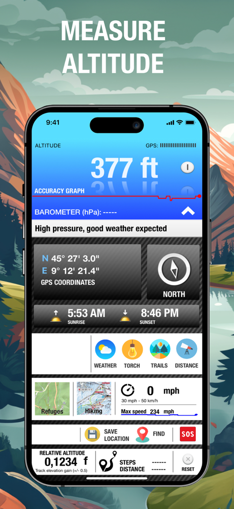
Altimeter GPS app interface showing altitude readings and navigation dashboard
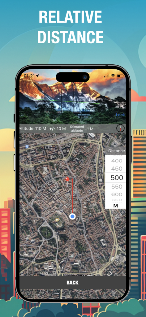
Altimeter GPS app showing relative distance measurement between user location and a target point on a satellite map
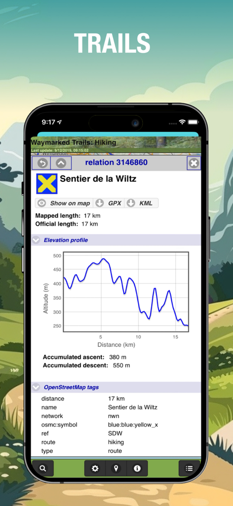
Elevation profile graph and trail data on the Altimeter GPS hiking app
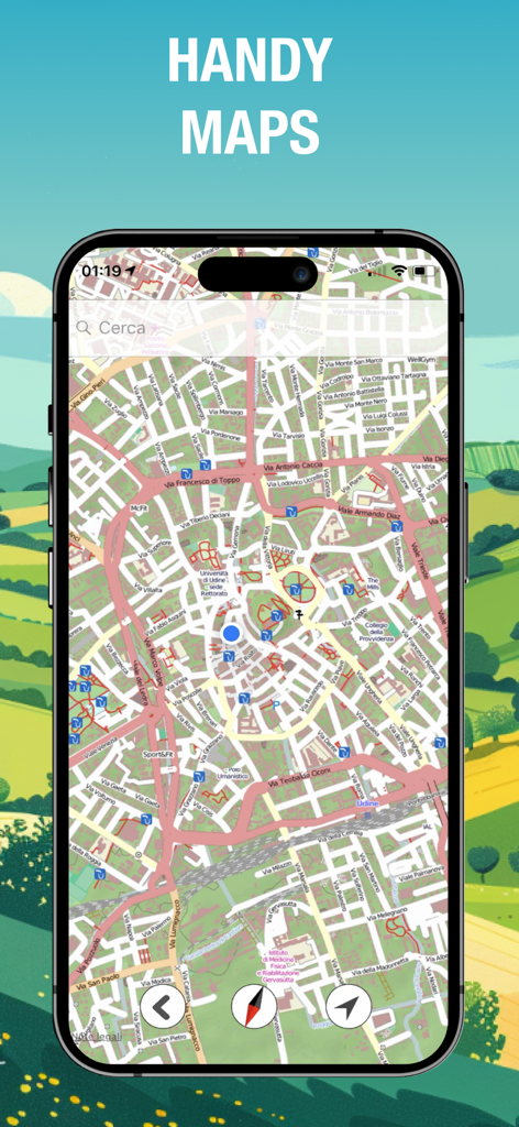
Navigation map interface in the Altimeter GPS app for backcountry hiking
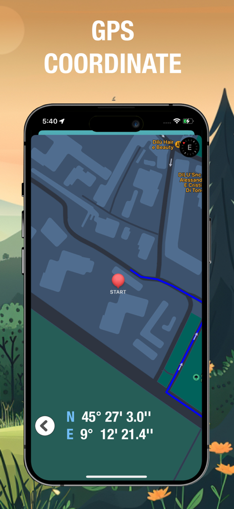
Smartphone screen of Altimeter GPS app displaying precise latitude and longitude coordinates on a navigation map with a route marker.
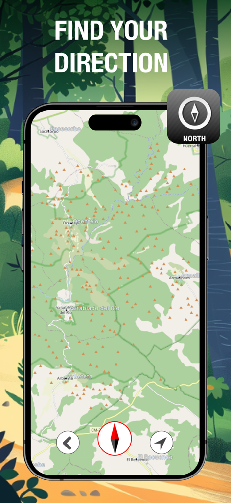
Altimeter GPS app displaying a topographic map and compass for backcountry navigation
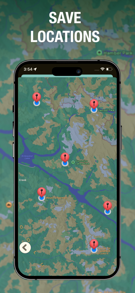
Altimeter GPS app displaying multiple saved waypoints on a topographic map for backcountry navigation
Description
Download
More Like This
Apps with similar features and user experience

经纬度指南针-测方位实时海拔天气相机
Guangzhou Duoyi Network Technology Co., Ltd.

My Altitude: GPS Altimeter
Enacti Ventures Private Limited

Compass & GPS
Seong Eon Kim

Compass App - Qibla finder
Simple Start Technologies

Compass & Coordinates Locator
ALVICOMP OU

Compass∞
Camera LLC(TX)

Compass - Professional
Peter Bohl

Elevation - Altimeter Map
Mapnitude Company Limited

Compass - GPS Altimeter
伟 雷
This page is not an official page of the app or its developer, but an independent editorial publication created for informational and commentary purposes. Unless expressly stated otherwise, neither the app nor its developer is affiliated with, endorsed by, sponsored by, authorized by, or otherwise officially connected with MWM, Apple, Google Play, the app publisher, or the app's developer, and nothing on this page implies that the app was developed using MWM's services. Any trademarks, logos, screenshots, and other content remain the property of their respective owners.