This page is not an official page of the app or its developer, but an independent editorial publication created for informational and commentary purposes. Unless expressly stated otherwise, neither the app nor its developer is affiliated with, endorsed by, sponsored by, authorized by, or otherwise officially connected with MWM, Apple, Google Play, the app publisher, or the app's developer, and nothing on this page implies that the app was developed using MWM's services. Any trademarks, logos, screenshots, and other content remain the property of their respective owners.

ArcGIS Field Maps
Empower your mobile workforce with industry-leading GIS tools. Streamline inspections, capture real-time data, and work seamlessly offline to bridge the gap between the field and the office.
Downloads
989K+User Rating
Total Ratings
200Publisher
Category
ProductivityLocales
31Latest Version
25.3.1Size
144.1 MBFirst Released
Nov 1, 2020Streamline Your Professional Field Operations
The most trusted tool for field technicians to collect high-accuracy data, work offline, and keep the entire organization in sync.
High-Accuracy Data Capture
Achieve sub-centimeter precision with external GNSS integration and smart forms that eliminate manual entry errors.
Uninterrupted Offline Access
Download critical maps and perform full inspections in remote zones, with automatic synchronization once connectivity is restored.
Frequently Asked Questions
Everything you need to know about ArcGIS Field Maps
What is ArcGIS Field Maps used for?
ArcGIS Field Maps is Esri's premier mobile maps app for field workers. It helps them understand surroundings, find assets, collect data, and perform inspections using interactive digital maps.
Does ArcGIS Field Maps allow offline work?
Yes, ArcGIS Field Maps allows users to download pre-created offline map areas or create their own on-device. Edits sync automatically or manually once connected to the internet.
Can I collect high-accuracy data with ArcGIS Field Maps?
Yes, ArcGIS Field Maps connects to external GNSS receivers for high-accuracy data collection. It supports creating new or editing existing asset data with precision.
Does ArcGIS Field Maps provide geofence alerts?
Yes, ArcGIS Field Maps provides geofence alerts to notify users when they enter specific areas. This feature helps ensure safety, for example, in fire zones or work areas.
How does ArcGIS Field Maps support field inspections?
ArcGIS Field Maps supports field inspections by allowing users to digitally document records, capture photos and videos, and use smart forms for efficient data entry and automated calculations.
Does ArcGIS Field Maps support indoor mapping?
Yes, ArcGIS Field Maps supports viewing assets and locations within floor-aware indoor maps. This allows for detailed navigation and data collection in indoor environments.
Is an ArcGIS organizational account required to use ArcGIS Field Maps?
Yes, an ArcGIS organizational account is required to collect and update data within ArcGIS Field Maps. However, public maps shared by organizations can be viewed without signing in.
Can users annotate maps in ArcGIS Field Maps?
Yes, users can annotate directly on the map in ArcGIS Field Maps using a finger or stylus. This allows for creating personal notes and marking up map areas.
Can ArcGIS Field Maps track user locations for team coordination?
Yes, ArcGIS Field Maps can share user locations with supervisors and teammates when enabled. It also allows viewing teammate locations to coordinate efforts and ensure safety.
What types of tasks can be managed in ArcGIS Field Maps?
ArcGIS Field Maps manages various field tasks, such as inspecting damaged street signs, identifying overflowing bins, or locating litter/junk. Users can view assigned tasks and their details.
The following screenshots and description are sourced directly from the app's official store listing and are the property of the app developer.
App Store
Screenshots
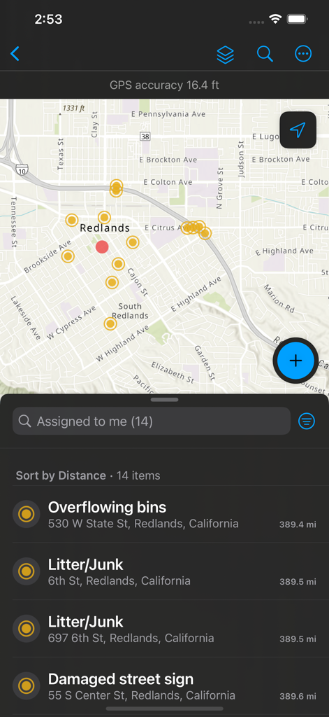
ArcGIS Field Maps mobile screen showing a map with data points and a list of assigned field tasks such as overflowing bins and damaged signs
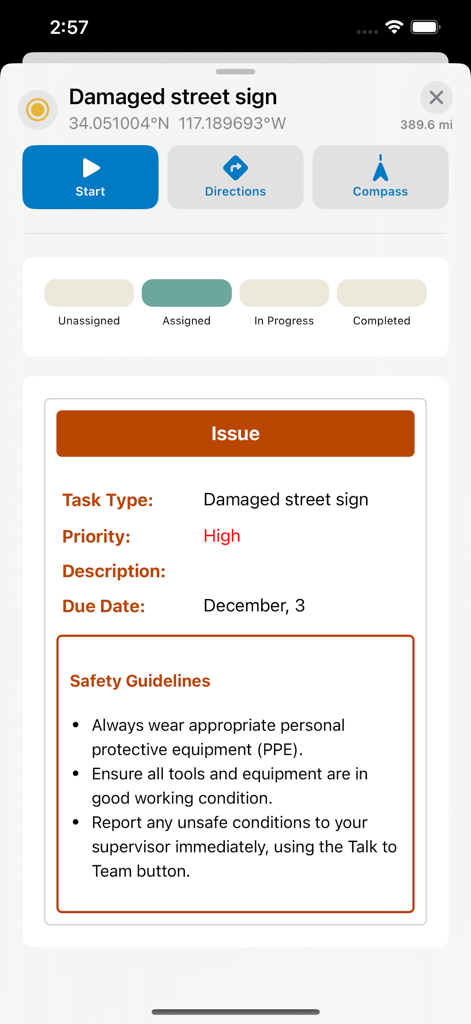
ArcGIS Field Maps screen showing a field task for a damaged street sign with GPS coordinates and safety guidelines
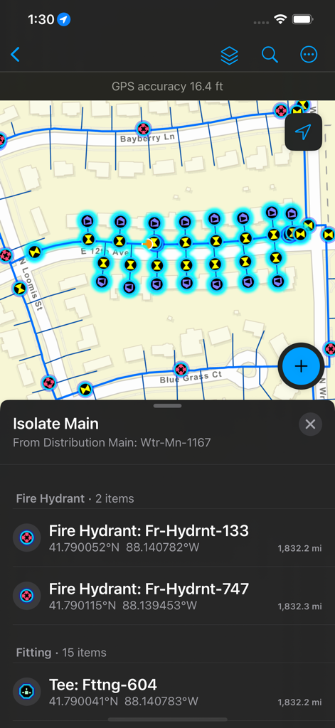
ArcGIS Field Maps screen showing a utility network map with fire hydrant locations and asset details
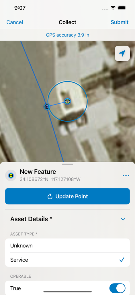
ArcGIS Field Maps interface showing satellite map data collection with a smart form for recording asset details and high GPS precision.
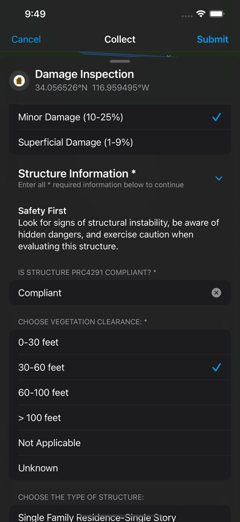
ArcGIS Field Maps mobile interface showing a digital damage inspection smart form for field data collection
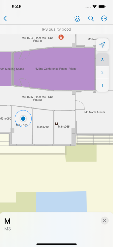
ArcGIS Field Maps interface showing an indoor floor plan with room labels and floor level selection.
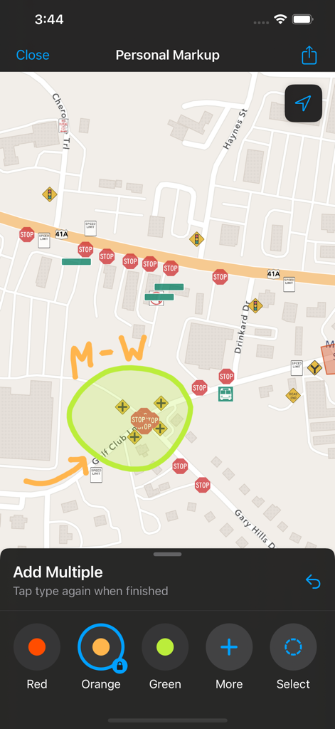
ArcGIS Field Maps screen showing personal markup annotations on a street map
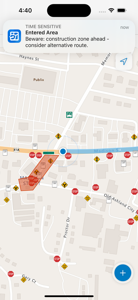
ArcGIS Field Maps mobile interface displaying a geofence alert for a construction zone on a street map
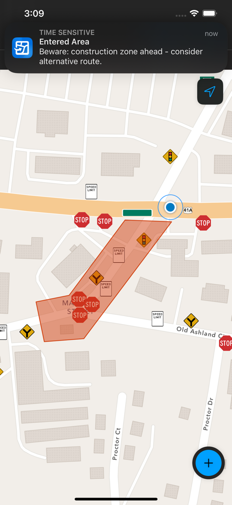
ArcGIS Field Maps interface showing a geofence notification for an entered construction zone on a map.
Description
Download
More Like This
Apps with similar features and user experience

MilGPS
Cascode Labs Pty Ltd

SEAiq Pilot VPP
Sakhalin, LLC

Cartograph Maps 3
Harald Meyer

新知卫星地图-路线规划,高清地图导航
Chongqing Xinzhi Space Technology Co., Ltd.

Coordinates – GPS Converter
Mapnitude Company Limited

Mgrs & Utm Map
Vahid Cataltas

DeepStateMap
Heorhii Karpenko

Map Plus
Miocool Inc.

Compass 55. Map & GPS kit.
Kalimex-Consulting s.r.o.
This page is not an official page of the app or its developer, but an independent editorial publication created for informational and commentary purposes. Unless expressly stated otherwise, neither the app nor its developer is affiliated with, endorsed by, sponsored by, authorized by, or otherwise officially connected with MWM, Apple, Google Play, the app publisher, or the app's developer, and nothing on this page implies that the app was developed using MWM's services. Any trademarks, logos, screenshots, and other content remain the property of their respective owners.