This page is not an official page of the app or its developer, but an independent editorial publication created for informational and commentary purposes. Unless expressly stated otherwise, neither the app nor its developer is affiliated with, endorsed by, sponsored by, authorized by, or otherwise officially connected with MWM, Apple, Google Play, the app publisher, or the app's developer, and nothing on this page implies that the app was developed using MWM's services. Any trademarks, logos, screenshots, and other content remain the property of their respective owners.

Area Measure & GIS GPS GMapper
Turn your device into a powerful field tool for coordinate capture, acreage measurement, and professional survey logging. Seamlessly export data in KML, GeoJSON, or Excel for a precision-driven workflow.
Downloads
3K+User Rating
Total Ratings
0Publisher
Category
UtilitiesLocales
1Latest Version
1.15.2Size
122.5 MBFirst Released
Jun 2, 2024Professional Precision for Field Mapping
Advanced GIS tools and high-accuracy measurements designed for surveyors, farmers, and land managers to optimize field workflows and data collection.
High-Precision Area Measurement
Calculate acreage and distances with professional-grade accuracy, enabling efficient land planning for agriculture and construction.
Seamless Data Integration
Streamline your office workflow by exporting field survey data directly into industry-standard formats like KML, GeoJSON, and Excel.
The following screenshots and description are sourced directly from the app's official store listing and are the property of the app developer.
App Store
Screenshots
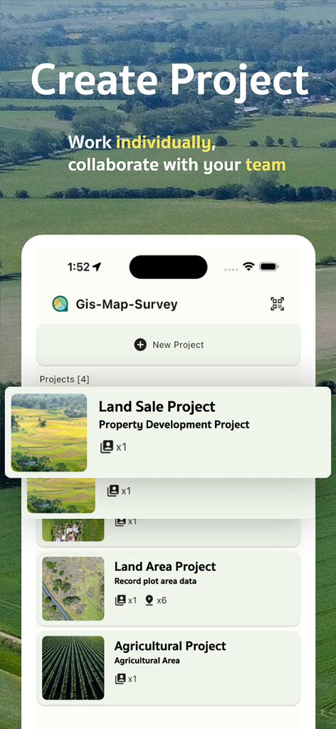
GMapper mobile interface for creating and managing land survey and agricultural projects with team collaboration
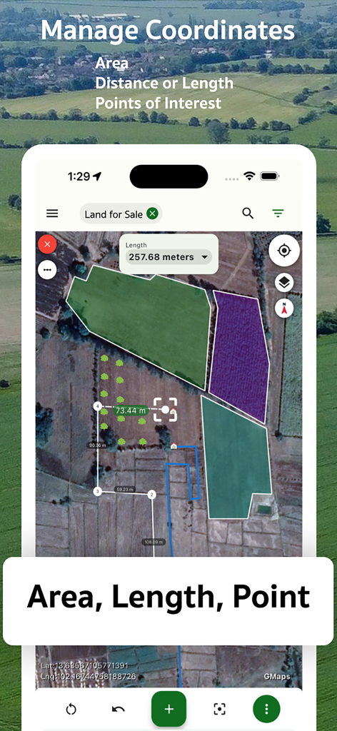
A mobile app displaying geographical measurements and land coordinates on a satellite map.
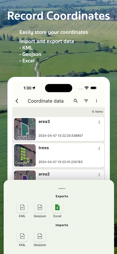
Interface for recording and exporting geographical coordinate data to KML, GeoJSON, and Excel formats.
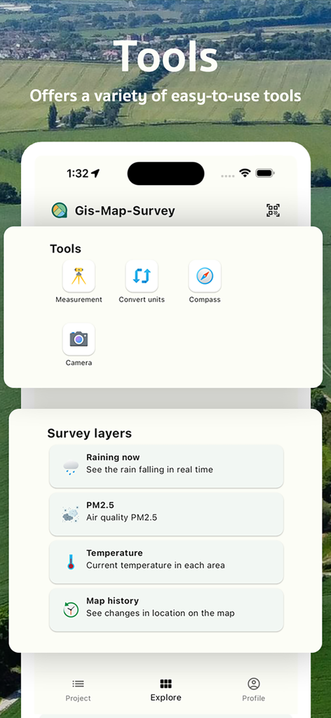
Interface of GMapper app showing land measurement tools and environmental survey layers over an aerial field view
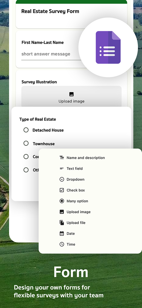
Interface for designing custom real estate survey forms within the GIS mapping app
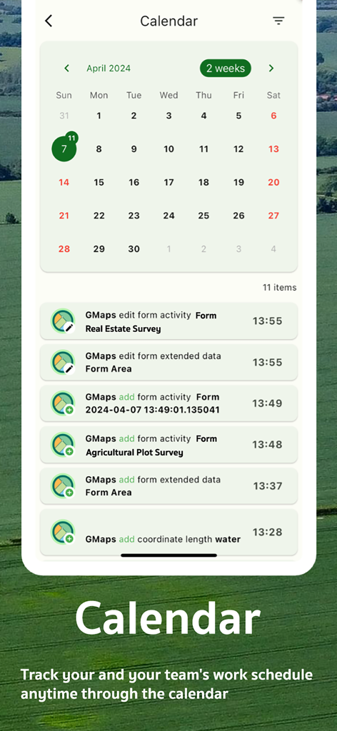
GMapper app calendar interface tracking surveying and land management activities

Interface for managing team member roles and account permissions in the GIS app
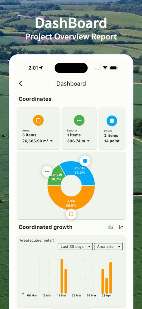
A mobile dashboard showing land measurement statistics including areas lengths and point data with a growth chart
Description
Download
More Like This
Top-ranked apps in the same category

Google LLC

Google Chrome
Google LLC

中国移动(手机营业厅)
China Mobile Online Services Co., Ltd.

Google Authenticator
Google LLC

CNH do Brasil
Servicos e Informacoes do Brasil

Cleanup: Phone Storage Cleaner
DEEP FLOW SOFTWARE SERVICES - FZCO

gov.br
Servicos e Informacoes do Brasil

中国电信-全国统一官方服务平台
CHINA TELECOM Corporation Ltd.

Microsoft Edge: AI Browser
Microsoft Corporation
This page is not an official page of the app or its developer, but an independent editorial publication created for informational and commentary purposes. Unless expressly stated otherwise, neither the app nor its developer is affiliated with, endorsed by, sponsored by, authorized by, or otherwise officially connected with MWM, Apple, Google Play, the app publisher, or the app's developer, and nothing on this page implies that the app was developed using MWM's services. Any trademarks, logos, screenshots, and other content remain the property of their respective owners.