This page is not an official page of the app or its developer, but an independent editorial publication created for informational and commentary purposes. Unless expressly stated otherwise, neither the app nor its developer is affiliated with, endorsed by, sponsored by, authorized by, or otherwise officially connected with MWM, Apple, Google Play, the app publisher, or the app's developer, and nothing on this page implies that the app was developed using MWM's services. Any trademarks, logos, screenshots, and other content remain the property of their respective owners.

Compass: GPS & Altimeter
The all-in-one outdoor tool for hikers, explorers, and professionals. Track altitude, monitor 3D terrain, and capture your journey with professional-grade geographic data—no signal required.
Downloads
12K+User Rating
Total Ratings
100Publisher
Category
TravelLocales
33Latest Version
2.1.4Size
31.4 MBFirst Released
May 14, 2025Master Every Trail and Terrain
From mountain peaks to remote deserts, get professional-grade navigation and real-time environmental data—even when you’re completely off-grid.
Precision Pro Navigation
Stay on course with 3D terrain views and magnetic field monitoring to prevent misdirection in the deep wilderness.
Real-Time Altitude & Weather
Track barometric pressure, wind speed, and altitude trends to stay ahead of sudden mountain weather changes.
The following screenshots and description are sourced directly from the app's official store listing and are the property of the app developer.
App Store
Screenshots
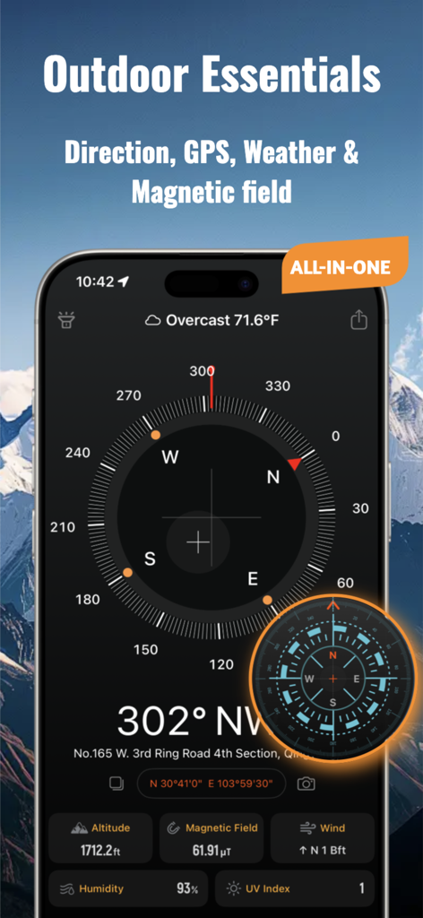
Compass GPS and Altimeter app interface showing direction weather and altitude information for outdoor exploration
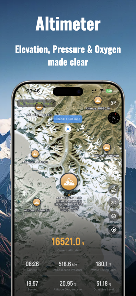
Altimeter screen displaying elevation atmospheric pressure and oxygen levels on a satellite map
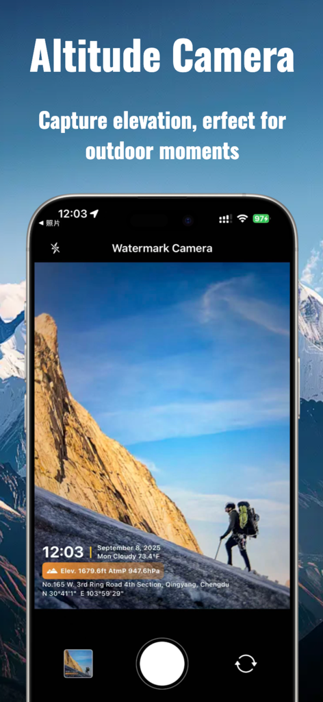
Altitude camera interface displaying GPS location and elevation data on a mountain hiking photo
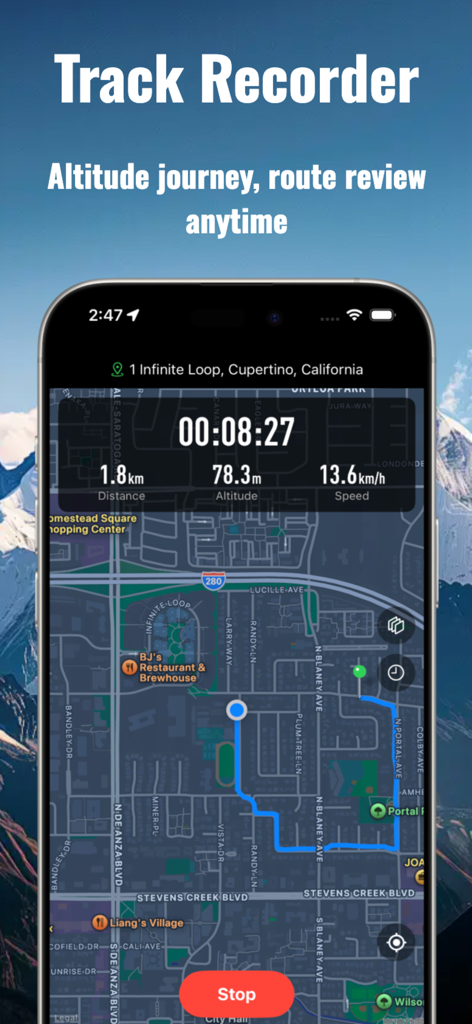
A smartphone screen showing the track recorder feature with a mapped route and real-time distance altitude and speed data

A grid of various compass and altimeter design themes in the mobile app interface.
Description
Download
More Like This
Apps with similar features and user experience

Realtime Altimeter
Zhenlai Xia

Travel Camera & Compass
Ha Nguyen

compass-latitude and longitude
美霞 熊

Compass ×
DOUBLE U s.r.o.

GPS Altitude-海拔表
祥琦 孔

Compass - GPS positioning
嘉 罗

Compass360X-GPS Speedometer
卫豪 吴

指南针-GPS经纬度海拔定位
Chongqing Xinzhi Space Technology Co., Ltd.

Travel Altimeter & Elevation
BranchenKing Ltd.
This page is not an official page of the app or its developer, but an independent editorial publication created for informational and commentary purposes. Unless expressly stated otherwise, neither the app nor its developer is affiliated with, endorsed by, sponsored by, authorized by, or otherwise officially connected with MWM, Apple, Google Play, the app publisher, or the app's developer, and nothing on this page implies that the app was developed using MWM's services. Any trademarks, logos, screenshots, and other content remain the property of their respective owners.