This page is not an official page of the app or its developer, but an independent editorial publication created for informational and commentary purposes. Unless expressly stated otherwise, neither the app nor its developer is affiliated with, endorsed by, sponsored by, authorized by, or otherwise officially connected with MWM, Apple, Google Play, the app publisher, or the app's developer, and nothing on this page implies that the app was developed using MWM's services. Any trademarks, logos, screenshots, and other content remain the property of their respective owners.

Field Area Measure on GPS Map
Calculate acreage, track boundaries, and manage land projects with professional-grade accuracy. The essential offline tool for farmers, real estate agents, and surveyors to measure any plot and export reports instantly.
Downloads
600User Rating
Total Ratings
0Publisher
Category
UtilitiesLocales
1Latest Version
1.5Size
97.6 MBFirst Released
Jul 15, 2025Measure Land with Professional Precision
Calculate area, distance, and perimeter in seconds. Whether you're in the field or the office, get the accurate data you need for farming, real estate, and construction.
GPS Boundary Tracking
Calculate field size and perimeter by simply walking the boundary with your phone—perfect for large-scale farm and property management.
Reliable Offline Access
Work with confidence in remote rural areas. Map and measure properties even without a cellular signal, ensuring your data is always accessible.
The following screenshots and description are sourced directly from the app's official store listing and are the property of the app developer.
App Store
Screenshots
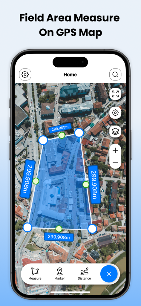
Field Area Measure on GPS Map app interface displaying a land area measurement polygon on a satellite map
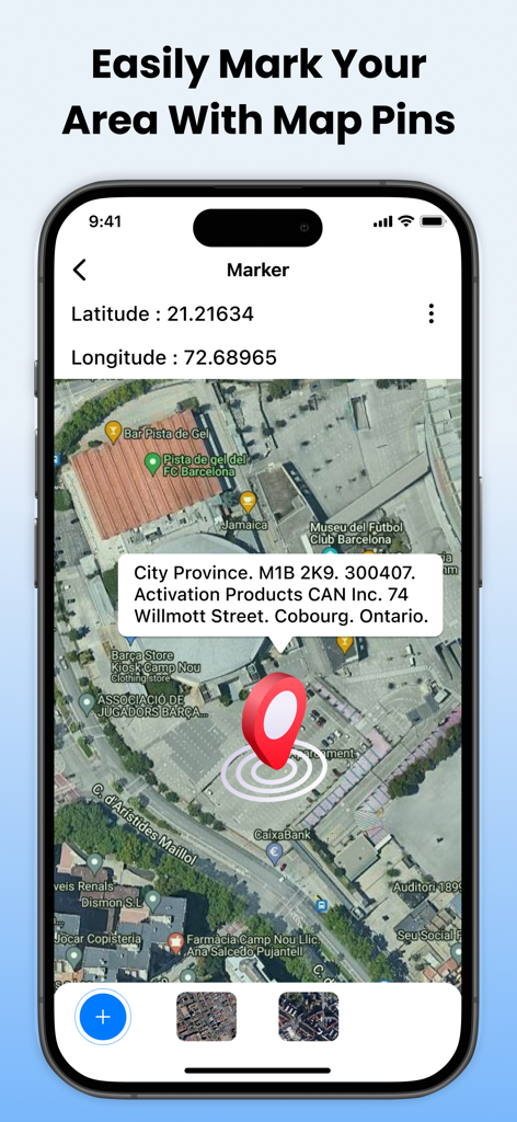
Screenshot of Field Area Measure app showing a red pin marker on a satellite map with GPS coordinates and address details.
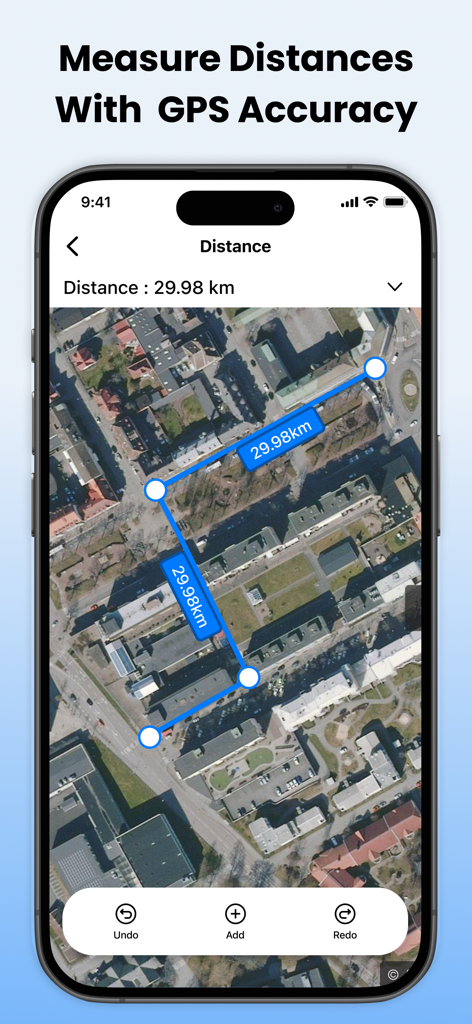
A smartphone showing a satellite map view with blue markers and lines measuring a total distance of 29.98 km
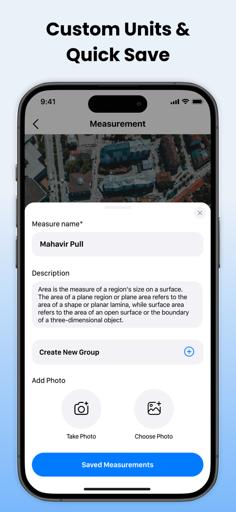
Mobile app interface showing options to name, describe, and add photos to a GPS land measurement.
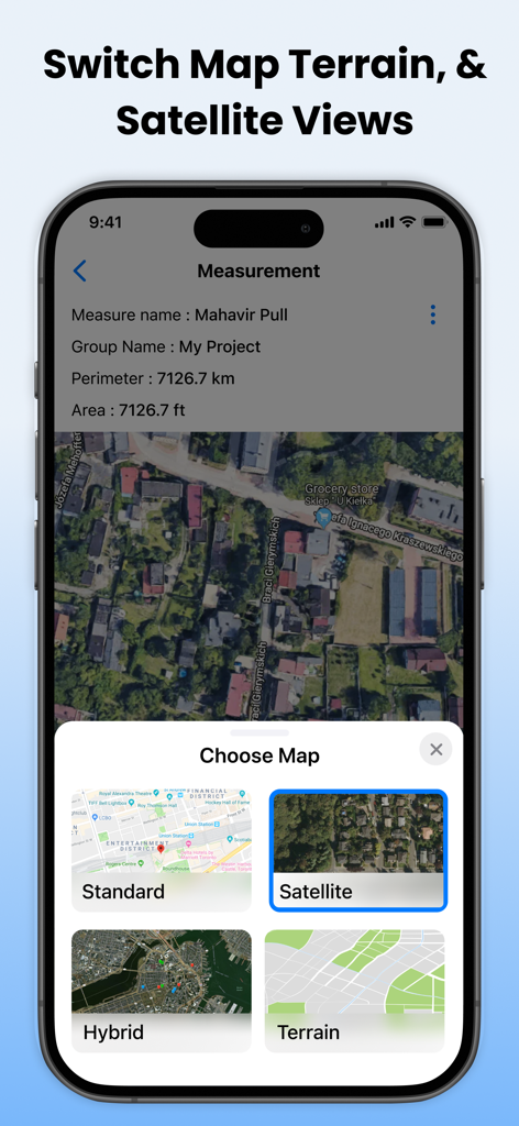
Interface showing options to switch between standard satellite hybrid and terrain map views
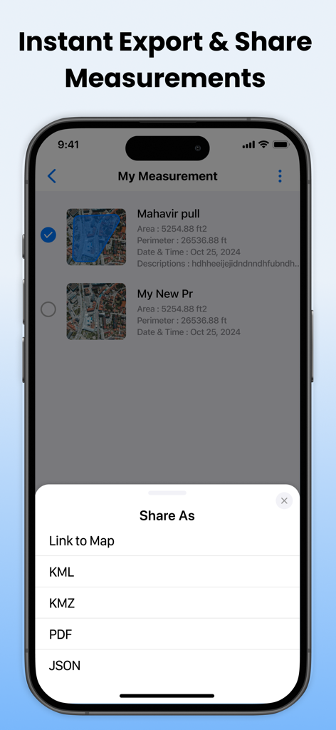
Mobile app screen showing export options for land measurements including KML and PDF formats
Description
Download
More Like This
Top-ranked apps in the same category

Google LLC

Google Chrome
Google LLC

中国移动(手机营业厅)
China Mobile Online Services Co., Ltd.

Google Authenticator
Google LLC

CNH do Brasil
Servicos e Informacoes do Brasil

Cleanup: Phone Storage Cleaner
DEEP FLOW SOFTWARE SERVICES - FZCO

gov.br
Servicos e Informacoes do Brasil

中国电信-全国统一官方服务平台
CHINA TELECOM Corporation Ltd.

Microsoft Edge: AI Browser
Microsoft Corporation
This page is not an official page of the app or its developer, but an independent editorial publication created for informational and commentary purposes. Unless expressly stated otherwise, neither the app nor its developer is affiliated with, endorsed by, sponsored by, authorized by, or otherwise officially connected with MWM, Apple, Google Play, the app publisher, or the app's developer, and nothing on this page implies that the app was developed using MWM's services. Any trademarks, logos, screenshots, and other content remain the property of their respective owners.