This page is not an official page of the app or its developer, but an independent editorial publication created for informational and commentary purposes. Unless expressly stated otherwise, neither the app nor its developer is affiliated with, endorsed by, sponsored by, authorized by, or otherwise officially connected with MWM, Apple, Google Play, the app publisher, or the app's developer, and nothing on this page implies that the app was developed using MWM's services. Any trademarks, logos, screenshots, and other content remain the property of their respective owners.

GeoMark - GPS Measurement Tool
Accurately measure property areas, distances, and boundaries using high-resolution satellite imagery. The ultimate utility for homeowners, farmers, and real estate professionals to calculate acreage and manage projects with ease.
Downloads
1K+User Rating
Total Ratings
100Publisher
Category
UtilitiesLocales
1Latest Version
3.0Size
50.8 MBFirst Released
Jan 30, 2026Master Your Land with Professional Precision
Whether you're estimating materials for a backyard DIY project or walking property lines with a client, GeoMark delivers the fast, accurate data you need to get the job done right.
Instant Acreage & Distance
Skip the manual measuring wheel. Calculate square footage or acreage in seconds by simply tapping on the map or walking the perimeter.
High-Definition Satellite Mapping
Identify landmarks and boundaries with crystal-clear aerial imagery, ensuring your measurements are pinpoint accurate down to the last foot.
The following screenshots and description are sourced directly from the app's official store listing and are the property of the app developer.
App Store
Screenshots
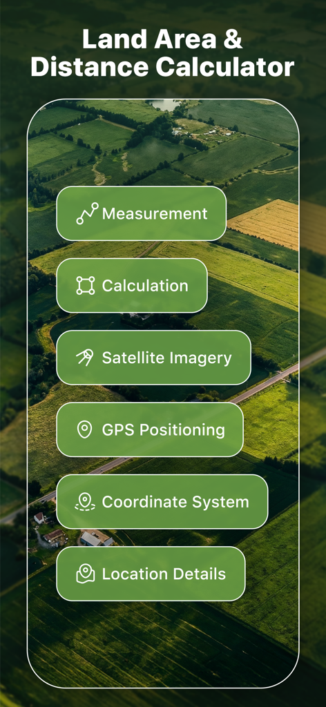
Interface of GeoMark GPS Measurement Tool showing features like land area calculation and satellite imagery over an aerial field view
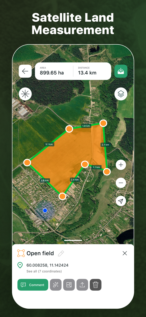
Satellite map view in GeoMark app measuring the area of an open field with GPS markers
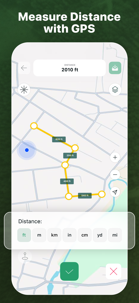
Interface of the GeoMark app showing a GPS distance measurement of 2010 feet on a map with multiple unit options like meters and yards
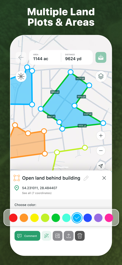
A map interface showing multiple measured land plots in different colors with area and distance details.
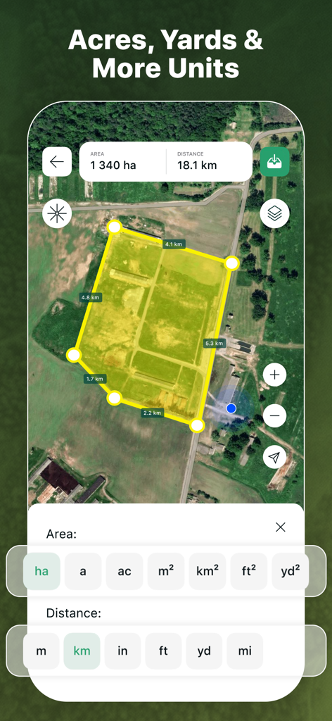
GeoMark app screen showing area and distance units conversion for land measurement on a satellite map
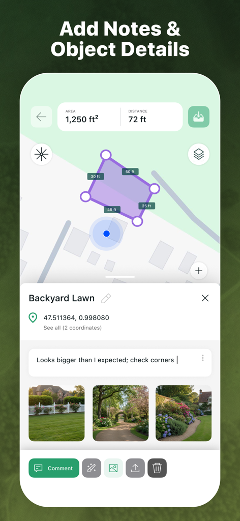
GeoMark app screen showing a backyard lawn measurement with custom notes and attached photos
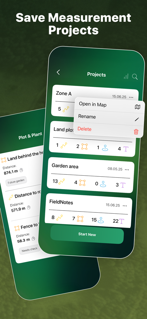
A mobile app interface displaying a list of saved measurement projects including property zones and land plots with options to manage and edit them.
Description
Download
More Like This
Top-ranked apps in the same category

Google LLC

Google Chrome
Google LLC

中国移动(手机营业厅)
China Mobile Online Services Co., Ltd.

Google Authenticator
Google LLC

Super VPN Fly 2026
YUNFAN TECHNOLOGY CO., LIMITED

gov.br
Servicos e Informacoes do Brasil

Cleanup: Phone Storage Cleaner
DEEP FLOW SOFTWARE SERVICES - FZCO

百度-AI智能搜索
Beijing Baidu Netcom Science & Technology Co.,Ltd

Microsoft Edge: AI Browser
Microsoft Corporation
This page is not an official page of the app or its developer, but an independent editorial publication created for informational and commentary purposes. Unless expressly stated otherwise, neither the app nor its developer is affiliated with, endorsed by, sponsored by, authorized by, or otherwise officially connected with MWM, Apple, Google Play, the app publisher, or the app's developer, and nothing on this page implies that the app was developed using MWM's services. Any trademarks, logos, screenshots, and other content remain the property of their respective owners.