This page is not an official page of the app or its developer, but an independent editorial publication created for informational and commentary purposes. Unless expressly stated otherwise, neither the app nor its developer is affiliated with, endorsed by, sponsored by, authorized by, or otherwise officially connected with MWM, Apple, Google Play, the app publisher, or the app's developer, and nothing on this page implies that the app was developed using MWM's services. Any trademarks, logos, screenshots, and other content remain the property of their respective owners.

GeoSap - Smart Geotag Engine
Turn snapshots into coordinates. From hidden travel gems to investigative research, our intelligent engine analyzes visual clues to identify street-level addresses and geographic data in seconds.
Downloads
0User Rating
Total Ratings
0Publisher
Category
UtilitiesLocales
36Latest Version
1.0.6Size
170.3 MBFirst Released
Aug 11, 2025Unlock the Hidden Map Within Your Photos
GeoSap leverages cutting-edge AI visual recognition to transform any image into precise geographic coordinates, giving context to your memories and clarity to your research.
AI-Powered Scene Recognition
Pinpoint locations using architecture, terrain, and landmarks, even from low-light or blurry snapshots with street-level accuracy.
Street View Verification
Instantly cross-reference AI results with real-world imagery to confirm the exact corner or trail where your photo was taken.
The following screenshots and description are sourced directly from the app's official store listing and are the property of the app developer.
App Store
Screenshots
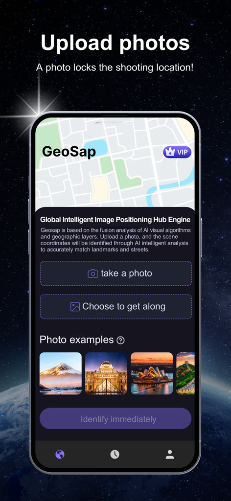
Main screen of GeoSap app showing photo upload options for AI location identification
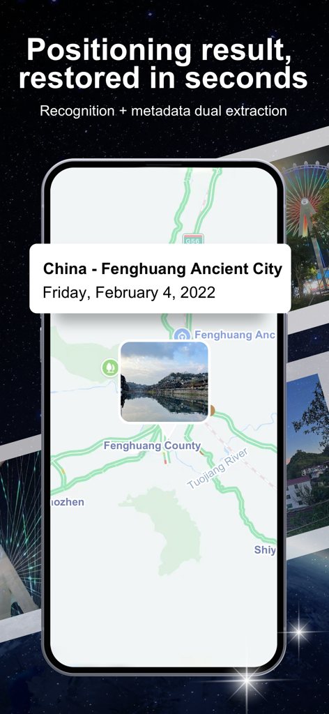
GeoSap app interface showing a photo pinned to its geographic location on a map with address details

GeoSap app using AI visual recognition to identify the real world location of a photo showing city architecture.
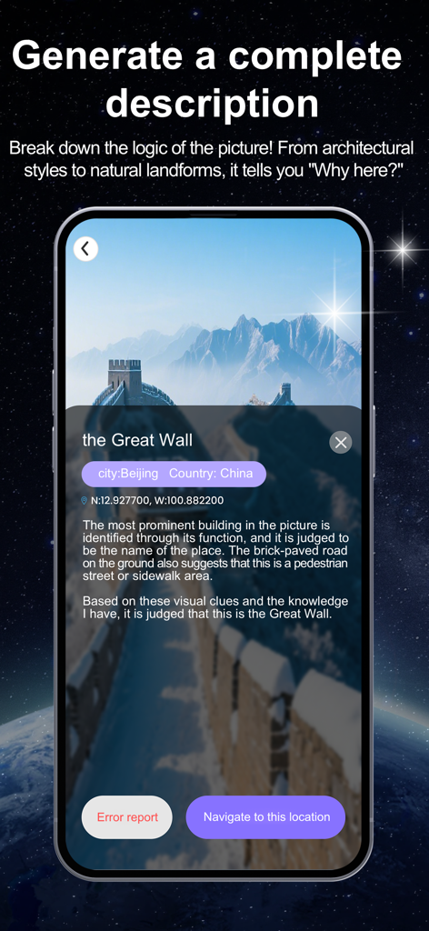
A smartphone interface showing the GeoSap app identifying the Great Wall of China through AI analysis of architectural and terrain features.
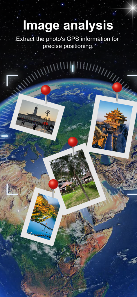
GeoSap app screen showing photos pinned to a 3D globe for GPS location analysis
Description
Download
More Like This
Top-ranked apps in the same category

Google LLC

Google Chrome
Google LLC

中国移动(手机营业厅)
China Mobile Online Services Co., Ltd.

Google Authenticator
Google LLC

gov.br
Servicos e Informacoes do Brasil

Cleanup: Phone Storage Cleaner
DEEP FLOW SOFTWARE SERVICES - FZCO

Super VPN Fly 2026
YUNFAN TECHNOLOGY CO., LIMITED

Meu Social - Gás do Povo
Servicos e Informacoes do Brasil

百度-AI智能搜索
Beijing Baidu Netcom Science & Technology Co.,Ltd
This page is not an official page of the app or its developer, but an independent editorial publication created for informational and commentary purposes. Unless expressly stated otherwise, neither the app nor its developer is affiliated with, endorsed by, sponsored by, authorized by, or otherwise officially connected with MWM, Apple, Google Play, the app publisher, or the app's developer, and nothing on this page implies that the app was developed using MWM's services. Any trademarks, logos, screenshots, and other content remain the property of their respective owners.