This page is not an official page of the app or its developer, but an independent editorial publication created for informational and commentary purposes. Unless expressly stated otherwise, neither the app nor its developer is affiliated with, endorsed by, sponsored by, authorized by, or otherwise officially connected with MWM, Apple, Google Play, the app publisher, or the app's developer, and nothing on this page implies that the app was developed using MWM's services. Any trademarks, logos, screenshots, and other content remain the property of their respective owners.

GoGoEarth - Custom map source
Unlock premium satellite sources from NASA, Maxar, and Nearmap. From 3D city models to real-time altitude, experience professional-grade mapping and virtual exploration at your fingertips.
Downloads
427K+User Rating
Total Ratings
8K+Publisher
Category
NavigationLocales
2Latest Version
3.2.3Size
155.6 MBFirst Released
May 11, 2022Explore the Earth in Stunning Detail
From high-res satellite imagery to 3D architectural models, GoGoEarth provides the professional-grade tools you need to discover the world from the palm of your hand.
Ultra-HD Satellite Views
Experience the world with crystal-clear imagery powered by NASA and Maxar, providing detail levels that go far beyond standard maps.
Virtual Global Tourism
Travel through 200+ regions with HD panoramic street views and explore realistic 3D models of the world's most famous sites.
The following screenshots and description are sourced directly from the app's official store listing and are the property of the app developer.
App Store
Screenshots
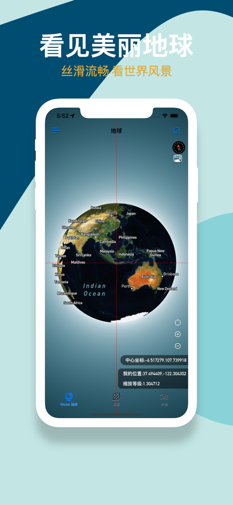
GoGoEarth app interface displaying a 3D satellite globe with geographic labels and coordinates
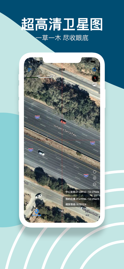
High-definition satellite imagery of a highway with cars and precise coordinates in the GoGoEarth app
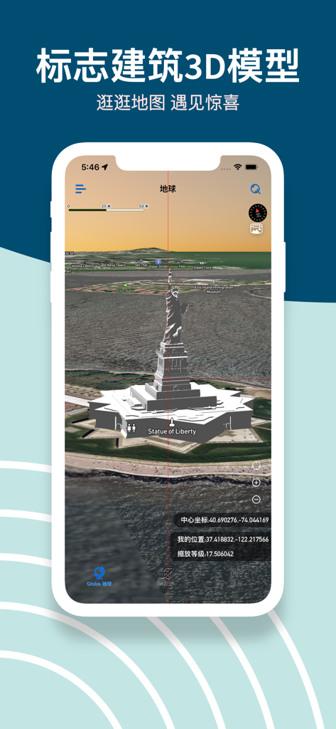
GoGoEarth app screenshot showing a detailed 3D model of the Statue of Liberty on a satellite map
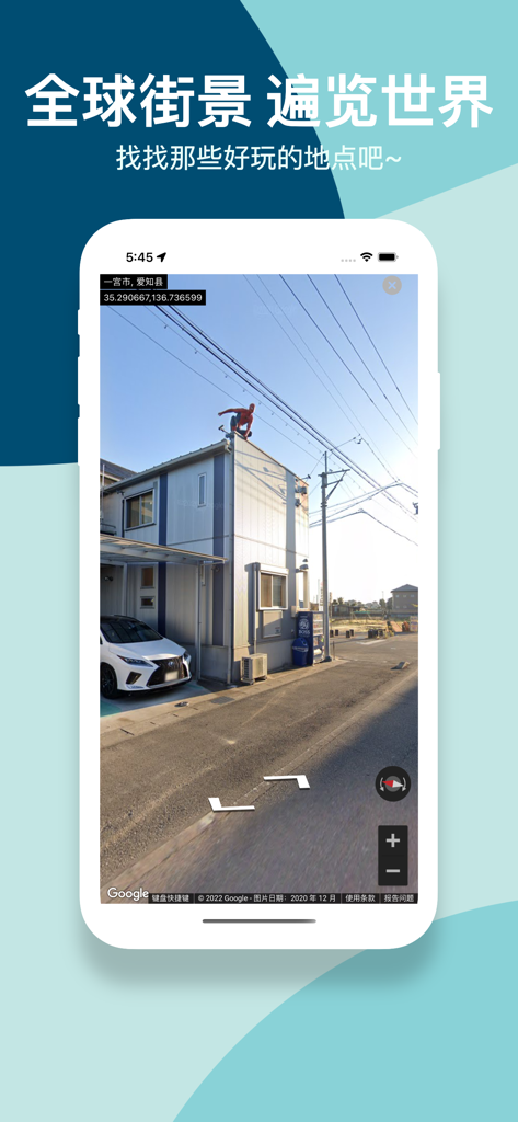
GoGoEarth app screenshot displaying a high-definition panoramic street view of a neighborhood in Japan
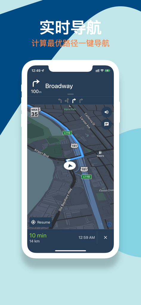
GoGoEarth mobile app showing real-time navigation interface with a route on a dark satellite map.
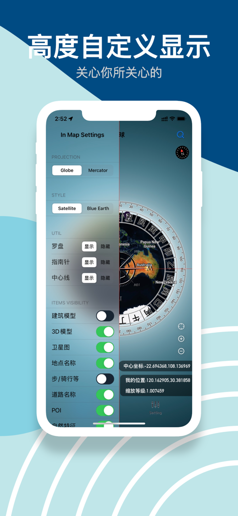
GoGoEarth app interface showing map settings for projection styles and visibility of 3D models
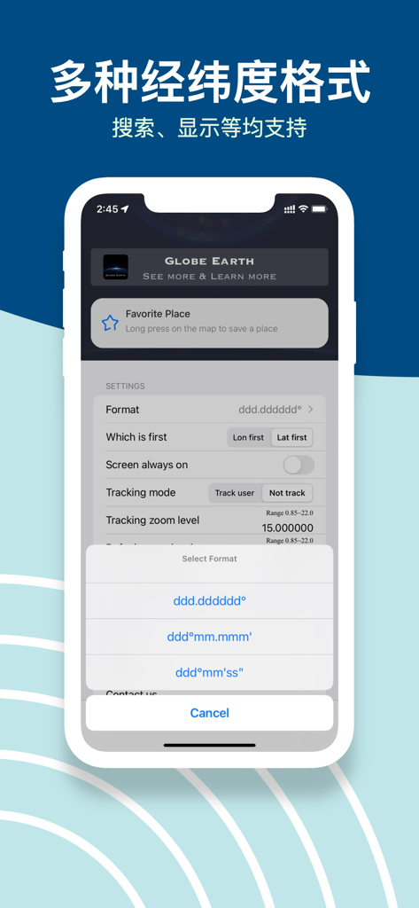
GoGoEarth app interface showing multiple latitude and longitude coordinate format options in the settings menu.
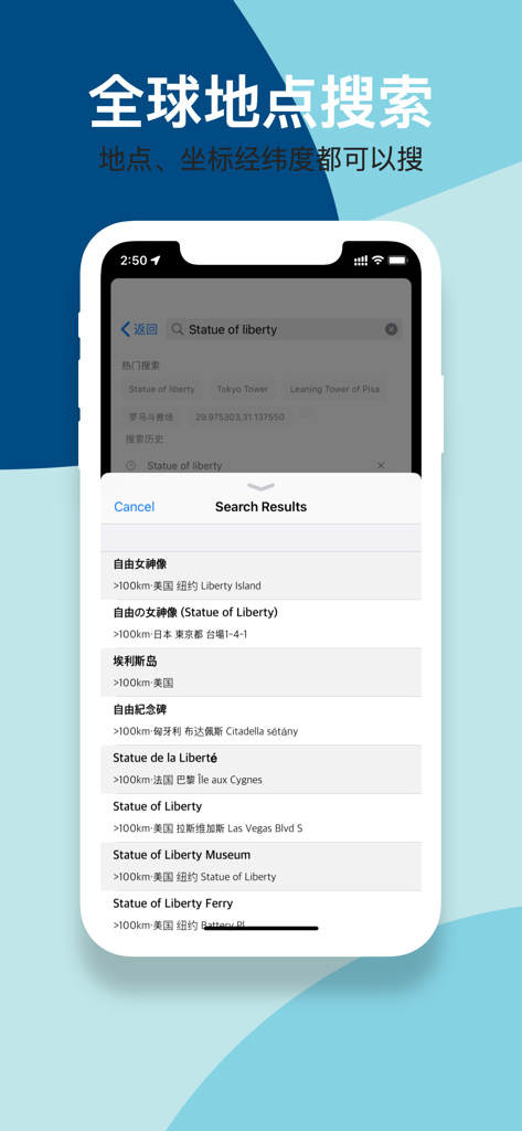
GoGoEarth app interface showing global search results for the Statue of Liberty with latitude and longitude support.
Description
Download
More Like This
Apps with similar features and user experience

Earth Maps
FOXPOI PTE. LTD.

Satellite Map - Live Earth
慧敏 赵

Satellite Map - Earth View
ANKAGIS YAZILIM ANONIM SIRKETI

World Street 3D Panoramic Map
Beijing Zhiyue Information Technology Co., Ltd

3D Earth Map Street View
Naik Ur Rehman

Globe 3D Earth: World Map Live
Shams Alam

Street View - street view maps
国辉 满

卫星地图-高清地球探索世界
方元 朱

高清3D街景地图-地图软件手机全景版
Suzhou Caichuang Network Technology Co., Ltd.
This page is not an official page of the app or its developer, but an independent editorial publication created for informational and commentary purposes. Unless expressly stated otherwise, neither the app nor its developer is affiliated with, endorsed by, sponsored by, authorized by, or otherwise officially connected with MWM, Apple, Google Play, the app publisher, or the app's developer, and nothing on this page implies that the app was developed using MWM's services. Any trademarks, logos, screenshots, and other content remain the property of their respective owners.