This page is not an official page of the app or its developer, but an independent editorial publication created for informational and commentary purposes. Unless expressly stated otherwise, neither the app nor its developer is affiliated with, endorsed by, sponsored by, authorized by, or otherwise officially connected with MWM, Apple, Google Play, the app publisher, or the app's developer, and nothing on this page implies that the app was developed using MWM's services. Any trademarks, logos, screenshots, and other content remain the property of their respective owners.
Satellite Map - Earth View
Suddenly, the entire planet is your private viewing gallery. It puts global reconnaissance in your pocket.
Downloads
500k+User Rating
Total Ratings
1.2KPublisher
Category
NavigationLocales
18Latest Version
1.4.9Size
103.8 MBFirst Released
Jan 2, 2025An in-depth evaluation of the application's primary functionalities for global exploration and learning.
Core Features Analysis: Satellite Map - Earth View
High-Definition Satellite Imagery
The app provides high-definition satellite maps with incredible detail.
Immersive Street View
This tool features immersive 360-degree panoramas for exploring streets and neighborhoods.
Interactive 3D Maps & Globe
It allows users to experience Earth in 3D with an interactive globe and terrain visualization.
Detailed Zoom Capabilities
It allows users to zoom in to explore landscapes, landmarks, and buildings in detail.
Global Coverage
The app provides global coverage, allowing exploration of cities, continents, and remote areas across the world.
Real-Time GPS Navigation
This tool features real-time GPS support for finding user location and navigation.
Frequently Asked Questions
Everything you need to know about Satellite Map - Earth View
What is Satellite Map - Earth View?
Satellite Map - Earth View is an app providing high-definition 3D satellite imagery, detailed maps, and immersive street views. It allows users to explore the world, navigate, and discover landmarks from their device.
Does Satellite Map - Earth View offer Street View?
Yes, Satellite Map - Earth View offers Street View, allowing users to explore streets and neighborhoods with immersive 360-degree panoramas. This feature enhances virtual exploration.
Can I view Earth in 3D using Satellite Map - Earth View?
Yes, Satellite Map - Earth View provides 3D maps and an interactive globe. Users can experience Earth in 3D with terrain visualization, offering detailed views of landscapes and buildings.
Does Satellite Map - Earth View include a World Atlas?
Yes, Satellite Map - Earth View includes a World Atlas. This feature provides geographical details for countries, capitals, and flags, serving as an educational tool for users.
Is Satellite Map - Earth View free to use?
Yes, Satellite Map - Earth View offers essential features for free. A premium subscription is available to unlock enhanced map providers, additional map styles, and an ad-free experience.
What benefits does a premium subscription for Satellite Map - Earth View offer?
A premium subscription for Satellite Map - Earth View unlocks enhanced map providers, interactive country borders with flag visualization, and additional map styles. It also provides an ad-free experience.
How do I manage my Satellite Map - Earth View subscription?
Users can manage their Satellite Map - Earth View subscription preferences and turn off auto-renewal anytime through their account settings. Subscriptions automatically renew for continued access.
Can I measure areas on the map with Satellite Map - Earth View?
Yes, Satellite Map - Earth View allows users to measure areas on the map. Screenshot #4 demonstrates this functionality by displaying a polygonal selection with an area measurement of 13.98 km².
Where can I find the Privacy Policy for Satellite Map - Earth View?
The Privacy Policy for Satellite Map - Earth View is available at the provided URL: https://www.ankagis.com/satellitemap/privacy/. This document outlines data handling practices.
Does Satellite Map - Earth View support real-time navigation?
Yes, Satellite Map - Earth View supports real-time navigation. The app helps users find their current location and navigate with accurate GPS support for efficient travel.
Can Satellite Map - Earth View display different map styles?
Yes, Satellite Map - Earth View can display different map styles. Users can select various map types, as shown in Screenshot #3, including different visual representations of the Earth's surface.
The following screenshots and description are sourced directly from the app's official store listing and are the property of the app developer.
App Store
Screenshots
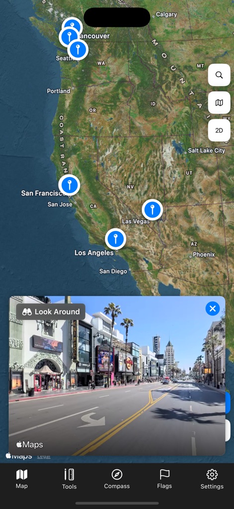
Users can seamlessly transition from a broad satellite map of California and Nevada to an immersive Street View preview of a specific location like Hollywood Boulevard.
Global Exploration, Street Level
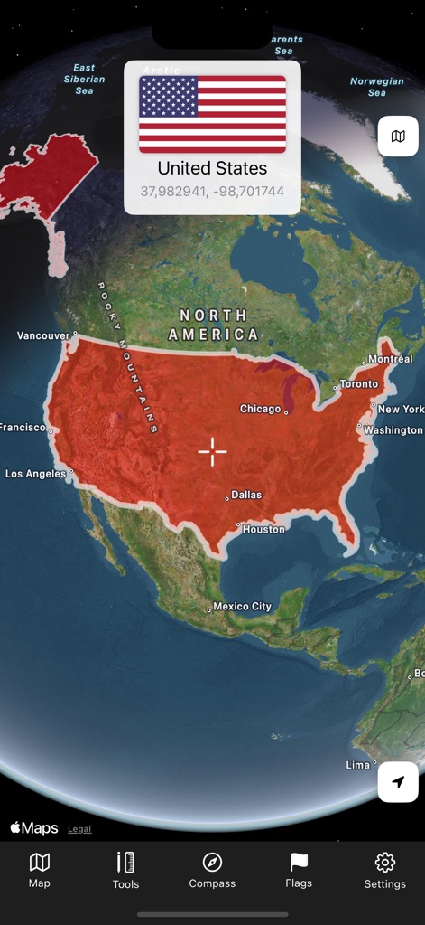
This tool provides an interactive 3D globe view, allowing users to select and highlight countries like the United States, complete with a national flag and geographical coordinates.
Country Insights
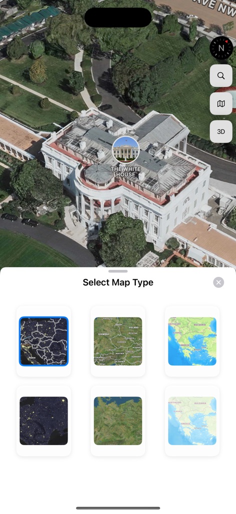
The app offers stunning 3D satellite imagery of landmarks such as The White House and provides a 'Select Map Type' interface for choosing between various geographical visualizations.
Detailed Views, Diverse Maps
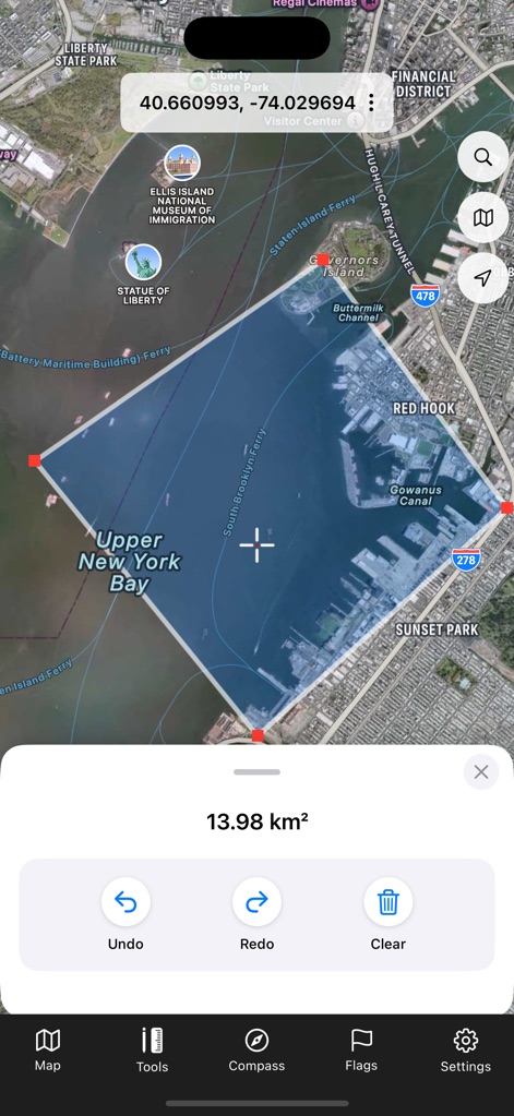
Users can utilize precision tools to measure areas on the map, such as the 13.98 km² shown for Upper New York Bay, with options to undo or clear measurements.
Precision Tools
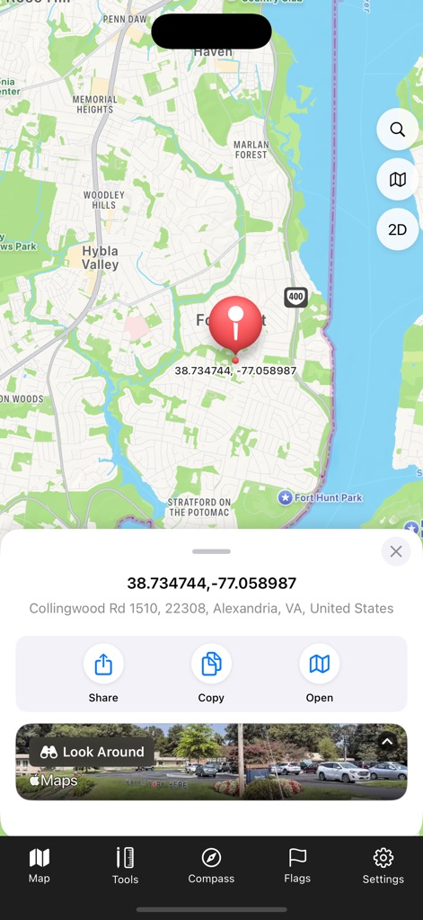
This tool allows users to pinpoint exact locations with a draggable pin, displaying precise coordinates and address details, alongside an integrated Street View preview.
Pinpoint Location Data
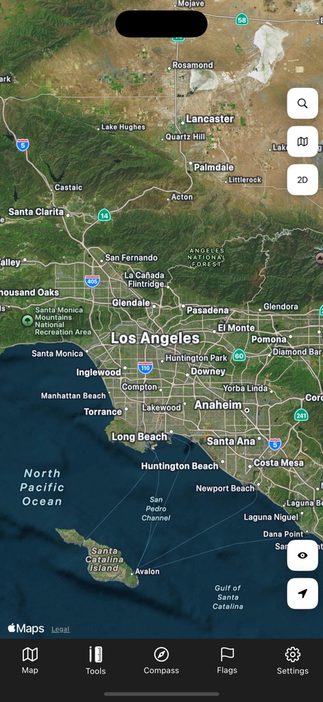
Experience a high-definition satellite map revealing the expansive urban sprawl of Los Angeles and its detailed surrounding geographical features.
Expansive Views
Description
Download
More Like This
Apps with similar features and user experience

Earth Maps
FOXPOI PTE. LTD.

Satellite Map - Live Earth
慧敏 赵

World Street 3D Panoramic Map
Beijing Zhiyue Information Technology Co., Ltd

3D Earth Map Street View
Naik Ur Rehman

Globe 3D Earth: World Map Live
Shams Alam

Street View - street view maps
国辉 满

卫星地图-高清地球探索世界
方元 朱

GoGoEarth - Custom map source
大靖 刘

高清3D街景地图-地图软件手机全景版
Suzhou Caichuang Network Technology Co., Ltd.
This page is not an official page of the app or its developer, but an independent editorial publication created for informational and commentary purposes. Unless expressly stated otherwise, neither the app nor its developer is affiliated with, endorsed by, sponsored by, authorized by, or otherwise officially connected with MWM, Apple, Google Play, the app publisher, or the app's developer, and nothing on this page implies that the app was developed using MWM's services. Any trademarks, logos, screenshots, and other content remain the property of their respective owners.