This page is not an official page of the app or its developer, but an independent editorial publication created for informational and commentary purposes. Unless expressly stated otherwise, neither the app nor its developer is affiliated with, endorsed by, sponsored by, authorized by, or otherwise officially connected with MWM, Apple, Google Play, the app publisher, or the app's developer, and nothing on this page implies that the app was developed using MWM's services. Any trademarks, logos, screenshots, and other content remain the property of their respective owners.

Satellite Map - Live Earth
No longer merely an atlas; this app delivers the entire planet to your screen, empowering users with unprecedented global access.
Downloads
2.5M+User Rating
Total Ratings
57.3KPublisher
Category
NavigationLocales
2Latest Version
2.5Size
63.1 MBFirst Released
Jan 10, 2020An evaluation of core functionalities for global exploration and geographical insights.
Key Features Analysis: Satellite Map - Live Earth
HD Satellite Imagery
The app provides access to the latest and most complete high-definition satellite maps, enabling users to explore the world from a unique aerial perspective and enjoy global scenery virtually.
Precision Contour Mapping
It allows users to view detailed contour maps which include real-time coordinates (longitude and latitude), providing precise geographical insights crucial for outdoor activities and professional use.
Immersive 3D City Views
This tool features 3D maps that display realistic 3D models of buildings, offering an immersive experience for urban exploration and architectural visualization.
Global Street-Level Maps
The app offers flat maps that provide global street information, facilitating standard navigation and detailed understanding of urban and rural layouts.
Frequently Asked Questions
Everything you need to know about Satellite Map - Live Earth
What is the Satellite Map - Live Earth app?
The Satellite Map - Live Earth app provides HD satellite maps, offering the latest and most complete global satellite imagery. It serves as a companion to explore the world and enjoy global scenery from home.
What types of maps are available in Satellite Map - Live Earth?
Satellite Map - Live Earth offers HD satellite maps, 3D maps displaying building models, contour maps with real-time coordinates, and flat maps showing global street information.
Does Satellite Map - Live Earth show 3D models of buildings?
Yes, Satellite Map - Live Earth includes 3D maps that specifically show 3D models of buildings. This feature enhances exploration by providing a more immersive view.
Does Satellite Map - Live Earth use background location services?
Yes, Satellite Map - Live Earth continues to use the device's location feature in the background. This ensures continuous tracking or updating of location-based data within the app.
Will Satellite Map - Live Earth reduce my phone's battery life?
Yes, Satellite Map - Live Earth's continuous use of the location feature in the background reduces battery life. Users should be aware of this impact on device power consumption.
Can I view global street information using Satellite Map - Live Earth?
Yes, Satellite Map - Live Earth provides flat maps that display global street information. This allows users to view street names and details worldwide, as seen in the app's interface.
Does Satellite Map - Live Earth provide real-time coordinates?
Yes, Satellite Map - Live Earth includes contour maps that show real-time coordinates, including longitude and latitude. This feature is useful for precise location data.
The following screenshots and description are sourced directly from the app's official store listing and are the property of the app developer.
App Store
Screenshots
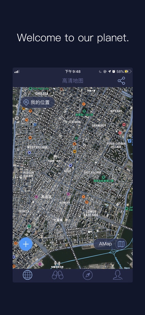
Users can experience precise urban mapping with the clear '高清地图' display and easily pinpoint their current position using the '我的位置' marker.
Detailed Urban View
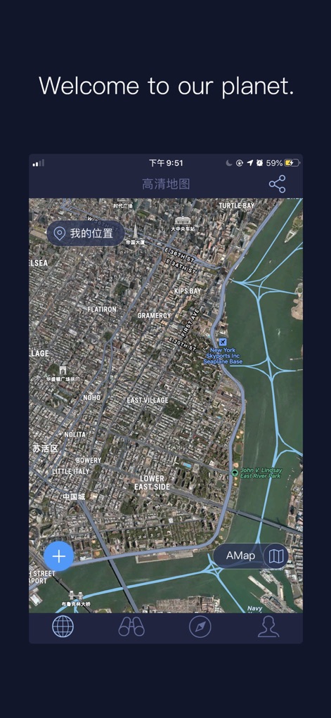
This tool delivers breathtaking, high-resolution satellite views of urban environments and offers quick access to various map styles via the 'AMap' button.
Live Satellite Imagery
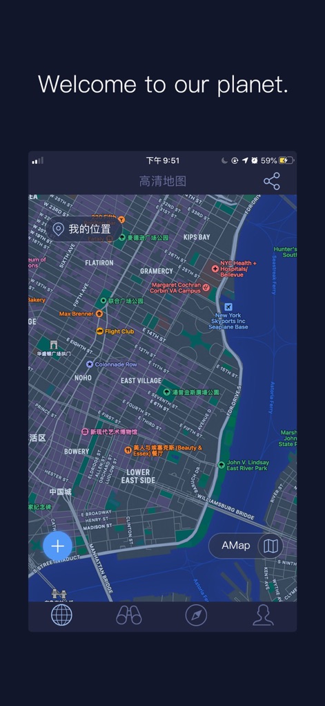
The app provides comprehensive street information, showcasing detailed road networks and clearly marking significant points of interest for effortless navigation.
Comprehensive Street Data
Description
Download
More Like This
Apps with similar features and user experience

Earth Maps
FOXPOI PTE. LTD.

Satellite Map - Earth View
ANKAGIS YAZILIM ANONIM SIRKETI

World Street 3D Panoramic Map
Beijing Zhiyue Information Technology Co., Ltd

3D Earth Map Street View
Naik Ur Rehman

Globe 3D Earth: World Map Live
Shams Alam

Street View - street view maps
国辉 满

卫星地图-高清地球探索世界
方元 朱

GoGoEarth - Custom map source
大靖 刘

高清3D街景地图-地图软件手机全景版
Suzhou Caichuang Network Technology Co., Ltd.
This page is not an official page of the app or its developer, but an independent editorial publication created for informational and commentary purposes. Unless expressly stated otherwise, neither the app nor its developer is affiliated with, endorsed by, sponsored by, authorized by, or otherwise officially connected with MWM, Apple, Google Play, the app publisher, or the app's developer, and nothing on this page implies that the app was developed using MWM's services. Any trademarks, logos, screenshots, and other content remain the property of their respective owners.