This page is not an official page of the app or its developer, but an independent editorial publication created for informational and commentary purposes. Unless expressly stated otherwise, neither the app nor its developer is affiliated with, endorsed by, sponsored by, authorized by, or otherwise officially connected with MWM, Apple, Google Play, the app publisher, or the app's developer, and nothing on this page implies that the app was developed using MWM's services. Any trademarks, logos, screenshots, and other content remain the property of their respective owners.

GPS Area Measure Map
Calculate acreage, track distances, and mark boundaries with precision. The essential all-in-one toolkit for farmers, contractors, and real estate professionals to map any terrain with confidence.
Downloads
100User Rating
Total Ratings
0Publisher
Category
UtilitiesLocales
13Latest Version
4.0Size
71.7 MBFirst Released
Jun 4, 2025Precision Tools for Every Project
Transform your iPhone into a professional-grade survey toolkit. Whether you are estimating a job site, mapping a farm, or marking property lines, get accurate data in seconds.
Instant Area & Perimeter Stats
Calculate acreage, square footage, or fence lengths by simply tapping the map or walking the boundary. Perfect for quick, on-site quotes.
Smart Location Marking
Pinpoint and save critical landmarks like property corners, water sources, or utility lines with custom markers to keep your field notes organized.
The following screenshots and description are sourced directly from the app's official store listing and are the property of the app developer.
App Store
Screenshots
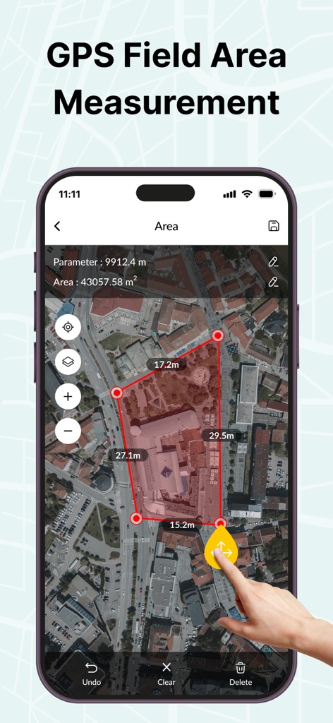
An iPhone displaying a satellite map with a red polygon used to measure the area of several buildings
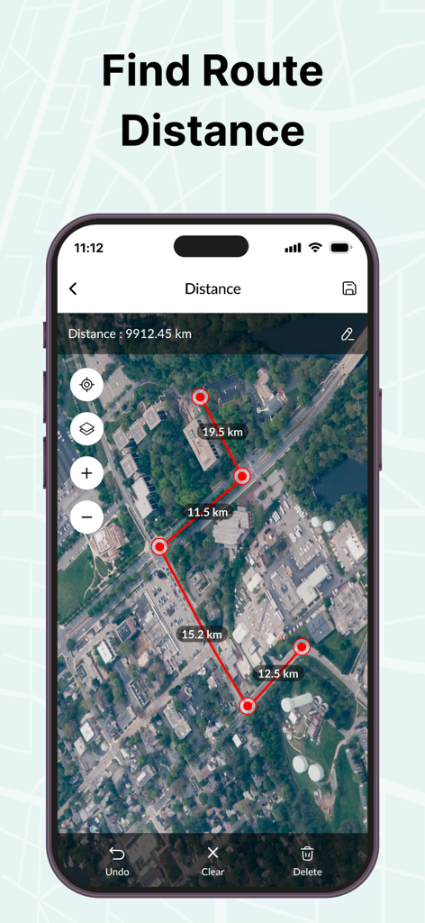
GPS app interface showing route distance measurement on a satellite map
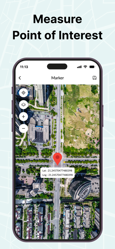
A smartphone screen displaying a satellite map with a red marker pin and latitude and longitude coordinates for a specific point of interest.
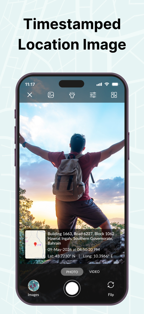
Smartphone screen showing a photo with a timestamped location overlay including GPS coordinates and a mini map.
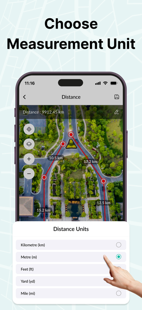
Selecting distance measurement units in the GPS Area Measure Map app interface showing a satellite map.
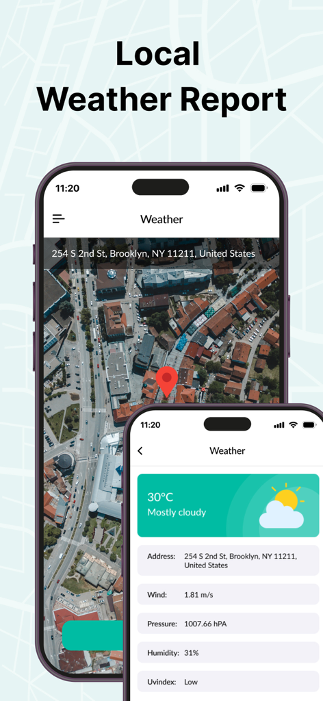
Smartphone screen showing a local weather report with satellite map view and environmental data including temperature and wind speed
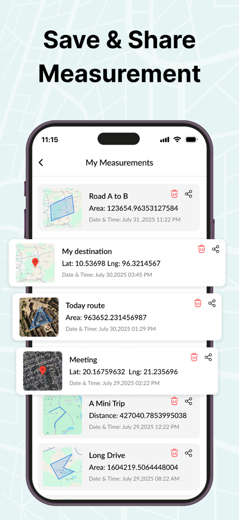
A list of saved measurements in the GPS Area Measure Map app showing various land areas and routes with save and share options
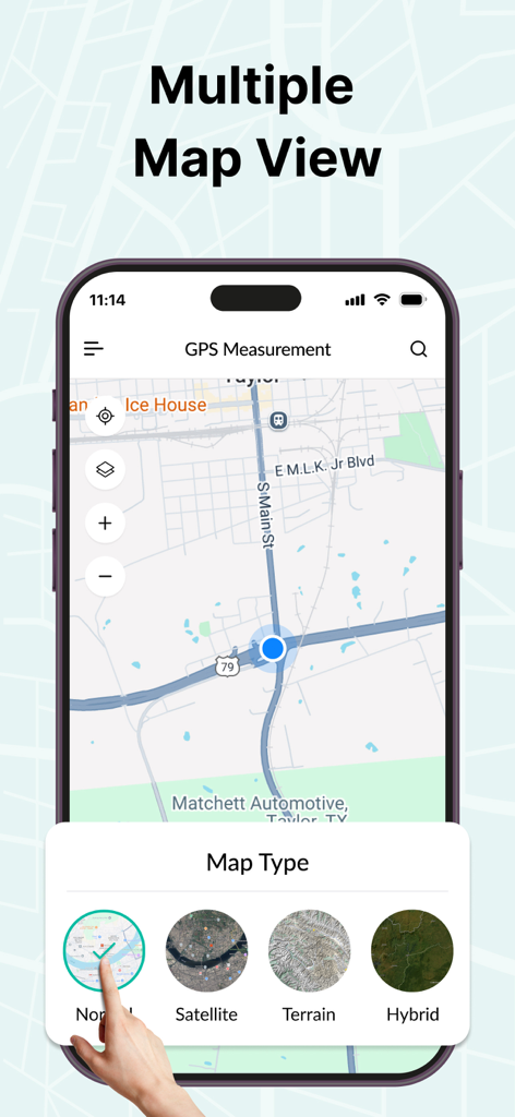
Multiple map view options in the GPS Area Measure app showing satellite and terrain modes
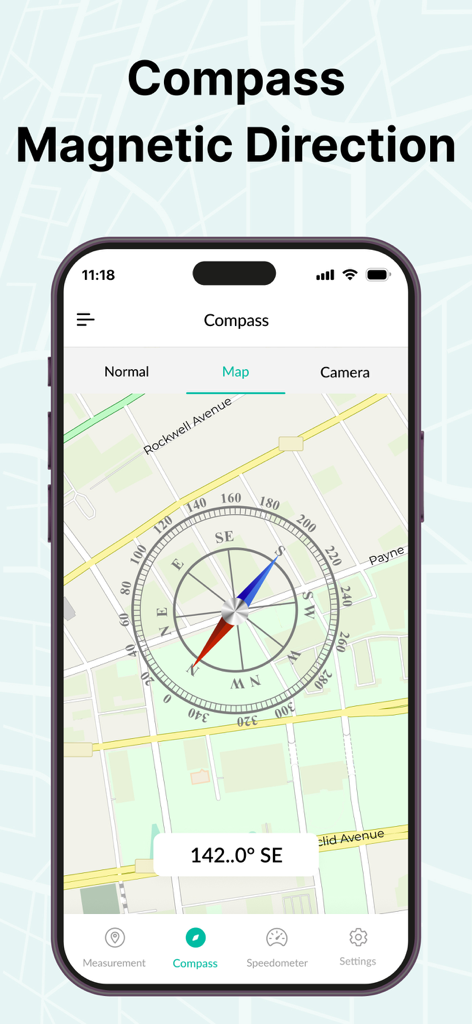
GPS Area Measure Map app showing magnetic compass direction over a street map view
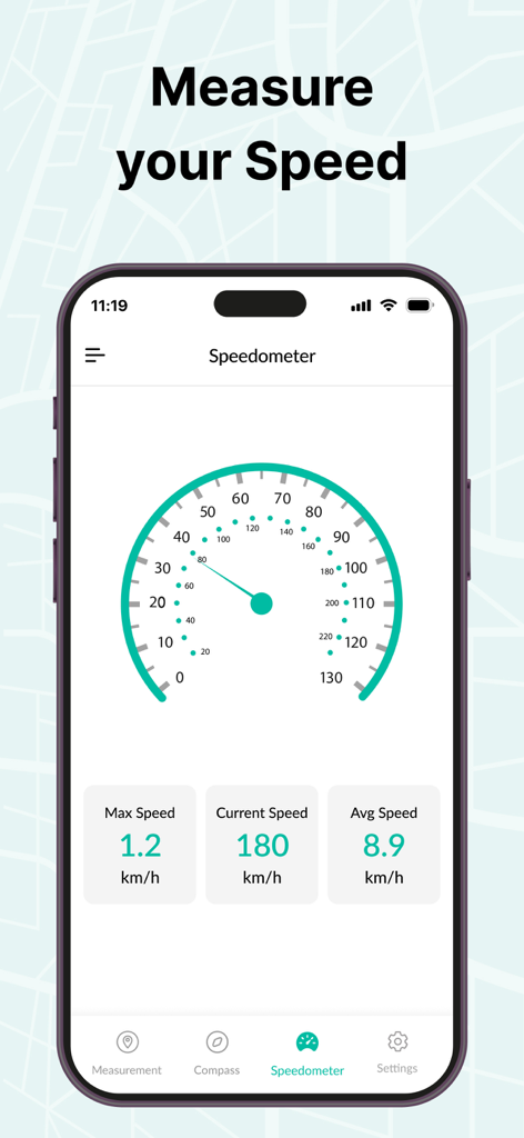
A smartphone showing the speedometer feature of the GPS Area Measure Map app with real-time speed tracking data.
Description
Download
More Like This
Top-ranked apps in the same category

Google LLC

Google Chrome
Google LLC

中国移动(手机营业厅)
China Mobile Online Services Co., Ltd.

Google Authenticator
Google LLC

CNH do Brasil
Servicos e Informacoes do Brasil

Cleanup: Phone Storage Cleaner
DEEP FLOW SOFTWARE SERVICES - FZCO

gov.br
Servicos e Informacoes do Brasil

Super VPN Fly 2026
YUNFAN TECHNOLOGY CO., LIMITED

Microsoft Edge: AI Browser
Microsoft Corporation
This page is not an official page of the app or its developer, but an independent editorial publication created for informational and commentary purposes. Unless expressly stated otherwise, neither the app nor its developer is affiliated with, endorsed by, sponsored by, authorized by, or otherwise officially connected with MWM, Apple, Google Play, the app publisher, or the app's developer, and nothing on this page implies that the app was developed using MWM's services. Any trademarks, logos, screenshots, and other content remain the property of their respective owners.