This page is not an official page of the app or its developer, but an independent editorial publication created for informational and commentary purposes. Unless expressly stated otherwise, neither the app nor its developer is affiliated with, endorsed by, sponsored by, authorized by, or otherwise officially connected with MWM, Apple, Google Play, the app publisher, or the app's developer, and nothing on this page implies that the app was developed using MWM's services. Any trademarks, logos, screenshots, and other content remain the property of their respective owners.

GPS Field Area & Land Measure
Effortlessly calculate acreage, measure boundaries, and plan land projects with high-accuracy satellite mapping. The essential tool for farmers, realtors, and contractors to get surveyor-grade results in seconds.
Downloads
0User Rating
Total Ratings
0Publisher
Category
UtilitiesLocales
19Latest Version
3.0Size
57.4 MBFirst Released
Sep 5, 2024Precision Mapping Made Simple
Designed for farmers, real estate pros, and contractors, our tool provides the professional accuracy you need to manage your land and projects with confidence.
Pinpoint Area Calculation
Calculate total acreage or perimeter distance by simply placing points on high-resolution satellite maps. Save hours of manual measurement and avoid the high cost of surveyors.
Customized for US Land
Speak the language of your industry. Instantly view results in acres, square feet, yards, or miles, tailored specifically for American agricultural and real estate standards.
The following screenshots and description are sourced directly from the app's official store listing and are the property of the app developer.
App Store
Screenshots
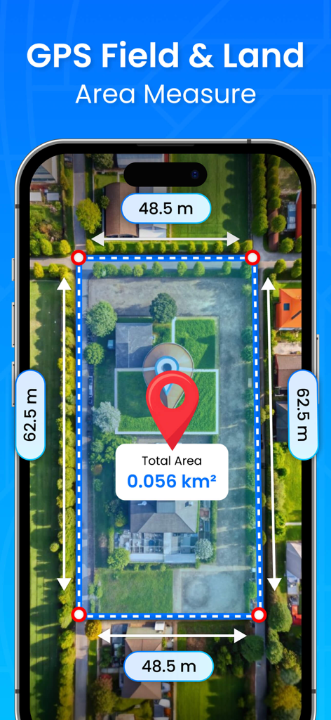
GPS Field and Land Area Measure app showing property area calculation on a satellite map.
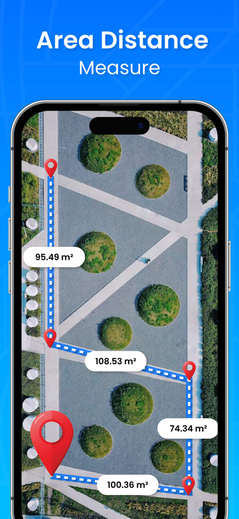
GPS Field Area and Land Measure app screen showing area and distance calculations on a satellite map view

Smartphone interface of GPS Field Area app showing a land plot measurement on a map with area and distance calculations
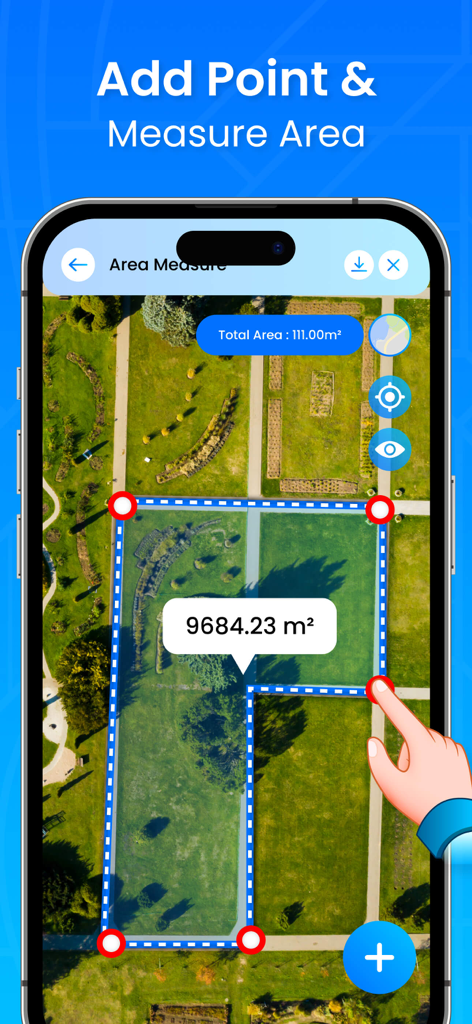
GPS app interface showing field area measurement on satellite map with points and area calculation
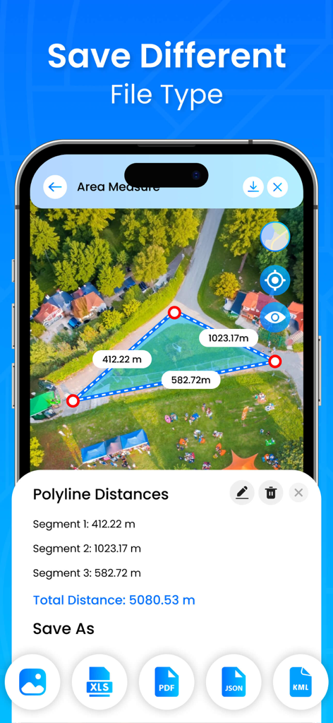
Interface of the GPS Field Area app showing file export options including PDF XLS JSON and KML for land measurements
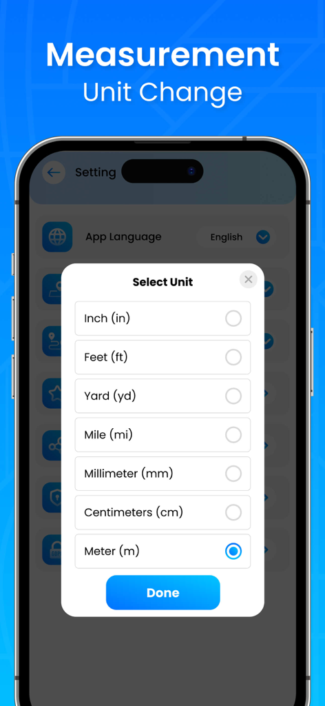
Interface of the GPS Field Area and Land Measure app showing a list of measurement units like feet, yards, and meters for selection.
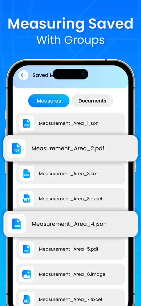
A list of saved land measurements in the GPS Field Area and Land Measure app shown in various formats like PDF Excel and JSON
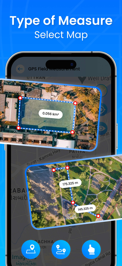
GPS Field Area and Land Measure app interface showing area and distance measurements on a satellite map
Description
Download
More Like This
Top-ranked apps in the same category

Google LLC

Google Chrome
Google LLC

中国移动(手机营业厅)
China Mobile Online Services Co., Ltd.

Google Authenticator
Google LLC

Cleanup: Phone Storage Cleaner
DEEP FLOW SOFTWARE SERVICES - FZCO

gov.br
Servicos e Informacoes do Brasil

Super VPN Fly 2026
YUNFAN TECHNOLOGY CO., LIMITED

CNH do Brasil
Servicos e Informacoes do Brasil

Microsoft Edge: AI Browser
Microsoft Corporation
This page is not an official page of the app or its developer, but an independent editorial publication created for informational and commentary purposes. Unless expressly stated otherwise, neither the app nor its developer is affiliated with, endorsed by, sponsored by, authorized by, or otherwise officially connected with MWM, Apple, Google Play, the app publisher, or the app's developer, and nothing on this page implies that the app was developed using MWM's services. Any trademarks, logos, screenshots, and other content remain the property of their respective owners.