This page is not an official page of the app or its developer, but an independent editorial publication created for informational and commentary purposes. Unless expressly stated otherwise, neither the app nor its developer is affiliated with, endorsed by, sponsored by, authorized by, or otherwise officially connected with MWM, Apple, Google Play, the app publisher, or the app's developer, and nothing on this page implies that the app was developed using MWM's services. Any trademarks, logos, screenshots, and other content remain the property of their respective owners.

GPS Land Measurement & Survey
The essential tool for contractors, farmers, and landowners. Measure acreage, map property lines, and calculate distances with GPS accuracy—even offline and in the most remote locations.
Downloads
561K+User Rating
Total Ratings
6K+Publisher
Category
UtilitiesLocales
1Latest Version
10.3.3Size
58.3 MBFirst Released
Jan 25, 2013Professional Field Tools for Every Acre
Turn your mobile device into a high-precision surveying suite. Mapulator delivers the accuracy and data integrity required by contractors, farmers, and landowners to manage property with confidence.
Precision Area & Perimeter Mapping
Calculate exact square footage or acreage for any terrain. Instantly switch between Imperial and Metric units to fit your professional standards and project requirements.
Live GPS Tracking & Offline Support
Walk your property lines to measure boundaries in real-time. Reliable offline maps ensure you never lose progress while working in remote rural areas or new construction sites.
The following screenshots and description are sourced directly from the app's official store listing and are the property of the app developer.
App Store
Screenshots
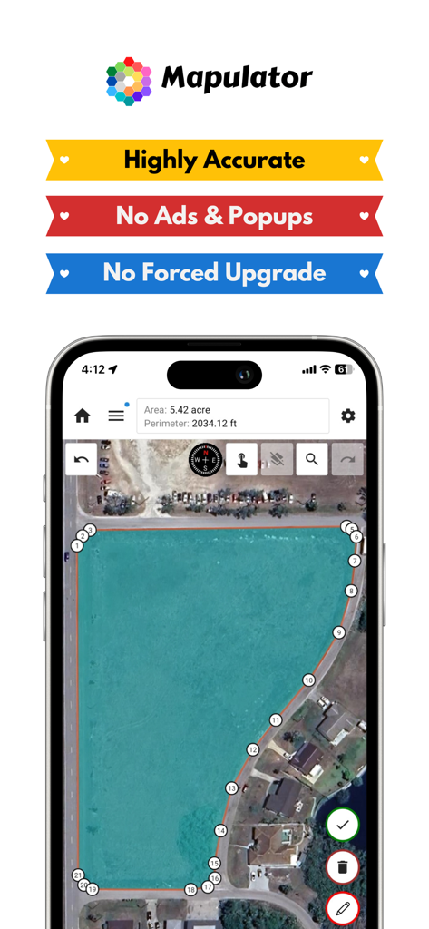
Mapulator app interface measuring a land area of five acres on a satellite map
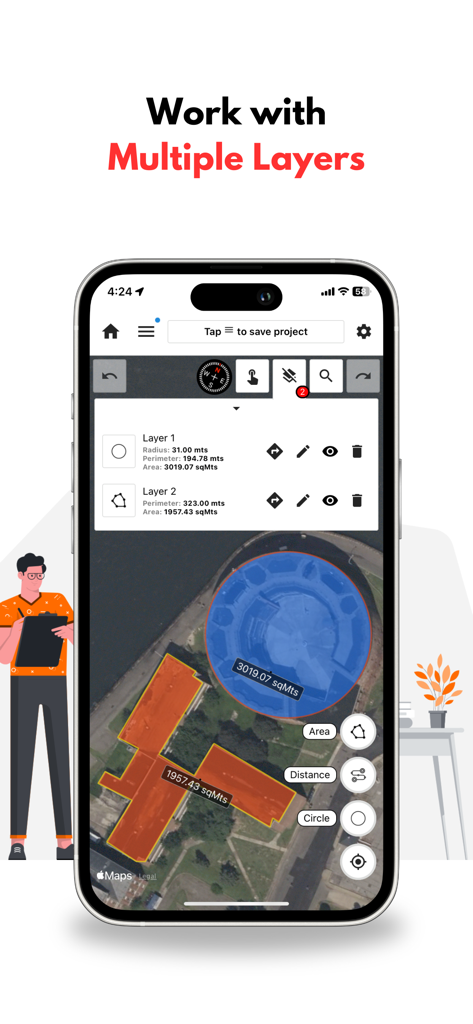
GPS Land Measurement app interface showing multiple layers for a circular and a polygonal area measurement on a map.
Mapulator app interface showing land area and perimeter measurement on a satellite map
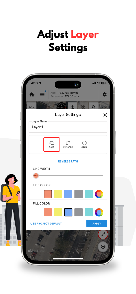
Smartphone screen showing the Mapulator app layer settings menu for customizing map colors and styles
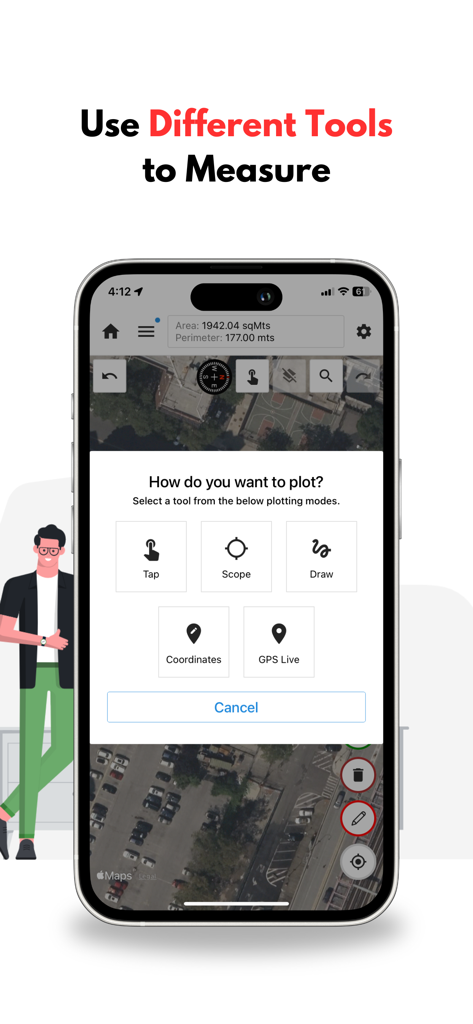
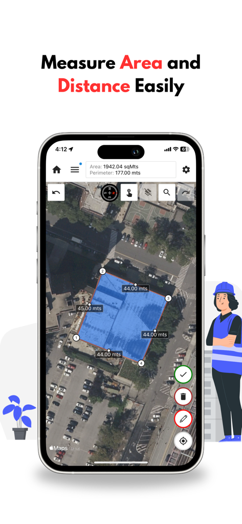
Interface of the Mapulator app showing various plotting tools like Tap, Scope, Draw, and GPS Live over a satellite map for land measurement.
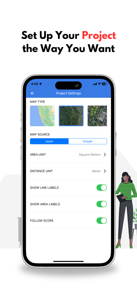
Interface showing project settings in the Mapulator app with options for map types and measurement units
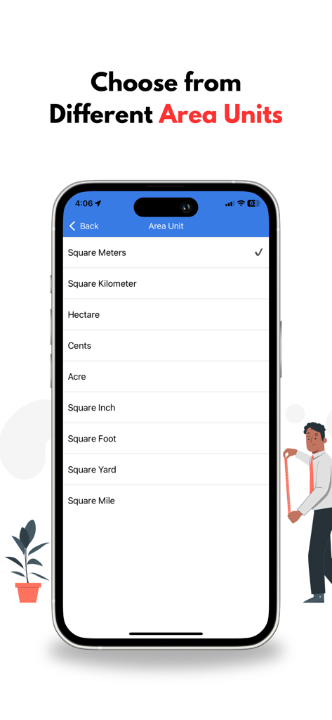
A smartphone screen displaying a list of various area measurement units like acres hectares and square feet in the Mapulator app
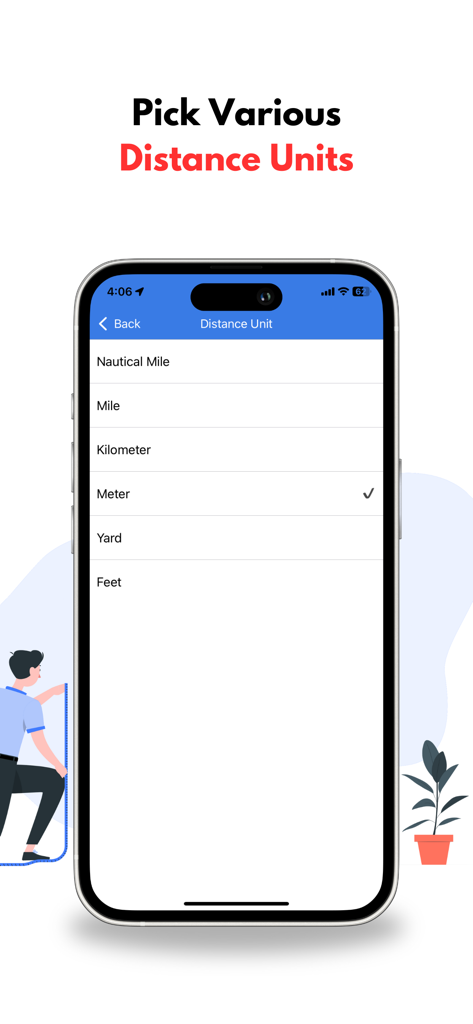
Interface showing a selection of distance units including miles kilometers and meters in the Mapulator app

Mapulator app screen showing project sharing and export options for KML and GeoJSON files

A laptop screen displaying the Mapulator web interface with color coded land measurements on a satellite map.
Description
Download
More Like This
Top-ranked apps in the same category

Google LLC

Google Chrome
Google LLC

中国移动(手机营业厅)
China Mobile Online Services Co., Ltd.

Google Authenticator
Google LLC

CNH do Brasil
Servicos e Informacoes do Brasil

Cleanup: Phone Storage Cleaner
DEEP FLOW SOFTWARE SERVICES - FZCO

gov.br
Servicos e Informacoes do Brasil

中国电信-全国统一官方服务平台
CHINA TELECOM Corporation Ltd.

Microsoft Edge: AI Browser
Microsoft Corporation
This page is not an official page of the app or its developer, but an independent editorial publication created for informational and commentary purposes. Unless expressly stated otherwise, neither the app nor its developer is affiliated with, endorsed by, sponsored by, authorized by, or otherwise officially connected with MWM, Apple, Google Play, the app publisher, or the app's developer, and nothing on this page implies that the app was developed using MWM's services. Any trademarks, logos, screenshots, and other content remain the property of their respective owners.