This page is not an official page of the app or its developer, but an independent editorial publication created for informational and commentary purposes. Unless expressly stated otherwise, neither the app nor its developer is affiliated with, endorsed by, sponsored by, authorized by, or otherwise officially connected with MWM, Apple, Google Play, the app publisher, or the app's developer, and nothing on this page implies that the app was developed using MWM's services. Any trademarks, logos, screenshots, and other content remain the property of their respective owners.

GPS & Maps: Location Tracker
Master any terrain with professional-grade coordinate systems, altitude logging, and waypoint tracking. Built for geocachers, hikers, and technical explorers who demand accuracy where standard maps fail.
Downloads
1M+User Rating
Total Ratings
6K+Publisher
Category
NavigationLocales
3Latest Version
4.3Size
32.4 MBFirst Released
Nov 23, 2011Precision for the Path Less Traveled
Empower your adventures with professional-grade GPS tools, real-time tracking, and specialized coordinate systems designed for explorers who demand more than just a map.
Military-Grade Precision
Switch instantly between MGRS, UTM, and Decimal Degrees. Get pinpoint accuracy for geocaching, surveying, or tactical navigation in any environment.
Quantified Adventures
Log your highest altitude, maximum speed, and real-time acceleration. Perfect for tracking progress across mountain trails, open seas, or flight paths.
The following screenshots and description are sourced directly from the app's official store listing and are the property of the app developer.
App Store
Screenshots
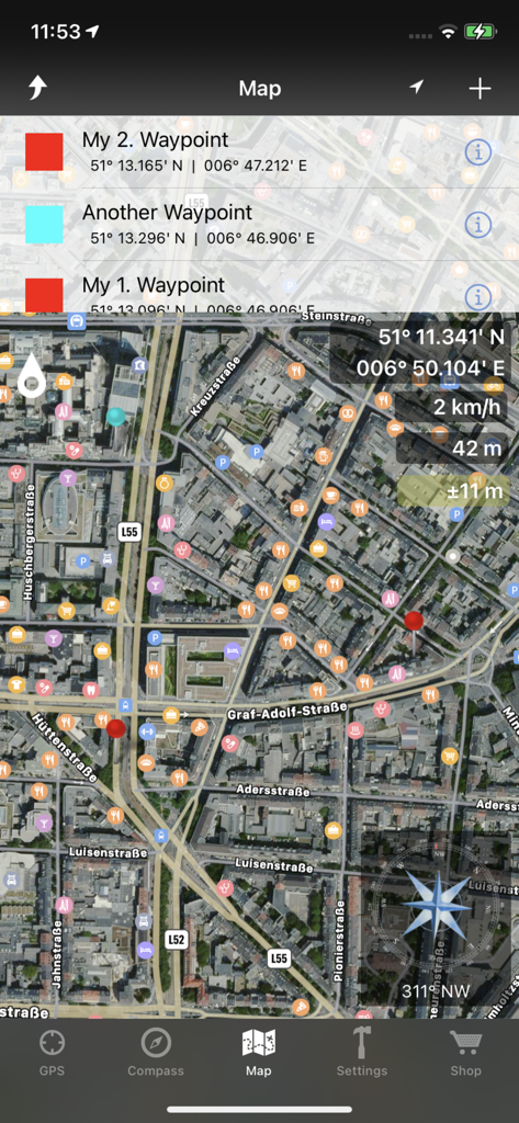
Satellite map interface displaying waypoints, GPS coordinates, altitude, and a compass.
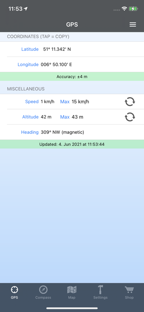
GPS app screen showing precise coordinates speed and altitude
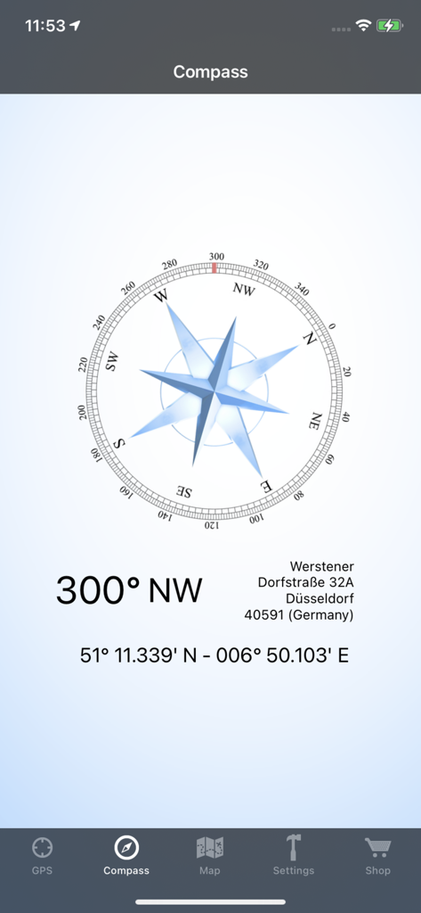
Digital compass interface showing 300 degrees northwest heading and precise GPS coordinates
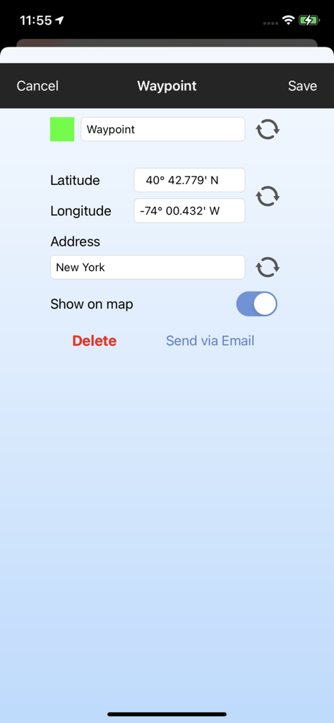
Interface for editing waypoint names and GPS coordinates
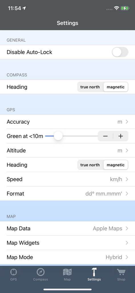
Settings screen of the GPS and Maps app showing configuration options for compass heading GPS units and map data sources
Description
Download
More Like This
Apps with similar features and user experience

Realtime Altimeter
Zhenlai Xia

Travel Camera & Compass
Ha Nguyen

compass-latitude and longitude
美霞 熊

Compass ×
DOUBLE U s.r.o.

GPS Altitude-海拔表
祥琦 孔

Compass: GPS & Altimeter
Shanghai BRC Internet Technology Co., Ltd.

Compass - GPS positioning
嘉 罗

Compass360X-GPS Speedometer
卫豪 吴

指南针-GPS经纬度海拔定位
Chongqing Xinzhi Space Technology Co., Ltd.
This page is not an official page of the app or its developer, but an independent editorial publication created for informational and commentary purposes. Unless expressly stated otherwise, neither the app nor its developer is affiliated with, endorsed by, sponsored by, authorized by, or otherwise officially connected with MWM, Apple, Google Play, the app publisher, or the app's developer, and nothing on this page implies that the app was developed using MWM's services. Any trademarks, logos, screenshots, and other content remain the property of their respective owners.