This page is not an official page of the app or its developer, but an independent editorial publication created for informational and commentary purposes. Unless expressly stated otherwise, neither the app nor its developer is affiliated with, endorsed by, sponsored by, authorized by, or otherwise officially connected with MWM, Apple, Google Play, the app publisher, or the app's developer, and nothing on this page implies that the app was developed using MWM's services. Any trademarks, logos, screenshots, and other content remain the property of their respective owners.

GPX Viewer PRO
Navigate with confidence using detailed offline vector maps and expert-grade data analysis. Import GPX and KML files to master your favorite trails and record every adventure in high detail, even without cell service.
Downloads
191K+User Rating
Total Ratings
1K+Publisher
Category
NavigationLocales
12Latest Version
1.29.4Size
58.0 MBFirst Released
Feb 5, 2020Professional Tools for Every Backcountry Mission
GPX Viewer PRO transforms your device into a high-precision navigation system designed for the technical demands of US wilderness exploration, from National Parks to hidden mountain bike trails.
Reliable Offline Vector Maps
Navigate the most remote areas of the Sierras or Appalachians with zero cell service. Access detailed worldwide maps that stay functional even when the signal disappears.
Versatile GPX & KML Support
Import custom route files directly from forums or iCloud. Whether you're overlanding forest service roads or hiking secret paths, your data is always ready for exploration.
The following screenshots and description are sourced directly from the app's official store listing and are the property of the app developer.
App Store
Screenshots
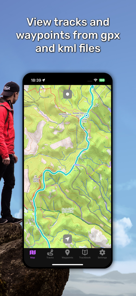
A smartphone screen displaying a turquoise hiking track on a detailed topographic map within the GPX Viewer PRO app.
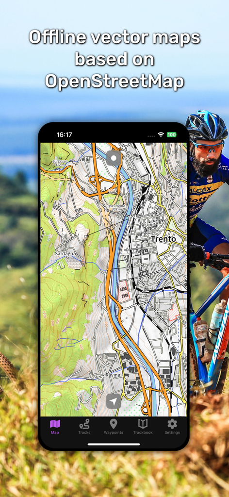
Smartphone displaying offline vector maps on GPX Viewer PRO for mountain biking
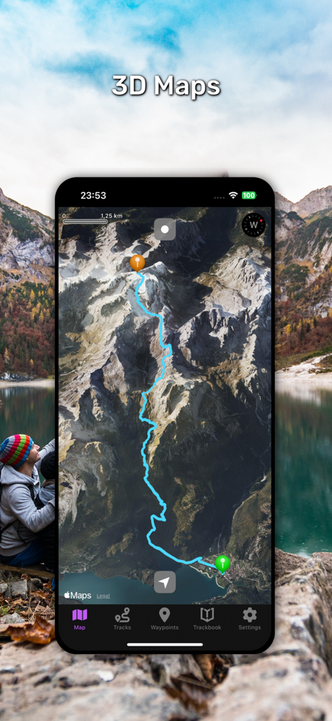
GPX Viewer PRO app displaying a 3D topographic map with a highlighted hiking trail through mountain terrain
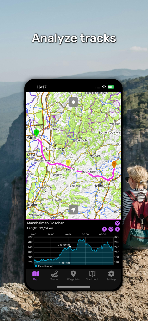
GPX Viewer PRO app interface showing a map route with an elevation profile chart
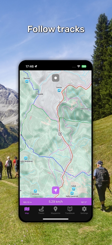
GPX Viewer PRO mobile app interface for tracking hiking routes on topographic maps
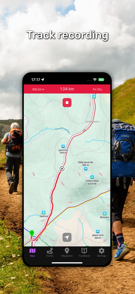
GPX Viewer PRO app interface showing topographic hiking tracks and real-time navigation data
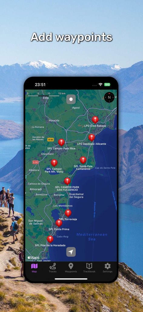
A smartphone displaying the GPX Viewer PRO app with multiple red waypoints on a coastal map.
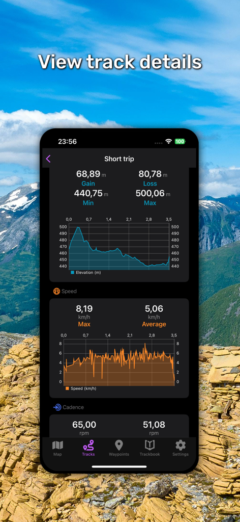
GPX Viewer PRO app interface displaying detailed track statistics and activity charts.
Description
Download
More Like This
Apps with similar features and user experience

MilGPS
Cascode Labs Pty Ltd

SEAiq Pilot VPP
Sakhalin, LLC

Cartograph Maps 3
Harald Meyer

新知卫星地图-路线规划,高清地图导航
Chongqing Xinzhi Space Technology Co., Ltd.

Coordinates – GPS Converter
Mapnitude Company Limited

Mgrs & Utm Map
Vahid Cataltas

DeepStateMap
Heorhii Karpenko

Map Plus
Miocool Inc.

Compass 55. Map & GPS kit.
Kalimex-Consulting s.r.o.
This page is not an official page of the app or its developer, but an independent editorial publication created for informational and commentary purposes. Unless expressly stated otherwise, neither the app nor its developer is affiliated with, endorsed by, sponsored by, authorized by, or otherwise officially connected with MWM, Apple, Google Play, the app publisher, or the app's developer, and nothing on this page implies that the app was developed using MWM's services. Any trademarks, logos, screenshots, and other content remain the property of their respective owners.