This page is not an official page of the app or its developer, but an independent editorial publication created for informational and commentary purposes. Unless expressly stated otherwise, neither the app nor its developer is affiliated with, endorsed by, sponsored by, authorized by, or otherwise officially connected with MWM, Apple, Google Play, the app publisher, or the app's developer, and nothing on this page implies that the app was developed using MWM's services. Any trademarks, logos, screenshots, and other content remain the property of their respective owners.

Hunting Points: GPS & Hunt App
Navigate the backcountry with confidence using offline maps, identify land boundaries instantly, and master your hunt with real-time wind and deer activity forecasts.
Downloads
371K+User Rating
Total Ratings
5K+Publisher
Category
NavigationLocales
1Latest Version
1.8.9Size
148.1 MBFirst Released
Aug 31, 2018The Ultimate Tactical Advantage for Every Hunter
From detailed property boundaries to real-time wind patterns, get the high-precision tools you need to scout, navigate, and succeed in the wild.
Master the Land Boundaries
Identify public and private property lines instantly with landowner names and parcel data to hunt with confidence and stay legal.
Off-the-Grid Navigation
Lose the signal, not your way. Access offline 3D terrain maps and GPS tracking to navigate safely back to base camp in the deepest backcountry.
The following screenshots and description are sourced directly from the app's official store listing and are the property of the app developer.
App Store
Screenshots
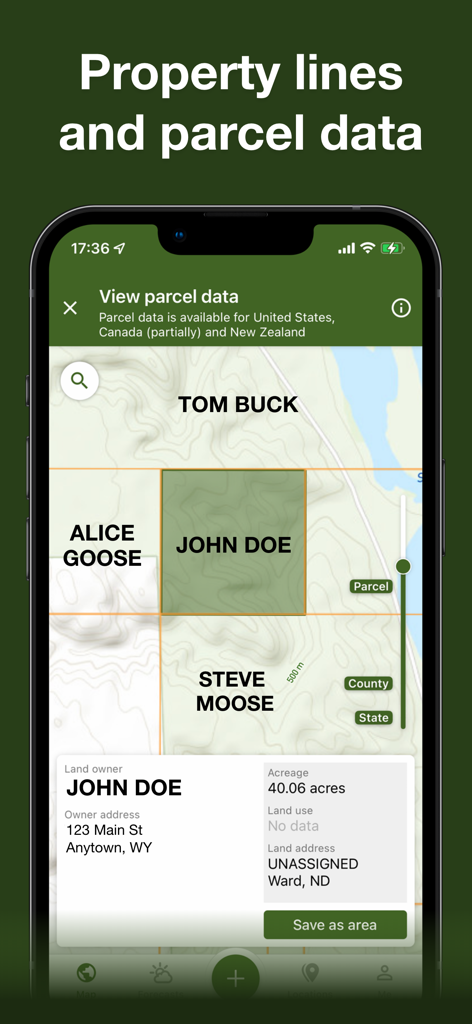
Smartphone screen showing property lines and landowner parcel data on a hunting map
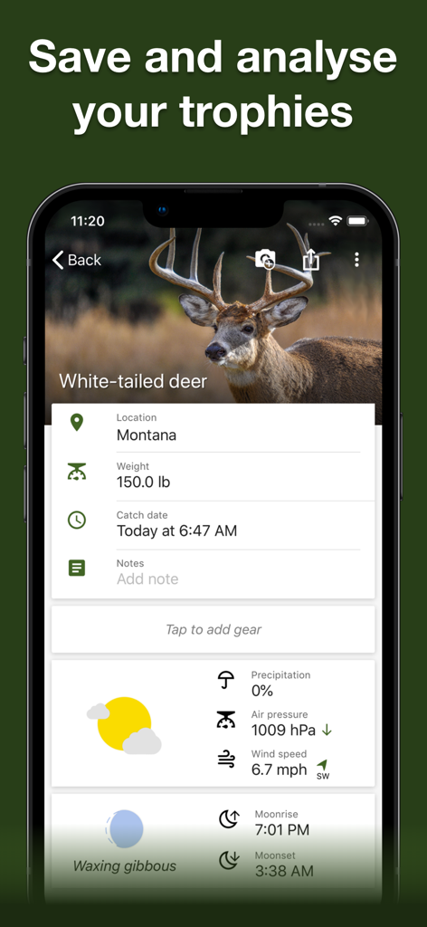
Hunting Points app trophy room screen showing a white-tailed deer catch report with weather and solunar data
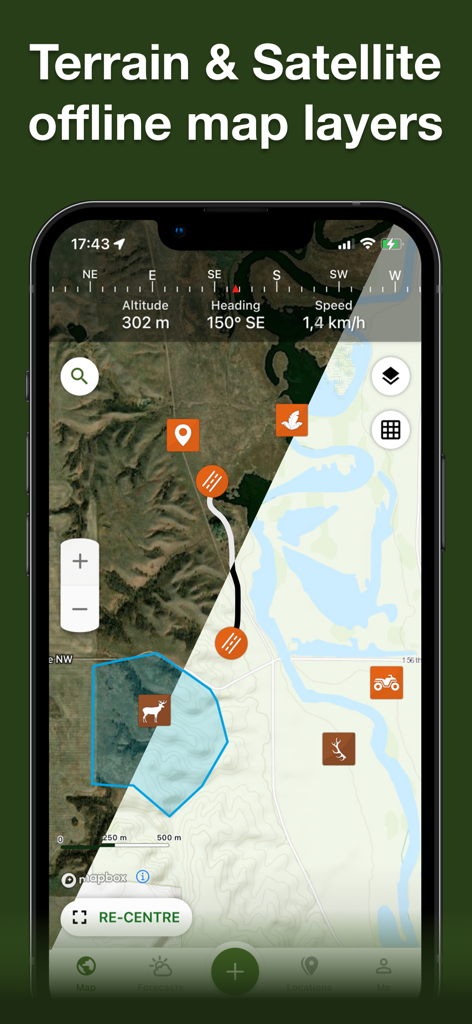
Hunting Points app showing a split view of terrain and satellite offline map layers with hunting icons and GPS data
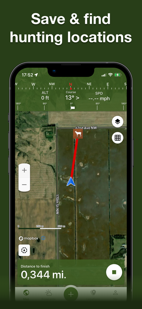
Screenshot of Hunting Points app showing a satellite map with a navigation path to a deer waypoint
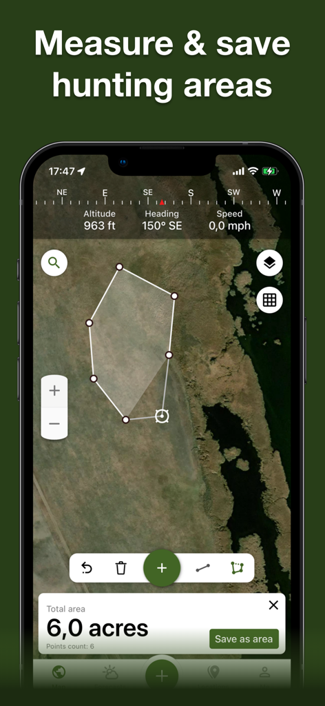
A smartphone interface showing a satellite map with a drawn polygon measuring a six acre hunting area.
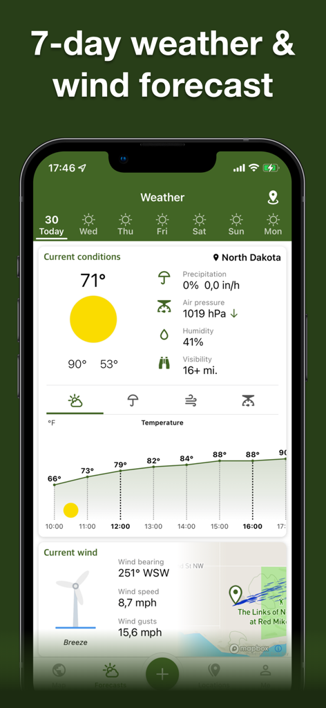
Weather and wind forecast screen on Hunting Points app
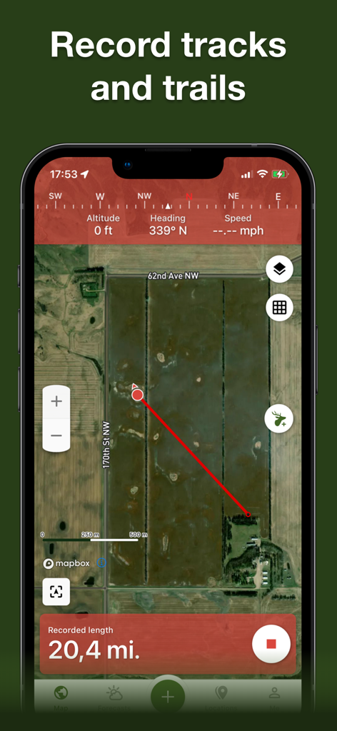
GPS track and trail recording on a satellite map within the Hunting Points app
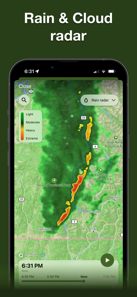
Rain and cloud radar map showing precipitation intensity for hunting planning.
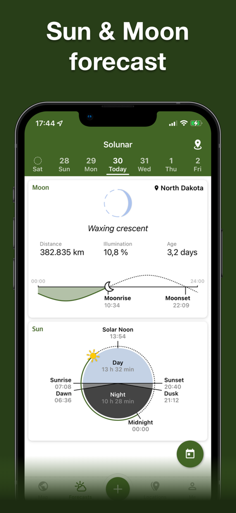
Detailed solunar data and sun and moon forecast on the Hunting Points app
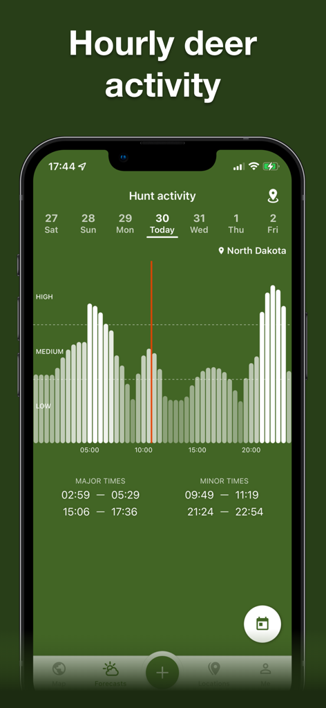
A mobile app screen showing a chart of hourly deer activity levels and feeding times for hunting in North Dakota.
Description
Download
More Like This
Apps with similar features and user experience

onX Hunt: GPS Hunting Maps
onXmaps, Inc.

GOHUNT: Research & Maps
GOHUNT, LLC

HuntWise: A Better Hunting App
Sportsman Tracker, Inc

HuntStand: GPS Maps & Tools
Good Sportsman Marketing, LLC

MyHunt: US Best Hunting App
Hunter & Companion Gesellschaft mit beschrankter Haftung

WeHunt
Natlink AB

DeerCast-Prep. Predict. Pursue
Good Sportsman Marketing, LLC

BaseMap: Hunting GPS Maps
BaseMap Inc

iHunter
Inside Outside Studios Inc.
This page is not an official page of the app or its developer, but an independent editorial publication created for informational and commentary purposes. Unless expressly stated otherwise, neither the app nor its developer is affiliated with, endorsed by, sponsored by, authorized by, or otherwise officially connected with MWM, Apple, Google Play, the app publisher, or the app's developer, and nothing on this page implies that the app was developed using MWM's services. Any trademarks, logos, screenshots, and other content remain the property of their respective owners.