This page is not an official page of the app or its developer, but an independent editorial publication created for informational and commentary purposes. Unless expressly stated otherwise, neither the app nor its developer is affiliated with, endorsed by, sponsored by, authorized by, or otherwise officially connected with MWM, Apple, Google Play, the app publisher, or the app's developer, and nothing on this page implies that the app was developed using MWM's services. Any trademarks, logos, screenshots, and other content remain the property of their respective owners.

经纬度定位-经纬度导航GPS卫星地图经纬度地图查询和拍照打卡
Master the outdoors with high-definition offline maps, real-time coordinate tracking, and professional watermark photography for field verification.
Downloads
0User Rating
Total Ratings
0Publisher
Category
UtilitiesLocales
5Latest Version
1.2.2Size
47.2 MBFirst Released
Apr 5, 2025Professional Precision for Field and Forest
A comprehensive suite of geospatial tools designed for professionals and outdoor enthusiasts who demand absolute accuracy in every environment.
Verified Watermark Camera
Automatically embed GPS coordinates, altitude, and timestamps into your photos—perfect for documenting job sites and inspection proof.
Offline Satellite Intelligence
Access high-resolution satellite and terrain maps without cellular service, ensuring you never lose your way in remote rural areas.
The following screenshots and description are sourced directly from the app's official store listing and are the property of the app developer.
App Store
Screenshots
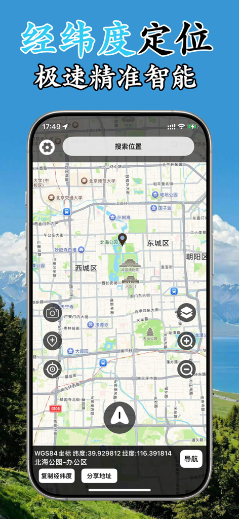
A mobile app interface displaying a detailed city map with precise GPS coordinates and professional navigation tools
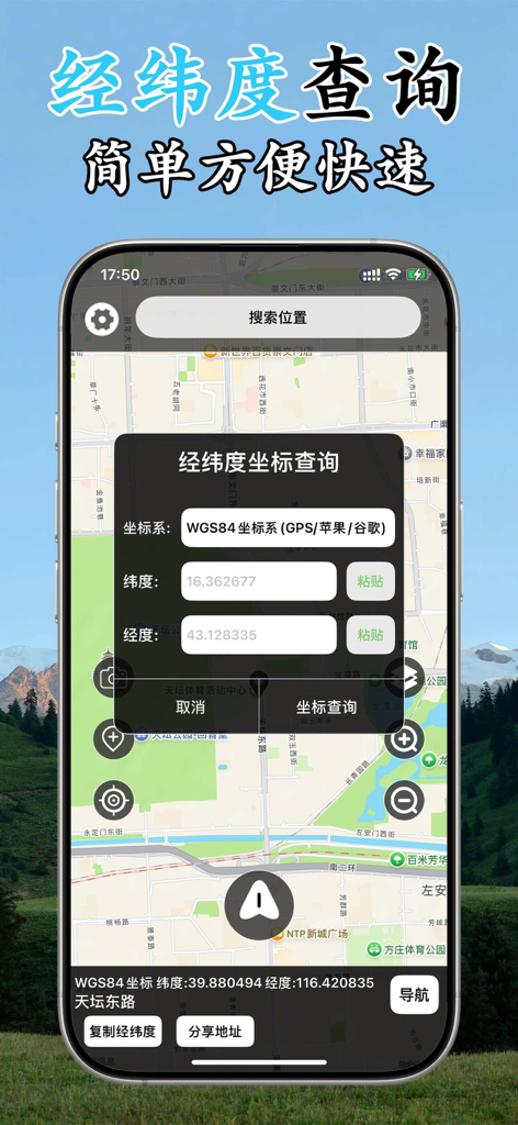
A mobile app interface showing a GPS coordinate search tool with latitude and longitude input fields over a street map
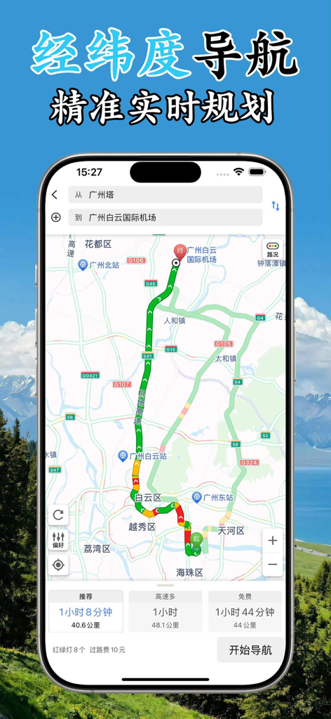
A smartphone screen showing a GPS navigation route with real-time traffic data and travel time estimates
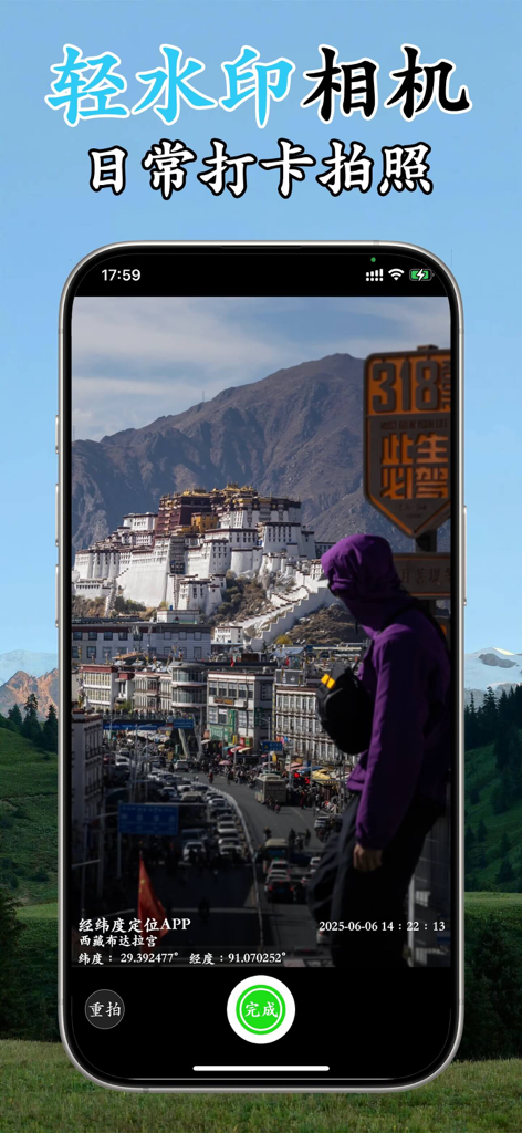
A smartphone displaying a camera feature with a GPS coordinate and timestamp watermark on a landscape photo.
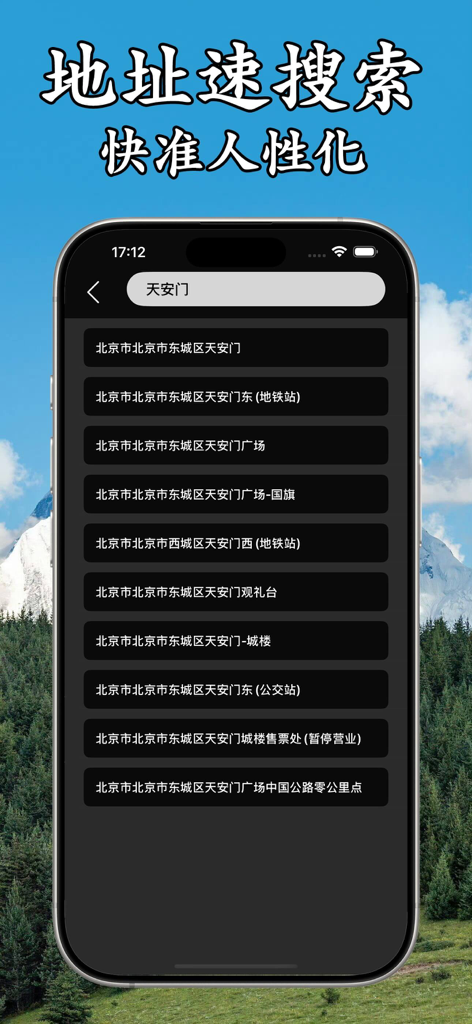
A mobile app interface displaying a search bar and a list of address search results for precision navigation.
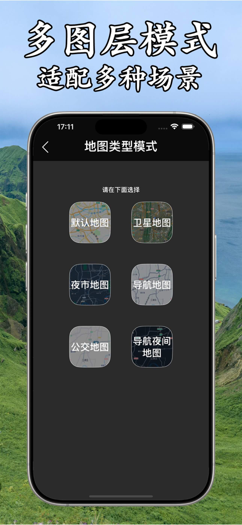
A smartphone interface showing different map layer options including satellite, navigation, and night modes for GPS positioning.
Description
Download
More Like This
Top-ranked apps in the same category

Google LLC

Google Chrome
Google LLC

中国移动(手机营业厅)
China Mobile Online Services Co., Ltd.

Google Authenticator
Google LLC

CNH do Brasil
Servicos e Informacoes do Brasil

Cleanup: Phone Storage Cleaner
DEEP FLOW SOFTWARE SERVICES - FZCO

gov.br
Servicos e Informacoes do Brasil

中国电信-全国统一官方服务平台
CHINA TELECOM Corporation Ltd.

Microsoft Edge: AI Browser
Microsoft Corporation
This page is not an official page of the app or its developer, but an independent editorial publication created for informational and commentary purposes. Unless expressly stated otherwise, neither the app nor its developer is affiliated with, endorsed by, sponsored by, authorized by, or otherwise officially connected with MWM, Apple, Google Play, the app publisher, or the app's developer, and nothing on this page implies that the app was developed using MWM's services. Any trademarks, logos, screenshots, and other content remain the property of their respective owners.