This page is not an official page of the app or its developer, but an independent editorial publication created for informational and commentary purposes. Unless expressly stated otherwise, neither the app nor its developer is affiliated with, endorsed by, sponsored by, authorized by, or otherwise officially connected with MWM, Apple, Google Play, the app publisher, or the app's developer, and nothing on this page implies that the app was developed using MWM's services. Any trademarks, logos, screenshots, and other content remain the property of their respective owners.

KartenWerft NavGo 2.0
Navigate the Baltic Sea and German inland waters with precision. Access high-resolution digital charts, bridge clearances, lock times, and real-time AIS integration—engineered for the safety-conscious boater.
Downloads
13K+User Rating
Total Ratings
700Publisher
Category
NavigationLocales
3Latest Version
2.3.0Size
81.4 MBFirst Released
May 3, 2022Master the Waterways with Precision
Experience professional-grade maritime navigation. From inland canals to the Baltic coast, NavGo 2.0 provides the technical accuracy and real-time data required for a safe, seamless voyage.
Nautical Intelligence
Navigate with confidence using detailed data on bridge clearances, depth restrictions, and lock schedules updated specifically for your route.
Live AIS Integration
Enhance situational awareness by overlaying real-time AIS signals from your onboard receiver directly onto high-resolution digital charts.
The following screenshots and description are sourced directly from the app's official store listing and are the property of the app developer.
App Store
Screenshots
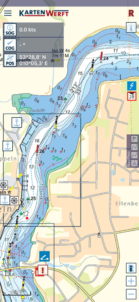
A screenshot of the KartenWerft NavGo 2.0 app displaying a detailed digital nautical chart with navigation data and waterway information
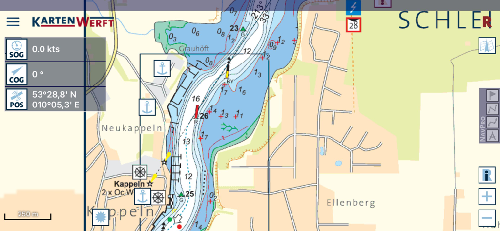
Detailed marine navigation chart on KartenWerft NavGo 2.0 app showing GPS position and nautical markers
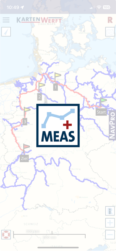
Nautical navigation app displaying a measurement tool over a map of German waterways
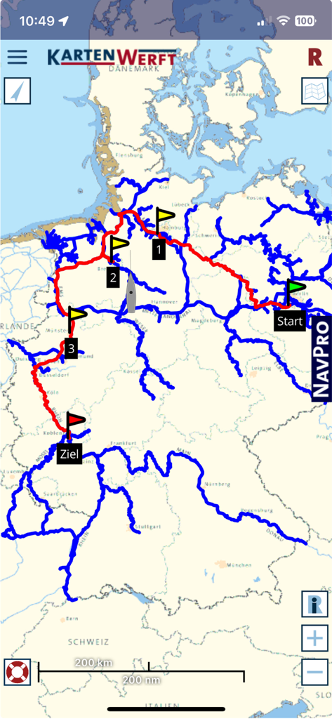
Digital nautical map showing a planned boat route across German inland waterways
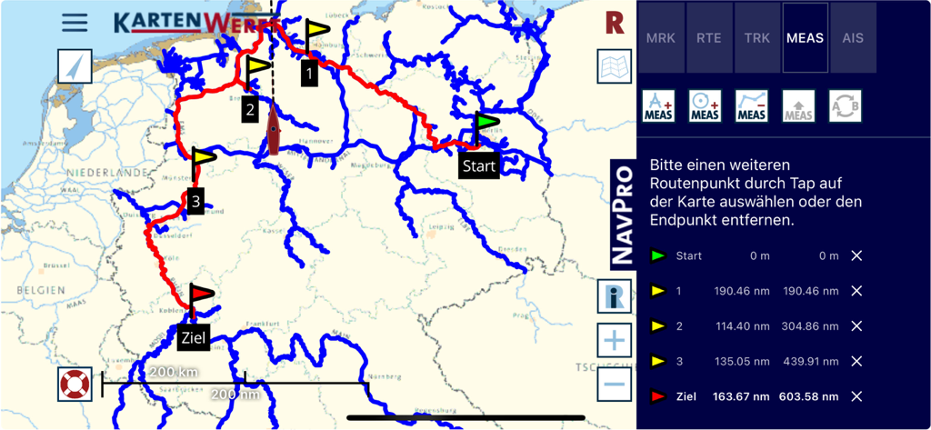
Marine navigation app showing a planned route with distance measurements on a nautical map
Description
Download
More Like This
Apps with similar features and user experience

PredictWind — Marine Forecasts
PredictWind Limited

Navily
The Navigation Family

Argo - Boating Navigation
Argo Navigation, LLC

SEAiq Pilot
Sakhalin, LLC

Maptrails
Pasi Salenius

MarineTraffic - Ship Tracking
MARINETRAFFIC APPLICATIONS LTD

Wavve Boating: Marine Boat GPS
Wavve Boating Inc

Savvy Navvy Boating Navigation
SAVVY NAVVY LTD

Aqua Map Boating
GEC s.r.l.
This page is not an official page of the app or its developer, but an independent editorial publication created for informational and commentary purposes. Unless expressly stated otherwise, neither the app nor its developer is affiliated with, endorsed by, sponsored by, authorized by, or otherwise officially connected with MWM, Apple, Google Play, the app publisher, or the app's developer, and nothing on this page implies that the app was developed using MWM's services. Any trademarks, logos, screenshots, and other content remain the property of their respective owners.