This page is not an official page of the app or its developer, but an independent editorial publication created for informational and commentary purposes. Unless expressly stated otherwise, neither the app nor its developer is affiliated with, endorsed by, sponsored by, authorized by, or otherwise officially connected with MWM, Apple, Google Play, the app publisher, or the app's developer, and nothing on this page implies that the app was developed using MWM's services. Any trademarks, logos, screenshots, and other content remain the property of their respective owners.

Map 3D Track+
Capture rich environmental data, record detailed field observations, and organize your outdoor adventures in one elegantly designed companion for researchers and data-driven enthusiasts.
Downloads
184K+User Rating
Total Ratings
0Publisher
Category
NavigationLocales
1Latest Version
1.1Size
5.0 MBFirst Released
Mar 31, 2025The Ultimate Toolkit for Modern Explorers
Seamlessly organize field notes, track terrain metrics, and archive your adventures with a professional-grade interface designed for precision and beauty.
Rich Field Documentation
Capture detailed observations with environmental data, photos, and custom tags for a complete scientific record of your discoveries.
Advanced 3D Path Tracking
Visualize every ascent in three dimensions with precise metrics on terrain, difficulty, and distance for better performance review.
Frequently Asked Questions
Everything you need to know about Map 3D Track+
What is GeoTrove?
GeoTrove is a personal field companion application. It organizes locations, routes, field notes, and travel journals, enabling users to record detailed observations with environmental data, photos, and customizable tags.
How does GeoTrove organize user field data?
GeoTrove organizes field data using color-coded categories and powerful filter and search tools. This provides quick access to recorded observations, photos, environmental data, and customizable tags.
Can GeoTrove track and log outdoor routes?
Yes, GeoTrove tracks routes and logs them with details such as distance, terrain, and difficulty. Users can create comprehensive route entries including start points, end points, and dates.
What information can users add to a GeoTrove travel journal entry?
Users can add locations, dates, and descriptive text to GeoTrove travel journal entries. The app also supports integrating images and categorizing entries with customizable tags for better organization.
Does GeoTrove support adding images to field notes?
Yes, GeoTrove supports adding images to field notes. Users can record detailed observations, such as a "Snow Leopard Sighting," including photographs, environmental data, and specific notes about the encounter.
How do GeoTrove users find specific saved data?
GeoTrove users find specific saved data using powerful filter and search tools. These functionalities enable quick retrieval of locations, field notes, route logs, and journal entries.
The following screenshots and description are sourced directly from the app's official store listing and are the property of the app developer.
App Store
Screenshots
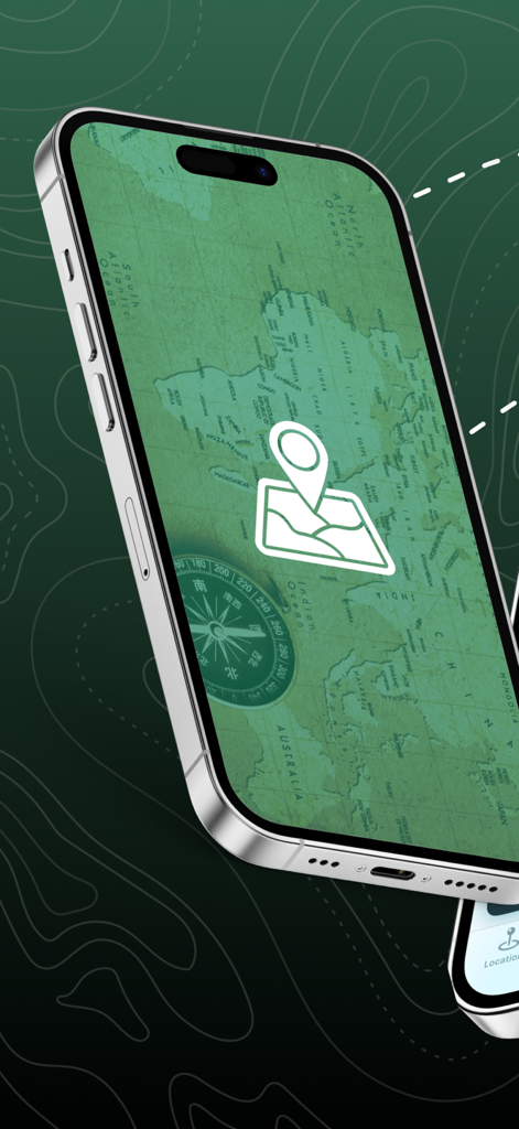
iPhone screen showing a vintage green world map and compass in the Map 3D Track app
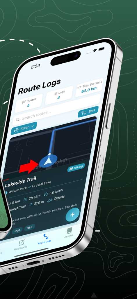
Smartphone screen showing hiking route logs with distance metrics and trail details
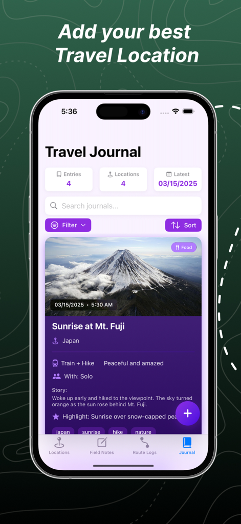
Travel journal interface in the Map 3D Track app displaying a field note entry for a sunrise hike at Mt Fuji.
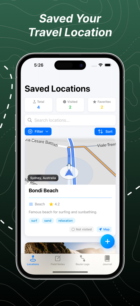
Interface of the Map 3D Track app displaying saved travel locations with a detailed card and map for Bondi Beach
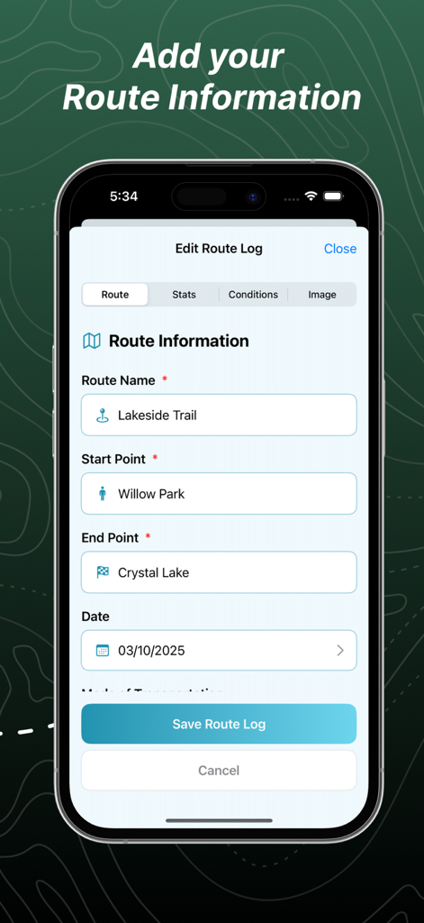
The route information entry screen in the Map 3D Track plus app showing fields for route name start point and end point
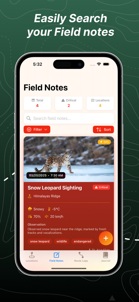
Map 3D Track app interface displaying a field note for a snow leopard sighting in the Himalayas with environmental data and photo.
Description
Download
More Like This
Apps with similar features and user experience

MilGPS
Cascode Labs Pty Ltd

SEAiq Pilot VPP
Sakhalin, LLC

Cartograph Maps 3
Harald Meyer

新知卫星地图-路线规划,高清地图导航
Chongqing Xinzhi Space Technology Co., Ltd.

Coordinates – GPS Converter
Mapnitude Company Limited

Mgrs & Utm Map
Vahid Cataltas

DeepStateMap
Heorhii Karpenko

Map Plus
Miocool Inc.

Compass 55. Map & GPS kit.
Kalimex-Consulting s.r.o.
This page is not an official page of the app or its developer, but an independent editorial publication created for informational and commentary purposes. Unless expressly stated otherwise, neither the app nor its developer is affiliated with, endorsed by, sponsored by, authorized by, or otherwise officially connected with MWM, Apple, Google Play, the app publisher, or the app's developer, and nothing on this page implies that the app was developed using MWM's services. Any trademarks, logos, screenshots, and other content remain the property of their respective owners.