This page is not an official page of the app or its developer, but an independent editorial publication created for informational and commentary purposes. Unless expressly stated otherwise, neither the app nor its developer is affiliated with, endorsed by, sponsored by, authorized by, or otherwise officially connected with MWM, Apple, Google Play, the app publisher, or the app's developer, and nothing on this page implies that the app was developed using MWM's services. Any trademarks, logos, screenshots, and other content remain the property of their respective owners.

MAPAS: Live Street View & GPS
No longer bound by geography, users gain omnipresent eyes on the world. This app grants instant immersion, making every street, every landmark, a personal viewport.
Downloads
2.5M+User Rating
Total Ratings
13.6KPublisher
Category
NavigationLocales
1Latest Version
15Size
82.4 MBFirst Released
Mar 17, 2017An evaluation of core functionalities and their impact on digital exploration and navigation.
Key Features Analysis
Live Street View Immersion
The app provides real-time street-level views of global locations, enabling users to explore famous places with stunning clarity and an immersive experience.
Advanced Google Maps Integration
This tool features precise navigation using the latest Google Maps data, offering multiple view options like satellite and terrain, and effortless direction finding.
Detailed 3D Earth Imagery
It allows users to dive into a 3D world with detailed earth imagery, facilitating virtual tours and educational exploration of buildings and landscapes from any angle.
Community-Driven Street Views
The app integrates user-contributed street-level imagery, offering comprehensive and frequently updated perspectives from a wide array of locations.
Interactive Discovery & Sharing
This tool features interactive functionalities, including the ability to capture and share screenshots, save favorite locations, and utilize a built-in compass for orientation.
Streamlined User Experience
It offers a sleek and intuitive design, ensuring easy and enjoyable exploration with quick access to essential features through a streamlined menu.
Frequently Asked Questions
Everything you need to know about MAPAS: Live Street View & GPS
What is MAPAS: Live Street View & GPS?
MAPAS: Live Street View & GPS is an app that transforms devices into virtual windows to the world. It provides live street view, integrates Google Maps, and offers 3D imagery for exploring places, navigating, and taking virtual tours.
Does MAPAS provide live street views?
Yes, MAPAS provides live street views. It allows users to experience real-time views of streets and landmarks globally, utilizing Google Maps' extensive street view data for an immersive experience and live street walks.
Can I use Google Maps features within the MAPAS app?
Yes, MAPAS integrates enhanced Google Maps features. Users can navigate with precision, access detailed maps with satellite, street, and terrain views, find their current location, and get directions effortlessly.
Does MAPAS offer 3D earth imagery?
Yes, MAPAS offers detailed 3D earth imagery. Users can zoom, pan, and rotate to explore buildings and landscapes from any angle. This feature is perfect for virtual tours and educational purposes.
What interactive features does MAPAS include?
MAPAS includes interactive features such as capturing and sharing screenshots of locations, adding places to favorites for quick access, and using a built-in compass for better orientation and navigation.
Are there in-app purchases or subscriptions in MAPAS?
Yes, MAPAS offers in-app purchase options to remove ads and unlock premium content. It also provides both monthly and lifetime subscription plans for users.
How can I manage my MAPAS subscription?
Users can manage their MAPAS subscription and turn off auto-renewal by accessing their iTunes Account Settings after purchase. Subscriptions renew automatically unless auto-renew is disabled 24 hours prior.
Does MAPAS support 360-degree indoor exploration?
Yes, MAPAS supports 360-degree indoor exploration. The app features a "360° Indoor Explorer" mode, allowing users to view interior spaces immersively.
Can MAPAS show weather information?
Yes, MAPAS displays current weather information. The "All-in-One GPS Toolkit" screen shows the temperature and conditions, such as "15°C BROKEN CLOUDS" for a specific location.
Does MAPAS offer a "Country Street Walk" feature?
Yes, MAPAS includes a "Country Street Walk" feature. This functionality is part of its "All-in-One GPS Toolkit," enabling users to virtually explore country streets.
The following screenshots and description are sourced directly from the app's official store listing and are the property of the app developer.
App Store
Screenshots

The app showcases stunning 3D earth imagery, allowing users to explore diverse urban landscapes and detailed geographical features from an aerial perspective.
Global Cityscapes
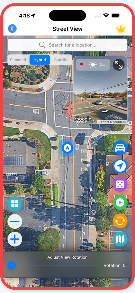
This tool provides an interactive street view experience, featuring precise Google Maps integration and a convenient view rotation control for detailed exploration.
Dynamic Street View

Users can immerse themselves in live street walk mode, offering high-fidelity views of famous global landmarks and the ability to capture and share these virtual journeys.
Live Walk Mode
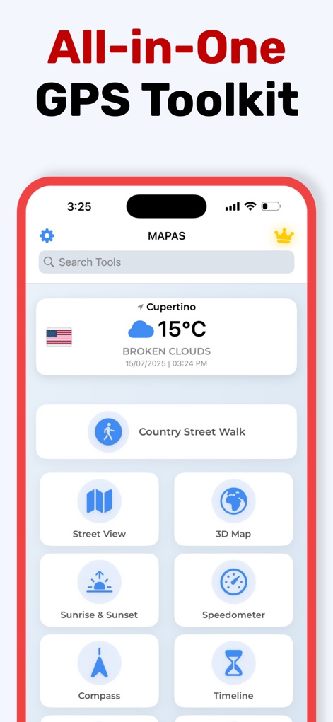
The app integrates a full GPS toolkit, providing essential navigation features such as a detailed 3D Map and a precise digital Compass for enhanced exploration.
Comprehensive Navigation Hub
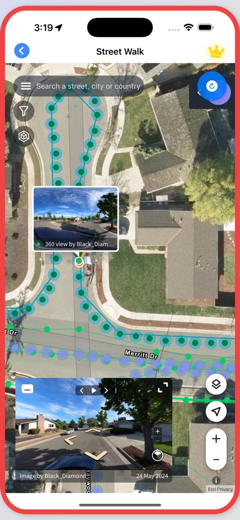
This tool presents detailed street walk paths, enabling users to explore routes with interactive 360-degree views and precise geographical overlays for comprehensive understanding.
Detailed Street Paths
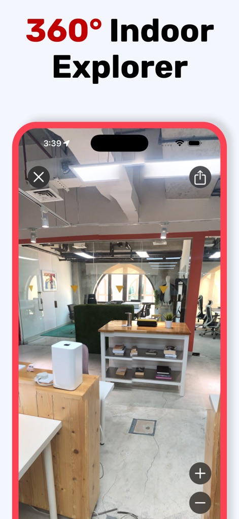
The app extends exploration indoors with its 360° Indoor Explorer, allowing users to virtually tour various internal spaces and zoom for minute details.
Indoor 360 Exploration
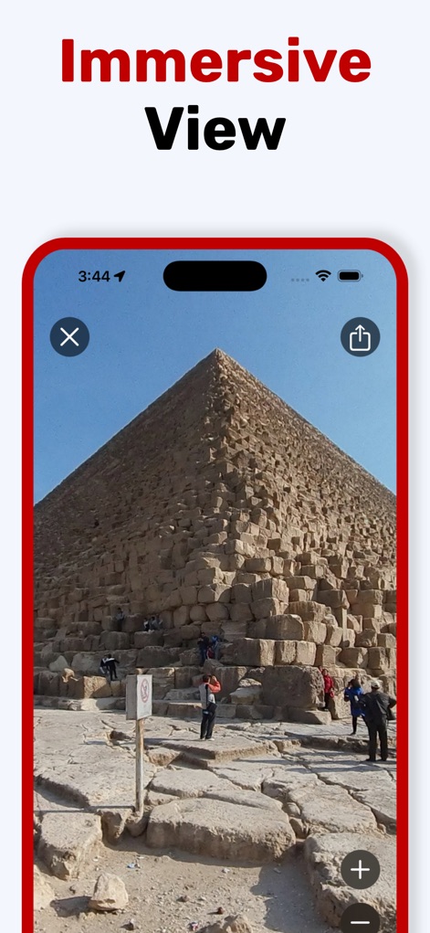
Users can experience iconic global landmarks through an immersive view, featuring stunning visual clarity and interactive zoom capabilities for detailed observation.
Iconic Landmark Views
Description
Download
More Like This
Apps with similar features and user experience

Earth Maps
FOXPOI PTE. LTD.

Satellite Map - Live Earth
慧敏 赵

Satellite Map - Earth View
ANKAGIS YAZILIM ANONIM SIRKETI

World Street 3D Panoramic Map
Beijing Zhiyue Information Technology Co., Ltd

3D Earth Map Street View
Naik Ur Rehman

Globe 3D Earth: World Map Live
Shams Alam

Street View - street view maps
国辉 满

卫星地图-高清地球探索世界
方元 朱

GoGoEarth - Custom map source
大靖 刘
This page is not an official page of the app or its developer, but an independent editorial publication created for informational and commentary purposes. Unless expressly stated otherwise, neither the app nor its developer is affiliated with, endorsed by, sponsored by, authorized by, or otherwise officially connected with MWM, Apple, Google Play, the app publisher, or the app's developer, and nothing on this page implies that the app was developed using MWM's services. Any trademarks, logos, screenshots, and other content remain the property of their respective owners.