This page is not an official page of the app or its developer, but an independent editorial publication created for informational and commentary purposes. Unless expressly stated otherwise, neither the app nor its developer is affiliated with, endorsed by, sponsored by, authorized by, or otherwise officially connected with MWM, Apple, Google Play, the app publisher, or the app's developer, and nothing on this page implies that the app was developed using MWM's services. Any trademarks, logos, screenshots, and other content remain the property of their respective owners.

Planimeter: Area & Distance
Calculate areas, perimeters, and distances instantly with satellite accuracy. The essential tool for landscaping, construction, and outdoor project planning.
Downloads
27K+User Rating
Total Ratings
400Publisher
Category
UtilitiesLocales
4Latest Version
3.8Size
29.9 MBFirst Released
Jun 22, 2019Precision Measurement Tools for Every Project
From professional site surveys to weekend landscaping, Planimeter delivers accurate area and distance calculations using advanced satellite imagery and GPS technology.
Instant Area & Perimeter Mapping
Easily measure plots of land, lawns, or construction sites by marking points on a map to get exact dimensions for materials.
Professional Contractor Insights
Calculate roof sizes, road lengths, and lot dimensions remotely, allowing you to provide fast, accurate quotes without leaving your office.
The following screenshots and description are sourced directly from the app's official store listing and are the property of the app developer.
App Store
Screenshots
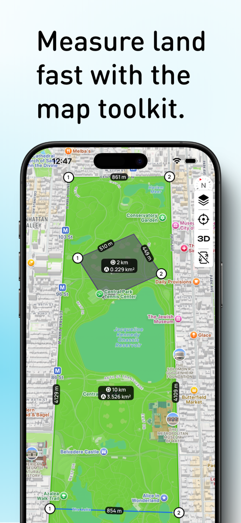
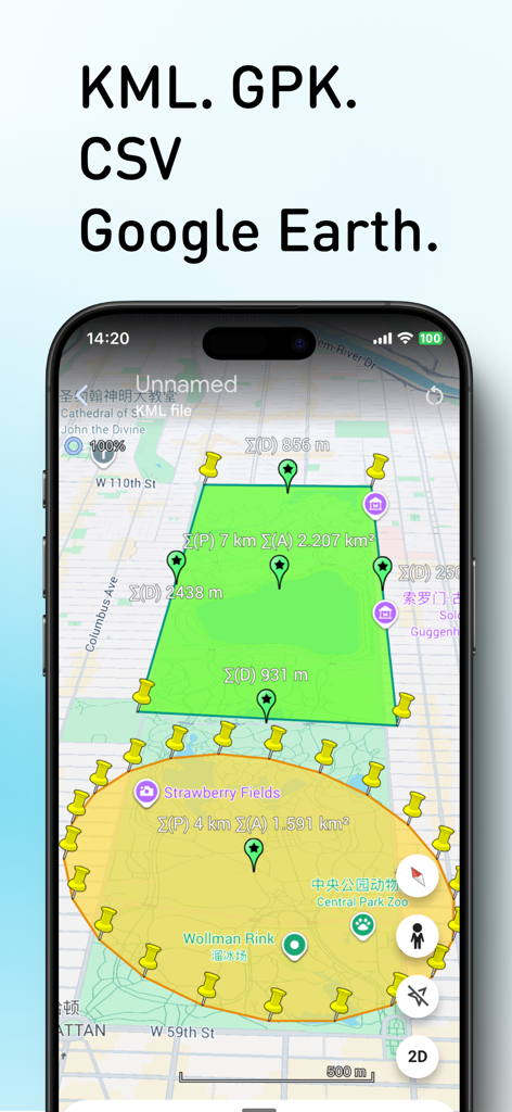
A smartphone screen displaying the Planimeter app measuring area and distance on a map of Central Park
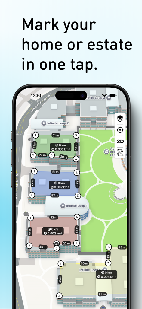
Planimeter app interface showing 3D satellite map with land area and perimeter measurements
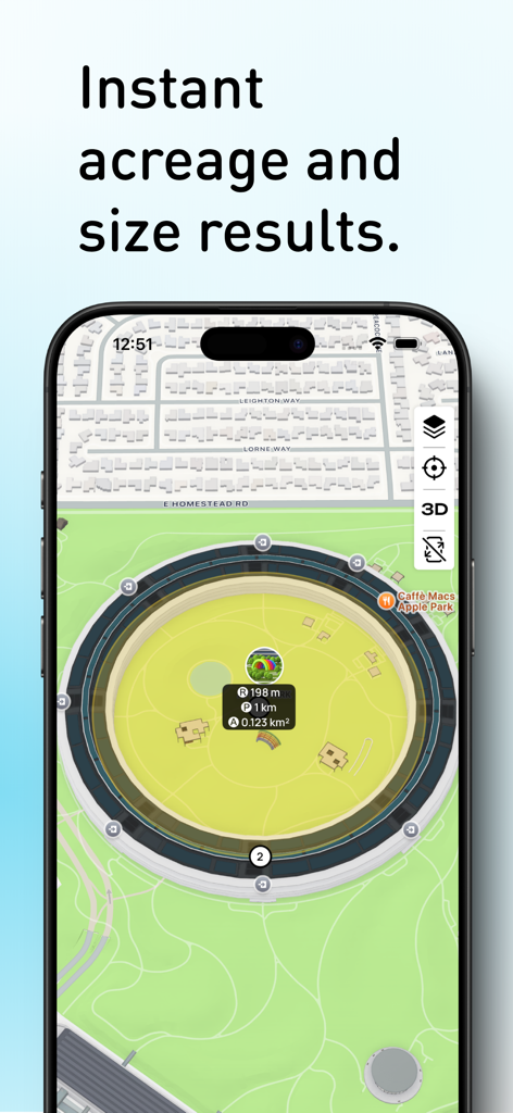
Mobile app screen showing land area and perimeter measurements on a satellite map
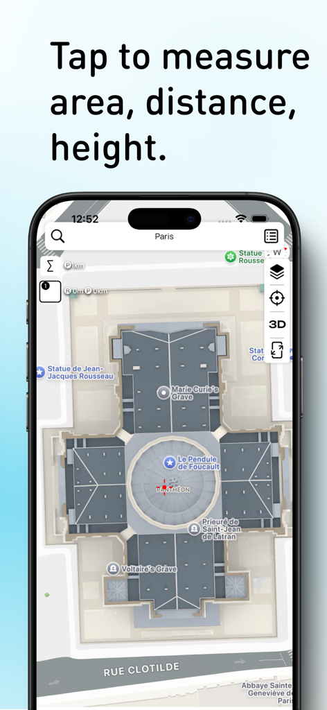
Planimeter app interface showing a satellite map to measure area distance and height
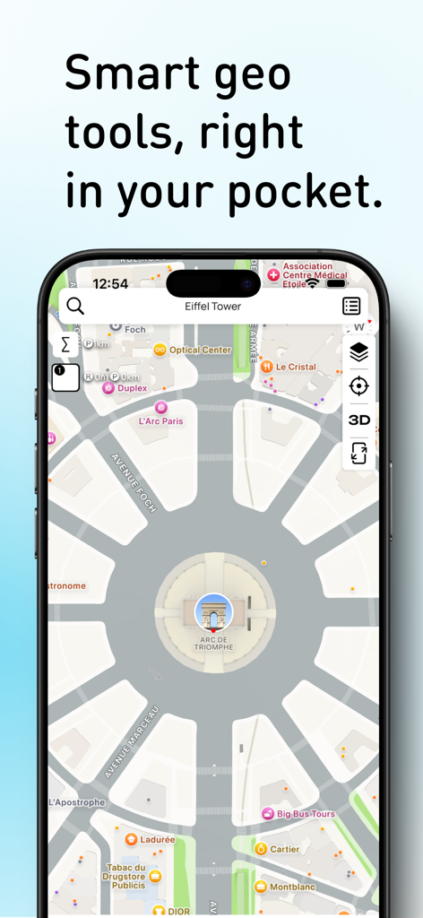
Planimeter app interface on a smartphone showing a map of the Arc de Triomphe with measurement tools
Planimeter app screen displaying area and distance calculations on a satellite map
Description
Download
More Like This
Top-ranked apps in the same category

Google LLC

Google Chrome
Google LLC

中国移动(手机营业厅)
China Mobile Online Services Co., Ltd.

Google Authenticator
Google LLC

CNH do Brasil
Servicos e Informacoes do Brasil

Cleanup: Phone Storage Cleaner
DEEP FLOW SOFTWARE SERVICES - FZCO

gov.br
Servicos e Informacoes do Brasil

中国电信-全国统一官方服务平台
CHINA TELECOM Corporation Ltd.

Microsoft Edge: AI Browser
Microsoft Corporation
This page is not an official page of the app or its developer, but an independent editorial publication created for informational and commentary purposes. Unless expressly stated otherwise, neither the app nor its developer is affiliated with, endorsed by, sponsored by, authorized by, or otherwise officially connected with MWM, Apple, Google Play, the app publisher, or the app's developer, and nothing on this page implies that the app was developed using MWM's services. Any trademarks, logos, screenshots, and other content remain the property of their respective owners.