This page is not an official page of the app or its developer, but an independent editorial publication created for informational and commentary purposes. Unless expressly stated otherwise, neither the app nor its developer is affiliated with, endorsed by, sponsored by, authorized by, or otherwise officially connected with MWM, Apple, Google Play, the app publisher, or the app's developer, and nothing on this page implies that the app was developed using MWM's services. Any trademarks, logos, screenshots, and other content remain the property of their respective owners.

ShipAtlas - Ship Tracker
Track over 125,000 vessels in real time with professional-grade satellite AIS, precise ETA estimation, and worldwide port traffic insights.
Downloads
21K+User Rating
Total Ratings
1K+Publisher
Category
ProductivityLocales
1Latest Version
8.0.1Size
84.4 MBFirst Released
Aug 9, 2020Professional Maritime Intelligence at Your Fingertips
From real-time AIS tracking to advanced route planning, ShipAtlas provides the data-driven insights you need to monitor global shipping and port activity with total confidence.
Satellite-Powered Live Tracking
Monitor over 125,000 vessels across the globe with high-resolution satellite and terrestrial AIS data, ensuring you never lose sight of a ship even in the open ocean.
Intelligent Sea Routing & ETAs
Plan precise voyages and calculate accurate arrival times from any AIS position to any port worldwide, tailored to specific vessel speeds and real-time maritime conditions.
The following screenshots and description are sourced directly from the app's official store listing and are the property of the app developer.
App Store
Screenshots
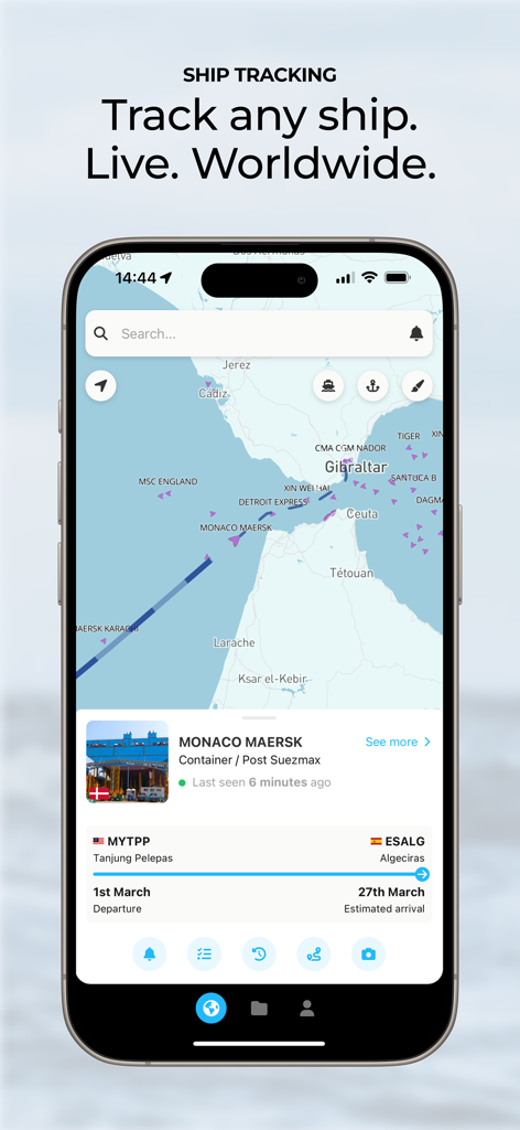
ShipAtlas mobile app interface displaying live AIS ship tracking and vessel details on a maritime map
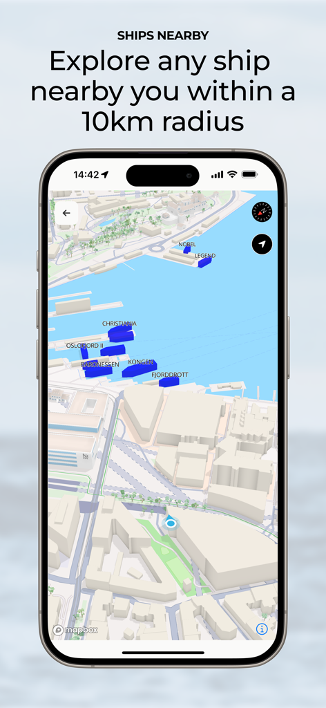
ShipAtlas app interface showing a map of ships nearby within a 10km radius
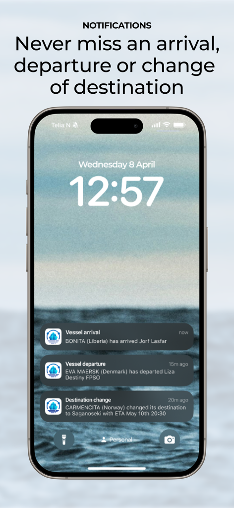
iPhone lock screen displaying ShipAtlas notifications for vessel arrivals departures and destination changes
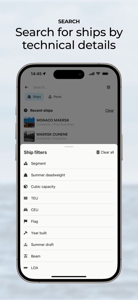
ShipAtlas app screen showing technical vessel search filters like deadweight and TEU.
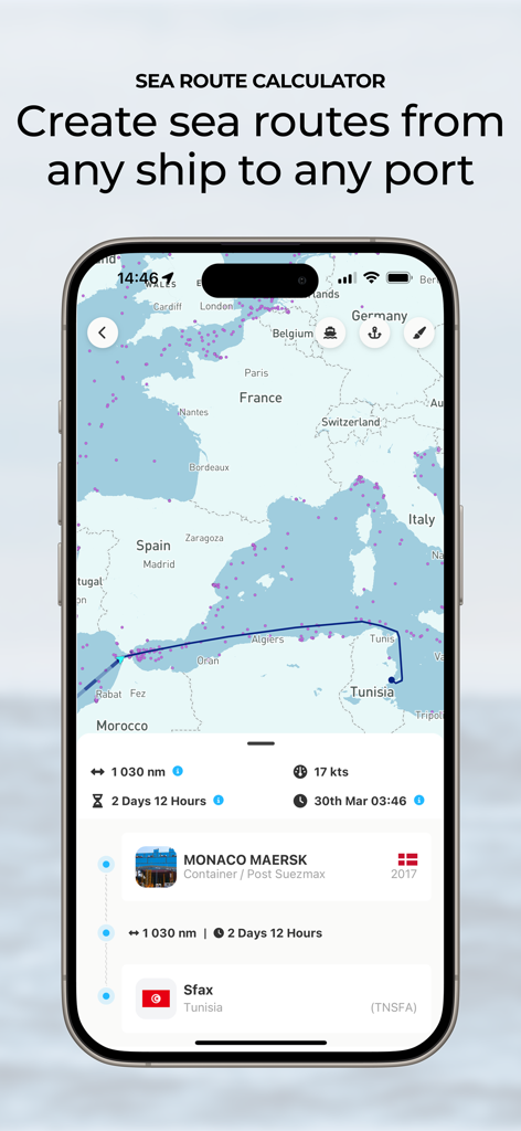
Sea route calculator in the ShipAtlas app showing a ship voyage from the Mediterranean to a port with estimated arrival time and distance.
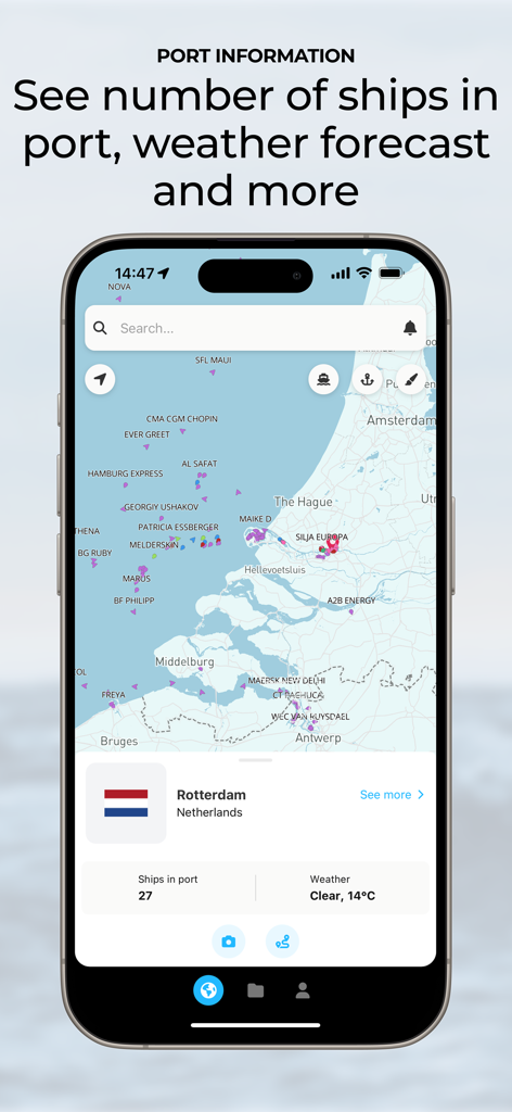
ShipAtlas app interface showing live port information for Rotterdam with ship counts and weather forecast on a map
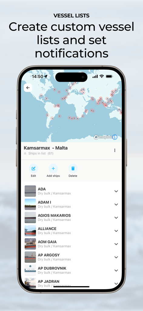
ShipAtlas app interface showing custom vessel lists and maritime tracking notifications
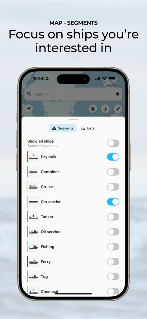
ShipAtlas interface showing vessel segment filters for customized ship tracking
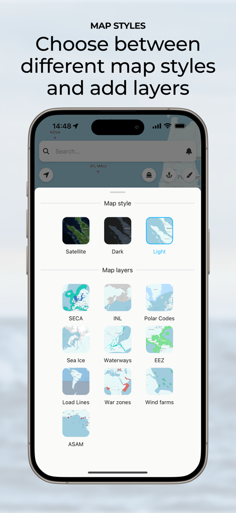
ShipAtlas app interface for choosing map styles and maritime data layers
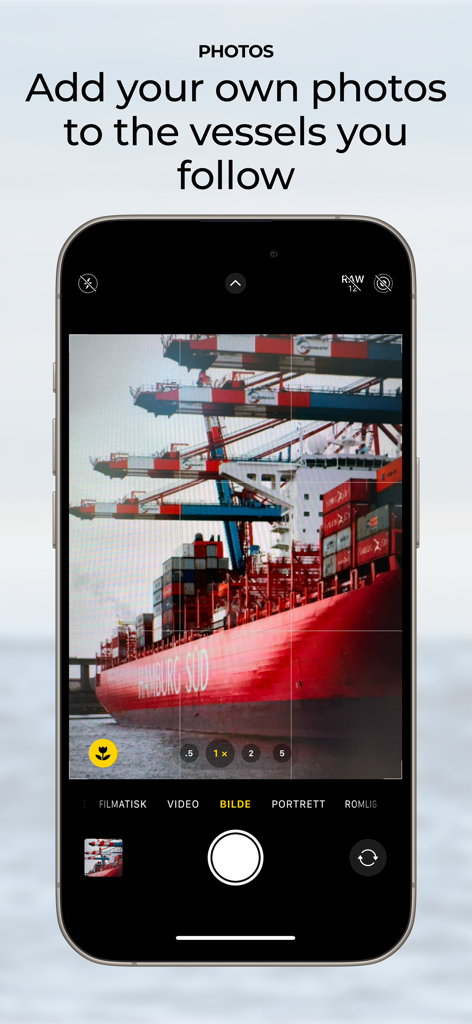
A smartphone screen demonstrating the feature to capture and add personal photos of tracked ships in the ShipAtlas app.
Description
Download
More Like This
Top-ranked apps in the same category

ChatGPT
OpenAI OpCo, LLC

Google Gemini
Google LLC

Grok
X.AI Corporation

Gmail - Email by Google
Google LLC

千问 - 阿里最强大模型官方AI助手
Shanghai Zhixin Puhui Technology Co., Ltd.

Google Drive
Google LLC

Microsoft Authenticator
Microsoft Corporation

Google Sheets
Google LLC

Google Docs
Google LLC
This page is not an official page of the app or its developer, but an independent editorial publication created for informational and commentary purposes. Unless expressly stated otherwise, neither the app nor its developer is affiliated with, endorsed by, sponsored by, authorized by, or otherwise officially connected with MWM, Apple, Google Play, the app publisher, or the app's developer, and nothing on this page implies that the app was developed using MWM's services. Any trademarks, logos, screenshots, and other content remain the property of their respective owners.