This page is not an official page of the app or its developer, but an independent editorial publication created for informational and commentary purposes. Unless expressly stated otherwise, neither the app nor its developer is affiliated with, endorsed by, sponsored by, authorized by, or otherwise officially connected with MWM, Apple, Google Play, the app publisher, or the app's developer, and nothing on this page implies that the app was developed using MWM's services. Any trademarks, logos, screenshots, and other content remain the property of their respective owners.

Theodolite
Trusted by millions of professionals since 2009. Consolidate your compass, inclinometer, rangefinder, and GPS into one battle-tested tool for capturing geo-overlay data in the most demanding environments.
Downloads
289K+User Rating
Total Ratings
3K+Publisher
Category
NavigationLocales
1Latest Version
9.1Size
29.6 MBFirst Released
Nov 30, 2009Professional-Grade Navigation for Field Experts
Theodolite consolidates a compass, inclinometer, rangefinder, and GPS into a single AR viewfinder designed for surveyors, engineers, and outdoor professionals.
Data-Overlay Documentation
Capture photos and movies with location, angle, and project notes embedded directly into the image and metadata for instant field records.
Precision Engineering Tools
Access pro-grade instruments including mil-based reticles, optical rangefinders, and multi-format coordinate systems like MGRS and US State Plane.
The following screenshots and description are sourced directly from the app's official store listing and are the property of the app developer.
App Store
Screenshots
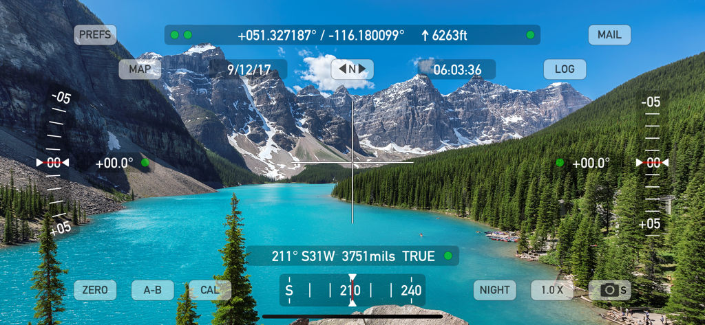
Theodolite app interface showing real-time GPS coordinates elevation and inclinometer data overlaid on a scenic mountain lake landscape
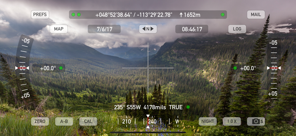
Theodolite app AR viewfinder with GPS and elevation data overlay on a mountain landscape
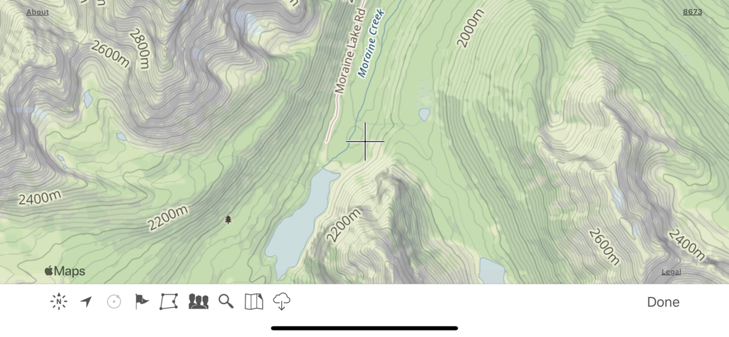
Topographic map interface in the Theodolite app showing contour lines and mountain terrain
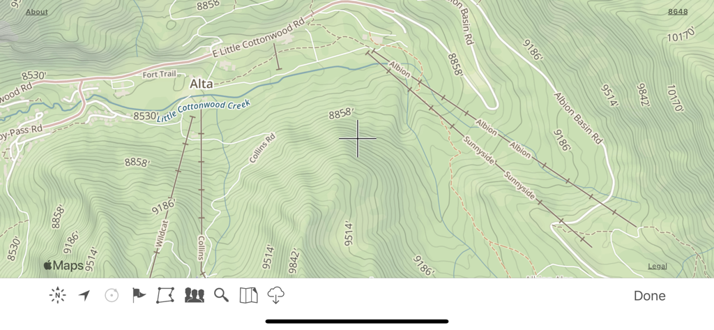
Topographic map display in the Theodolite app featuring elevation contours and trail labels
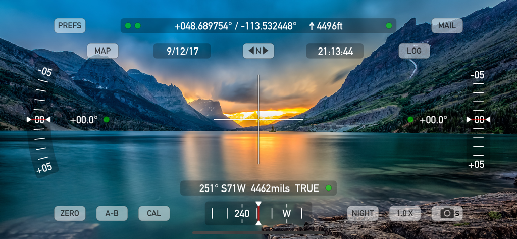
Theodolite app AR viewfinder displaying GPS coordinates and professional navigation data over a mountain lake.
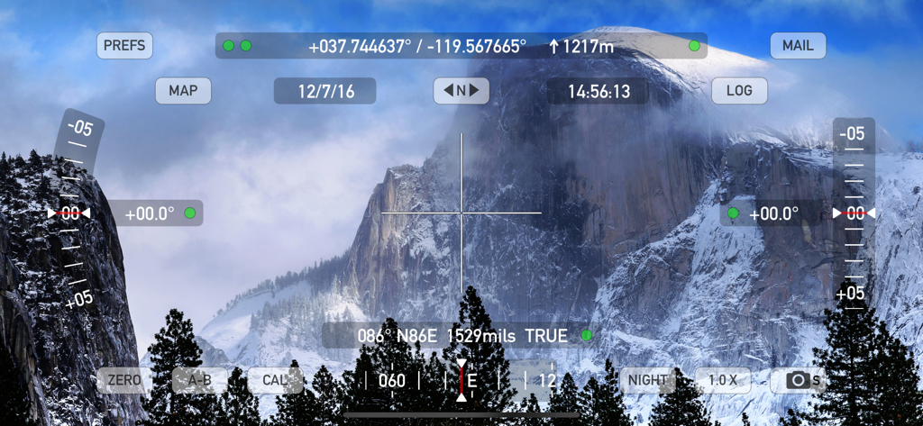
Theodolite app augmented reality viewfinder with GPS coordinates and elevation data over a mountain landscape
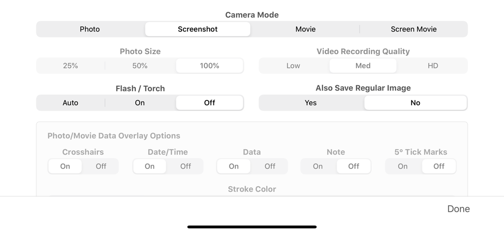
Camera mode and data overlay configuration screen in the Theodolite app settings

Theodolite app settings screen for photo metadata and filename formatting options.
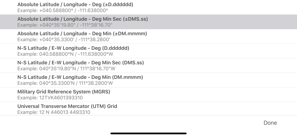
A menu in the Theodolite app showing various GPS coordinate format options like MGRS and UTM
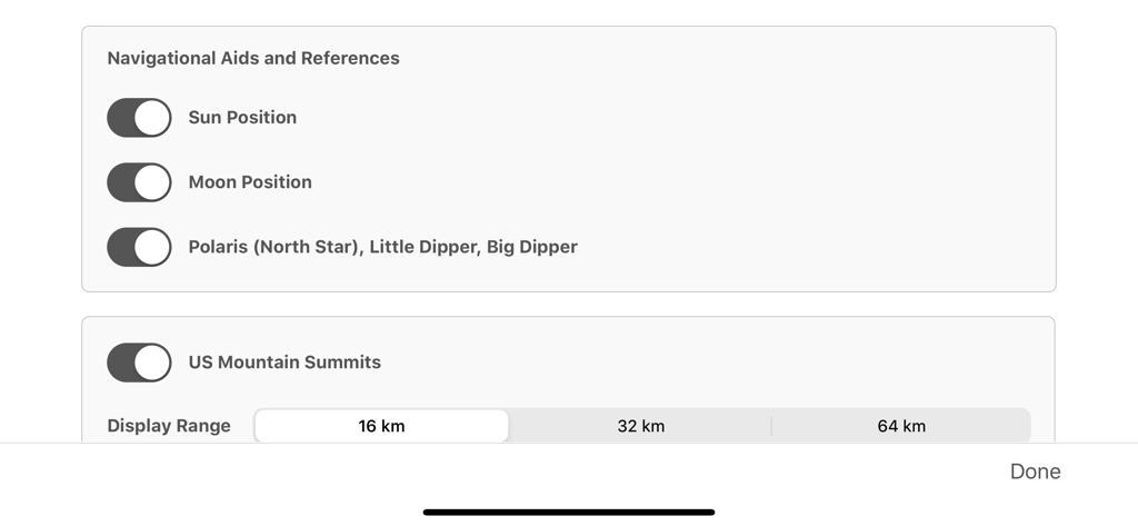
Theodolite app settings for celestial navigation aids and US mountain summits display range

List of geographic coordinate system options in the Theodolite app including MGRS and UTM
Description
Download
More Like This
Apps with similar features and user experience

MilGPS
Cascode Labs Pty Ltd

SEAiq Pilot VPP
Sakhalin, LLC

Cartograph Maps 3
Harald Meyer

新知卫星地图-路线规划,高清地图导航
Chongqing Xinzhi Space Technology Co., Ltd.

Coordinates – GPS Converter
Mapnitude Company Limited

Mgrs & Utm Map
Vahid Cataltas

DeepStateMap
Heorhii Karpenko

Map Plus
Miocool Inc.

Compass 55. Map & GPS kit.
Kalimex-Consulting s.r.o.
This page is not an official page of the app or its developer, but an independent editorial publication created for informational and commentary purposes. Unless expressly stated otherwise, neither the app nor its developer is affiliated with, endorsed by, sponsored by, authorized by, or otherwise officially connected with MWM, Apple, Google Play, the app publisher, or the app's developer, and nothing on this page implies that the app was developed using MWM's services. Any trademarks, logos, screenshots, and other content remain the property of their respective owners.