このページはアプリまたはその開発者の公式ページではなく、情報提供および論評を目的として作成された独立した編集出版物です。明示的に別段の記載がない限り、アプリおよびその開発者は、MWM、Apple、Google Play、アプリのパブリッシャー、またはアプリの開発者と提携、承認、後援、認可、またはその他の公式的な関係はなく、このページのいかなる内容も、アプリがMWMのサービスを使用して開発されたことを意味するものではありません。すべての商標、ロゴ、スクリーンショット、その他のコンテンツはそれぞれの所有者の財産です。

BaseMap: Hunting GPS Maps
880万人以上のアウトドア愛好家が、保証された土地所有権マップ、3Dスカウティング、オフラインGPSを使用して、より賢く狩猟し、合法的に行動し、自信を持ってバックカントリーをナビゲートしています。
ダウンロード
882K+ユーザー評価
評価数
9K+開発元
カテゴリ
Navigation対応言語
1最新バージョン
6.2.0サイズ
336.9 MBリリース日
2018年4月22日地形をマスターし、狩猟を所有する
業界で最も高度なGPSツールで自分自身を装備しましょう。全国の土地所有権データからオフライン3Dマッピングまで、成功した安全な収穫に必要なインテリジェンスを提供します。
正確な土地所有権
全国の民有地の境界と所有者名を瞬時に表示し、合法的に行動し、最良のアクセスポイントを見つけます。
信頼性の高いオフラインナビゲーション
無制限のオフラインマップキャッシュで道に迷うことはありません。セルサービスなしで現在地を追跡し、危険な地形をナビゲートします。
以下のスクリーンショットと説明は、アプリの公式ストアリスティングから直接取得されたものであり、アプリ開発者の所有物です。
アプリストア
スクリーンショット
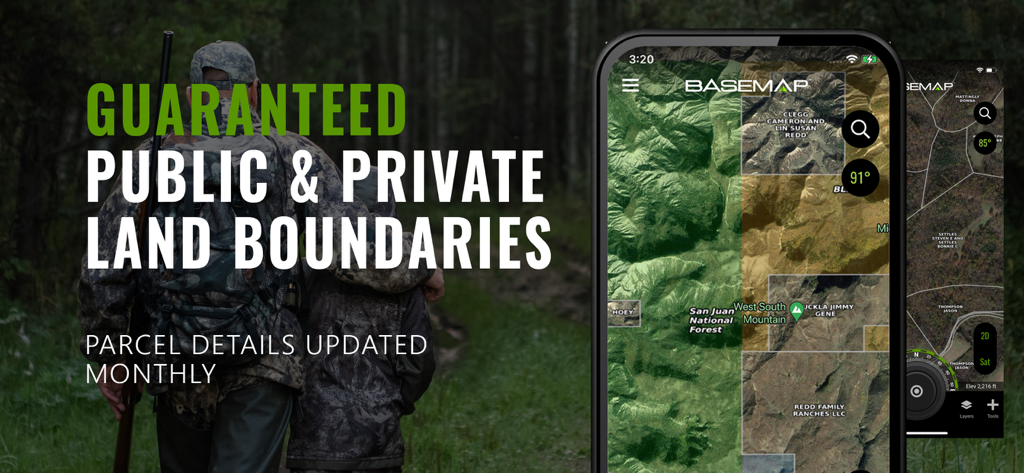
BaseMapアプリインターフェース。地形図上に、公有地と私有地の境界線および地主名が表示されています。
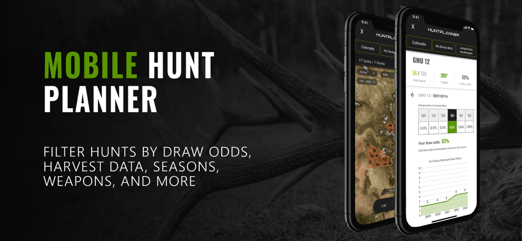
BaseMapハンティングアプリインターフェース。モバイルフォン上に、抽選確率と収穫データが表示されています。
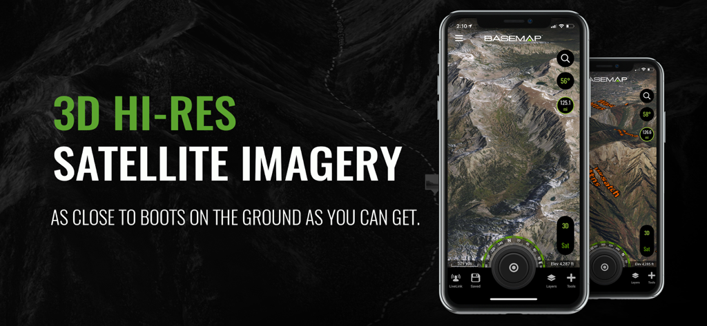
BaseMapアプリ。狩猟やスカウティングのために、山岳地帯の3D高解像度衛星画像を表示しています。
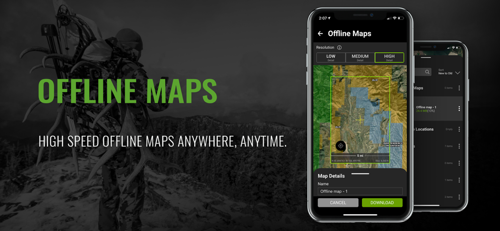
スマートフォンにBaseMapオフラインハンティングマップ機能が表示されており、背景にはハンターがいます。
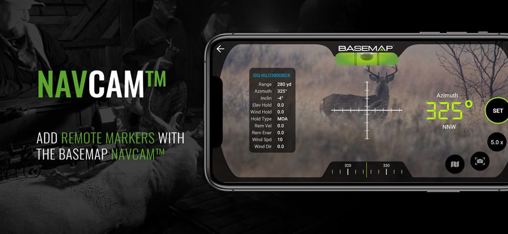
スマートフォンにBaseMap NavCam機能が表示されており、距離と方位角データとともにデジタルスコープを介して鹿が見えています。
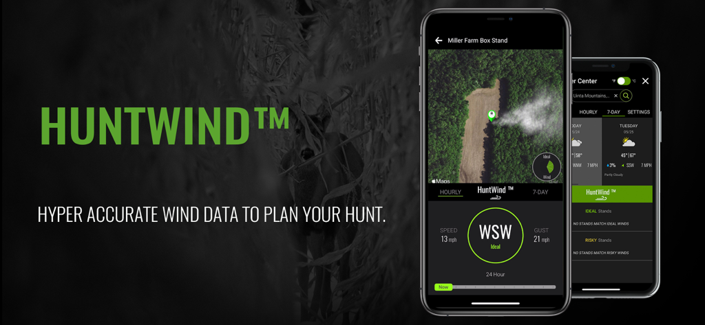
BaseMapアプリインターフェース。狩猟計画のための正確な風向と風速データを提供するHuntWind機能を表示しています。
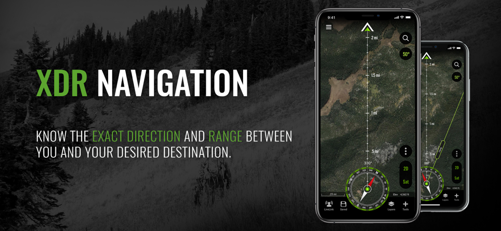
BaseMapアプリインターフェース。ハンター向けのコンパスと衛星画像付きXDRナビゲーションを表示しています。
説明
Download
類似アプリ
似た機能とユーザー体験を持つアプリ

onX Hunt: GPS Hunting Maps
onXmaps, Inc.

GOHUNT: Research & Maps
GOHUNT, LLC

HuntWise: A Better Hunting App
Sportsman Tracker, Inc

HuntStand: GPS Maps & Tools
Good Sportsman Marketing, LLC

MyHunt: US Best Hunting App
Hunter & Companion Gesellschaft mit beschrankter Haftung

WeHunt
Natlink AB

DeerCast-Prep. Predict. Pursue
Good Sportsman Marketing, LLC

iHunter
Inside Outside Studios Inc.

Hunting Points: GPS & Hunt App
Fishing Points d.o.o.
このページはアプリまたはその開発者の公式ページではなく、情報提供および論評を目的として作成された独立した編集出版物です。明示的に別段の記載がない限り、アプリおよびその開発者は、MWM、Apple、Google Play、アプリのパブリッシャー、またはアプリの開発者と提携、承認、後援、認可、またはその他の公式的な関係はなく、このページのいかなる内容も、アプリがMWMのサービスを使用して開発されたことを意味するものではありません。すべての商標、ロゴ、スクリーンショット、その他のコンテンツはそれぞれの所有者の財産です。