このページはアプリまたはその開発者の公式ページではなく、情報提供および論評を目的として作成された独立した編集出版物です。明示的に別段の記載がない限り、アプリおよびその開発者は、MWM、Apple、Google Play、アプリのパブリッシャー、またはアプリの開発者と提携、承認、後援、認可、またはその他の公式的な関係はなく、このページのいかなる内容も、アプリがMWMのサービスを使用して開発されたことを意味するものではありません。すべての商標、ロゴ、スクリーンショット、その他のコンテンツはそれぞれの所有者の財産です。

iHunter
フィールドでの究極の信頼性のために構築された、オフライン対応の衛星マップ、リアルタイムの狩猟ゾーン境界、正確な土地所有データを使用して、自信を持って野生をナビゲートしましょう。
ダウンロード
294K+ユーザー評価
評価数
28K+開発元
カテゴリ
Sports対応言語
2最新バージョン
5.0.50サイズ
295.6 MBリリース日
2012年10月24日自信を持って荒野をマスターしましょう
カナダおよびデスティネーションハンターにとって最も信頼されているツールであり、リアルタイムのゾーン規制、プロフェッショナルグレードのオフラインマッピング、正確な土地所有データを組み合わせています。
常にコンプライアンスを遵守して狩猟
狩猟ゾーンに直接重ねられた最新の州規制とシーズン概要に即座にアクセスし、合法かつ倫理的に行動できるようにします。
プログレードのオフラインナビゲーション
高解像度の衛星および地形図をダウンロードして、携帯サービスがなくても、バックカントリーの奥深くで自分の位置を追跡し、ウェイポイントをマークできます。
以下のスクリーンショットと説明は、アプリの公式ストアリスティングから直接取得されたものであり、アプリ開発者の所有物です。
アプリストア
スクリーンショット
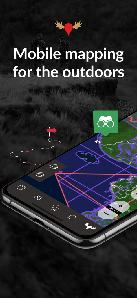
iHunterアプリを表示するスマートフォン、詳細な狩猟ゾーンマップのオーバーレイ付き
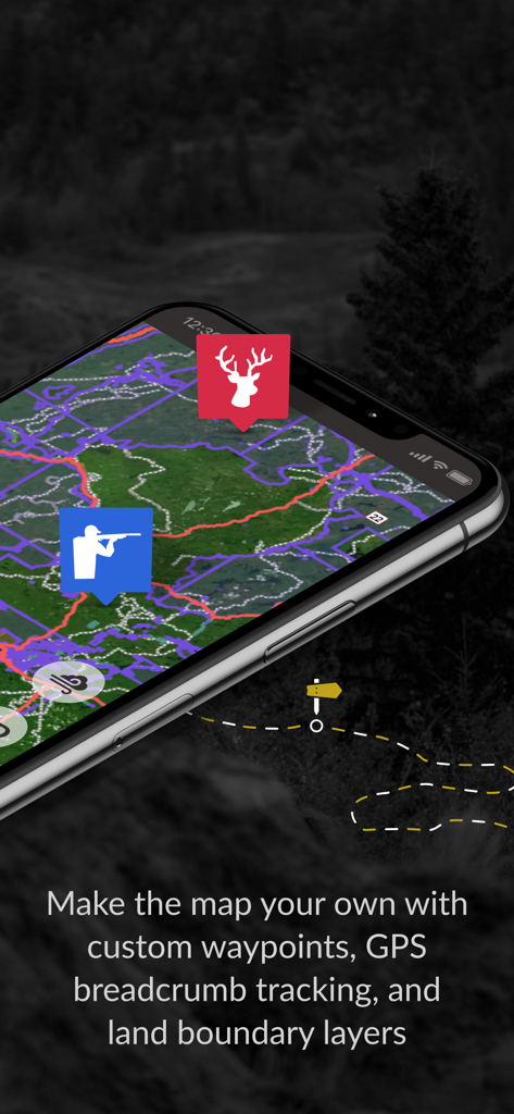
iHunterアプリのインターフェース、カスタムウェイポイントとGPSパンくずリスト追跡を詳細マップに表示
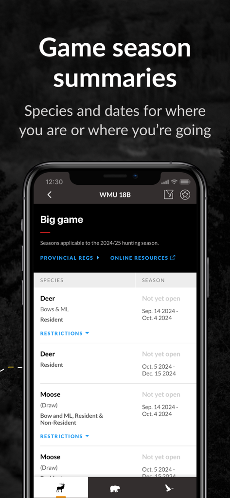
iHunterアプリの画面、鹿とヘラジカの狩猟シーズンの日付と概要を表示
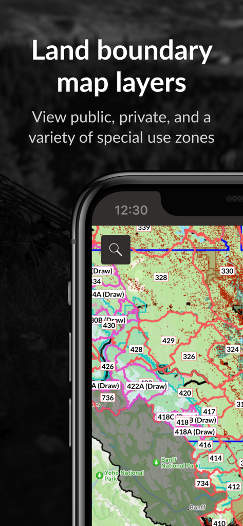
iHunterアプリ、公的および私的なゾーンを含む土地境界マップレイヤーを表示
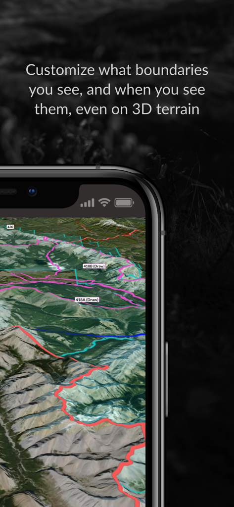
iHunterアプリと3D衛星地形およびカラフルな狩猟ゾーン境界線を表示するiPhoneディスプレイ
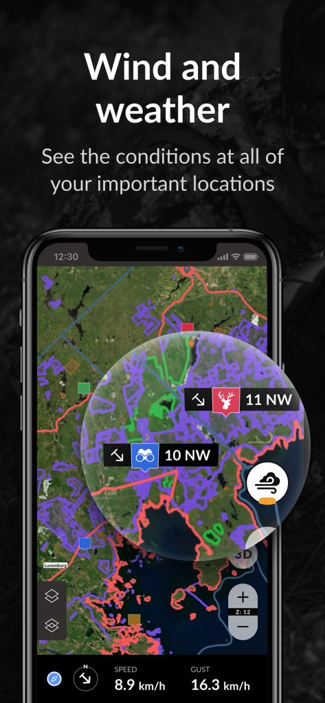
iHunterアプリのインターフェース、狩猟ゾーンマップの風と気象条件を表示
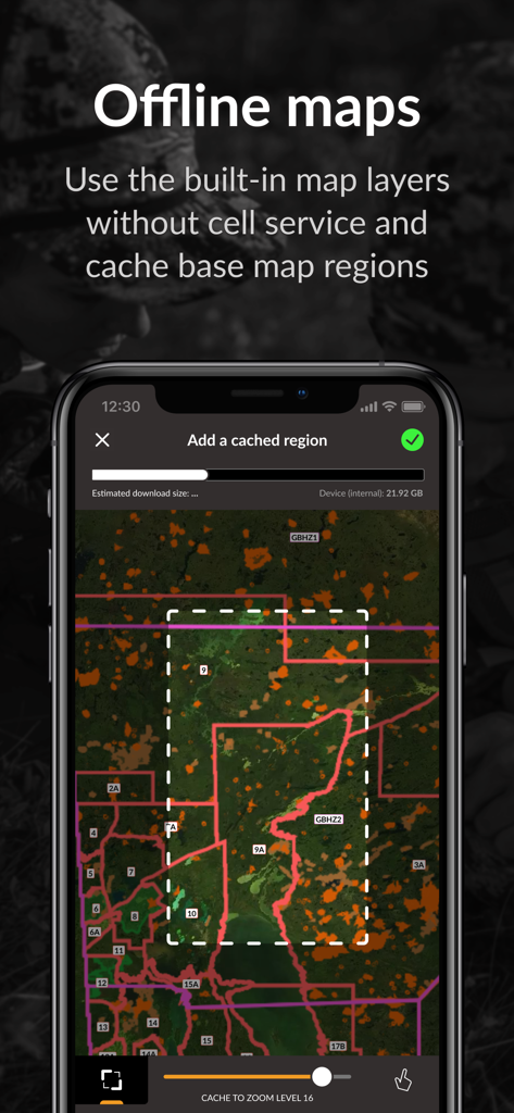
iHunterアプリのインターフェース、携帯サービスなしでオフライン使用のためにマップ領域を選択してダウンロードする方法を表示
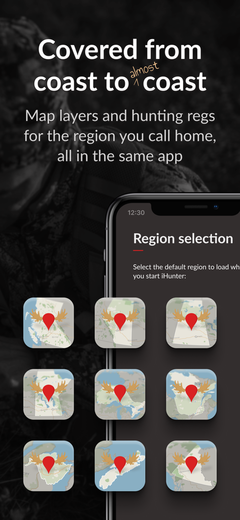
iHunterモバイルアプリの画面、地域狩猟規制およびレイヤーのためのカナダの州マップの選択を表示
説明
Download
類似アプリ
似た機能とユーザー体験を持つアプリ

onX Hunt: GPS Hunting Maps
onXmaps, Inc.

GOHUNT: Research & Maps
GOHUNT, LLC

HuntWise: A Better Hunting App
Sportsman Tracker, Inc

HuntStand: GPS Maps & Tools
Good Sportsman Marketing, LLC

MyHunt: US Best Hunting App
Hunter & Companion Gesellschaft mit beschrankter Haftung

WeHunt
Natlink AB

DeerCast-Prep. Predict. Pursue
Good Sportsman Marketing, LLC

BaseMap: Hunting GPS Maps
BaseMap Inc

Hunting Points: GPS & Hunt App
Fishing Points d.o.o.
このページはアプリまたはその開発者の公式ページではなく、情報提供および論評を目的として作成された独立した編集出版物です。明示的に別段の記載がない限り、アプリおよびその開発者は、MWM、Apple、Google Play、アプリのパブリッシャー、またはアプリの開発者と提携、承認、後援、認可、またはその他の公式的な関係はなく、このページのいかなる内容も、アプリがMWMのサービスを使用して開発されたことを意味するものではありません。すべての商標、ロゴ、スクリーンショット、その他のコンテンツはそれぞれの所有者の財産です。