이 페이지는 앱이나 개발자의 공식 페이지가 아니며, 정보 제공 및 논평을 목적으로 작성된 독립 편집 간행물입니다. 명시적으로 달리 언급되지 않는 한, 해당 앱이나 개발자는 MWM, Apple, Google Play, 앱 퍼블리셔 또는 앱 개발자와 제휴, 보증, 후원, 승인 또는 공식적으로 연결되어 있지 않으며, 이 페이지의 어떤 내용도 해당 앱이 MWM의 서비스를 사용하여 개발되었음을 의미하지 않습니다. 모든 상표, 로고, 스크린샷 및 기타 콘텐츠는 해당 소유자의 자산입니다.

ShipAtlas - Ship Tracker
전문가 수준의 위성 AIS, 정확한 ETA 추정, 전 세계 항만 교통 인사이트를 통해 125,000척 이상의 선박을 실시간으로 추적하세요.
다운로드
21K+사용자 평점
총 평가 수
1K+개발사
카테고리
Productivity지원 언어
1최신 버전
8.0.1크기
84.4 MB출시일
2020년 8월 9일전문적인 해운 정보, 손안에서
실시간 AIS 추적부터 고급 항로 계획까지, ShipAtlas는 글로벌 해운 및 항만 활동을 완벽하게 신뢰하며 모니터링하는 데 필요한 데이터 기반 인사이트를 제공합니다.
위성 기반 실시간 추적
고해상도 위성 및 지상 AIS 데이터를 통해 전 세계 125,000척 이상의 선박을 모니터링하여, 먼바다에서도 선박을 놓치지 않도록 합니다.
지능형 항로 계획 및 ETA
특정 선박 속도와 실시간 해운 조건을 고려하여, AIS 위치에서 전 세계 모든 항만까지 정확한 항해를 계획하고 도착 시간을 계산합니다.
다음 스크린샷과 설명은 앱의 공식 스토어 목록에서 직접 가져온 것이며 앱 개발자의 자산입니다.
앱 스토어
스크린샷
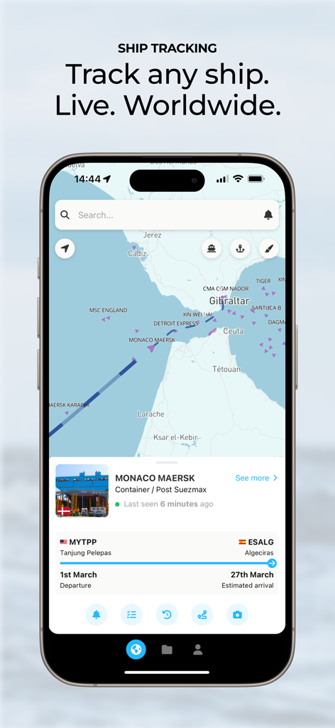
ShipAtlas 모바일 앱 인터페이스, 해상 지도에 실시간 AIS 선박 추적 및 선박 세부 정보 표시
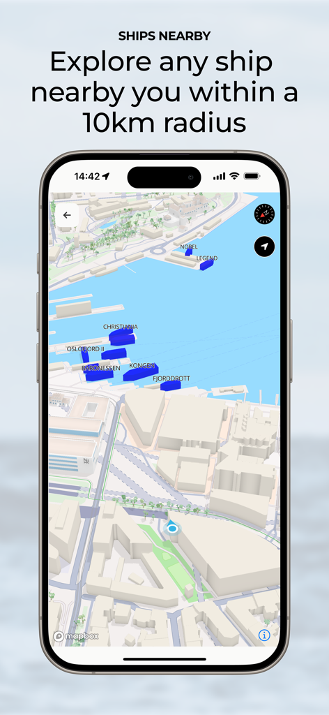
ShipAtlas 앱 인터페이스, 10km 반경 내 주변 선박 지도 표시
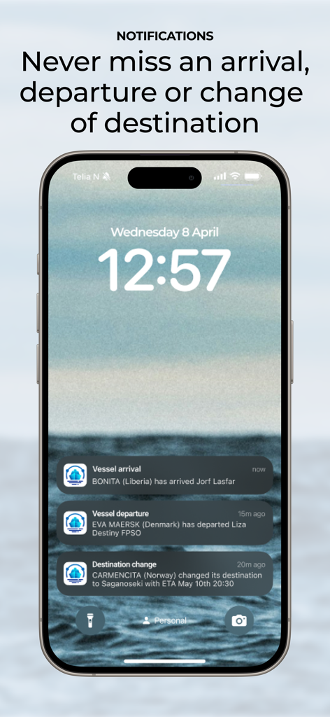
iPhone 잠금 화면, ShipAtlas 선박 도착, 출발, 목적지 변경 알림 표시
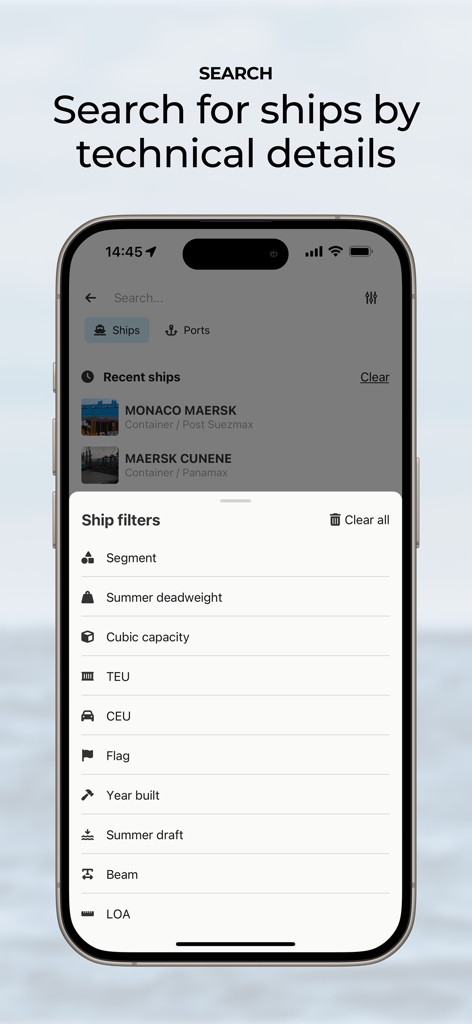
ShipAtlas 앱 화면, 배수량 및 TEU와 같은 기술적 선박 검색 필터 표시
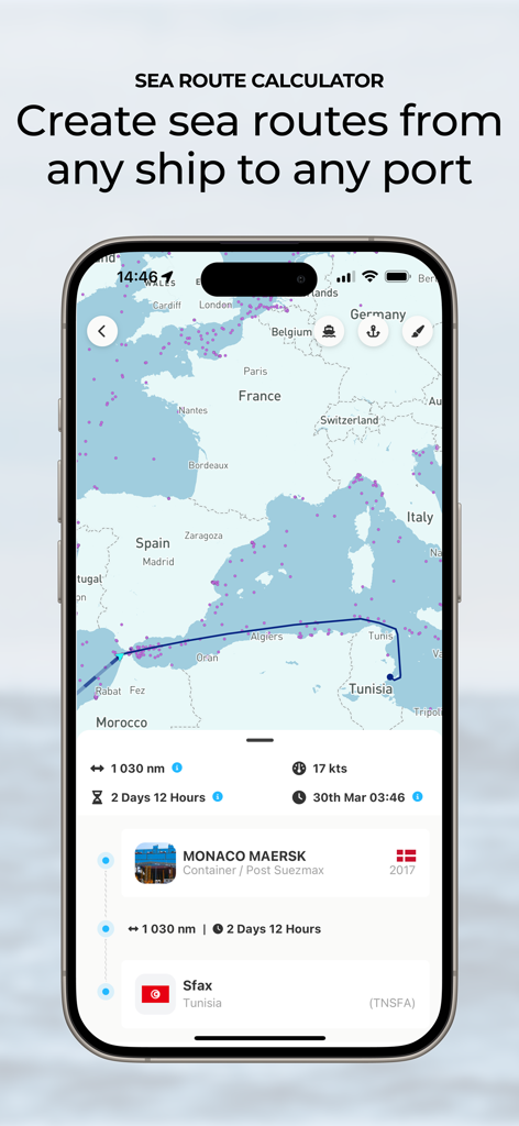
ShipAtlas 앱의 항로 계산기, 지중해에서 항만까지의 선박 항해, 예상 도착 시간 및 거리 표시
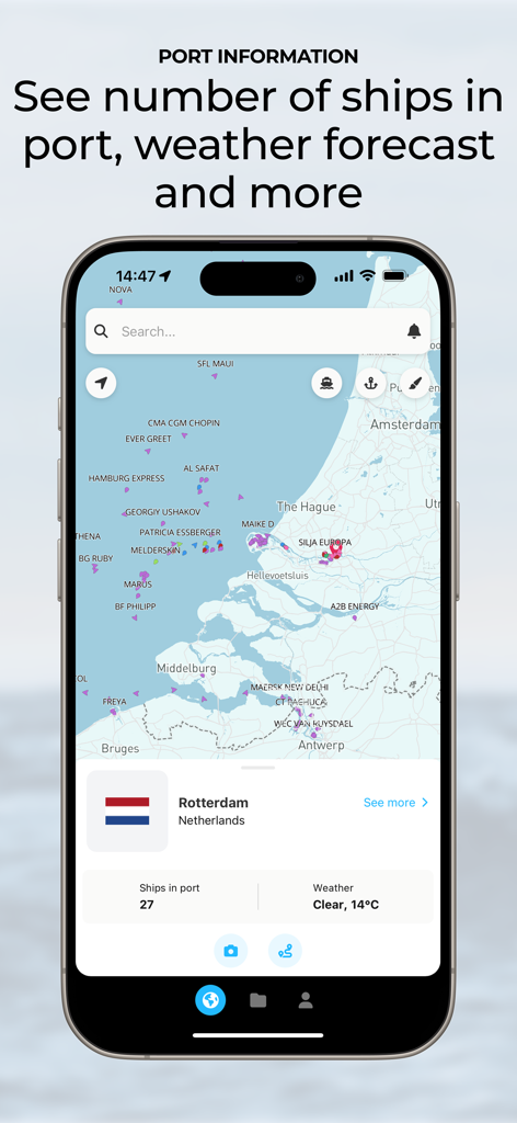
ShipAtlas 앱 인터페이스, 로테르담의 실시간 항만 정보, 선박 수 및 지도상의 날씨 예보 표시
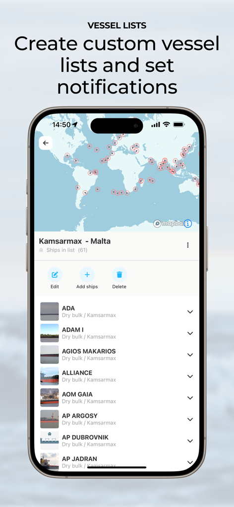
ShipAtlas 앱 인터페이스, 맞춤형 선박 목록 및 해운 추적 알림 표시
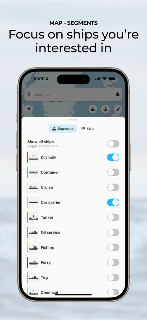
ShipAtlas 인터페이스, 맞춤형 선박 추적을 위한 선박 세그먼트 필터 표시
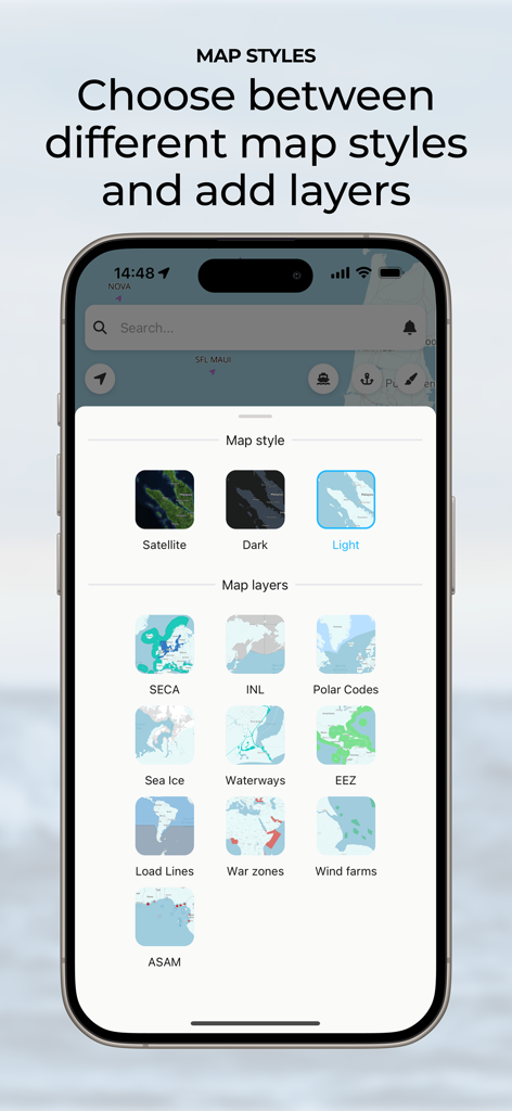
ShipAtlas 앱 인터페이스, 지도 스타일 및 해운 데이터 레이어 선택
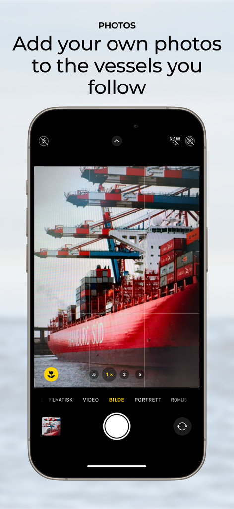
추적 중인 선박의 개인 사진을 캡처하고 추가하는 기능을 시연하는 스마트폰 화면 (ShipAtlas 앱)
설명
Download
비슷한 앱
같은 카테고리의 상위 앱

ChatGPT
OpenAI OpCo, LLC

Google Gemini
Google LLC

Grok
X.AI Corporation

Gmail - Email by Google
Google LLC

千问 - 阿里最强大模型官方AI助手
Shanghai Zhixin Puhui Technology Co., Ltd.

Google Drive
Google LLC

Microsoft Authenticator
Microsoft Corporation

Google Sheets
Google LLC

Google Docs
Google LLC
이 페이지는 앱이나 개발자의 공식 페이지가 아니며, 정보 제공 및 논평을 목적으로 작성된 독립 편집 간행물입니다. 명시적으로 달리 언급되지 않는 한, 해당 앱이나 개발자는 MWM, Apple, Google Play, 앱 퍼블리셔 또는 앱 개발자와 제휴, 보증, 후원, 승인 또는 공식적으로 연결되어 있지 않으며, 이 페이지의 어떤 내용도 해당 앱이 MWM의 서비스를 사용하여 개발되었음을 의미하지 않습니다. 모든 상표, 로고, 스크린샷 및 기타 콘텐츠는 해당 소유자의 자산입니다.