This page is not an official page of the app or its developer, but an independent editorial publication created for informational and commentary purposes. Unless expressly stated otherwise, neither the app nor its developer is affiliated with, endorsed by, sponsored by, authorized by, or otherwise officially connected with MWM, Apple, Google Play, the app publisher, or the app's developer, and nothing on this page implies that the app was developed using MWM's services. Any trademarks, logos, screenshots, and other content remain the property of their respective owners.

700 City Maps
Navigate over 700 cities and national parks without using a single byte of data. Avoid expensive roaming fees and signal anxiety with detailed maps that work perfectly offline, from the streets of Rome to the trails of Yellowstone.
Downloads
535K+User Rating
Total Ratings
2K+Publisher
Category
TravelLocales
1Latest Version
2.0.10Size
29.2 MBFirst Released
Jul 20, 2010Travel Confidently with Complete Offline Freedom
Designed for the savvy traveler, 700 City Maps provides reliable navigation without the need for an internet connection, saving you from expensive roaming charges and signal anxiety.
Zero Data, Zero Roaming Fees
Download high-detail maps at home and navigate entirely offline. Avoid the 'bill shock' of international data roaming while staying perfectly on track.
Essential Local Landmarks
Easily find vital services like ATMs, parking, and pharmacies, or discover cultural sites and museums even in the most remote areas or narrow city streets.
The following screenshots and description are sourced directly from the app's official store listing and are the property of the app developer.
App Store
Screenshots
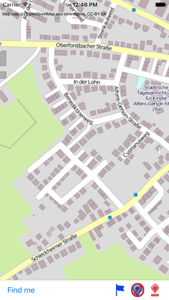
Offline street map view within the 700 City Maps app showing roads and location names
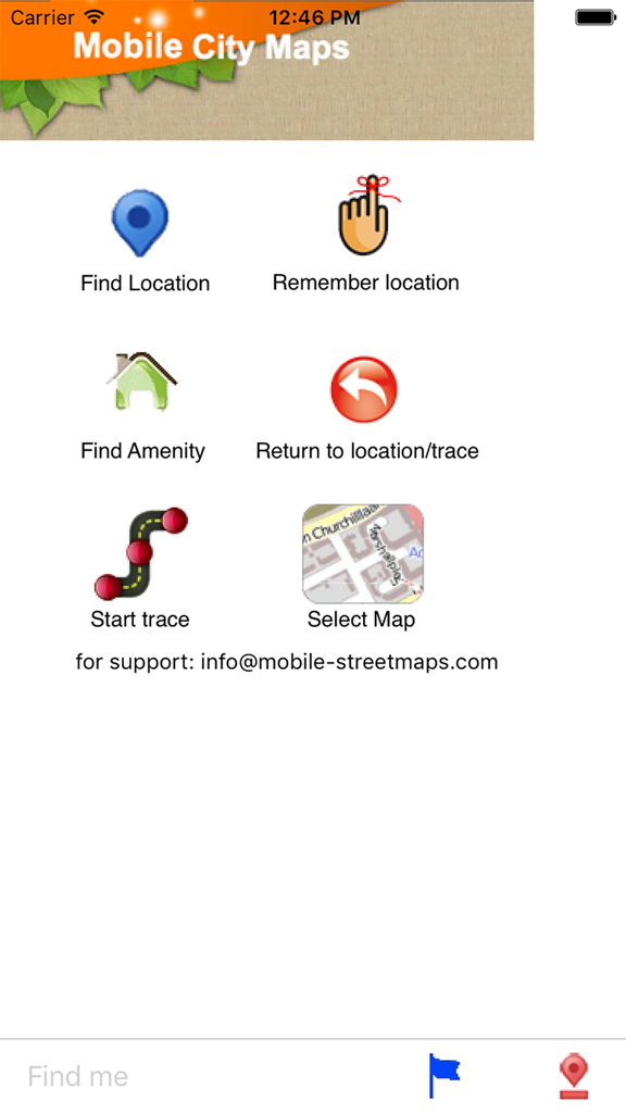
Main menu of the 700 City Maps app showing navigation icons for finding locations and amenities
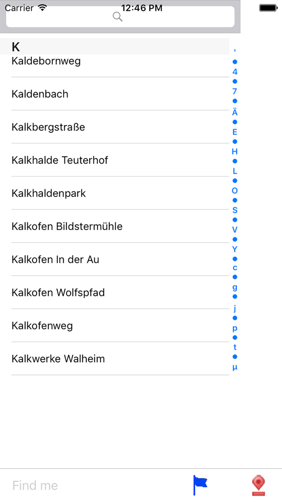
An alphabetical street index within the 700 City Maps application showing a list of roads starting with the letter K
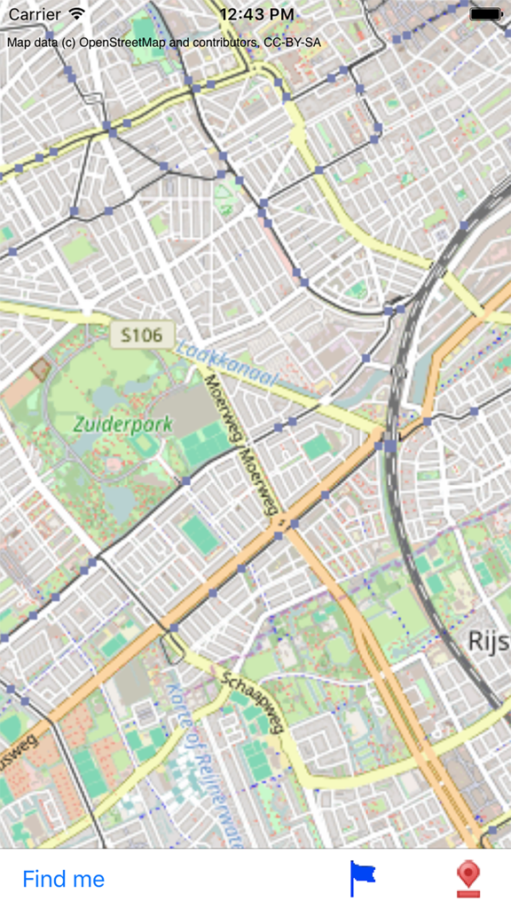
Detailed offline street map view within the 700 City Maps mobile app showing urban roads and parks
Description
Download
More Like This
Apps with similar features and user experience

MAPS.ME: Offline Maps, GPS Nav
Convexity Holdings AG

CoMaps
Anton Wenemoser

GPS Navigation & Path Finder
Muhammad Asad Khan

MapFactor Navigator - GPS Maps
MAPFACTOR, s.r.o.

Guru Maps Pro & GPS Tracker
Evgen Bodunov

Offline Map Navigation
virtualmaze

Karta GPS - Offline Maps Nav
Karta Software Technologies lda

Genius Maps: GPS Navigation
Mireo d.d.

NaviMaps: 3D GPS Navigation
CE Info Systems Limited
This page is not an official page of the app or its developer, but an independent editorial publication created for informational and commentary purposes. Unless expressly stated otherwise, neither the app nor its developer is affiliated with, endorsed by, sponsored by, authorized by, or otherwise officially connected with MWM, Apple, Google Play, the app publisher, or the app's developer, and nothing on this page implies that the app was developed using MWM's services. Any trademarks, logos, screenshots, and other content remain the property of their respective owners.