This page is not an official page of the app or its developer, but an independent editorial publication created for informational and commentary purposes. Unless expressly stated otherwise, neither the app nor its developer is affiliated with, endorsed by, sponsored by, authorized by, or otherwise officially connected with MWM, Apple, Google Play, the app publisher, or the app's developer, and nothing on this page implies that the app was developed using MWM's services. Any trademarks, logos, screenshots, and other content remain the property of their respective owners.

Coo
Uncover the data behind any plot. Access cadastral maps, historical sales prices, and comprehensive environmental risk reports to find your next investment with total confidence.
Downloads
500User Rating
Total Ratings
100Publisher
Category
UtilitiesLocales
1Latest Version
7.7.2Size
56.6 MBFirst Released
May 4, 2018Data-Driven Property Intelligence
Coo aggregates professional-grade land data, transaction histories, and environmental risks into one powerful interface for informed decision-making.
Comprehensive Risk Assessment
Mitigate investment risks with instant access to flood maps, soil stability data, and historical natural hazard reports.
Precision Location Search
Filter properties by building footprint, energy ratings, or exact travel distances to the coast and city centers.
The following screenshots and description are sourced directly from the app's official store listing and are the property of the app developer.
App Store
Screenshots
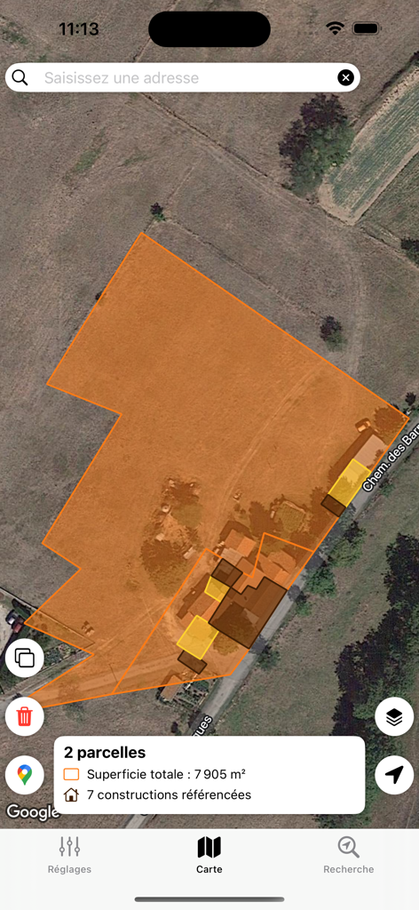
Satellite map view of the Coo app showing real estate land parcels and total area details
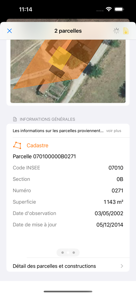
Screenshot of Coo app displaying cadastral data and a satellite map for property parcels
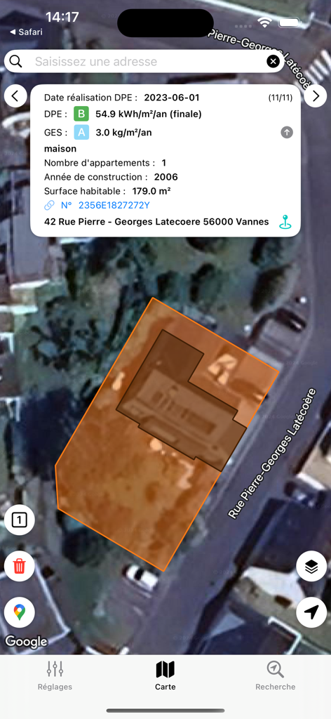
Satellite map view of a house plot in Vannes showing energy efficiency and building details in the Coo mobile app
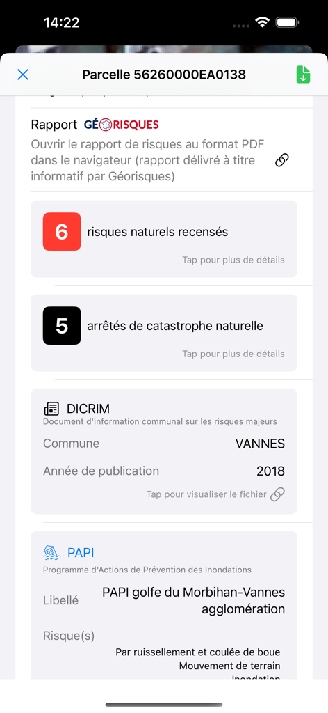
Coo app interface showing a detailed georisks report for a real estate property including environmental hazards and natural disaster history
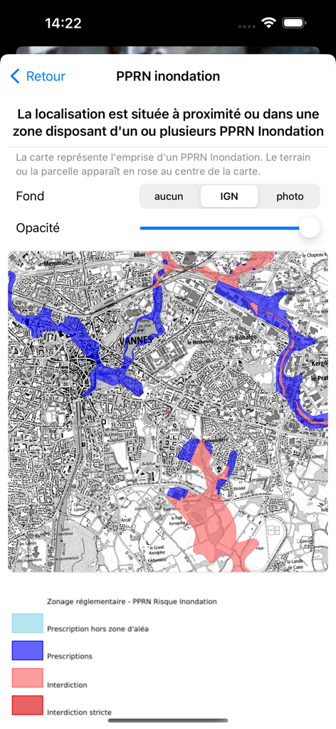
Coo app interface displaying flood risk zones on a city map of Vannes
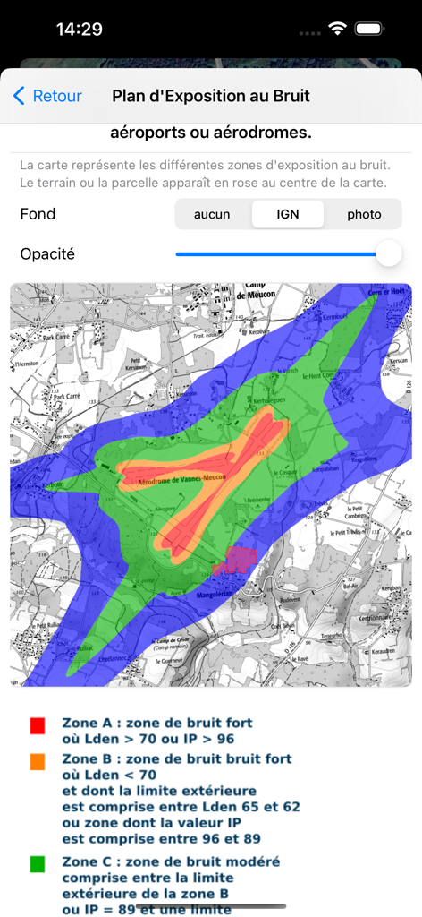
Map displaying noise exposure zones around an airport on the Coo mobile app.
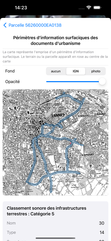
Urban planning map and noise infrastructure classification for a property parcel in the Coo app
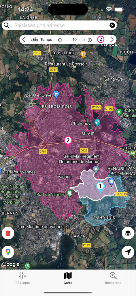
Coo app interface displaying travel time isochrone zones for a 10 minute bicycle ride on a property map
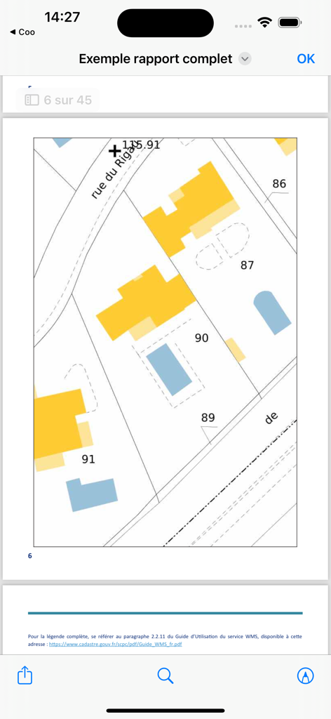
A cadastral map view within a property report showing building footprints and land parcels
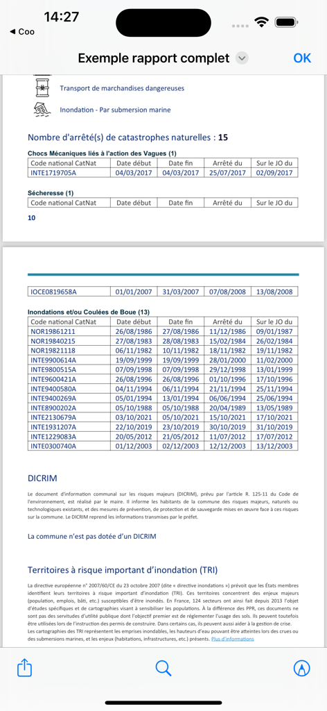
A detailed property risk report from the Coo app showing natural disaster history and environmental data.
Description
Download
More Like This
Top-ranked apps in the same category

Google LLC

Google Chrome
Google LLC

中国移动(手机营业厅)
China Mobile Online Services Co., Ltd.

Google Authenticator
Google LLC

CNH do Brasil
Servicos e Informacoes do Brasil

Cleanup: Phone Storage Cleaner
DEEP FLOW SOFTWARE SERVICES - FZCO

gov.br
Servicos e Informacoes do Brasil

中国电信-全国统一官方服务平台
CHINA TELECOM Corporation Ltd.

Microsoft Edge: AI Browser
Microsoft Corporation
This page is not an official page of the app or its developer, but an independent editorial publication created for informational and commentary purposes. Unless expressly stated otherwise, neither the app nor its developer is affiliated with, endorsed by, sponsored by, authorized by, or otherwise officially connected with MWM, Apple, Google Play, the app publisher, or the app's developer, and nothing on this page implies that the app was developed using MWM's services. Any trademarks, logos, screenshots, and other content remain the property of their respective owners.