This page is not an official page of the app or its developer, but an independent editorial publication created for informational and commentary purposes. Unless expressly stated otherwise, neither the app nor its developer is affiliated with, endorsed by, sponsored by, authorized by, or otherwise officially connected with MWM, Apple, Google Play, the app publisher, or the app's developer, and nothing on this page implies that the app was developed using MWM's services. Any trademarks, logos, screenshots, and other content remain the property of their respective owners.

FarOut: Offline GPS Trail Maps
Navigate 50,000+ miles of world-class trails with official, expert-verified data that works 100% offline. Built for thru-hikers, bikepackers, and explorers who demand reliability in the wildest terrain.
Downloads
515K+User Rating
Total Ratings
25K+Publisher
Category
NavigationLocales
4Latest Version
15.0.3Size
182.1 MBFirst Released
Mar 8, 2013Engineered for the Thru-Hiker's Journey
More than just a map—it's your essential digital guide for long-distance hiking, biking, and paddling across over 50,000 miles of wilderness.
100% Offline Navigation
Leave the grid behind. Access detailed topographic maps and GPS tracking that function perfectly in airplane mode, preserving battery and signal independence.
Verified Critical Waypoints
Stop guessing. Access reliable data on water sources, trail closures, and resupply points provided by official trail partners and verified community experts.
The following screenshots and description are sourced directly from the app's official store listing and are the property of the app developer.
App Store
Screenshots
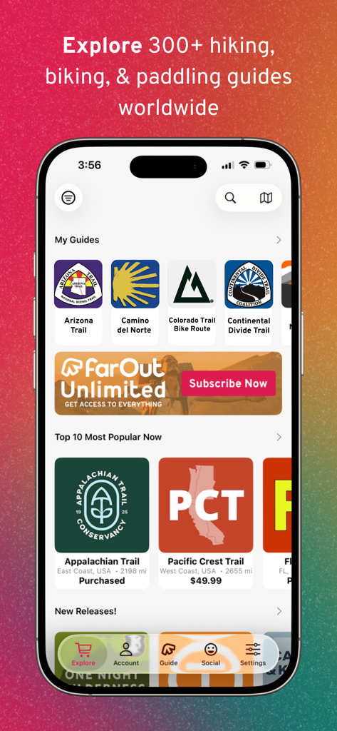
FarOut mobile app interface showing a library of hiking and biking trail guides like the Appalachian Trail and Pacific Crest Trail
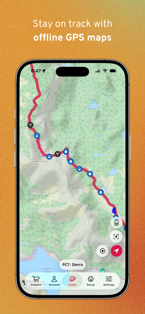
FarOut app displaying an offline topographic trail map of the PCT Sierra with waypoints for water and junctions
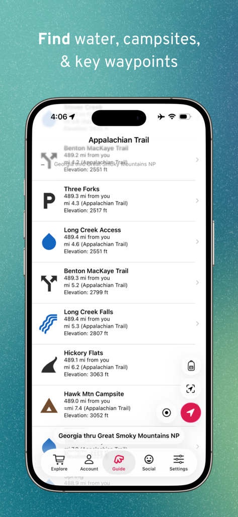
Mobile screen showing trail waypoints for water sources and campsites on the Appalachian Trail in the FarOut app
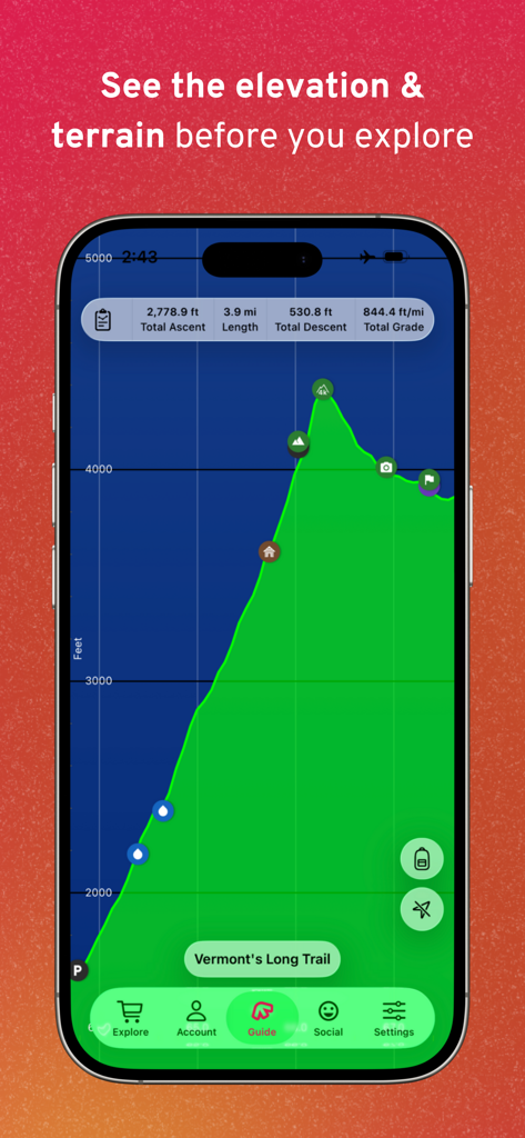
FarOut app displaying an elevation profile and terrain overview for Vermont's Long Trail
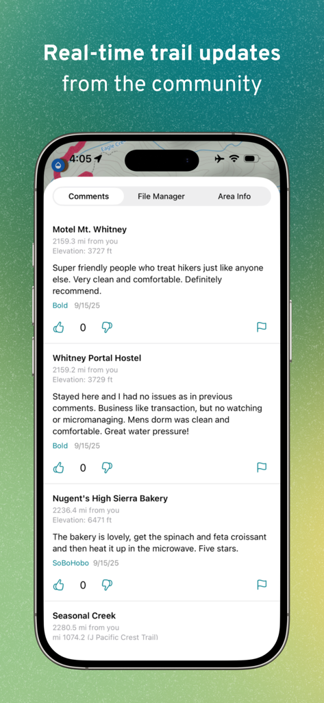
Interface of the FarOut app showing real-time community comments and updates for trail waypoints like hostels and bakeries
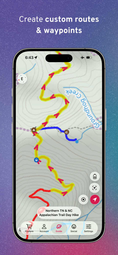
FarOut app screen showing custom trail routes and waypoints on a topographic hiking map
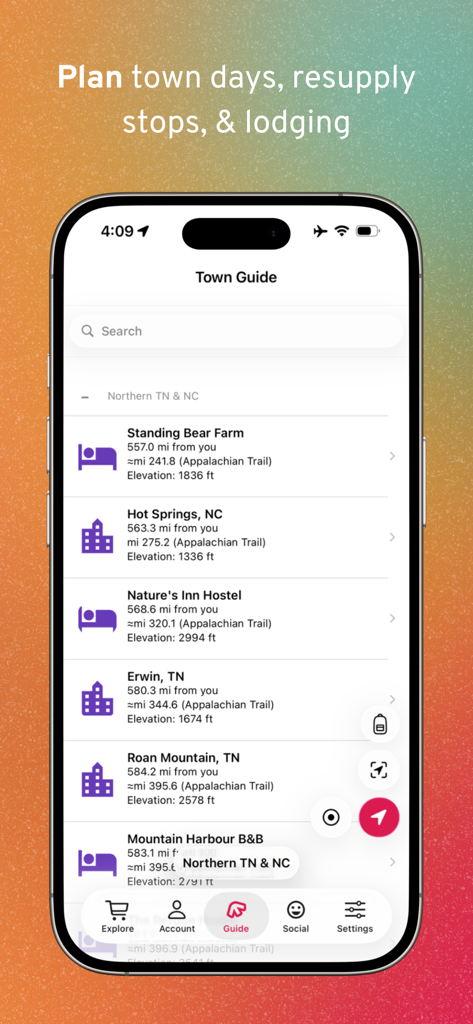
Smartphone display of FarOut app Town Guide for planning resupply stops and lodging.
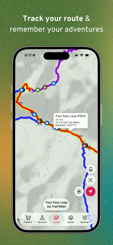
FarOut app displaying a topographic GPS trail map with elevation and waypoints for thru-hiking

A hiker check-in post on a topographic trail map within the FarOut mobile app
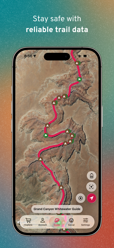
Satellite map of the Grand Canyon Whitewater Guide in the FarOut trail navigation app.
Description
Download
More Like This
Apps with similar features and user experience

AllTrails: Hike, Bike & Run
AllTrails, Inc.

Pedometer++
Cross Forward Consulting, LLC

Organic Maps: Offline Map
Organic Maps OU

Gaia GPS: Mobile Trail Maps
Trailbehind, INC.

Offline hiking maps: Mapy.com
Seznam.cz a.s.

Hiking Map Poland
Mapa Turystyczna sp. z o.o.

MapOut
Valnova GmbH

Norgeskart
Norgeskart AS

GPX viewer - map
Lucas den Otter
This page is not an official page of the app or its developer, but an independent editorial publication created for informational and commentary purposes. Unless expressly stated otherwise, neither the app nor its developer is affiliated with, endorsed by, sponsored by, authorized by, or otherwise officially connected with MWM, Apple, Google Play, the app publisher, or the app's developer, and nothing on this page implies that the app was developed using MWM's services. Any trademarks, logos, screenshots, and other content remain the property of their respective owners.