This page is not an official page of the app or its developer, but an independent editorial publication created for informational and commentary purposes. Unless expressly stated otherwise, neither the app nor its developer is affiliated with, endorsed by, sponsored by, authorized by, or otherwise officially connected with MWM, Apple, Google Play, the app publisher, or the app's developer, and nothing on this page implies that the app was developed using MWM's services. Any trademarks, logos, screenshots, and other content remain the property of their respective owners.

Hiking Map Poland
Reconnect with your heritage and explore official Polish trails with confidence. Plan routes, download offline maps, and track your progress with professional-grade GPS and Apple Watch support.
Downloads
276K+User Rating
Total Ratings
19K+Publisher
Category
TravelLocales
2Latest Version
2.0.20Size
84.0 MBFirst Released
Jun 29, 2016Master the Polish Mountains Like a Local
The ultimate route planner for your heritage journey across the Tatras, Beskids, and Sudetes, designed for hikers who demand precision and reliability.
Reliable Offline Navigation
Avoid international data roaming fees. Download detailed topographic maps and navigate official trails even when you are completely off the grid.
Authentic Trail Planning
Access the official PTTK trail network with exact elevation profiles and estimated times between mountain huts (Schronisko).
The following screenshots and description are sourced directly from the app's official store listing and are the property of the app developer.
App Store
Screenshots
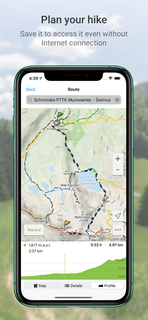
Interface of the Hiking Map Poland app displaying a planned trail route in the Tatra Mountains with an elevation profile and map details
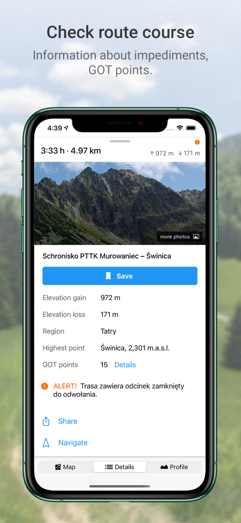
Smartphone screen showing hiking route details for the Tatra Mountains in Poland including elevation and GOT points
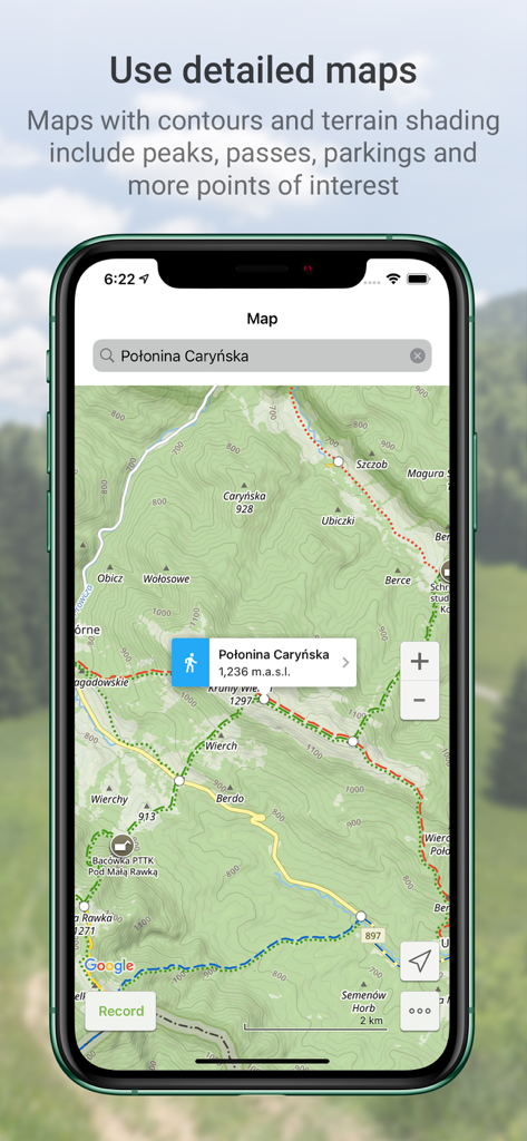
Detailed topographic map in the Hiking Map Poland app showing hiking trails and elevation contours for Polonina Carynska.
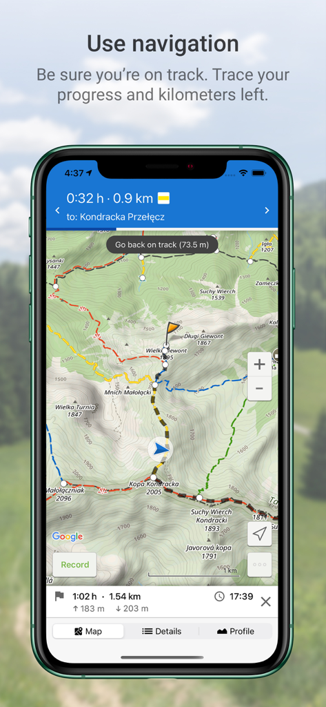
Mobile app screen showing GPS navigation on a topographic hiking trail map in the Polish mountains.
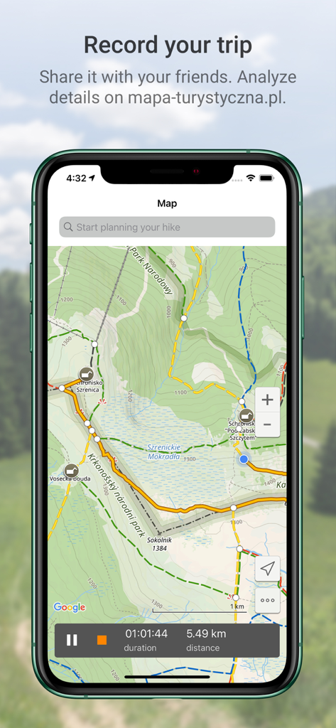
Interface of the Hiking Map Poland app displaying a recorded hiking track with distance and time data
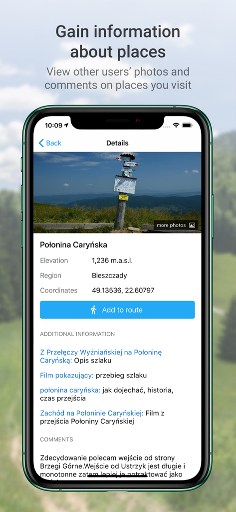
Details screen of the hiking app showing photos elevation and comments for Polonina Carynska in Poland
Description
Download
More Like This
Apps with similar features and user experience

AllTrails: Hike, Bike & Run
AllTrails, Inc.

Pedometer++
Cross Forward Consulting, LLC

Organic Maps: Offline Map
Organic Maps OU

Gaia GPS: Mobile Trail Maps
Trailbehind, INC.

Offline hiking maps: Mapy.com
Seznam.cz a.s.

MapOut
Valnova GmbH

FarOut: Offline GPS Trail Maps
Atlas Guides DE, Inc.

Norgeskart
Norgeskart AS

GPX viewer - map
Lucas den Otter
This page is not an official page of the app or its developer, but an independent editorial publication created for informational and commentary purposes. Unless expressly stated otherwise, neither the app nor its developer is affiliated with, endorsed by, sponsored by, authorized by, or otherwise officially connected with MWM, Apple, Google Play, the app publisher, or the app's developer, and nothing on this page implies that the app was developed using MWM's services. Any trademarks, logos, screenshots, and other content remain the property of their respective owners.