This page is not an official page of the app or its developer, but an independent editorial publication created for informational and commentary purposes. Unless expressly stated otherwise, neither the app nor its developer is affiliated with, endorsed by, sponsored by, authorized by, or otherwise officially connected with MWM, Apple, Google Play, the app publisher, or the app's developer, and nothing on this page implies that the app was developed using MWM's services. Any trademarks, logos, screenshots, and other content remain the property of their respective owners.

Norgeskart
The definitive offline map for hikers, sailors, and adventurers. Navigate the fjords and mountains safely with official Kartverket data and detailed topographical trails.
Downloads
487K+User Rating
Total Ratings
10K+Publisher
Category
NavigationLocales
16Latest Version
4.83.0Size
48.9 MBFirst Released
Oct 28, 2013Navigate the Norwegian Wilderness with Professional Precision
From remote mountain peaks to historic ancestral farmlands, explore Norway with the country's most detailed official maps, even when you're completely offline.
Official Kartverket Mapping
Navigate with total confidence using the same high-resolution topographic data and official sea charts used by Norwegian rescue teams and locals.
Reliable Offline Access
Save on roaming fees and stay safe in the wild. Download custom map sectors to your device to ensure you never lose your way in areas without cell service.
The following screenshots and description are sourced directly from the app's official store listing and are the property of the app developer.
App Store
Screenshots
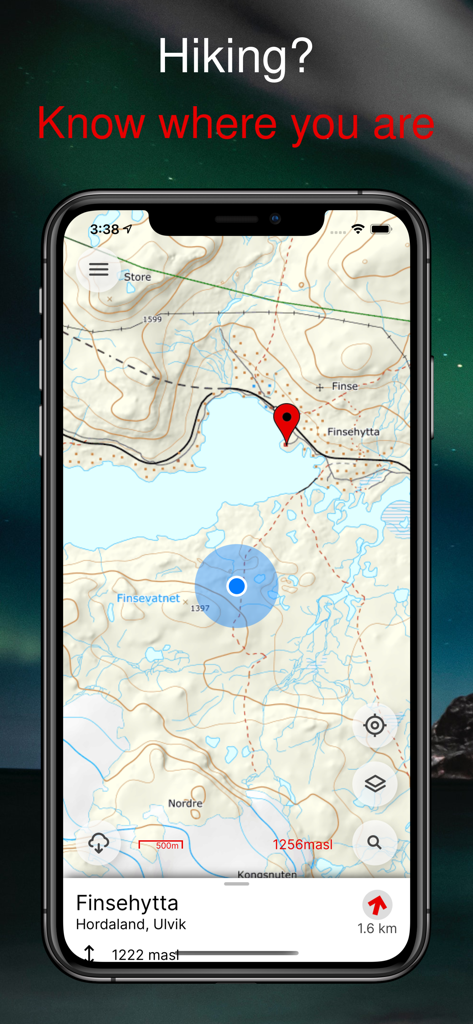
Detailed topographic hiking map of Finsehytta in Norway shown on the Norgeskart mobile app interface
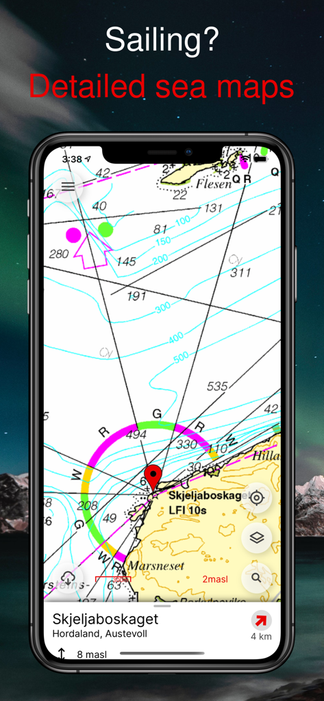
Detailed nautical sea map of Norway for sailing and maritime navigation.
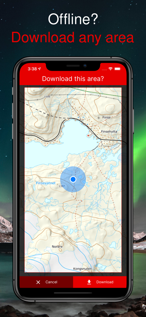
Smartphone screen showing the offline map download feature in the Norgeskart app
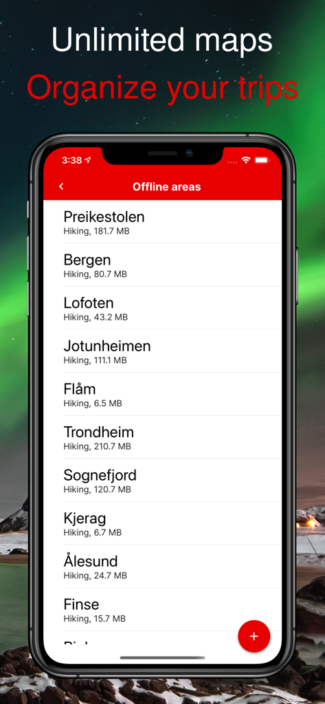
iPhone screen showing organized offline hiking maps for various Norwegian destinations
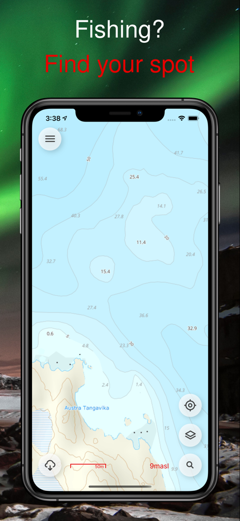
Norgeskart app displaying a detailed nautical sea map for fishing along the Norwegian coast
Description
Download
More Like This
Apps with similar features and user experience

AllTrails: Hike, Bike & Run
AllTrails, Inc.

Pedometer++
Cross Forward Consulting, LLC

Organic Maps: Offline Map
Organic Maps OU

Gaia GPS: Mobile Trail Maps
Trailbehind, INC.

Offline hiking maps: Mapy.com
Seznam.cz a.s.

Hiking Map Poland
Mapa Turystyczna sp. z o.o.

MapOut
Valnova GmbH

FarOut: Offline GPS Trail Maps
Atlas Guides DE, Inc.

GPX viewer - map
Lucas den Otter
This page is not an official page of the app or its developer, but an independent editorial publication created for informational and commentary purposes. Unless expressly stated otherwise, neither the app nor its developer is affiliated with, endorsed by, sponsored by, authorized by, or otherwise officially connected with MWM, Apple, Google Play, the app publisher, or the app's developer, and nothing on this page implies that the app was developed using MWM's services. Any trademarks, logos, screenshots, and other content remain the property of their respective owners.