This page is not an official page of the app or its developer, but an independent editorial publication created for informational and commentary purposes. Unless expressly stated otherwise, neither the app nor its developer is affiliated with, endorsed by, sponsored by, authorized by, or otherwise officially connected with MWM, Apple, Google Play, the app publisher, or the app's developer, and nothing on this page implies that the app was developed using MWM's services. Any trademarks, logos, screenshots, and other content remain the property of their respective owners.

MapOut
Plan custom routes, analyze elevation profiles, and navigate the world’s most remote trails with an elegant, paper-like interface designed for iPhone and iPad. No cell signal required, no subscriptions needed—just pure exploration.
Downloads
362K+User Rating
Total Ratings
900Publisher
Category
NavigationLocales
3Latest Version
3.4.13Size
71.3 MBFirst Released
Mar 20, 2012Precision Tools for the Self-Reliant Explorer
MapOut combines the high-resolution clarity of traditional paper maps with professional-grade offline navigation and custom planning tools for your iPad and iPhone.
100% Offline Independence
Navigate remote backcountry trails in the Rockies or Pacific Northwest without a cell signal. Download entire regions with high-resolution topographical details for total safety.
Intuitive Route Planning
Use your finger or stylus to draw custom paths directly on your map. Instantly check elevation profiles and import GPX files to build your perfect weekend excursion.
The following screenshots and description are sourced directly from the app's official store listing and are the property of the app developer.
App Store
Screenshots
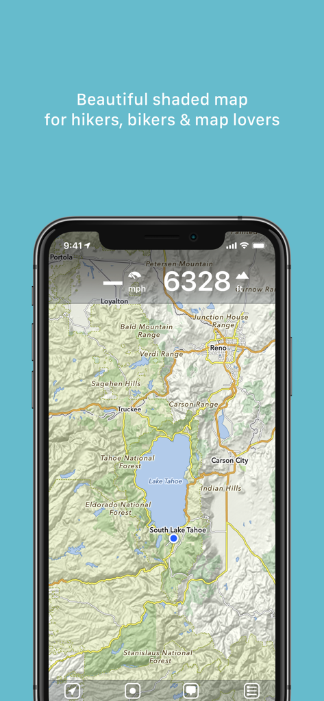
Detailed shaded topographical map on the MapOut app showing the Lake Tahoe area for hikers and bikers.
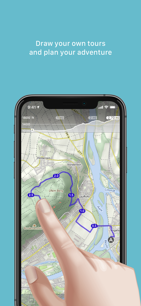
A person drawing a custom outdoor tour route with their finger on a topographical map within the MapOut app.
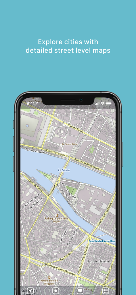
Smartphone screen showing a detailed street level map of Paris with the Seine river and landmarks
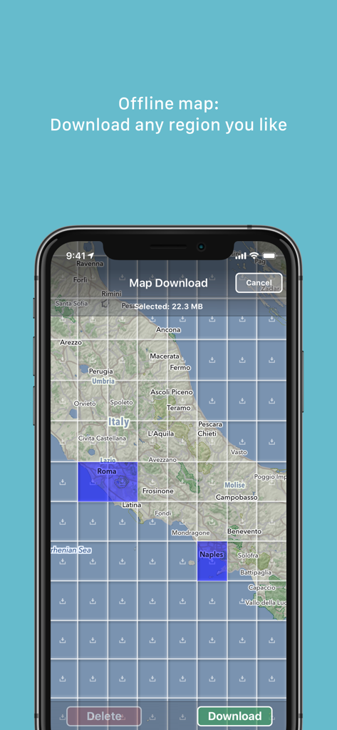
Screenshot of the MapOut app showing the offline map download interface with a grid selection over Italy
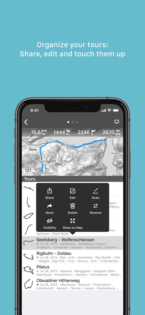
MapOut app interface showing a list of saved tours and a menu with options to share edit and draw routes on a map
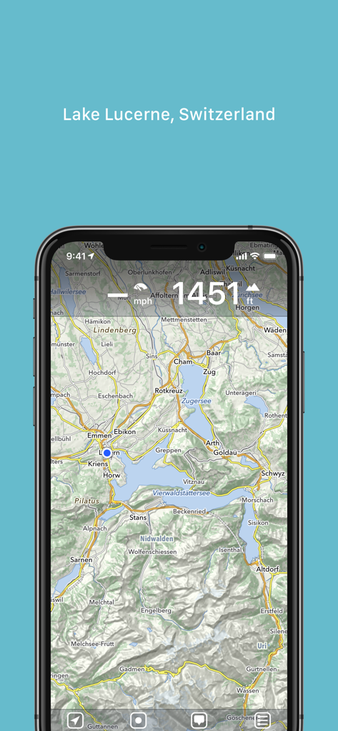
Topographic map of Lake Lucerne Switzerland in the MapOut app
Description
Download
More Like This
Apps with similar features and user experience

AllTrails: Hike, Bike & Run
AllTrails, Inc.

Pedometer++
Cross Forward Consulting, LLC

Organic Maps: Offline Map
Organic Maps OU

Gaia GPS: Mobile Trail Maps
Trailbehind, INC.

Offline hiking maps: Mapy.com
Seznam.cz a.s.

Hiking Map Poland
Mapa Turystyczna sp. z o.o.

FarOut: Offline GPS Trail Maps
Atlas Guides DE, Inc.

Norgeskart
Norgeskart AS

GPX viewer - map
Lucas den Otter
This page is not an official page of the app or its developer, but an independent editorial publication created for informational and commentary purposes. Unless expressly stated otherwise, neither the app nor its developer is affiliated with, endorsed by, sponsored by, authorized by, or otherwise officially connected with MWM, Apple, Google Play, the app publisher, or the app's developer, and nothing on this page implies that the app was developed using MWM's services. Any trademarks, logos, screenshots, and other content remain the property of their respective owners.