This page is not an official page of the app or its developer, but an independent editorial publication created for informational and commentary purposes. Unless expressly stated otherwise, neither the app nor its developer is affiliated with, endorsed by, sponsored by, authorized by, or otherwise officially connected with MWM, Apple, Google Play, the app publisher, or the app's developer, and nothing on this page implies that the app was developed using MWM's services. Any trademarks, logos, screenshots, and other content remain the property of their respective owners.

Geo Tracker - GPS Tracker
Record your most ambitious treks with offline maps, high-precision stats, and industry-leading battery efficiency. No subscriptions, no ads, and no data tracking—your location data stays exactly where it belongs: on your device.
Downloads
100K+User Rating
Total Ratings
300Publisher
Category
TravelLocales
15Latest Version
5.5.0Size
135.2 MBFirst Released
Oct 15, 2024Engineered for the Uncharted Path
A professional-grade GPS tracker for those who value precise data, long-lasting battery, and absolute privacy. No ads, no subscriptions—just the tools you need for the trail.
Your Data, Your Device
We don’t believe in cloud tracking. Your location history stays 100% local, ensuring your privacy is never compromised or sold to third parties.
Superior Battery Efficiency
Our specialized background tracking technology minimizes drain, allowing you to record full-day expeditions without carrying a power bank.
The following screenshots and description are sourced directly from the app's official store listing and are the property of the app developer.
App Store
Screenshots
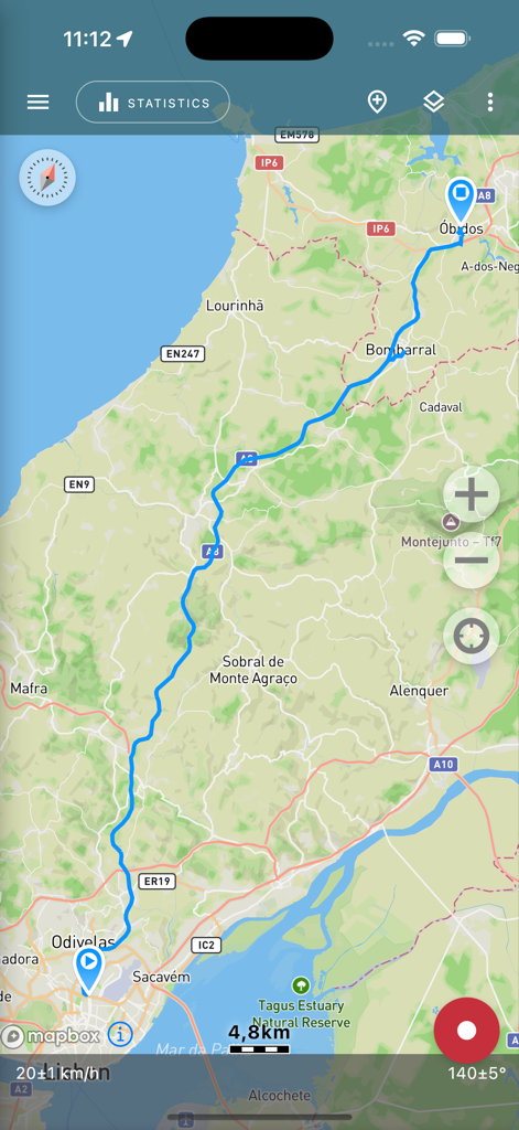
Geo Tracker app screen displaying a recorded GPS route on a topographical map
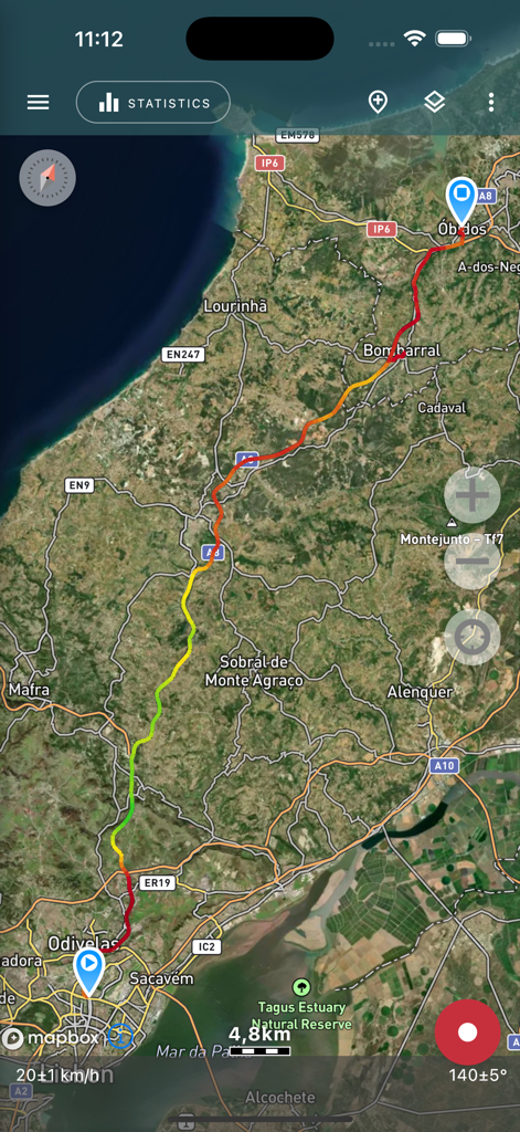
Satellite map showing a recorded GPS track with speed indicators
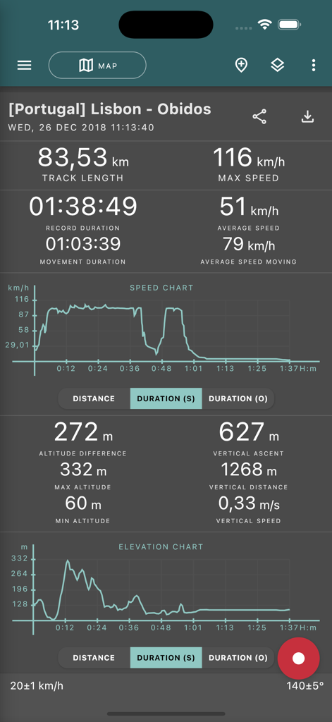
Detailed GPS trip statistics and charts in the Geo Tracker app
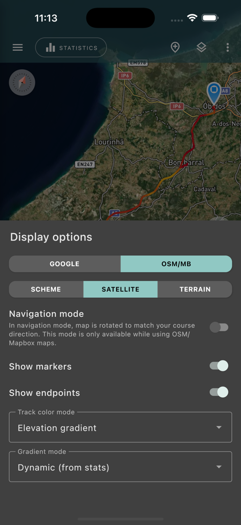
Geo Tracker app interface showing map display options and a satellite view with a recorded GPS track.
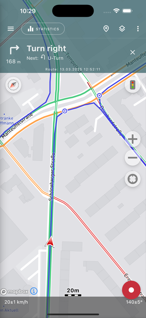
Geo Tracker app navigation screen displaying a route on a map with turn-by-turn instructions and speed statistics
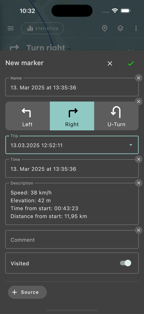
New marker creation interface in the Geo Tracker app showing trip statistics and navigation direction selection
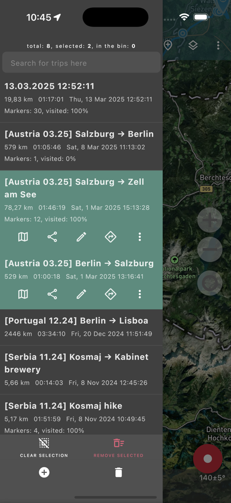
List of recorded GPS tracks and travel statistics in the Geo Tracker app
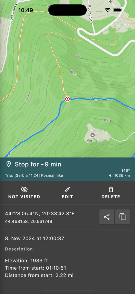
GPS tracker app showing hike statistics and coordinates on a topographic map
Description
Download
More Like This
Apps with similar features and user experience

AllTrails: Hike, Bike & Run
AllTrails, Inc.

Pedometer++
Cross Forward Consulting, LLC

Organic Maps: Offline Map
Organic Maps OU

Gaia GPS: Mobile Trail Maps
Trailbehind, INC.

Offline hiking maps: Mapy.com
Seznam.cz a.s.

Hiking Map Poland
Mapa Turystyczna sp. z o.o.

MapOut
Valnova GmbH

FarOut: Offline GPS Trail Maps
Atlas Guides DE, Inc.

Norgeskart
Norgeskart AS
This page is not an official page of the app or its developer, but an independent editorial publication created for informational and commentary purposes. Unless expressly stated otherwise, neither the app nor its developer is affiliated with, endorsed by, sponsored by, authorized by, or otherwise officially connected with MWM, Apple, Google Play, the app publisher, or the app's developer, and nothing on this page implies that the app was developed using MWM's services. Any trademarks, logos, screenshots, and other content remain the property of their respective owners.