This page is not an official page of the app or its developer, but an independent editorial publication created for informational and commentary purposes. Unless expressly stated otherwise, neither the app nor its developer is affiliated with, endorsed by, sponsored by, authorized by, or otherwise officially connected with MWM, Apple, Google Play, the app publisher, or the app's developer, and nothing on this page implies that the app was developed using MWM's services. Any trademarks, logos, screenshots, and other content remain the property of their respective owners.

GLand: GPS Field Area Measure
The all-in-one utility for farmers, real estate agents, and contractors. Measure land area by walking or pinning, calculate soil needs, and export professional reports in KML, PDF, or Excel instantly.
Downloads
443K+User Rating
Total Ratings
15K+Publisher
Category
UtilitiesLocales
19Latest Version
2.11.0Size
42.9 MBFirst Released
Nov 22, 2022Precision Mapping for Land Professionals
Whether you are managing a farm, surveying a construction site, or listing a property, GLand delivers the accurate measurements and professional reports you need to succeed.
Dual-Mode Precision
Map boundaries with pinpoint accuracy by placing digital pins or tracking your exact location as you walk the terrain.
Professional Reporting
Generate and share high-quality PDF, KML, and Excel files to streamline your real estate listings or agricultural planning.
Frequently Asked Questions
Everything you need to know about GLand: GPS Field Area Measure
What is GLandMeasure?
GLandMeasure is a free application for measuring land area and length. It assists real estate professionals and farmers in calculating field sizes and distances accurately using map pinning or actual walking methods.
Is GLandMeasure a free application?
Yes, GLandMeasure is a free app designed for measuring land areas and lengths. It provides automatic calculations for farms, fields, and homes without any cost.
How does GLandMeasure measure land area?
GLandMeasure measures land area by letting users pin points on a map or by tracking their actual walking path. The app then automatically calculates both the area and length based on these inputted points or routes.
What measurement units does GLandMeasure support?
GLandMeasure supports various length units like Meters, Kilometers, Feet, and Yards. It also includes area units such as Square meters, Acres, Hectares, Rai-Ngan, and Square feet, offering diverse measurement options.
Can I export data from the GLandMeasure app?
Yes, GLandMeasure allows exporting coordinate data in multiple formats. Users can export measurements as PDF, Excel (XLS), KML, and Geojson files, facilitating easy sharing and documentation of their land data.
Does GLandMeasure support coordinate conversion?
Yes, GLandMeasure features a coordinate unit converter tool. It supports GEO (Lat Long), UTM, MGRS, and Geojson formats, enabling users to convert and display various geographic coordinate types within the app.
Can GLandMeasure calculate ratio or pricing per unit?
Yes, GLandMeasure provides a ratio calculation function. Users can input specific values, such as a total price, to calculate ratios like cost per square meter directly within the application's interface.
What additional tools are available in GLandMeasure?
GLandMeasure includes many tools such as a compass, weather forecasts, route finder, and elevation calculation. It also offers soil volume calculation, tree counting, and geographic camera functions for comprehensive utility.
Can I organize my measurement data in GLandMeasure?
Yes, GLandMeasure supports creating multiple projects and grouping data. This feature allows users to efficiently organize and manage various measured areas and lengths, enhancing data management within the app.
Can I save notes within the GLandMeasure app?
Yes, GLandMeasure enables users to save relevant information as notes. The app supports adding text, images, and links directly into these notes for detailed record-keeping alongside measurements.
The following screenshots and description are sourced directly from the app's official store listing and are the property of the app developer.
App Store
Screenshots
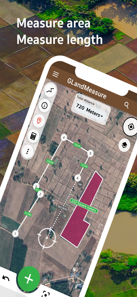
Satellite map view of the GLandMeasure app showing land area and length measurements with markers and highlighted zones.
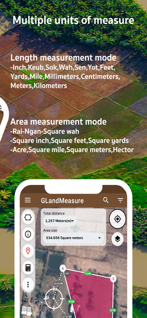
GLand app screenshot showing multiple units of length and area measurement on a satellite map
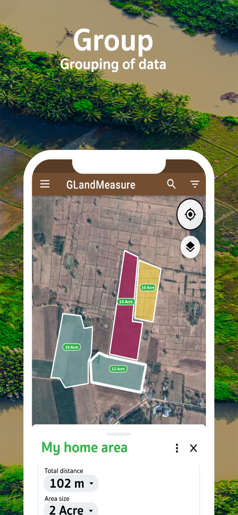
Satellite map view showing multiple land plots grouped and measured in acres using GLand GPS Field Area Measure
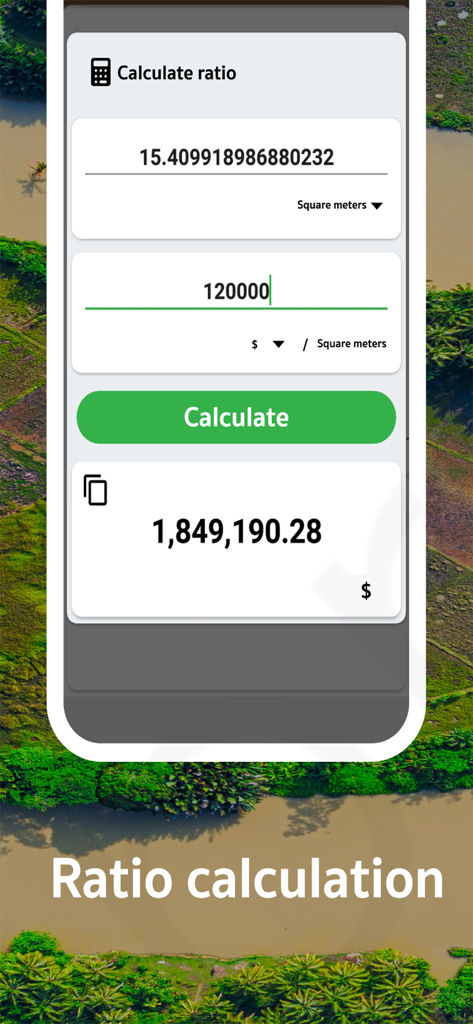
A screenshot of the GLand app showing a land value ratio calculation based on square meters and price.
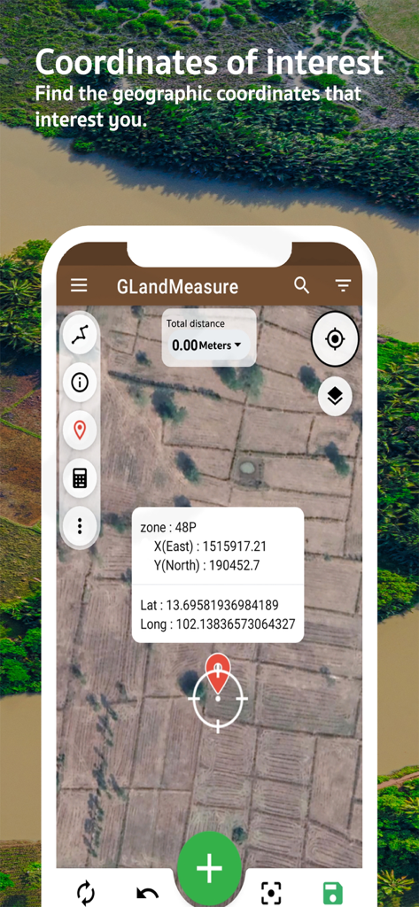
GLand app interface displaying latitude longitude and UTM coordinates on a satellite map of farm fields
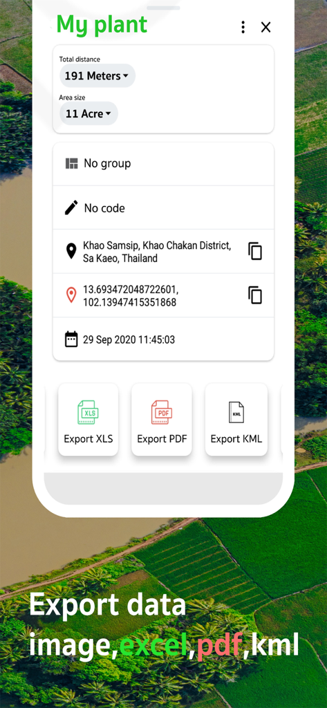
Interface showing land measurement details with export buttons for Excel, PDF, and KML formats
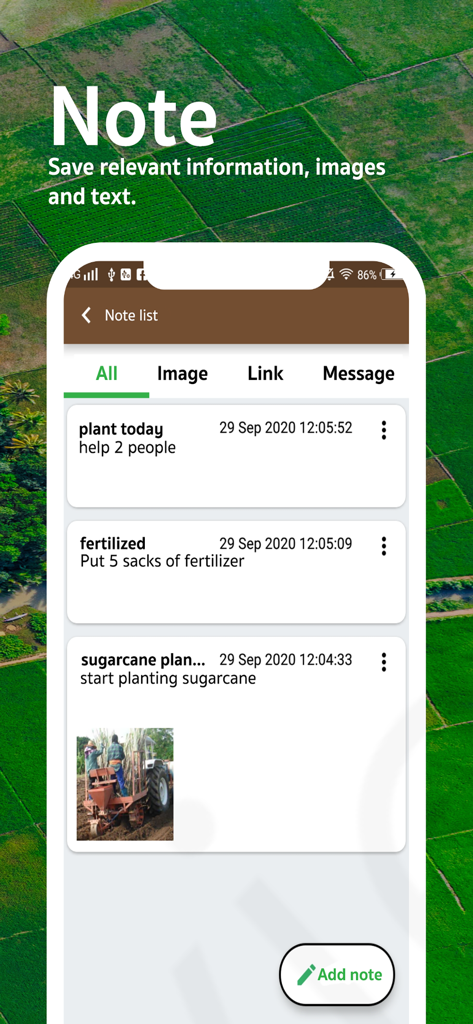
GLand app interface showing a note list for tracking farming activities like planting and fertilizing
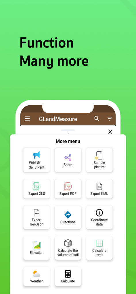
GLandMeasure menu showing export options and land analysis tools
Description
Download
More Like This
Apps with similar features and user experience

Field MapS - Measure Land GPS
Aleksei Metelkin

Field Area MeasureーLand Parcel
Irina Metelkina

FieldCalc - GPS Area Measure
Pravin Gondaliya

GPS Fields Area Measure Map
Rento UAB

Geo Field Area - GPS Measure
STOMBERG s.r.o

Distance - Find My Distance
Mapnitude Company Limited

Area & Distance - Map Measure
Mapnitude Company Limited

Measure Map
Xuan Luong Do

Field Area Measure
Yaroslav Babenko
This page is not an official page of the app or its developer, but an independent editorial publication created for informational and commentary purposes. Unless expressly stated otherwise, neither the app nor its developer is affiliated with, endorsed by, sponsored by, authorized by, or otherwise officially connected with MWM, Apple, Google Play, the app publisher, or the app's developer, and nothing on this page implies that the app was developed using MWM's services. Any trademarks, logos, screenshots, and other content remain the property of their respective owners.