This page is not an official page of the app or its developer, but an independent editorial publication created for informational and commentary purposes. Unless expressly stated otherwise, neither the app nor its developer is affiliated with, endorsed by, sponsored by, authorized by, or otherwise officially connected with MWM, Apple, Google Play, the app publisher, or the app's developer, and nothing on this page implies that the app was developed using MWM's services. Any trademarks, logos, screenshots, and other content remain the property of their respective owners.

GPS Tracker: Offline Maps, GPX
Master the backcountry with precision UTM support, advanced route planning, and unlimited offline maps. No ads, no subscriptions—just pure performance for your next adventure.
Downloads
271K+User Rating
Total Ratings
1K+Publisher
Category
NavigationLocales
30Latest Version
5.1.7Size
53.5 MBFirst Released
Oct 19, 2020Master Every Terrain
Professional-grade navigation tools designed for precision, reliability, and total independence from cellular networks.
Unlimited Offline Freedom
Navigate anywhere with high-resolution maps stored directly on your device. Stay on course in the deepest wilderness without cellular signal.
Professional GPX Analysis
Import, export, and analyze tracks with UTM coordinate support and detailed color gradients for speed and elevation profiling.
Frequently Asked Questions
Everything you need to know about GPS Tracker: Offline Maps, GPX
Does GPS Tracker: Offline Maps, GPX support offline maps?
Yes, GPS Tracker: Offline Maps, GPX supports offline maps. Users can load and store maps of their travel area for unlimited use without an internet connection.
Does GPS Tracker: Offline Maps, GPX include a pedometer?
Yes, GPS Tracker: Offline Maps, GPX includes a pedometer. It records steps and distance, allowing users to view data for the last three months, even while recording a track.
What file formats does GPS Tracker: Offline Maps, GPX support for track import and export?
GPS Tracker: Offline Maps, GPX supports importing and exporting tracks in .gpx format. It uses all available device methods for sharing with services, friends, and other applications.
What map engine does the GPS Tracker: Offline Maps, GPX app use?
The GPS Tracker: Offline Maps, GPX app uses a new fast engine from MapBox. This engine ensures convenient and fast loading of maps for users.
Can users create and edit waypoints in GPS Tracker: Offline Maps, GPX?
Yes, users can create, edit, and delete waypoints in GPS Tracker: Offline Maps, GPX. This functionality is available in any application mode and at any location on the map.
What detailed track information does GPS Tracker: Offline Maps, GPX provide?
GPS Tracker: Offline Maps, GPX provides extended track information including average and maximum speed, track duration by time and distance, number of waypoints, and number of steps.
Does GPS Tracker: Offline Maps, GPX support the UTM coordinate system?
Yes, GPS Tracker: Offline Maps, GPX supports the UTM coordinate system. This allows for precise location tracking and waypoint management using this specific grid reference system.
Is GPS Tracker: Offline Maps, GPX compatible with Apple Silicon MacBooks?
Yes, GPS Tracker: Offline Maps, GPX is compatible with Apple Silicon MacBooks. This ensures that the application functions seamlessly on the latest Apple hardware.
Does GPS Tracker: Offline Maps, GPX contain ads or time limits?
No, GPS Tracker: Offline Maps, GPX has no time limits and contains no ads. The application provides an uninterrupted user experience for tracking and navigation.
What map styles are available in GPS Tracker: Offline Maps, GPX?
GPS Tracker: Offline Maps, GPX offers several map styles. These include satellite, streets, combo, and dark themes, allowing users to choose their preferred visual display.
The following screenshots and description are sourced directly from the app's official store listing and are the property of the app developer.
App Store
Screenshots
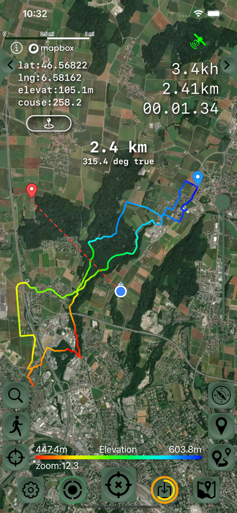
Satellite map view of a GPS track with a color gradient showing elevation changes and navigation data
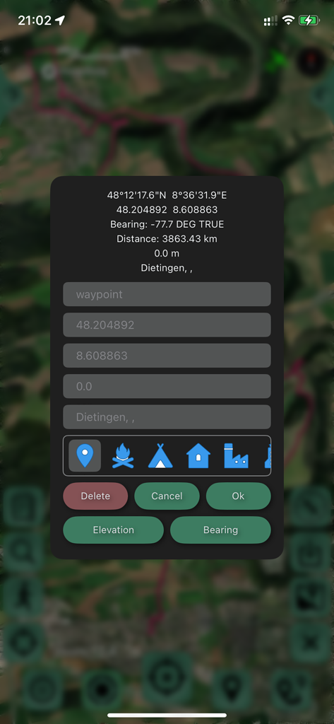
Interface for editing a waypoint showing coordinates and location icons over a satellite map
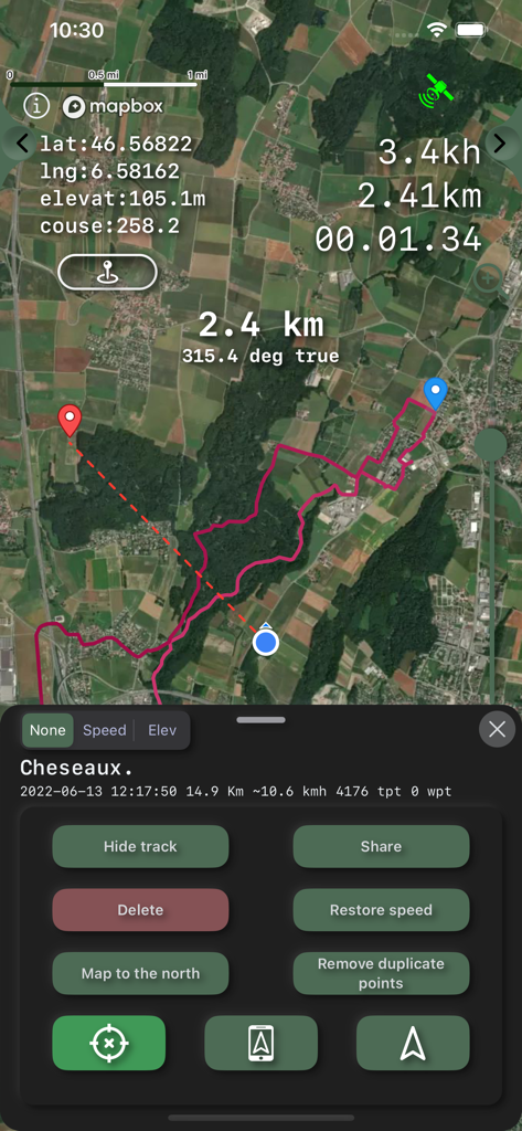
GPS Tracker app interface showing a satellite map with a recorded pink track and navigation data
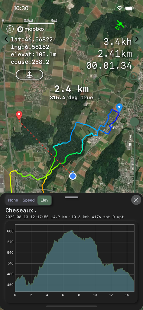
GPS tracking app showing a satellite map route and an elevation profile graph
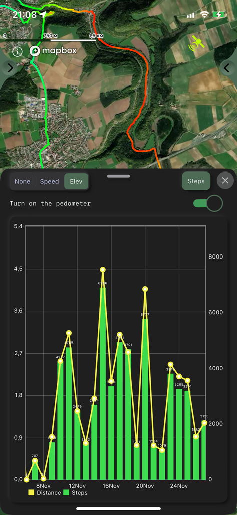
GPS tracker app interface showing a satellite map and a pedometer chart with daily steps and distance statistics
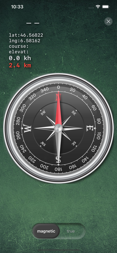
Digital compass interface displaying latitude and longitude coordinates for navigation
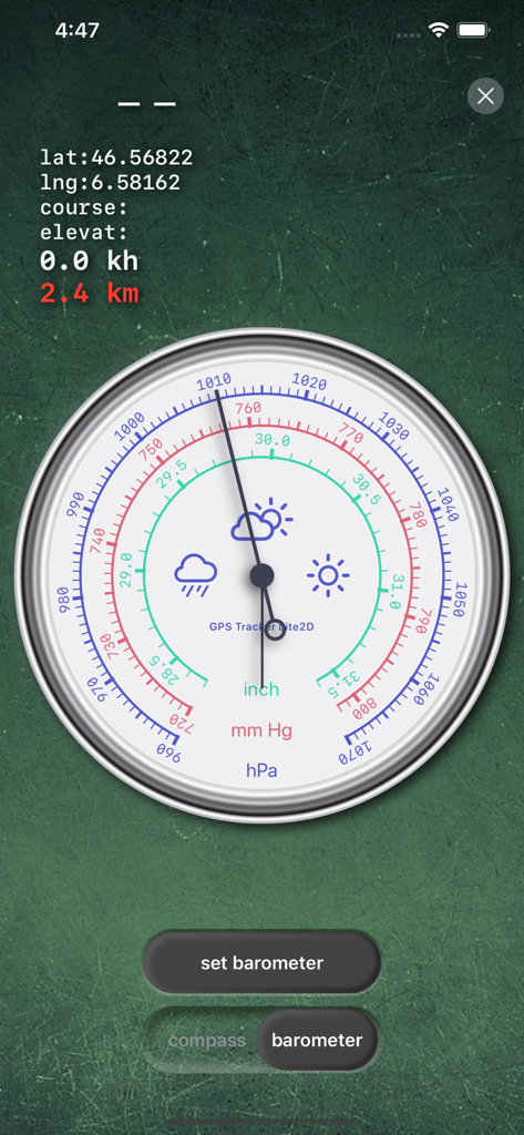
GPS Tracker app interface showing a detailed barometer with hPa, mmHg, and inch scales.
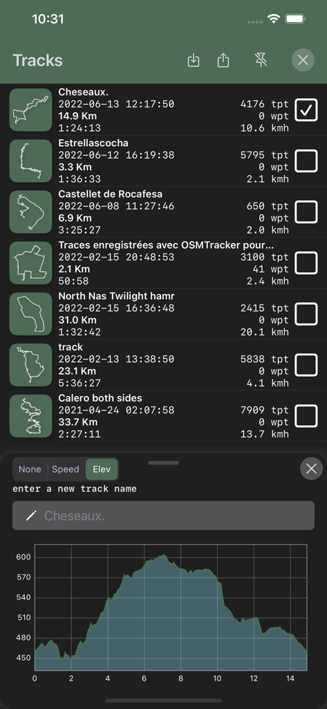
Interface showing a list of recorded GPS tracks with distance and speed statistics and an elevation profile graph
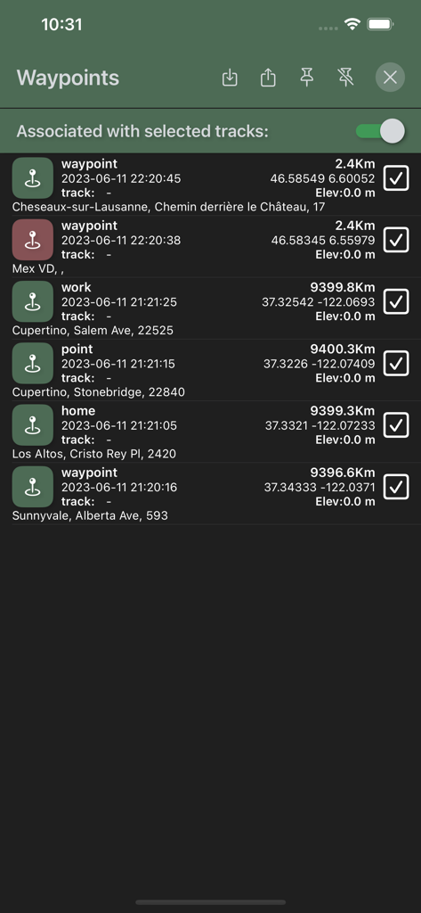
List of saved waypoints in the GPS Tracker app showing geographical coordinates elevation and distance data
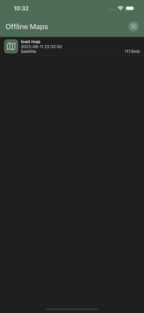
Offline Maps management screen in the GPS Tracker app showing a list of downloaded satellite maps with file sizes
Description
Download
More Like This
Apps with similar features and user experience

AllTrails: Hike, Bike & Run
AllTrails, Inc.

Pedometer++
Cross Forward Consulting, LLC

Organic Maps: Offline Map
Organic Maps OU

Gaia GPS: Mobile Trail Maps
Trailbehind, INC.

Offline hiking maps: Mapy.com
Seznam.cz a.s.

Hiking Map Poland
Mapa Turystyczna sp. z o.o.

MapOut
Valnova GmbH

FarOut: Offline GPS Trail Maps
Atlas Guides DE, Inc.

Norgeskart
Norgeskart AS
This page is not an official page of the app or its developer, but an independent editorial publication created for informational and commentary purposes. Unless expressly stated otherwise, neither the app nor its developer is affiliated with, endorsed by, sponsored by, authorized by, or otherwise officially connected with MWM, Apple, Google Play, the app publisher, or the app's developer, and nothing on this page implies that the app was developed using MWM's services. Any trademarks, logos, screenshots, and other content remain the property of their respective owners.