This page is not an official page of the app or its developer, but an independent editorial publication created for informational and commentary purposes. Unless expressly stated otherwise, neither the app nor its developer is affiliated with, endorsed by, sponsored by, authorized by, or otherwise officially connected with MWM, Apple, Google Play, the app publisher, or the app's developer, and nothing on this page implies that the app was developed using MWM's services. Any trademarks, logos, screenshots, and other content remain the property of their respective owners.

KOMPASS Outdoor & Hiking Maps
Engineered for the serious adventurer. Experience high-density topographical detail, offline safety, and thousands of certified tours for your next European mountain expedition.
Downloads
387K+User Rating
Total Ratings
6K+Publisher
Category
NavigationLocales
2Latest Version
6.3.2Size
114.5 MBFirst Released
Sep 27, 2013Master Your European Adventures
Navigate the Alps and beyond with the world’s most trusted professional cartography, editorially-reviewed tours, and advanced offline safety features.
Certified Professional Maps
Leave unreliable crowdsourced data behind. Access high-precision maps with certified trail networks and local landmarks trusted by experts since 1953.
Offline Reliability & Safety
Save maps and routes directly to your device. Navigate safely in remote mountain ranges without needing a data connection or incurring roaming fees.
The following screenshots and description are sourced directly from the app's official store listing and are the property of the app developer.
App Store
Screenshots
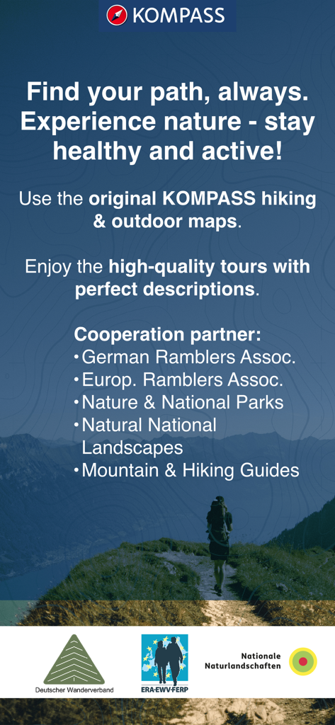
Promotional screen for KOMPASS hiking app showing a hiker on a mountain path with a list of certified partners
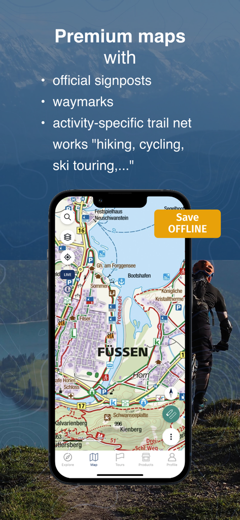
iPhone screen showing the KOMPASS app with a detailed topographic map of Fussen and premium outdoor features
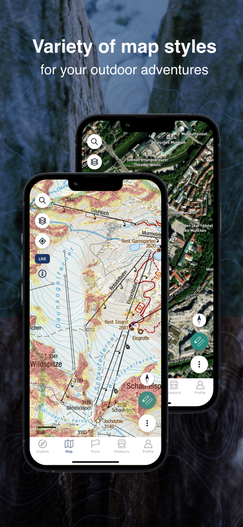
Variety of map styles for outdoor adventures on the KOMPASS hiking app
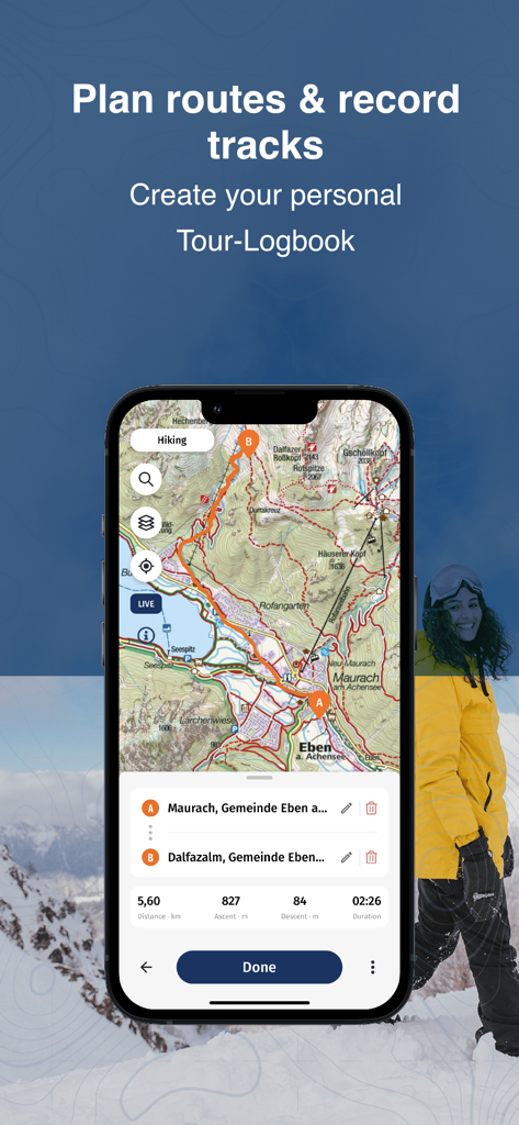
The KOMPASS app interface showing a detailed topographic map with a planned hiking route and tour statistics.

Smartphone screen showing digital hiking and cycling guides from Kompass publishing.
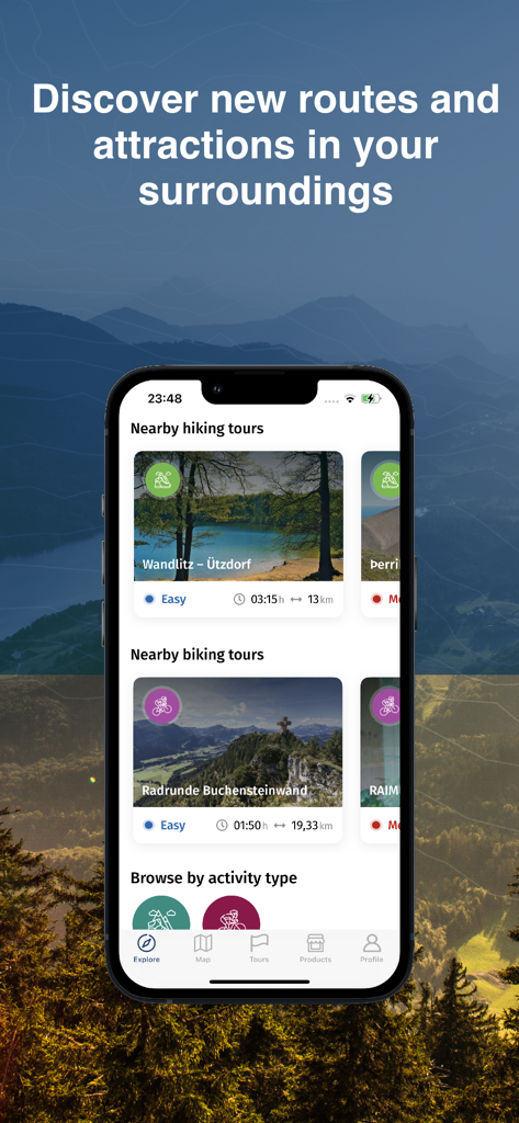
KOMPASS app explore screen showing curated hiking and biking tours
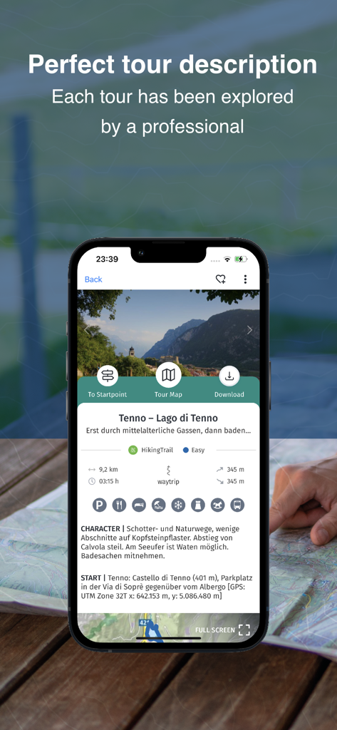
Smartphone showing a certified hiking tour description for Tenno in the KOMPASS outdoor app
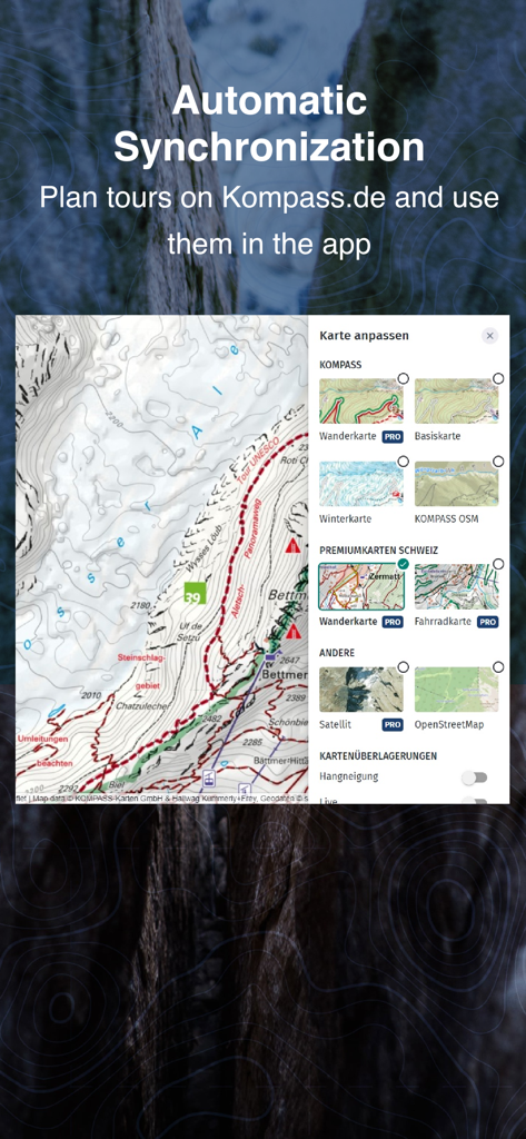
KOMPASS app showing automatic synchronization between website planning and mobile maps
Description
Download
More Like This
Apps with similar features and user experience

AllTrails: Hike, Bike & Run
AllTrails, Inc.

Pedometer++
Cross Forward Consulting, LLC

Organic Maps: Offline Map
Organic Maps OU

Gaia GPS: Mobile Trail Maps
Trailbehind, INC.

Offline hiking maps: Mapy.com
Seznam.cz a.s.

Hiking Map Poland
Mapa Turystyczna sp. z o.o.

MapOut
Valnova GmbH

FarOut: Offline GPS Trail Maps
Atlas Guides DE, Inc.

Norgeskart
Norgeskart AS
This page is not an official page of the app or its developer, but an independent editorial publication created for informational and commentary purposes. Unless expressly stated otherwise, neither the app nor its developer is affiliated with, endorsed by, sponsored by, authorized by, or otherwise officially connected with MWM, Apple, Google Play, the app publisher, or the app's developer, and nothing on this page implies that the app was developed using MWM's services. Any trademarks, logos, screenshots, and other content remain the property of their respective owners.