This page is not an official page of the app or its developer, but an independent editorial publication created for informational and commentary purposes. Unless expressly stated otherwise, neither the app nor its developer is affiliated with, endorsed by, sponsored by, authorized by, or otherwise officially connected with MWM, Apple, Google Play, the app publisher, or the app's developer, and nothing on this page implies that the app was developed using MWM's services. Any trademarks, logos, screenshots, and other content remain the property of their respective owners.

Measure Map Pro
The ultimate mapping utility for engineers, contractors, and landowners. Calculate complex perimeters and areas with earth-curvature accuracy and export instantly to AutoCAD, KML, and GIS formats.
Downloads
99K+User Rating
Total Ratings
2K+Publisher
Category
UtilitiesLocales
10Latest Version
13.10.5Size
239.0 MBFirst Released
Jun 22, 2011Professional Mapping in the Palm of Your Hand
Replace your tape measure with high-resolution satellite technology. Save hours on site visits by calculating precise areas, perimeters, and distances directly from your mobile device.
Laser-Sharp Precise Measurements
Account for the earth’s curvature while measuring anything from small building footprints to massive thousand-acre ranches with sub-meter accuracy.
Industry-Standard Exporting
Instantly export your data to AutoCAD (DXF), Shapefiles (SHP), KML, or CSV to seamlessly integrate field measurements into your professional CAD or GIS workflow.
The following screenshots and description are sourced directly from the app's official store listing and are the property of the app developer.
App Store
Screenshots
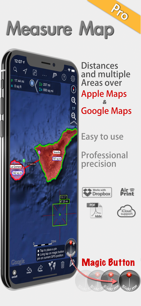
Measure Map Pro app showing professional area and distance measurements on satellite maps
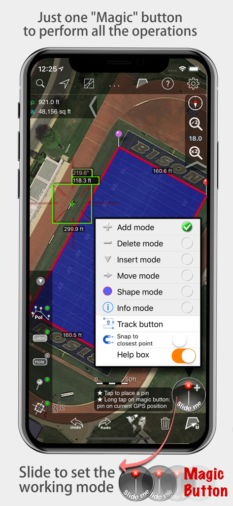
Measure Map Pro app displaying area and distance measurements on a satellite map with the magic button menu open
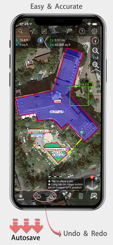
Measure Map Pro mobile app displaying precise area and distance measurements of a hotel building on a satellite map.
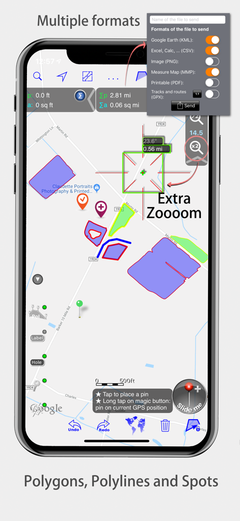
Measure Map Pro interface showing map polygons and export formats
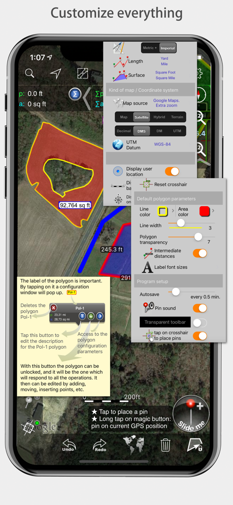
Measure Map Pro mobile app interface showcasing various customization menus for measurements and map styles
Description
Download
More Like This
Apps with similar features and user experience

Field MapS - Measure Land GPS
Aleksei Metelkin

Field Area MeasureーLand Parcel
Irina Metelkina

FieldCalc - GPS Area Measure
Pravin Gondaliya

GPS Fields Area Measure Map
Rento UAB

Geo Field Area - GPS Measure
STOMBERG s.r.o

GLand: GPS Field Area Measure
Authai Yaprasat

Distance - Find My Distance
Mapnitude Company Limited

Area & Distance - Map Measure
Mapnitude Company Limited

Measure Map
Xuan Luong Do
This page is not an official page of the app or its developer, but an independent editorial publication created for informational and commentary purposes. Unless expressly stated otherwise, neither the app nor its developer is affiliated with, endorsed by, sponsored by, authorized by, or otherwise officially connected with MWM, Apple, Google Play, the app publisher, or the app's developer, and nothing on this page implies that the app was developed using MWM's services. Any trademarks, logos, screenshots, and other content remain the property of their respective owners.