This page is not an official page of the app or its developer, but an independent editorial publication created for informational and commentary purposes. Unless expressly stated otherwise, neither the app nor its developer is affiliated with, endorsed by, sponsored by, authorized by, or otherwise officially connected with MWM, Apple, Google Play, the app publisher, or the app's developer, and nothing on this page implies that the app was developed using MWM's services. Any trademarks, logos, screenshots, and other content remain the property of their respective owners.

Mergin Maps: QGIS in pocket
Transform your mobile device into a professional surveying tool. Capture precise GPS data and intelligent forms offline, then sync directly to your QGIS desktop in seconds.
Downloads
13K+User Rating
Total Ratings
0Publisher
Category
UtilitiesLocales
22Latest Version
2025.8.0Size
130.0 MBFirst Released
Nov 16, 2019Streamline Your Field Workflow
Effortlessly capture, sync, and manage professional-grade GIS data directly from your mobile device, fully integrated with your QGIS environment.
Seamless QGIS Integration
Your mobile map layers look and behave exactly like your desktop QGIS project. No cables or complex conversions—just direct, effortless syncing.
Reliable Offline Data Capture
Work in remote locations with no cell service. Capture GPS data, photos, and notes offline and sync them back to the office in seconds.
The following screenshots and description are sourced directly from the app's official store listing and are the property of the app developer.
App Store
Screenshots
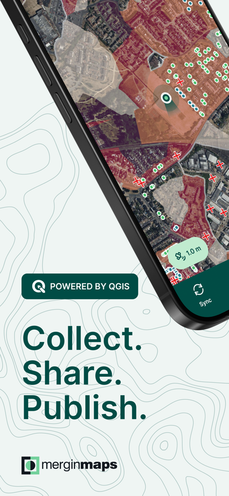
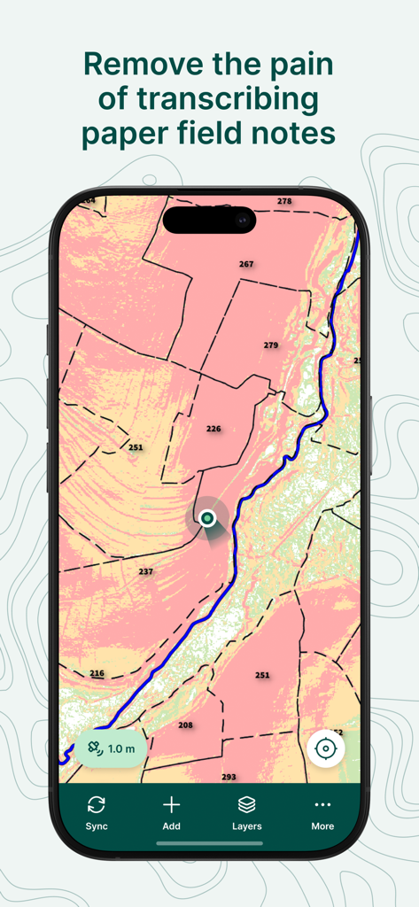
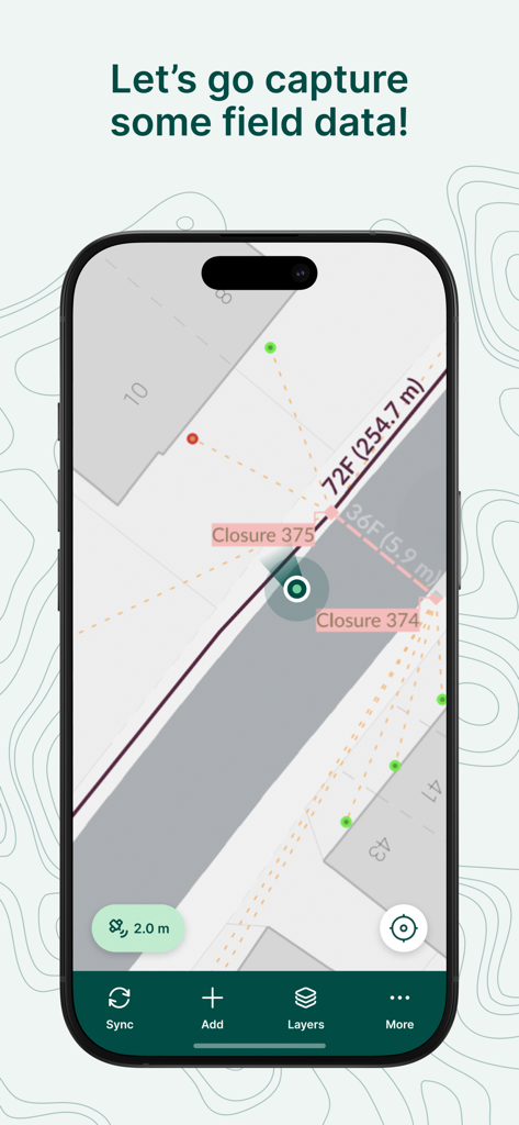
Mergin Maps app screen showing topographic mapping and field data collection
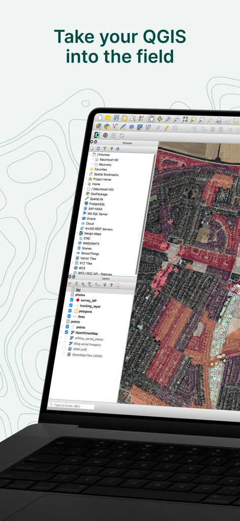
A laptop displaying the QGIS desktop software interface with a detailed satellite map and geographic layers under the heading Take your QGIS into the field
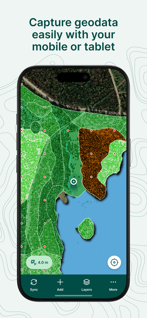
Mergin Maps mobile app displaying a detailed GIS map with land cover layers and a data capture interface
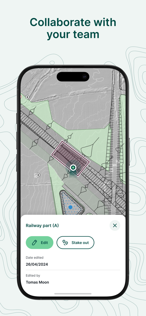
Mergin Maps mobile app interface showing collaborative field data collection and editing for a railway project
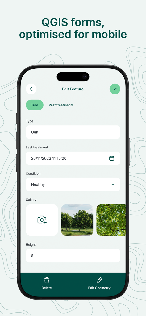
A mobile interface of Mergin Maps showing a professional field survey form with data entry fields for tree types and conditions
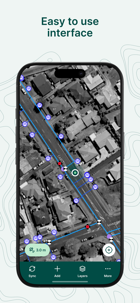
Screenshot of the Mergin Maps mobile app showing an easy to use satellite map interface with professional GIS survey markers and data lines
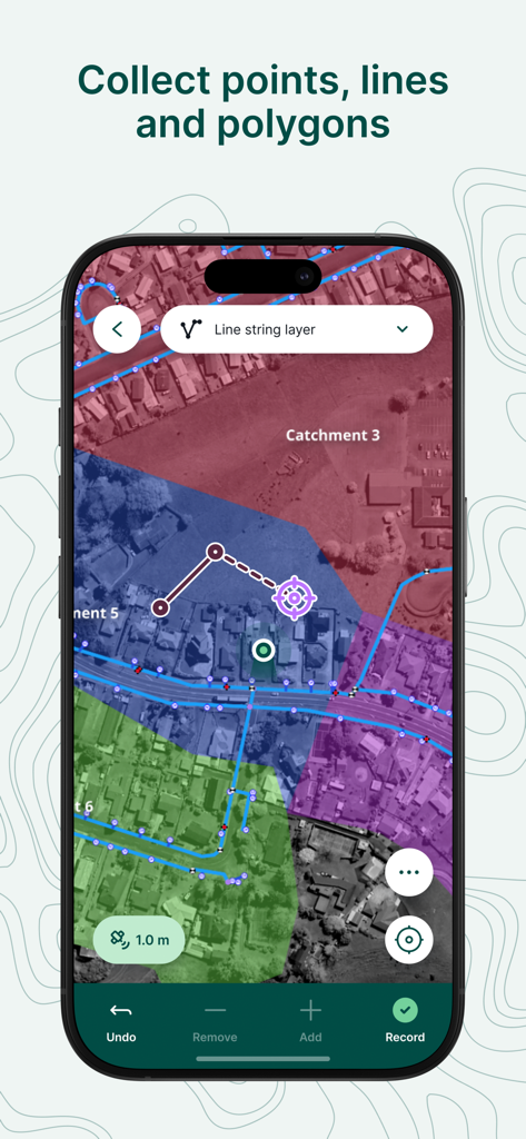
Mobile app screen showing a satellite map with colored geometric overlays for professional field surveying and data collection
Mergin Maps app displaying a professional GIS map with parcel data on a smartphone screen
Mergin Maps app interface displaying field data capture and survey measurements on a map
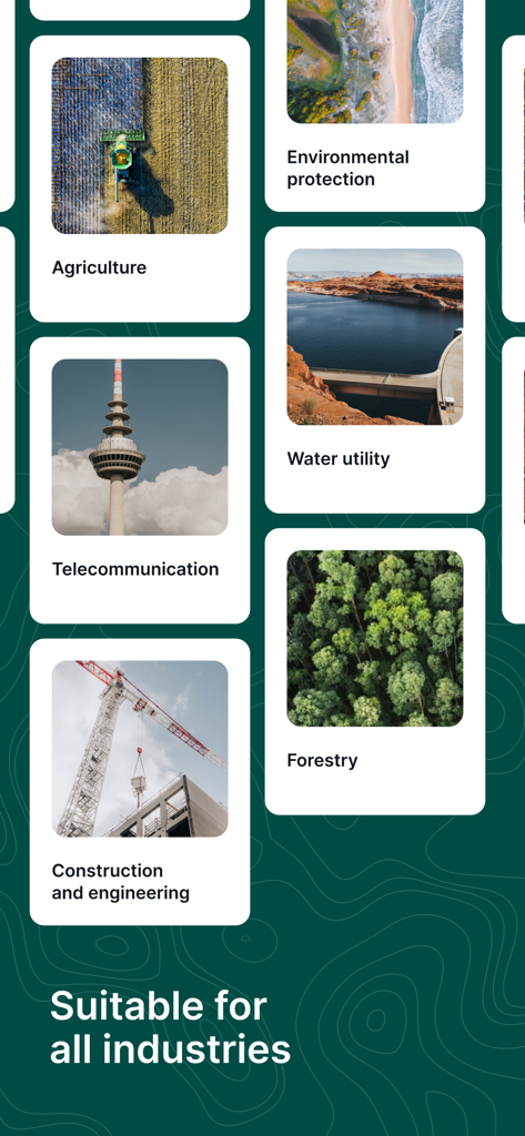
Mergin Maps interface showing suitability for various industries including agriculture forestry and construction
Description
Download
More Like This
Top-ranked apps in the same category

Google LLC

Google Chrome
Google LLC

中国移动(手机营业厅)
China Mobile Online Services Co., Ltd.

Google Authenticator
Google LLC

CNH do Brasil
Servicos e Informacoes do Brasil

Cleanup: Phone Storage Cleaner
DEEP FLOW SOFTWARE SERVICES - FZCO

gov.br
Servicos e Informacoes do Brasil

中国电信-全国统一官方服务平台
CHINA TELECOM Corporation Ltd.

Microsoft Edge: AI Browser
Microsoft Corporation
This page is not an official page of the app or its developer, but an independent editorial publication created for informational and commentary purposes. Unless expressly stated otherwise, neither the app nor its developer is affiliated with, endorsed by, sponsored by, authorized by, or otherwise officially connected with MWM, Apple, Google Play, the app publisher, or the app's developer, and nothing on this page implies that the app was developed using MWM's services. Any trademarks, logos, screenshots, and other content remain the property of their respective owners.