This page is not an official page of the app or its developer, but an independent editorial publication created for informational and commentary purposes. Unless expressly stated otherwise, neither the app nor its developer is affiliated with, endorsed by, sponsored by, authorized by, or otherwise officially connected with MWM, Apple, Google Play, the app publisher, or the app's developer, and nothing on this page implies that the app was developed using MWM's services. Any trademarks, logos, screenshots, and other content remain the property of their respective owners.

Norgeskart friluftsliv
Master the terrain with official government-grade UTM maps, offline navigation, and critical safety layers designed for the technical explorer and backcountry adventurer.
Downloads
236K+User Rating
Total Ratings
4K+Publisher
Category
NavigationLocales
2Latest Version
1.11.1Size
55.8 MBFirst Released
Jul 31, 2018Master the Wild with Professional Precision
Navigate Norway with the same data used by professionals. Access official Norwegian Mapping Authority maps, advanced safety layers, and high-resolution tools designed for technical explorers who demand reliability in the backcountry.
Government-Grade Offline Maps
Download high-resolution UTM topographical maps to navigate confidently in remote fjords and rugged mountains, even when you are miles away from cell coverage.
Advanced Safety Intelligence
Stay ahead of environmental risks with specialized layers for avalanche steepness, weak ice, and snow depth—critical for safe backcountry skiing and mountaineering.
The following screenshots and description are sourced directly from the app's official store listing and are the property of the app developer.
App Store
Screenshots
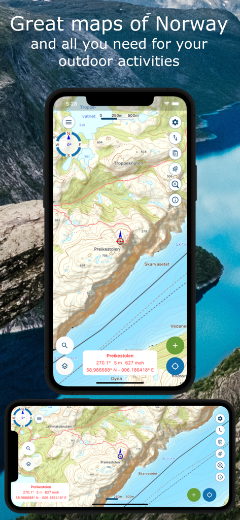
Norgeskart friluftsliv app interface showing a detailed topographical map of Preikestolen for outdoor navigation
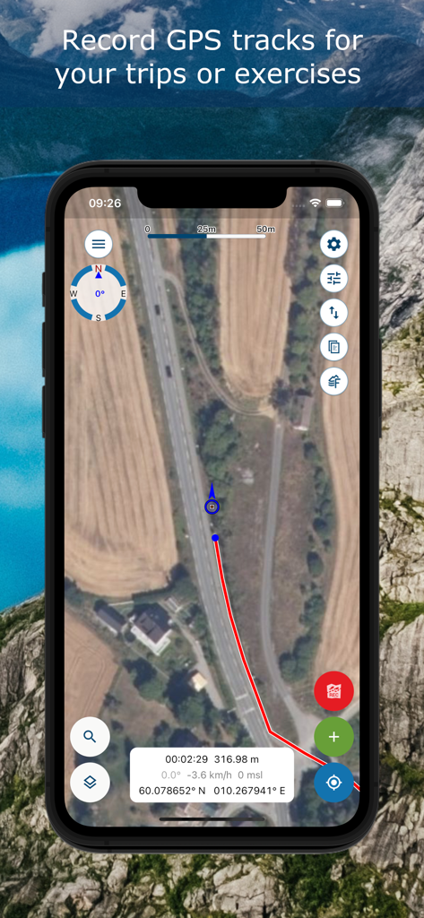
Norgeskart friluftsliv app screen showing GPS track recording on a satellite map
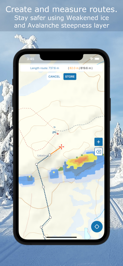
Norgeskart friluftsliv interface showing route measurement and avalanche steepness safety layers on a topographic map
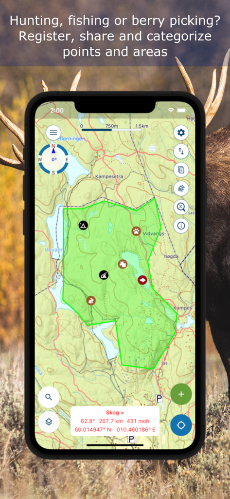
Topographic map in Norgeskart app showing custom points and areas for hunting and fishing.
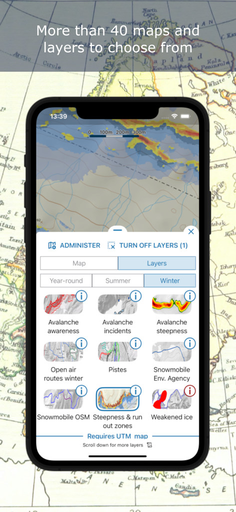
Norgeskart friluftsliv app interface showing technical winter map layers like avalanche awareness and ski pistes
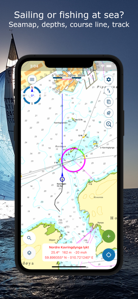
Norgeskart friluftsliv app showing nautical maps with sea depths and course lines for sailing.
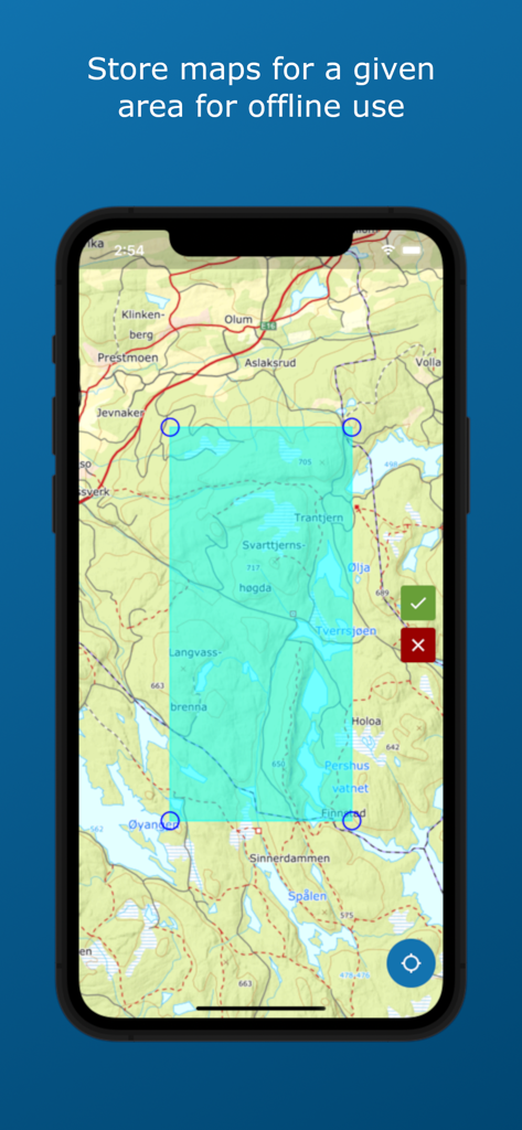
Selecting a map area for offline use in the Norgeskart friluftsliv app
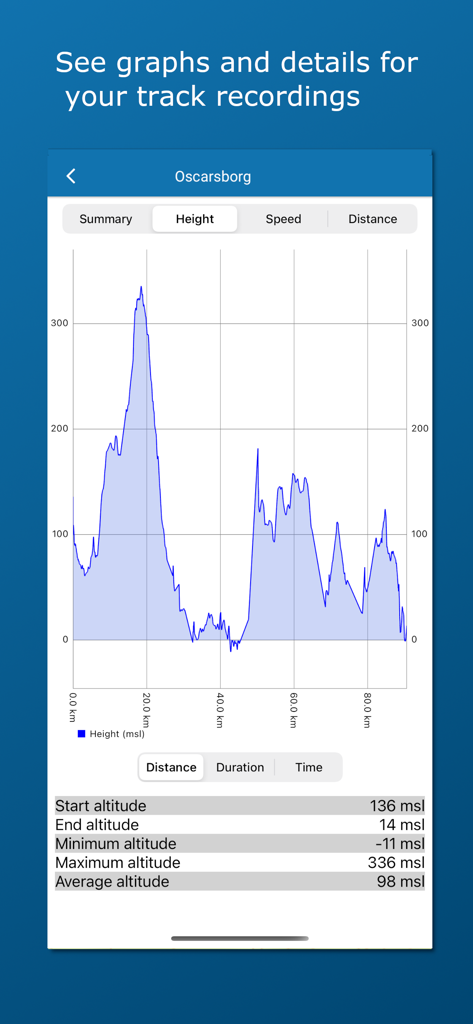
Altitude profile graph and statistics for a track recording in the Norgeskart friluftsliv app showing height over distance.
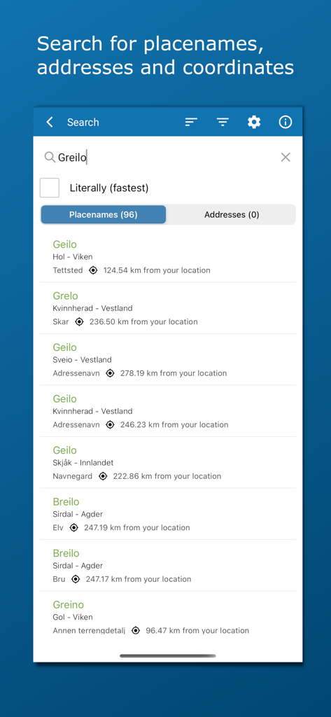
A search tool for finding Norwegian locations addresses and coordinates
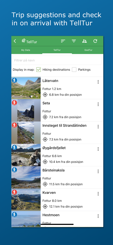
Norgeskart friluftsliv app interface showing a list of hiking trails and trip suggestions in Norway with photos and distances
Description
Download
More Like This
Apps with similar features and user experience

AllTrails: Hike, Bike & Run
AllTrails, Inc.

Pedometer++
Cross Forward Consulting, LLC

Organic Maps: Offline Map
Organic Maps OU

Gaia GPS: Mobile Trail Maps
Trailbehind, INC.

Offline hiking maps: Mapy.com
Seznam.cz a.s.

Hiking Map Poland
Mapa Turystyczna sp. z o.o.

MapOut
Valnova GmbH

FarOut: Offline GPS Trail Maps
Atlas Guides DE, Inc.

Norgeskart
Norgeskart AS
This page is not an official page of the app or its developer, but an independent editorial publication created for informational and commentary purposes. Unless expressly stated otherwise, neither the app nor its developer is affiliated with, endorsed by, sponsored by, authorized by, or otherwise officially connected with MWM, Apple, Google Play, the app publisher, or the app's developer, and nothing on this page implies that the app was developed using MWM's services. Any trademarks, logos, screenshots, and other content remain the property of their respective owners.