This page is not an official page of the app or its developer, but an independent editorial publication created for informational and commentary purposes. Unless expressly stated otherwise, neither the app nor its developer is affiliated with, endorsed by, sponsored by, authorized by, or otherwise officially connected with MWM, Apple, Google Play, the app publisher, or the app's developer, and nothing on this page implies that the app was developed using MWM's services. Any trademarks, logos, screenshots, and other content remain the property of their respective owners.

PathAway Outdoor Navigation
Master the outdoors with high-precision GPS tracking, offline maps, and advanced tools designed for serious explorers and field professionals who demand reliability beyond the cell signal.
Downloads
202K+User Rating
Total Ratings
0Publisher
Category
NavigationLocales
8Latest Version
7.14.00Size
20.4 MBFirst Released
Nov 23, 2010Engineered for the Great Outdoors
From backcountry expeditions to professional land surveys, PathAway provides the precision tracking and offline tools you need to explore with absolute confidence.
100% Offline Independence
Download topographic, satellite, and custom maps to navigate safely in remote wilderness areas where cell service doesn't exist.
Precision Route Planning
Create custom paths, set critical waypoints with photos, and use the BackTrack feature to ensure a safe return from every journey.
The following screenshots and description are sourced directly from the app's official store listing and are the property of the app developer.
App Store
Screenshots
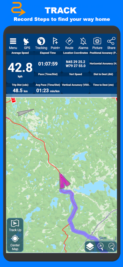
PathAway mobile app screen showing real time GPS tracking data including speed distance and coordinates over a topographic map
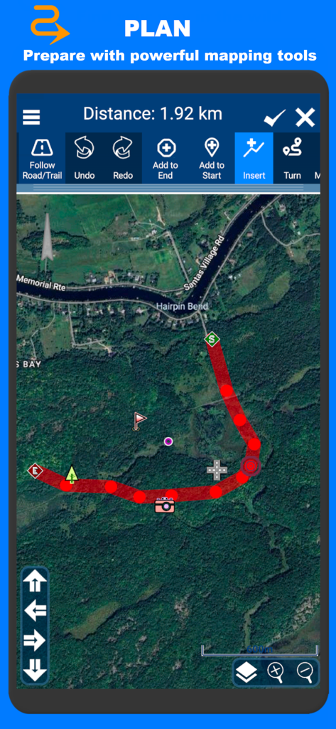
PathAway app screenshot showing satellite map route planning with distance measurement and editing tools
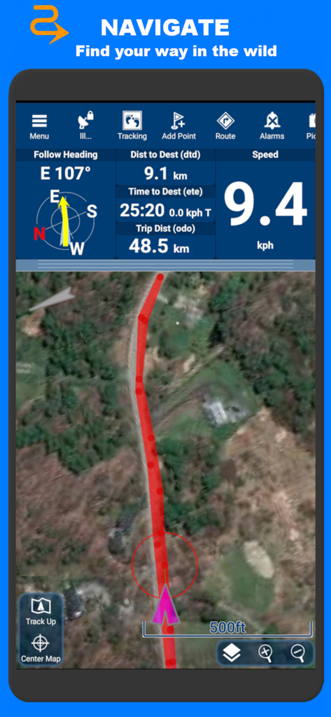
PathAway app screen displaying GPS navigation data and a satellite map track
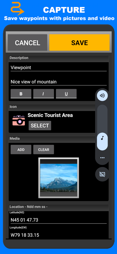
PathAway app interface showing the capture screen for saving a waypoint with a description photo and GPS coordinates
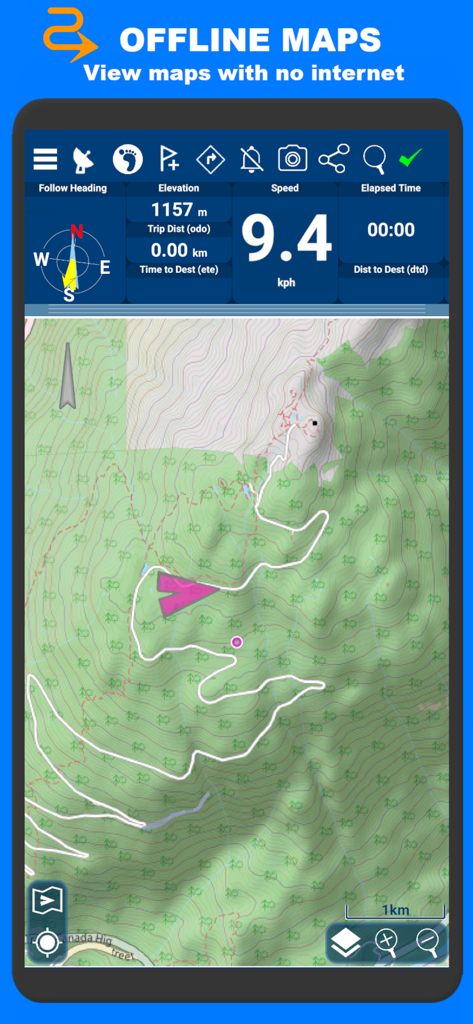
PathAway mobile app showing topographical offline maps and navigation data including elevation and speed
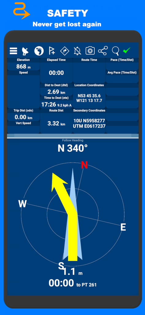
Technical navigation dashboard of PathAway app displaying coordinates elevation and a large compass
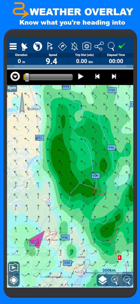
PathAway app displaying a weather overlay map with wind and atmospheric pressure data
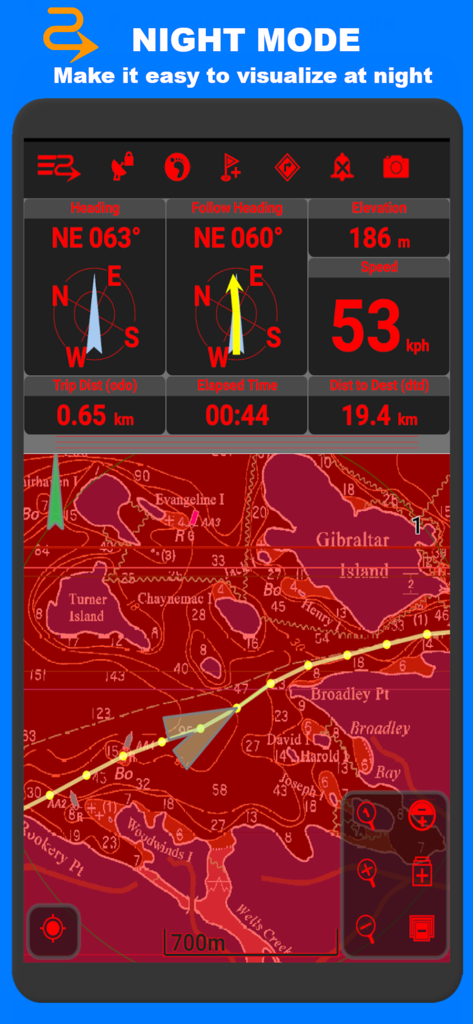
PathAway navigation app interface in red night mode showing marine maps and GPS tracking data
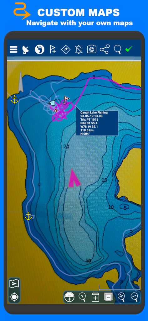
PathAway app displaying a custom marine map with depth contours and recorded fishing tracks
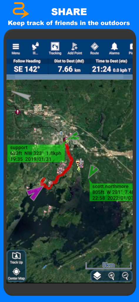
Real-time location sharing and friend tracking on a satellite map in PathAway navigation
Description
Download
More Like This
Apps with similar features and user experience

AllTrails: Hike, Bike & Run
AllTrails, Inc.

Pedometer++
Cross Forward Consulting, LLC

Organic Maps: Offline Map
Organic Maps OU

Gaia GPS: Mobile Trail Maps
Trailbehind, INC.

Offline hiking maps: Mapy.com
Seznam.cz a.s.

Hiking Map Poland
Mapa Turystyczna sp. z o.o.

MapOut
Valnova GmbH

FarOut: Offline GPS Trail Maps
Atlas Guides DE, Inc.

Norgeskart
Norgeskart AS
This page is not an official page of the app or its developer, but an independent editorial publication created for informational and commentary purposes. Unless expressly stated otherwise, neither the app nor its developer is affiliated with, endorsed by, sponsored by, authorized by, or otherwise officially connected with MWM, Apple, Google Play, the app publisher, or the app's developer, and nothing on this page implies that the app was developed using MWM's services. Any trademarks, logos, screenshots, and other content remain the property of their respective owners.