This page is not an official page of the app or its developer, but an independent editorial publication created for informational and commentary purposes. Unless expressly stated otherwise, neither the app nor its developer is affiliated with, endorsed by, sponsored by, authorized by, or otherwise officially connected with MWM, Apple, Google Play, the app publisher, or the app's developer, and nothing on this page implies that the app was developed using MWM's services. Any trademarks, logos, screenshots, and other content remain the property of their respective owners.

SityTrail
Explore with confidence using official USGS topographic maps, off-path safety alerts, and seamless Apple Watch integration. From meticulous planning on your desktop to hands-free navigation on the trail, SityTrail is the ultimate tool for serious explorers.
Downloads
167K+User Rating
Total Ratings
2K+Publisher
Category
TravelLocales
6Latest Version
12.16.2Size
55.6 MBFirst Released
Mar 21, 2011Master the Trails with Professional Precision
SityTrail combines high-end topographic mapping with advanced safety features to turn your iPhone and Apple Watch into the ultimate outdoor navigation system.
Official USGS Topo Maps
Access high-resolution topographic data offline. Navigate the most remote wilderness areas with professional-grade accuracy even without cell service.
Active Off-Path Protection
Explore with confidence using real-time vibration alerts and voice instructions that notify you the moment you deviate from your planned route.
The following screenshots and description are sourced directly from the app's official store listing and are the property of the app developer.
App Store
Screenshots
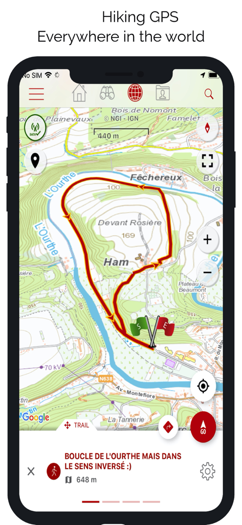
SityTrail app interface displaying a detailed topographic map with a red hiking trail loop.

SityTrail app screen showing a collection of hiking and mountain landscape photos
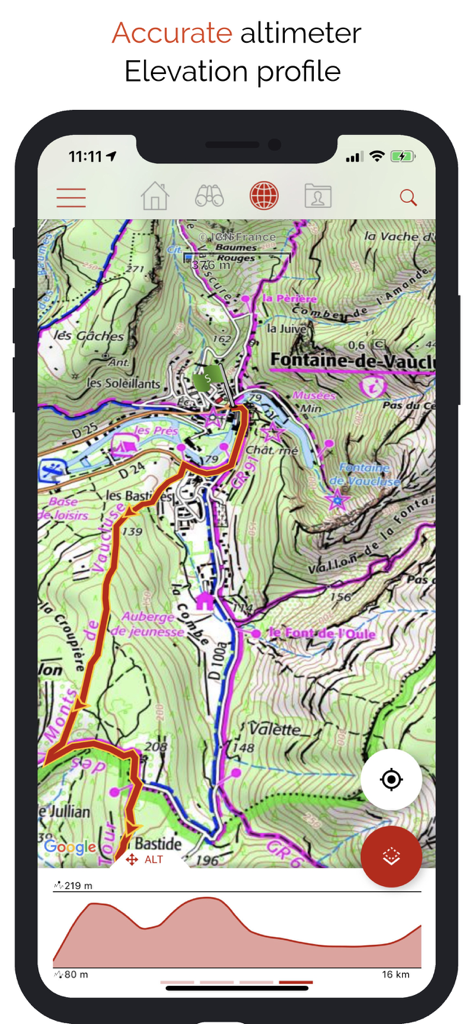
SityTrail app interface showing a detailed topographic map and a hiking elevation profile graph

SityTrail app interface showing the user profile and organized lists of hiking trails and points of interest

SityTrail app interface showing the premium trail catalog and community-curated outdoor routes.
Description
Download
More Like This
Apps with similar features and user experience

AllTrails: Hike, Bike & Run
AllTrails, Inc.

Pedometer++
Cross Forward Consulting, LLC

Organic Maps: Offline Map
Organic Maps OU

Gaia GPS: Mobile Trail Maps
Trailbehind, INC.

Offline hiking maps: Mapy.com
Seznam.cz a.s.

Hiking Map Poland
Mapa Turystyczna sp. z o.o.

MapOut
Valnova GmbH

FarOut: Offline GPS Trail Maps
Atlas Guides DE, Inc.

Norgeskart
Norgeskart AS
This page is not an official page of the app or its developer, but an independent editorial publication created for informational and commentary purposes. Unless expressly stated otherwise, neither the app nor its developer is affiliated with, endorsed by, sponsored by, authorized by, or otherwise officially connected with MWM, Apple, Google Play, the app publisher, or the app's developer, and nothing on this page implies that the app was developed using MWM's services. Any trademarks, logos, screenshots, and other content remain the property of their respective owners.