이 페이지는 앱이나 개발자의 공식 페이지가 아니며, 정보 제공 및 논평을 목적으로 작성된 독립 편집 간행물입니다. 명시적으로 달리 언급되지 않는 한, 해당 앱이나 개발자는 MWM, Apple, Google Play, 앱 퍼블리셔 또는 앱 개발자와 제휴, 보증, 후원, 승인 또는 공식적으로 연결되어 있지 않으며, 이 페이지의 어떤 내용도 해당 앱이 MWM의 서비스를 사용하여 개발되었음을 의미하지 않습니다. 모든 상표, 로고, 스크린샷 및 기타 콘텐츠는 해당 소유자의 자산입니다.

BaseMap: Hunting GPS Maps
신뢰할 수 있는 토지 소유 지도, 3D 스카우팅, 오프라인 GPS를 사용하여 더 스마트하게 사냥하고, 합법적으로 활동하고, 자신 있게 후방 지역을 탐색하는 880만 명 이상의 야외 활동가들과 함께하세요.
다운로드
882K+사용자 평점
총 평가 수
9K+개발사
카테고리
Navigation지원 언어
1최신 버전
6.2.0크기
336.9 MB출시일
2018년 4월 22일지형을 마스터하고 사냥을 소유하세요
업계 최고의 GPS 도구로 자신을 갖추세요. 전국 토지 소유 데이터부터 오프라인 3D 지도까지, 성공적이고 안전한 수확에 필요한 정보를 제공합니다.
정확한 토지 소유
전국의 개인 필지 경계와 소유자 이름을 즉시 확인하여 합법적으로 활동하고 최적의 접근 지점을 찾으세요.
신뢰할 수 있는 오프라인 내비게이션
무제한 오프라인 지도 캐싱으로 길을 잃지 마세요. 셀룰러 서비스 없이도 자신의 위치를 추적하고 험난한 지형을 탐색하세요.
다음 스크린샷과 설명은 앱의 공식 스토어 목록에서 직접 가져온 것이며 앱 개발자의 자산입니다.
앱 스토어
스크린샷
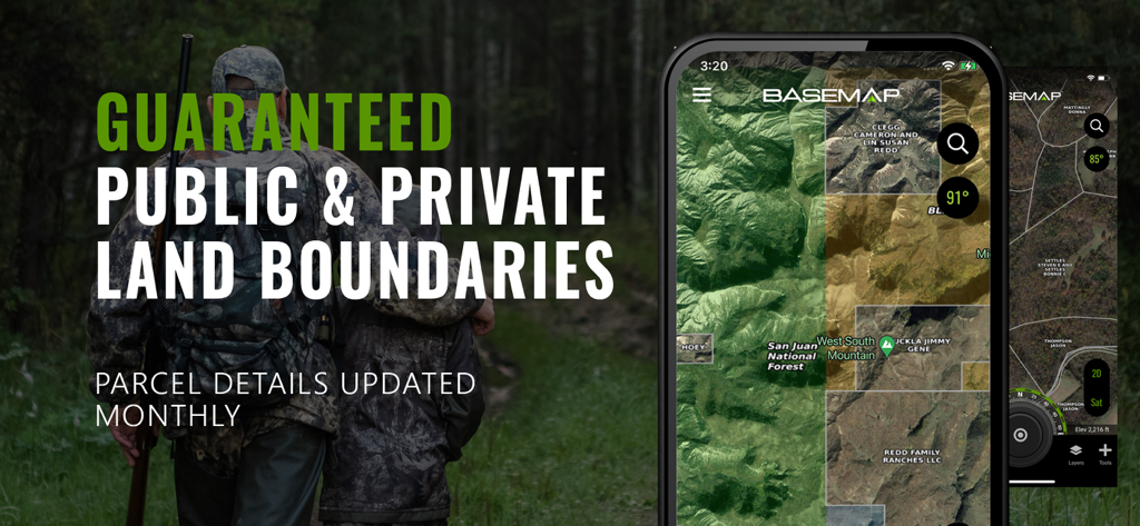
BaseMap 앱 인터페이스는 지형 지도에 소유자 이름과 함께 공개 및 비공개 토지 경계를 표시합니다.
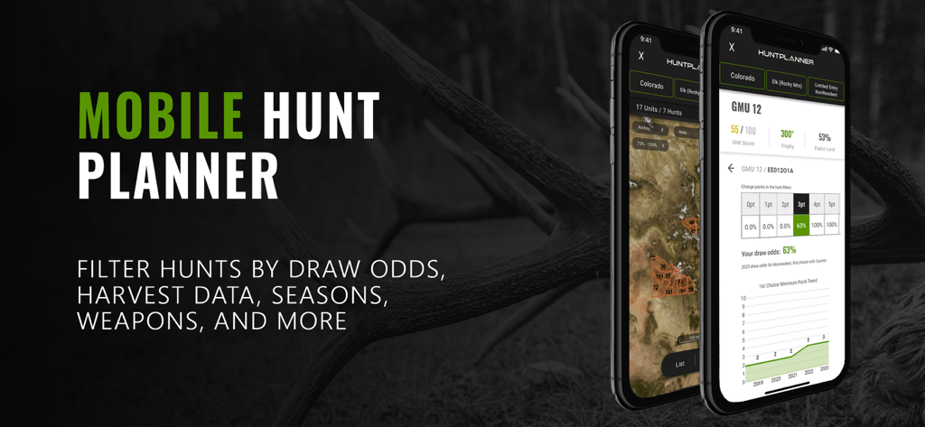
BaseMap 사냥 앱 인터페이스는 모바일 전화에서 추첨 확률 및 수확 데이터를 표시합니다.
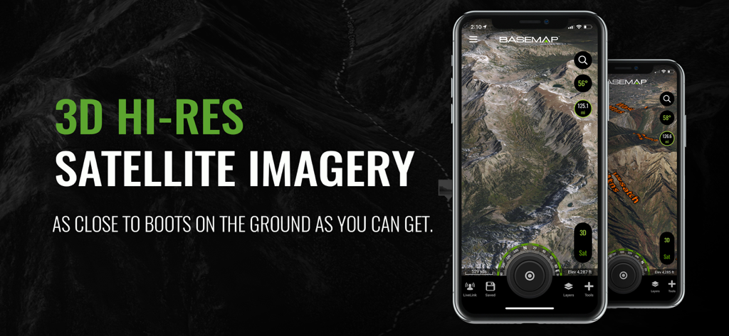
BaseMap 앱은 사냥 및 스카우팅을 위한 산악 지형의 3D 고해상도 위성 이미지를 표시합니다.
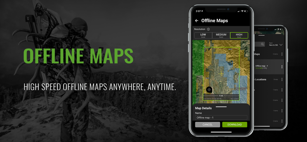
스마트폰은 배경에 사냥꾼이 있는 BaseMap 오프라인 사냥 지도 기능을 표시합니다.
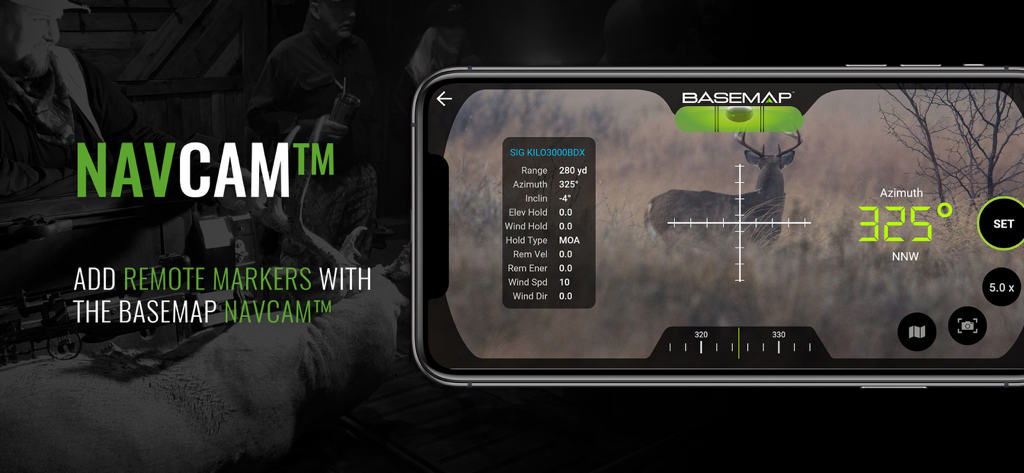
스마트폰은 범위 및 방위각 데이터와 함께 디지털 조준경을 통해 사슴을 보여주는 BaseMap NavCam 기능을 표시합니다.
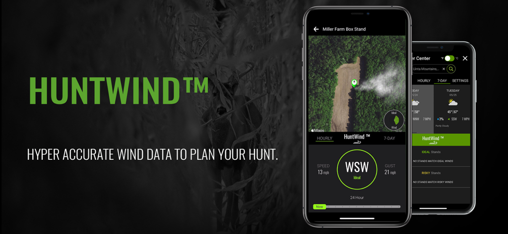
BaseMap 앱 인터페이스는 사냥 계획을 위한 정확한 바람 방향 및 속도 데이터를 제공하는 HuntWind 기능을 표시합니다.
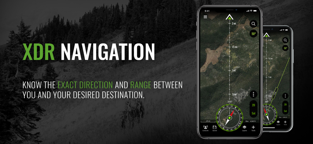
BaseMap 앱 인터페이스는 사냥꾼을 위한 위성 이미지와 나침반이 있는 XDR 내비게이션을 표시합니다.
설명
Download
비슷한 앱
유사한 기능과 사용자 경험을 가진 앱

onX Hunt: GPS Hunting Maps
onXmaps, Inc.

GOHUNT: Research & Maps
GOHUNT, LLC

HuntWise: A Better Hunting App
Sportsman Tracker, Inc

HuntStand: GPS Maps & Tools
Good Sportsman Marketing, LLC

MyHunt: US Best Hunting App
Hunter & Companion Gesellschaft mit beschrankter Haftung

WeHunt
Natlink AB

DeerCast-Prep. Predict. Pursue
Good Sportsman Marketing, LLC

iHunter
Inside Outside Studios Inc.

Hunting Points: GPS & Hunt App
Fishing Points d.o.o.
이 페이지는 앱이나 개발자의 공식 페이지가 아니며, 정보 제공 및 논평을 목적으로 작성된 독립 편집 간행물입니다. 명시적으로 달리 언급되지 않는 한, 해당 앱이나 개발자는 MWM, Apple, Google Play, 앱 퍼블리셔 또는 앱 개발자와 제휴, 보증, 후원, 승인 또는 공식적으로 연결되어 있지 않으며, 이 페이지의 어떤 내용도 해당 앱이 MWM의 서비스를 사용하여 개발되었음을 의미하지 않습니다. 모든 상표, 로고, 스크린샷 및 기타 콘텐츠는 해당 소유자의 자산입니다.