이 페이지는 앱이나 개발자의 공식 페이지가 아니며, 정보 제공 및 논평을 목적으로 작성된 독립 편집 간행물입니다. 명시적으로 달리 언급되지 않는 한, 해당 앱이나 개발자는 MWM, Apple, Google Play, 앱 퍼블리셔 또는 앱 개발자와 제휴, 보증, 후원, 승인 또는 공식적으로 연결되어 있지 않으며, 이 페이지의 어떤 내용도 해당 앱이 MWM의 서비스를 사용하여 개발되었음을 의미하지 않습니다. 모든 상표, 로고, 스크린샷 및 기타 콘텐츠는 해당 소유자의 자산입니다.

다운로드
294K+사용자 평점
총 평가 수
28K+개발사
카테고리
Sports지원 언어
2최신 버전
5.0.50크기
295.6 MB출시일
2012년 10월 24일자신 있게 야생을 마스터하세요
실시간 구역 규정, 전문 등급 오프라인 지도 제작, 정확한 토지 소유권 데이터를 결합한 캐나다 및 목적지 사냥꾼을 위한 가장 신뢰할 수 있는 도구입니다.
항상 규정 준수 사냥
사냥 구역에 직접 겹쳐진 최신 주 규정 및 시즌 요약에 즉시 액세스하여 합법적이고 윤리적으로 사냥하도록 하세요.
전문 등급 오프라인 탐색
고해상도 위성 및 지형도를 다운로드하여 셀 서비스 없이도 깊은 후방 지역에서 자신의 위치를 추적하고 웨이포인트를 표시하세요.
다음 스크린샷과 설명은 앱의 공식 스토어 목록에서 직접 가져온 것이며 앱 개발자의 자산입니다.
앱 스토어
스크린샷
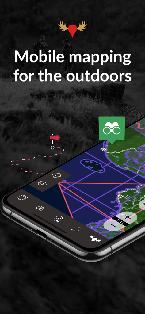
상세한 사냥 구역 지도 오버레이가 있는 iHunter 앱을 표시하는 스마트폰
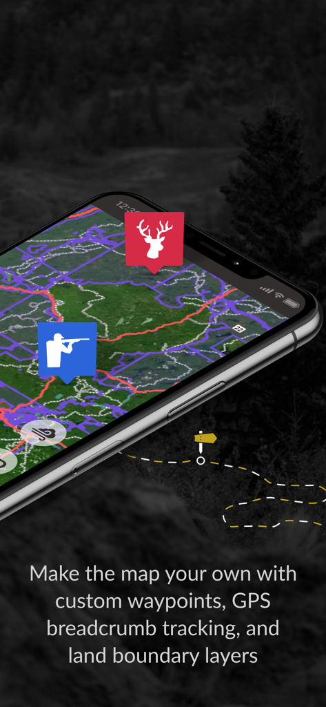
상세 지도에 사용자 지정 웨이포인트와 GPS 경로 추적을 보여주는 iHunter 앱 인터페이스
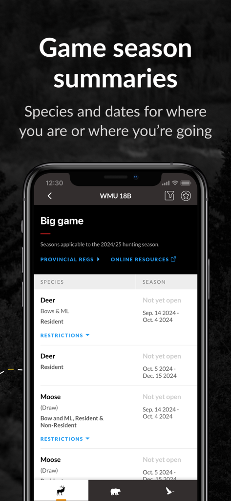
사슴과 무스를 위한 사냥 시즌 날짜 및 요약을 보여주는 iHunter 앱 화면
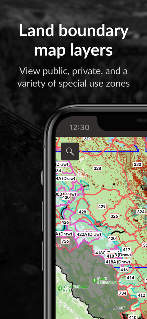
공공 및 민간 구역이 있는 토지 경계 지도 레이어를 표시하는 iHunter 앱
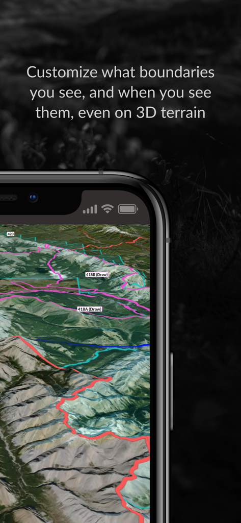
iHunter 앱이 3D 위성 지형 및 화려한 사냥 구역 경계와 함께 표시되는 iPhone 디스플레이
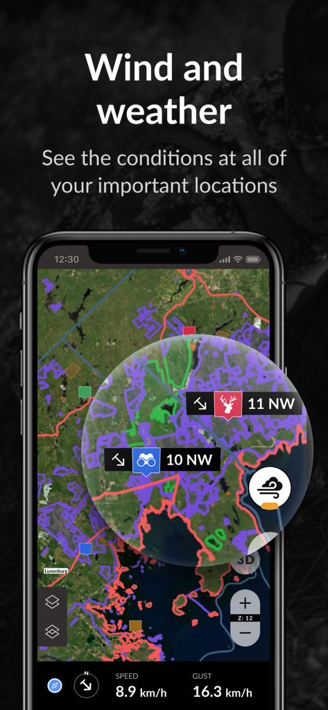
사냥 구역 지도에 바람 및 날씨 조건을 표시하는 iHunter 앱 인터페이스
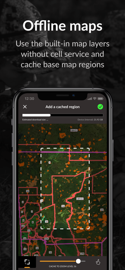
셀 서비스 없이 오프라인 사용을 위해 지도 영역을 선택하고 다운로드하는 방법을 보여주는 iHunter 앱 인터페이스
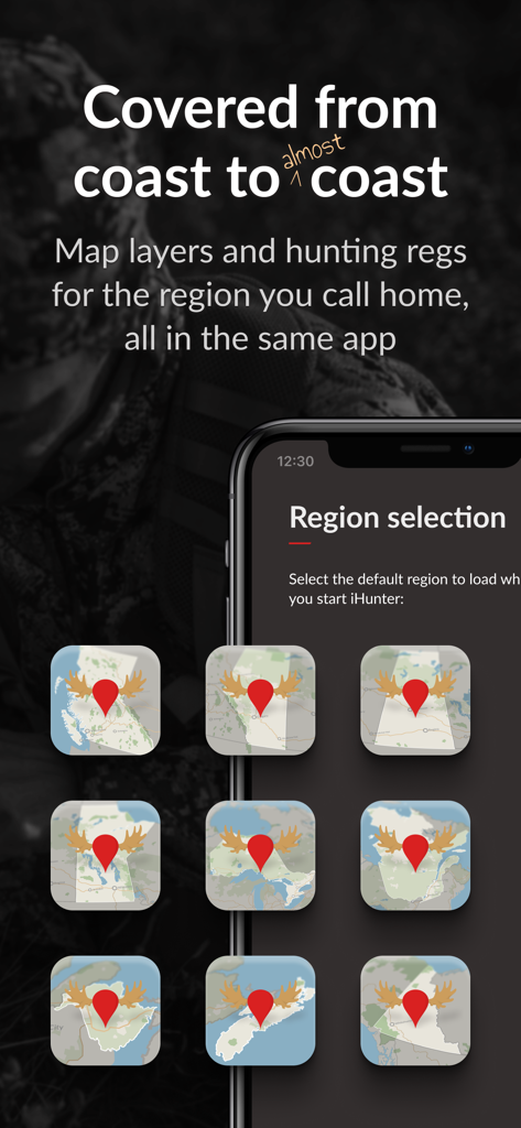
지역별 사냥 규정 및 레이어를 위한 캐나다 주 지도 선택을 보여주는 iHunter 모바일 앱 화면
설명
Download
비슷한 앱
유사한 기능과 사용자 경험을 가진 앱

onX Hunt: GPS Hunting Maps
onXmaps, Inc.

GOHUNT: Research & Maps
GOHUNT, LLC

HuntWise: A Better Hunting App
Sportsman Tracker, Inc

HuntStand: GPS Maps & Tools
Good Sportsman Marketing, LLC

MyHunt: US Best Hunting App
Hunter & Companion Gesellschaft mit beschrankter Haftung

WeHunt
Natlink AB

DeerCast-Prep. Predict. Pursue
Good Sportsman Marketing, LLC

BaseMap: Hunting GPS Maps
BaseMap Inc

Hunting Points: GPS & Hunt App
Fishing Points d.o.o.
이 페이지는 앱이나 개발자의 공식 페이지가 아니며, 정보 제공 및 논평을 목적으로 작성된 독립 편집 간행물입니다. 명시적으로 달리 언급되지 않는 한, 해당 앱이나 개발자는 MWM, Apple, Google Play, 앱 퍼블리셔 또는 앱 개발자와 제휴, 보증, 후원, 승인 또는 공식적으로 연결되어 있지 않으며, 이 페이지의 어떤 내용도 해당 앱이 MWM의 서비스를 사용하여 개발되었음을 의미하지 않습니다. 모든 상표, 로고, 스크린샷 및 기타 콘텐츠는 해당 소유자의 자산입니다.