이 페이지는 앱이나 개발자의 공식 페이지가 아니며, 정보 제공 및 논평을 목적으로 작성된 독립 편집 간행물입니다. 명시적으로 달리 언급되지 않는 한, 해당 앱이나 개발자는 MWM, Apple, Google Play, 앱 퍼블리셔 또는 앱 개발자와 제휴, 보증, 후원, 승인 또는 공식적으로 연결되어 있지 않으며, 이 페이지의 어떤 내용도 해당 앱이 MWM의 서비스를 사용하여 개발되었음을 의미하지 않습니다. 모든 상표, 로고, 스크린샷 및 기타 콘텐츠는 해당 소유자의 자산입니다.

WeHunt
실시간 GPS, 냄새 지표 및 고급 지형 지도를 사용하여 모든 사냥을 자신과 반려견에게 더 안전하고 효율적이며 성공적으로 만드는 80만 명의 사냥꾼과 함께하세요.
다운로드
317K+사용자 평점
총 평가 수
9K+개발사
카테고리
Navigation지원 언어
13최신 버전
6.8.1크기
40.3 MB출시일
2017년 1월 27일고급 전술 도구로 사냥을 마스터하세요
전 세계 80만 명 이상의 사냥꾼이 신뢰하는 팀 조정, 정밀 매핑 및 실시간 안전을 위한 최고의 플랫폼입니다.
실시간 팀 안전
사냥 파티와 협력하고 지도에서 모든 사람의 실시간 위치를 확인하여 안전하고 성공적인 포획을 보장하세요.
전략적 냄새 및 지형 도구
정밀하고 정확한 지도로 계획을 세우고 냄새 지표를 사용하여 풍향을 시각화함으로써 먹잇감보다 한발 앞서 나가세요.
다음 스크린샷과 설명은 앱의 공식 스토어 목록에서 직접 가져온 것이며 앱 개발자의 자산입니다.
앱 스토어
스크린샷
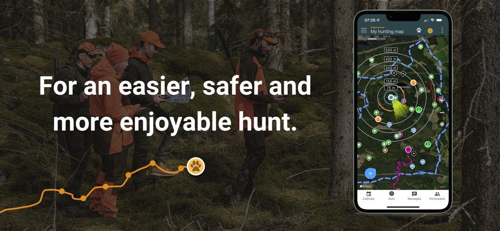
스마트폰에서 WeHunt 내비게이션 앱을 사용하는 숲속의 사냥꾼 그룹
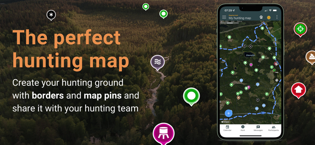
항공 숲 배경 위에 경계선과 핀이 표시된 상세한 사냥 지도를 보여주는 WeHunt 앱 인터페이스
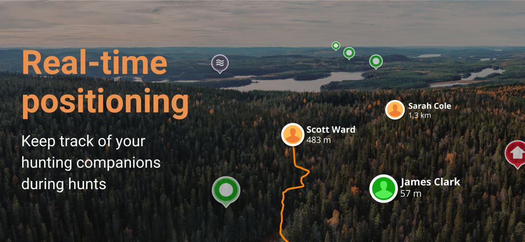
숲 지도에 표시된 사냥 동료들의 실시간 위치
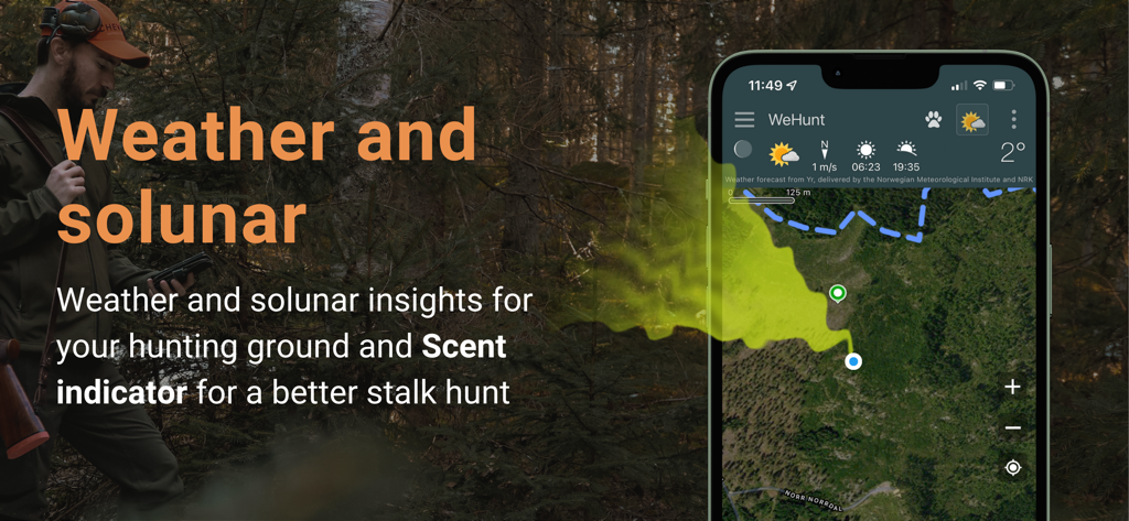
사냥 지도에 기상 솔루나 데이터와 냄새 지표를 표시하는 WeHunt 앱 인터페이스
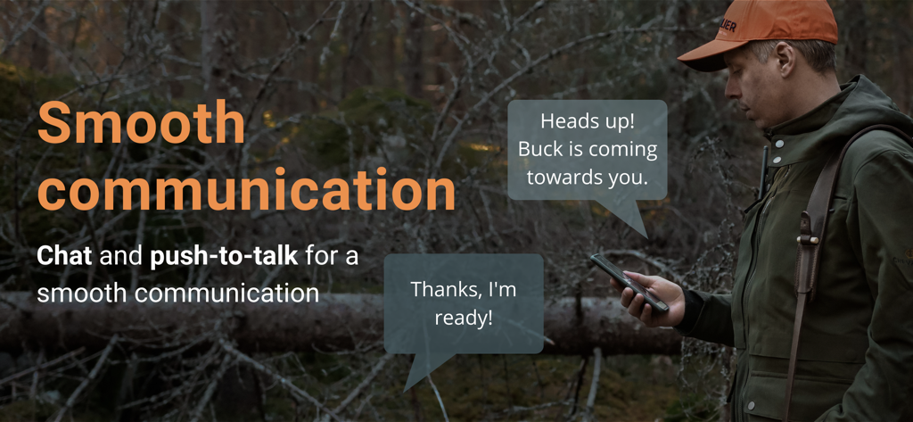
WeHunt 앱 채팅 및 푸시 투 토크 기능을 사용하는 숲속의 사냥꾼
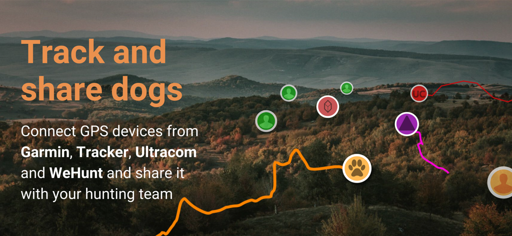
지형 지도에서 반려견 추적 및 팀 공유를 보여주는 WeHunt 앱 인터페이스
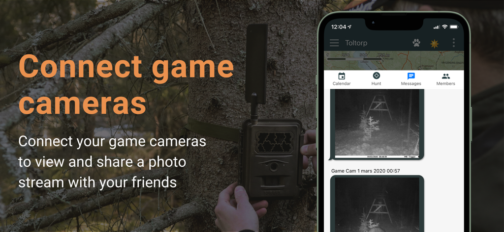
나무에 설치된 게임 카메라의 사진 스트림을 표시하는 WeHunt 앱 인터페이스
설명
Download
비슷한 앱
유사한 기능과 사용자 경험을 가진 앱

onX Hunt: GPS Hunting Maps
onXmaps, Inc.

GOHUNT: Research & Maps
GOHUNT, LLC

HuntWise: A Better Hunting App
Sportsman Tracker, Inc

HuntStand: GPS Maps & Tools
Good Sportsman Marketing, LLC

MyHunt: US Best Hunting App
Hunter & Companion Gesellschaft mit beschrankter Haftung

DeerCast-Prep. Predict. Pursue
Good Sportsman Marketing, LLC

BaseMap: Hunting GPS Maps
BaseMap Inc

iHunter
Inside Outside Studios Inc.

Hunting Points: GPS & Hunt App
Fishing Points d.o.o.
이 페이지는 앱이나 개발자의 공식 페이지가 아니며, 정보 제공 및 논평을 목적으로 작성된 독립 편집 간행물입니다. 명시적으로 달리 언급되지 않는 한, 해당 앱이나 개발자는 MWM, Apple, Google Play, 앱 퍼블리셔 또는 앱 개발자와 제휴, 보증, 후원, 승인 또는 공식적으로 연결되어 있지 않으며, 이 페이지의 어떤 내용도 해당 앱이 MWM의 서비스를 사용하여 개발되었음을 의미하지 않습니다. 모든 상표, 로고, 스크린샷 및 기타 콘텐츠는 해당 소유자의 자산입니다.