This page is not an official page of the app or its developer, but an independent editorial publication created for informational and commentary purposes. Unless expressly stated otherwise, neither the app nor its developer is affiliated with, endorsed by, sponsored by, authorized by, or otherwise officially connected with MWM, Apple, Google Play, the app publisher, or the app's developer, and nothing on this page implies that the app was developed using MWM's services. Any trademarks, logos, screenshots, and other content remain the property of their respective owners.

Air Navigation Pro
Master the skies with professional-grade aeronautical charts, real-time traffic alerts, and advanced weather layers. Designed for safety-conscious pilots who demand total situational awareness from take-off to landing.
Downloads
523K+User Rating
Total Ratings
200Publisher
Category
NavigationLocales
10Latest Version
8.4.150Size
213.4 MBFirst Released
Jan 6, 2009Precision Flight Tools for the Modern Pilot
Transform your iPad into a professional-grade Electronic Flight Bag with real-time situational awareness and worldwide aeronautical data.
3D Synthetic Vision & TAWS
Fly with confidence in any terrain using high-resolution 3D views and Terrain Awareness Warning Systems for ultimate situational safety.
Integrated Live Traffic
Get real-time visual and audio alerts through native SafeSky integration, ensuring you stay aware of nearby aircraft at all times.
The following screenshots and description are sourced directly from the app's official store listing and are the property of the app developer.
App Store
Screenshots
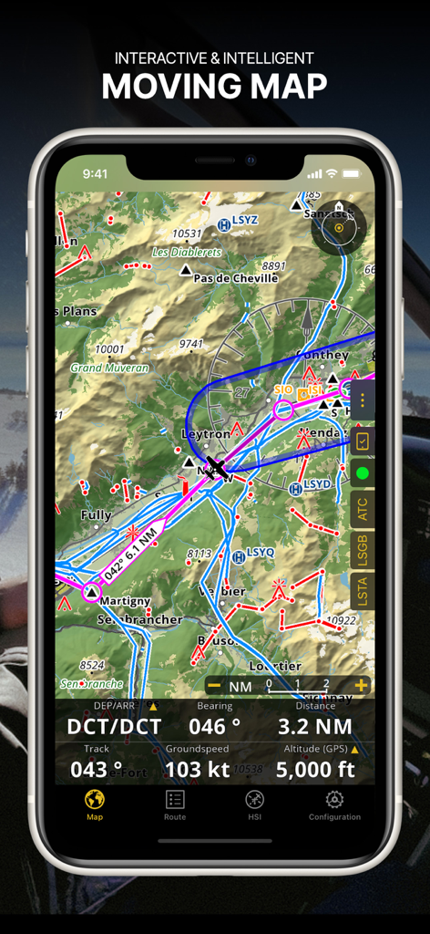
Air Navigation Pro app screenshot showing an interactive moving map with aeronautical charts and real-time flight data
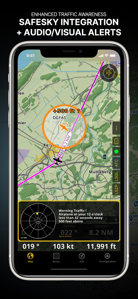
Air Navigation Pro interface showing enhanced traffic awareness with Safesky integration and visual alerts
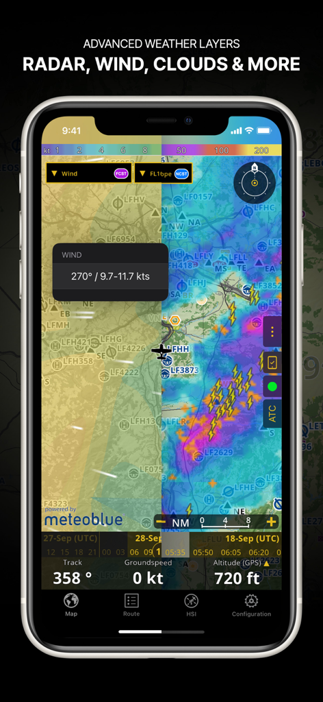
Air Navigation Pro app screenshot showing advanced weather layers including radar wind and cloud coverage on a navigation map
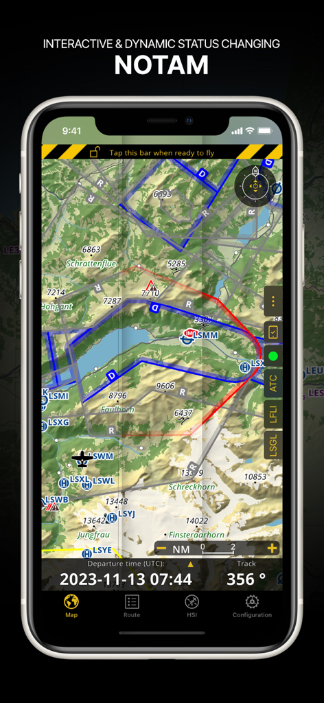
Air Navigation Pro interface displaying dynamic NOTAM information on a topographical aeronautical map
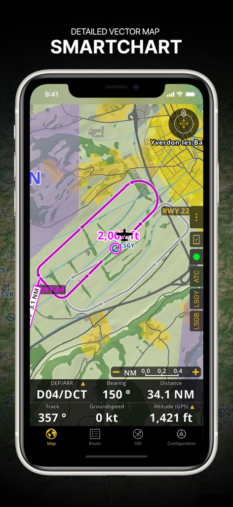
Air Navigation Pro interface showing a detailed vector SmartChart with a flight route and real-time navigation data.
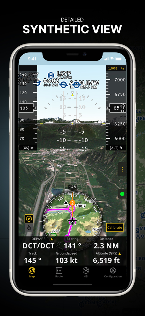
Air Navigation Pro app displaying the detailed synthetic view feature with 3D terrain and integrated flight instruments
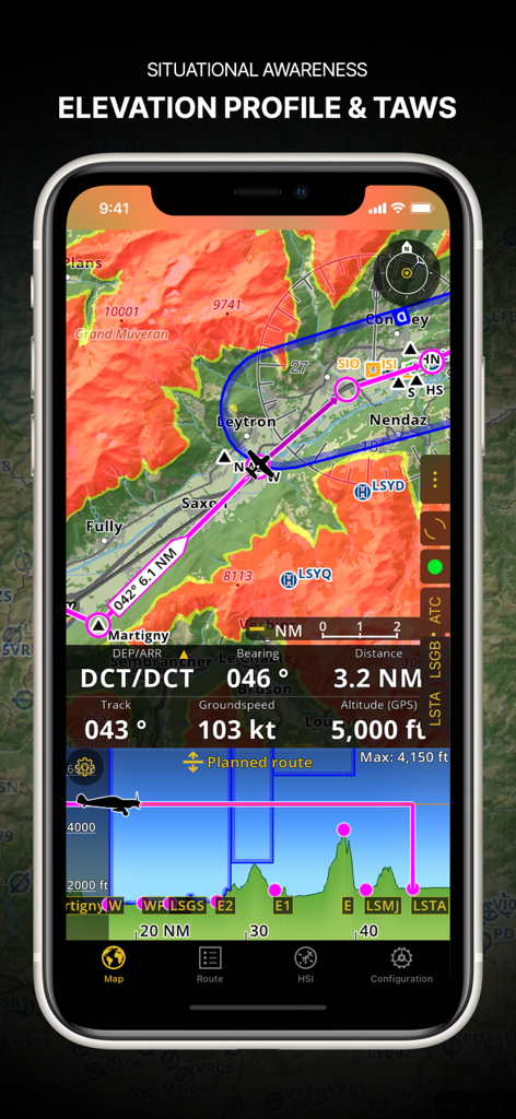
Air Navigation Pro screenshot showing elevation profile and terrain awareness warning system.
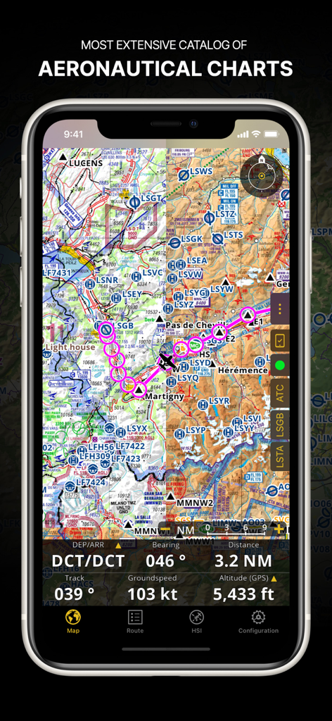
Air Navigation Pro app displaying a detailed aeronautical chart with a flight path and navigation data on a smartphone screen
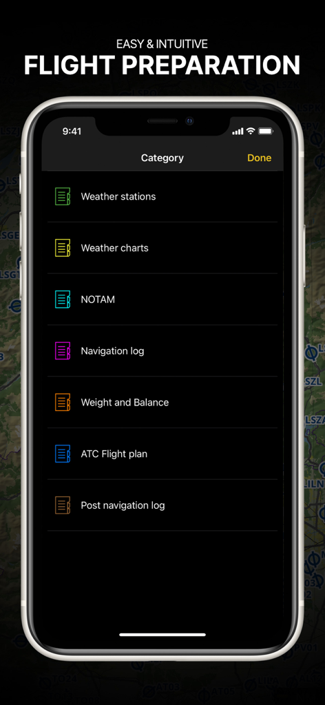
Air Navigation Pro app showing the flight preparation menu with briefing categories for pilots
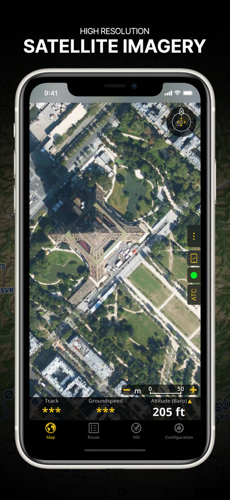
Air Navigation Pro app screenshot displaying high-resolution satellite imagery of the Eiffel Tower with flight data overlays
Description
Download
More Like This
Apps with similar features and user experience

Navigraph Charts
Navigraph KB

SkyDemon
Divelements Limited

Airports
Applicate Ltd

OzRunways EFB
OzRunways Pty. Ltd.

fDeck: flight instruments
Darren Yeates

Noisy Goose
Automata Solutions Ltd.

StationWeather - METAR and TAF
Oliver Puetz

Drone UAV Fly Forecast: AirMap
MONIQ TAP COMPANY LIMITED

Airmate
Myriel Aviation SA
This page is not an official page of the app or its developer, but an independent editorial publication created for informational and commentary purposes. Unless expressly stated otherwise, neither the app nor its developer is affiliated with, endorsed by, sponsored by, authorized by, or otherwise officially connected with MWM, Apple, Google Play, the app publisher, or the app's developer, and nothing on this page implies that the app was developed using MWM's services. Any trademarks, logos, screenshots, and other content remain the property of their respective owners.