This page is not an official page of the app or its developer, but an independent editorial publication created for informational and commentary purposes. Unless expressly stated otherwise, neither the app nor its developer is affiliated with, endorsed by, sponsored by, authorized by, or otherwise officially connected with MWM, Apple, Google Play, the app publisher, or the app's developer, and nothing on this page implies that the app was developed using MWM's services. Any trademarks, logos, screenshots, and other content remain the property of their respective owners.

OzRunways EFB
Experience Australia’s most trusted Electronic Flight Bag. Access world-class SkyVector maps, live weather radar, and comprehensive offline charts designed for safety and efficiency in every cockpit.
Downloads
267K+User Rating
Total Ratings
8K+Publisher
Category
NavigationLocales
5Latest Version
13.3.7Size
68.7 MBFirst Released
Dec 10, 2010Master the Skies with Professional Precision
OzRunways EFB provides a streamlined, high-performance navigation suite for pilots who demand global chart coverage and uncompromising offline reliability.
Global Chart Integration
Fly with confidence across borders using SkyVector global maps and official aeronautical charts for North America, Oceania, Africa, and beyond.
Built for Remote Operations
Never lose your way in dead zones. Download high-resolution maps for 100% offline use, perfect for mountain routes and long-haul ferry flights.
The following screenshots and description are sourced directly from the app's official store listing and are the property of the app developer.
App Store
Screenshots
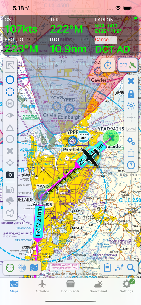
OzRunways EFB interface displaying a moving map with aeronautical charts and flight telemetry
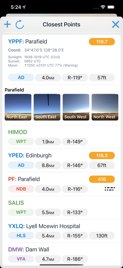
A mobile interface of OzRunways EFB displaying the closest aviation waypoints and airports with distances and bearings.
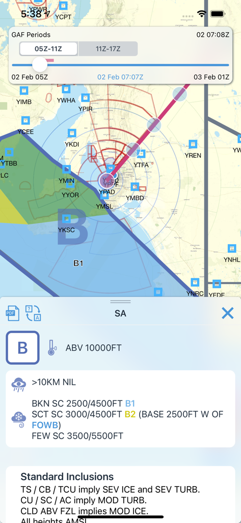
OzRunways EFB mobile app displaying a graphical area forecast map and aviation weather data
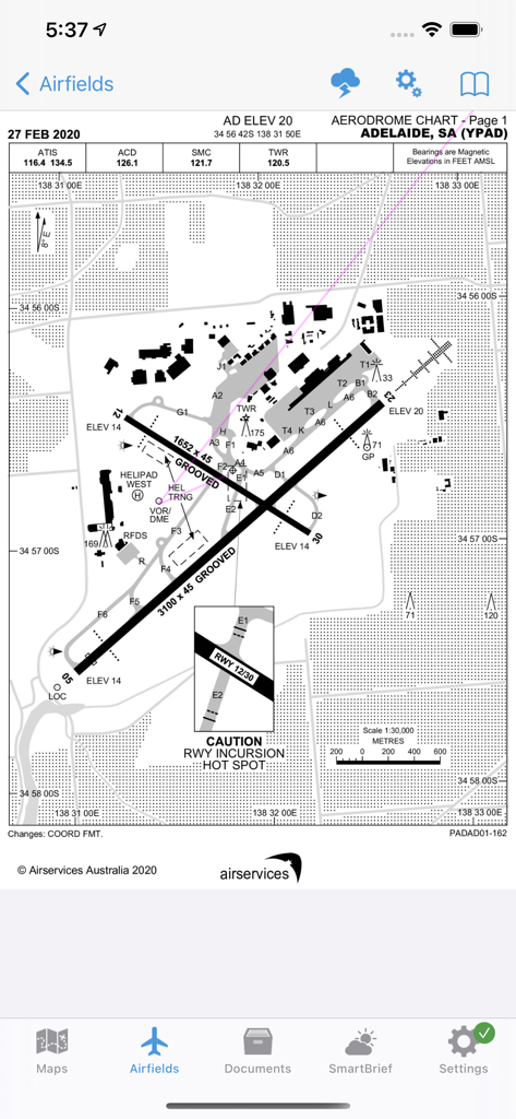
Aerodrome chart for Adelaide airport showing runways and taxiways in OzRunways EFB
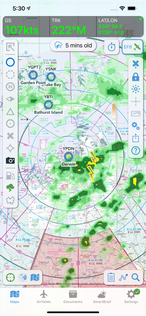
OzRunways EFB flight navigation interface displaying a GPS moving map with weather radar and lightning overlays over Northern Australia
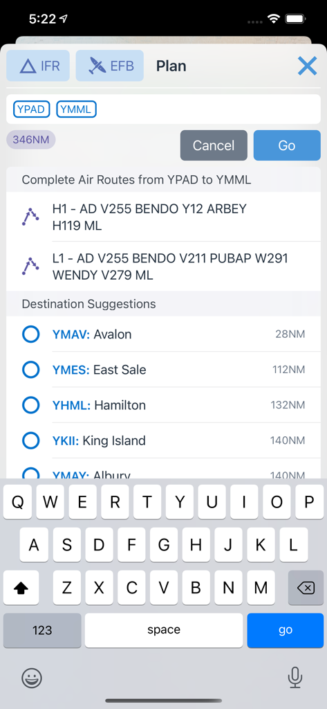
OzRunways EFB mobile app interface showing flight route planning and destination suggestions
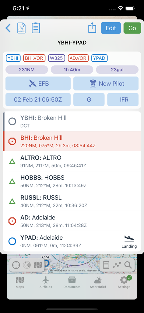
OzRunways EFB flight planning screen showing route waypoints and fuel estimates between Broken Hill and Adelaide.
Description
Download
More Like This
Apps with similar features and user experience

Navigraph Charts
Navigraph KB

SkyDemon
Divelements Limited

Airports
Applicate Ltd

fDeck: flight instruments
Darren Yeates

Noisy Goose
Automata Solutions Ltd.

StationWeather - METAR and TAF
Oliver Puetz

Drone UAV Fly Forecast: AirMap
MONIQ TAP COMPANY LIMITED

Airmate
Myriel Aviation SA

AvPlan EFB
BJA Consulting Pty Ltd
This page is not an official page of the app or its developer, but an independent editorial publication created for informational and commentary purposes. Unless expressly stated otherwise, neither the app nor its developer is affiliated with, endorsed by, sponsored by, authorized by, or otherwise officially connected with MWM, Apple, Google Play, the app publisher, or the app's developer, and nothing on this page implies that the app was developed using MWM's services. Any trademarks, logos, screenshots, and other content remain the property of their respective owners.