This page is not an official page of the app or its developer, but an independent editorial publication created for informational and commentary purposes. Unless expressly stated otherwise, neither the app nor its developer is affiliated with, endorsed by, sponsored by, authorized by, or otherwise officially connected with MWM, Apple, Google Play, the app publisher, or the app's developer, and nothing on this page implies that the app was developed using MWM's services. Any trademarks, logos, screenshots, and other content remain the property of their respective owners.

Drone UAV Fly Forecast: AirMap
Master the skies with real-time wind data, KP index tracking, and comprehensive No-Fly Zone maps. Get your custom 'Good-to-Fly' score to protect your equipment and stay compliant with FAA regulations.
Downloads
76K+User Rating
Total Ratings
300Publisher
Category
WeatherLocales
1Latest Version
1.6Size
57.5 MBFirst Released
Oct 24, 2024Fly with Absolute Confidence
The ultimate flight-planning toolkit designed to protect your equipment, ensure legal compliance, and help you capture the perfect shot every time.
Precision Risk Mitigation
Avoid costly crashes and GPS interference by monitoring real-time wind speeds, gust data, and KP Index levels tailored to your flight altitude.
Smart Airspace Compliance
Stay legal and avoid heavy FAA fines with interactive maps identifying No-Fly Zones, air traffic control areas, and temporary flight restrictions.
Frequently Asked Questions
Everything you need to know about Drone UAV Fly Forecast: AirMap
What is Drone UAV Fly Forecast: AirMap?
Yes, Drone UAV Fly Forecast: AirMap is an essential tool for drone pilots. It provides detailed weather forecasts, identifies air traffic control areas, and monitors no-fly zones to ensure safe and efficient flights.
Does Drone UAV Fly Forecast: AirMap provide real-time weather alerts?
Yes, Drone UAV Fly Forecast: AirMap provides real-time alerts. The app notifies users of any changes in conditions that could affect drone flights, including the arrival of storms or sudden weather changes.
Can I identify no-fly zones with the Drone UAV Fly Forecast: AirMap app?
Yes, the Drone UAV Fly Forecast: AirMap app helps identify no-fly zones and air traffic control areas using its drone map feature. This keeps pilots updated on local flight restrictions and regulations.
How does Drone UAV Fly Forecast: AirMap help plan safe drone flights?
Drone UAV Fly Forecast: AirMap helps plan safe flights by providing detailed weather forecasts like wind speed and temperature. It also identifies no-fly zones and suggests optimal flying times using a good-to-fly threshold.
What weather metrics does Drone UAV Fly Forecast: AirMap provide?
Drone UAV Fly Forecast: AirMap provides detailed weather forecasts including wind speed, temperature, KP index, precipitation, cloud coverage, visibility, and dew point. It also tracks these factors for drone camera stability.
Is Drone UAV Fly Forecast: AirMap a free application?
No, Drone UAV Fly Forecast: AirMap is free-to-install, but it is not entirely free. It contains premium features that require a purchase or subscription to access and utilize fully.
How do I manage subscriptions for Drone UAV Fly Forecast: AirMap?
Yes, you can manage your subscription for Drone UAV Fly Forecast: AirMap in your account settings. Here, you can also turn off the auto-renewal option. Subscriptions renew automatically unless cancelled 24 hours before the period ends.
Does Drone UAV Fly Forecast: AirMap suggest optimal flying times?
Yes, Drone UAV Fly Forecast: AirMap suggests the best times to fly. It uses a "Good-to-fly threshold" that considers weather metrics and your specific drone models to provide optimal flight recommendations.
Does Drone UAV Fly Forecast: AirMap support different map types?
Yes, Drone UAV Fly Forecast: AirMap supports various map types. These include Standard, Standard Satellite, Streets, Outdoor, Satellite, Satellite Streets, Light, Dark, Traffic Day, and Traffic Night views.
Can Drone UAV Fly Forecast: AirMap provide a visual chart for flight planning?
Yes, Drone UAV Fly Forecast: AirMap provides a visual chart to plan your drone flight. This chart displays forecast data for wind, temperature, dew point, and precipitation over an extended period.
The following screenshots and description are sourced directly from the app's official store listing and are the property of the app developer.
App Store
Screenshots

A drone pilot standing on a cliff edge overlooking a forested valley with a UAV in the sky
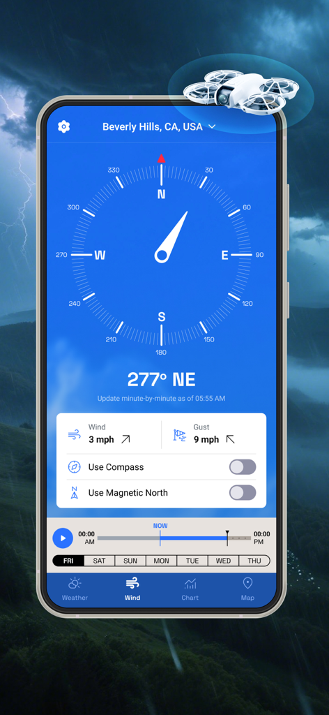
Interface of the drone flight forecast app showing wind speed gust data and a directional compass for Beverly Hills.
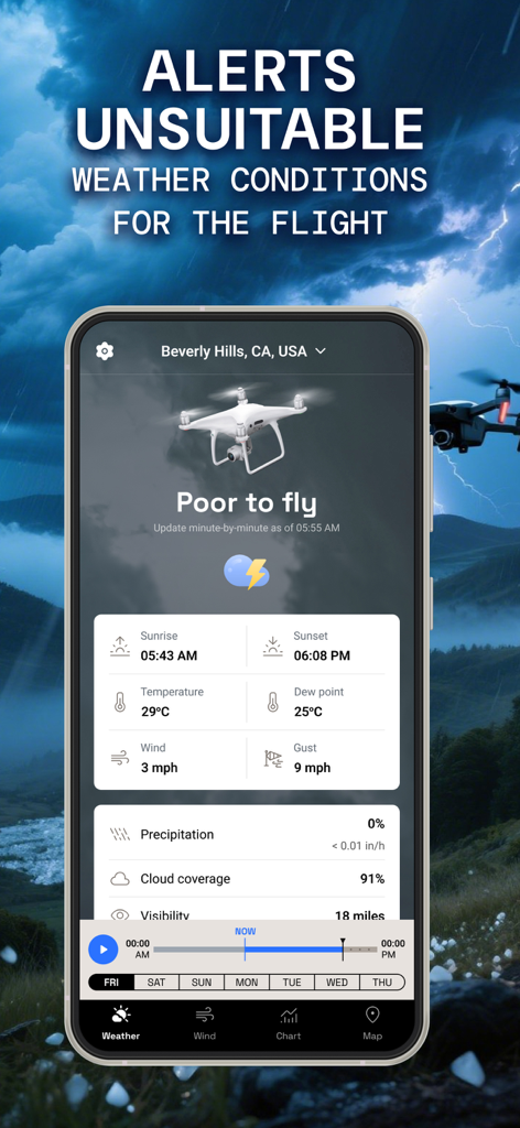
Smartphone app displaying poor to fly status with detailed weather alerts for drone pilots.
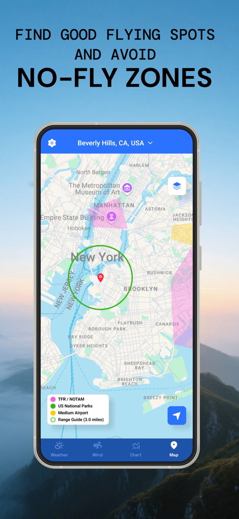
Drone map interface showing restricted flight areas and no fly zones in a city
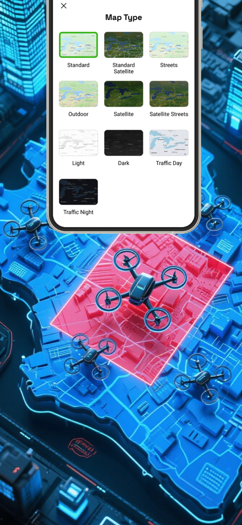
Interface showing multiple map type options including satellite and traffic views for drone flight planning
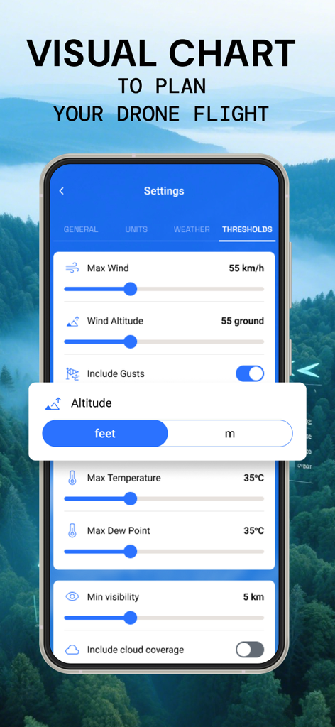
App settings screen showing customizable drone flight safety thresholds for wind and visibility
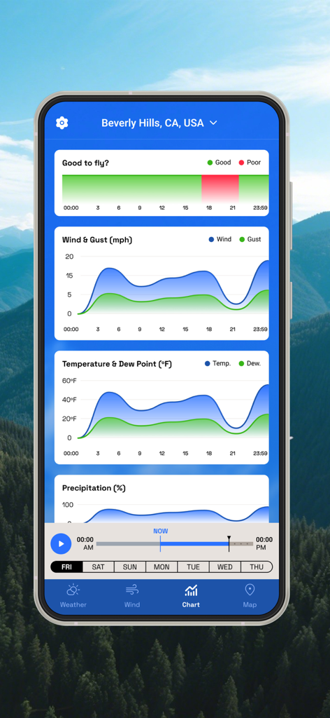
A mobile interface for drone pilots showing line graphs for wind speed temperature and precipitation with a good to fly safety indicator.
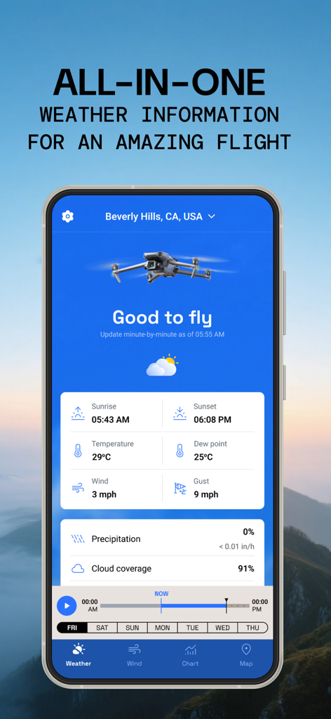
A mobile screen showing drone flight weather conditions like wind speed and temperature with a good to fly status.
Description
Download
More Like This
Apps with similar features and user experience

Navigraph Charts
Navigraph KB

SkyDemon
Divelements Limited

Airports
Applicate Ltd

OzRunways EFB
OzRunways Pty. Ltd.

fDeck: flight instruments
Darren Yeates

Noisy Goose
Automata Solutions Ltd.

StationWeather - METAR and TAF
Oliver Puetz

Airmate
Myriel Aviation SA

AvPlan EFB
BJA Consulting Pty Ltd
This page is not an official page of the app or its developer, but an independent editorial publication created for informational and commentary purposes. Unless expressly stated otherwise, neither the app nor its developer is affiliated with, endorsed by, sponsored by, authorized by, or otherwise officially connected with MWM, Apple, Google Play, the app publisher, or the app's developer, and nothing on this page implies that the app was developed using MWM's services. Any trademarks, logos, screenshots, and other content remain the property of their respective owners.