This page is not an official page of the app or its developer, but an independent editorial publication created for informational and commentary purposes. Unless expressly stated otherwise, neither the app nor its developer is affiliated with, endorsed by, sponsored by, authorized by, or otherwise officially connected with MWM, Apple, Google Play, the app publisher, or the app's developer, and nothing on this page implies that the app was developed using MWM's services. Any trademarks, logos, screenshots, and other content remain the property of their respective owners.

AvPlan EFB
Streamline your cockpit with FAA-certified charts, real-time weather overlays, and automated flight planning. Designed by pilots to enhance situational awareness and get you flying faster.
Downloads
315K+User Rating
Total Ratings
4K+Publisher
Category
NavigationLocales
2Latest Version
9.9.8Size
218.2 MBFirst Released
Aug 9, 2011Your Ultimate Cockpit Companion
AvPlan EFB streamlines everything from flight planning to landing, providing the professional-grade tools you need for a safer, more efficient journey.
Faster Pre-Flight Planning
Complete your FAA-compliant flight plans, weight and balance, and fuel calculations in minutes with our automated flight model engine.
Elite Situational Awareness
Navigate with confidence using live weather radar, geo-referenced airport diagrams, and proactive terrain and TFR alerts.
The following screenshots and description are sourced directly from the app's official store listing and are the property of the app developer.
App Store
Screenshots
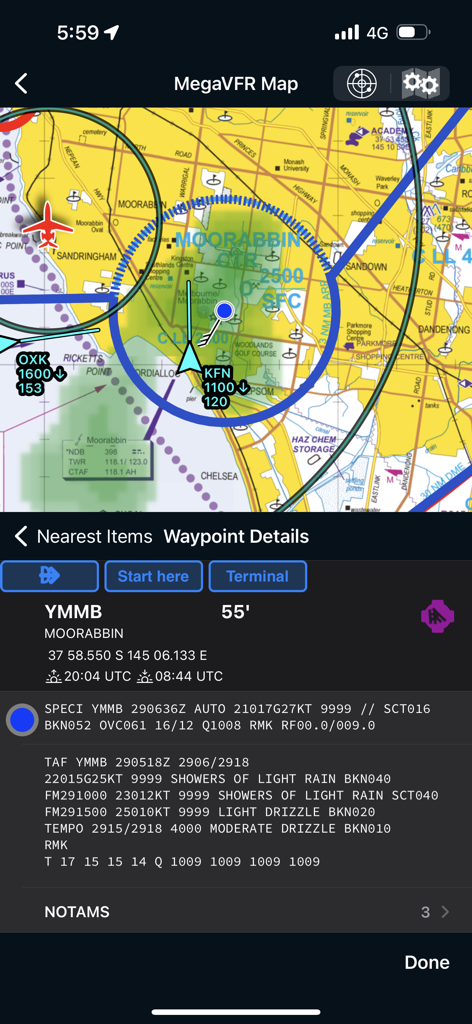
AvPlan EFB navigation screen showing aeronautical map and airport weather details
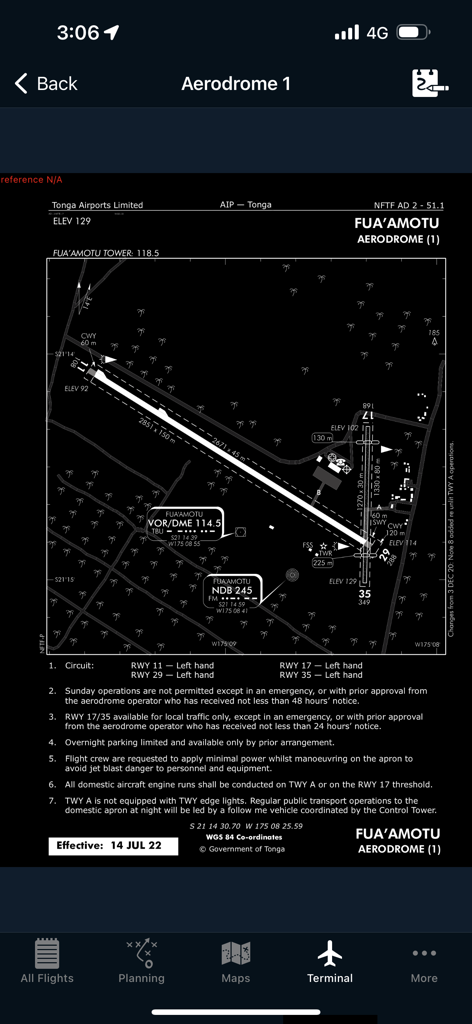
Detailed aerodrome diagram for Fuaamotu airport within the AvPlan EFB terminal interface
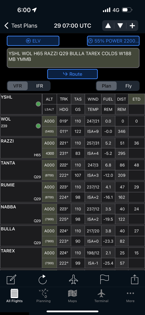
AvPlan EFB flight plan log showing waypoints and navigation data
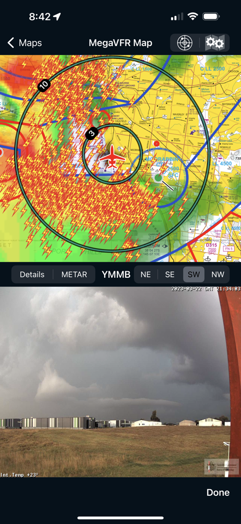
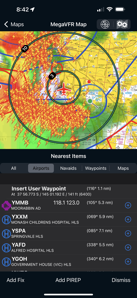
AvPlan EFB split screen showing a VFR map with lightning radar overlays and a live camera feed of Moorabbin Airport.
AvPlan EFB flight navigation screen with weather radar and airport list
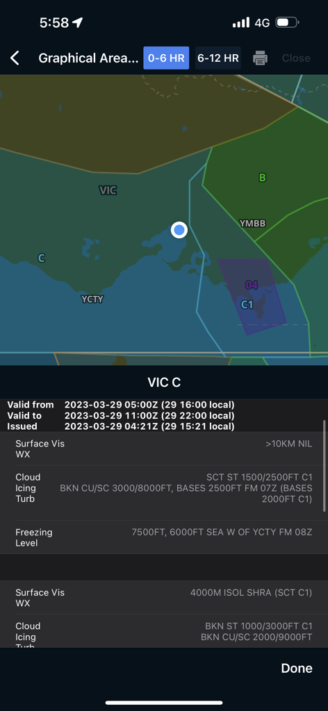
AvPlan EFB graphical weather forecast screen with map and visibility details
Description
Download
More Like This
Apps with similar features and user experience

Navigraph Charts
Navigraph KB

SkyDemon
Divelements Limited

Airports
Applicate Ltd

OzRunways EFB
OzRunways Pty. Ltd.

fDeck: flight instruments
Darren Yeates

Noisy Goose
Automata Solutions Ltd.

StationWeather - METAR and TAF
Oliver Puetz

Drone UAV Fly Forecast: AirMap
MONIQ TAP COMPANY LIMITED

Airmate
Myriel Aviation SA
This page is not an official page of the app or its developer, but an independent editorial publication created for informational and commentary purposes. Unless expressly stated otherwise, neither the app nor its developer is affiliated with, endorsed by, sponsored by, authorized by, or otherwise officially connected with MWM, Apple, Google Play, the app publisher, or the app's developer, and nothing on this page implies that the app was developed using MWM's services. Any trademarks, logos, screenshots, and other content remain the property of their respective owners.