This page is not an official page of the app or its developer, but an independent editorial publication created for informational and commentary purposes. Unless expressly stated otherwise, neither the app nor its developer is affiliated with, endorsed by, sponsored by, authorized by, or otherwise officially connected with MWM, Apple, Google Play, the app publisher, or the app's developer, and nothing on this page implies that the app was developed using MWM's services. Any trademarks, logos, screenshots, and other content remain the property of their respective owners.

OpenRunner – Bike, hike, trail
The elite route-planning tool for hikers, cyclists, and trail runners. Navigate with high-precision mapping, offline reliability, and real-time safety tracking for total peace of mind on every trail.
Downloads
496K+User Rating
Total Ratings
8K+Publisher
Category
Health & FitnessLocales
4Latest Version
2.9.1Size
89.5 MBFirst Released
Jun 2, 2017Engineer Your Perfect Adventure
From planning custom gravel loops to navigating remote trails, get the precision and safety features you need to explore with total confidence.
Precision Route Architecture
Plot custom paths for any activity with real-time elevation gain and distance metrics tailored to your specific performance goals.
Reliable Offline Safety
Download high-res maps for dead-zone navigation and use LiveTrack to keep loved ones updated on your position in real-time.
The following screenshots and description are sourced directly from the app's official store listing and are the property of the app developer.
App Store
Screenshots
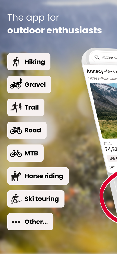
Interface of the OpenRunner app displaying a list of outdoor activities including hiking, gravel biking, and trail running
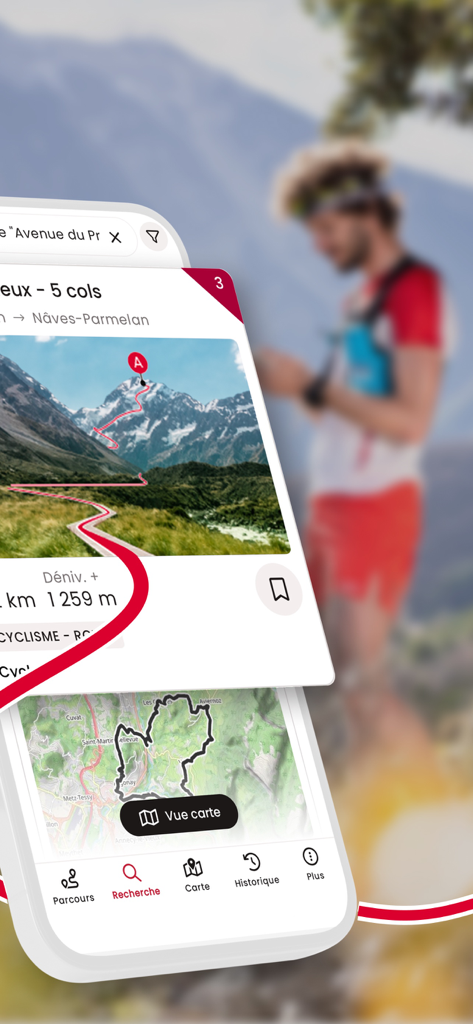
OpenRunner app interface showing a mountain hiking route with elevation details and map
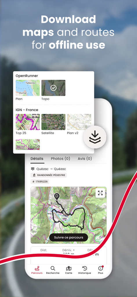
OpenRunner app interface showing options to download topographic maps and routes for offline use
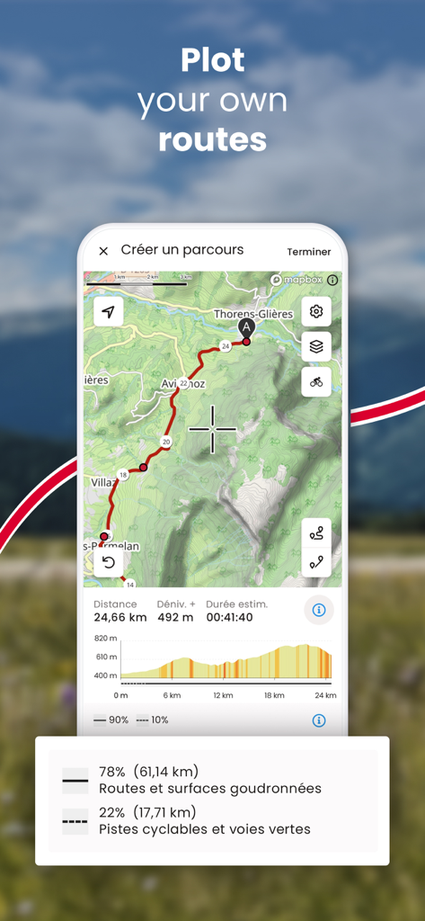
OpenRunner app interface for plotting custom outdoor routes with elevation profile and distance statistics.
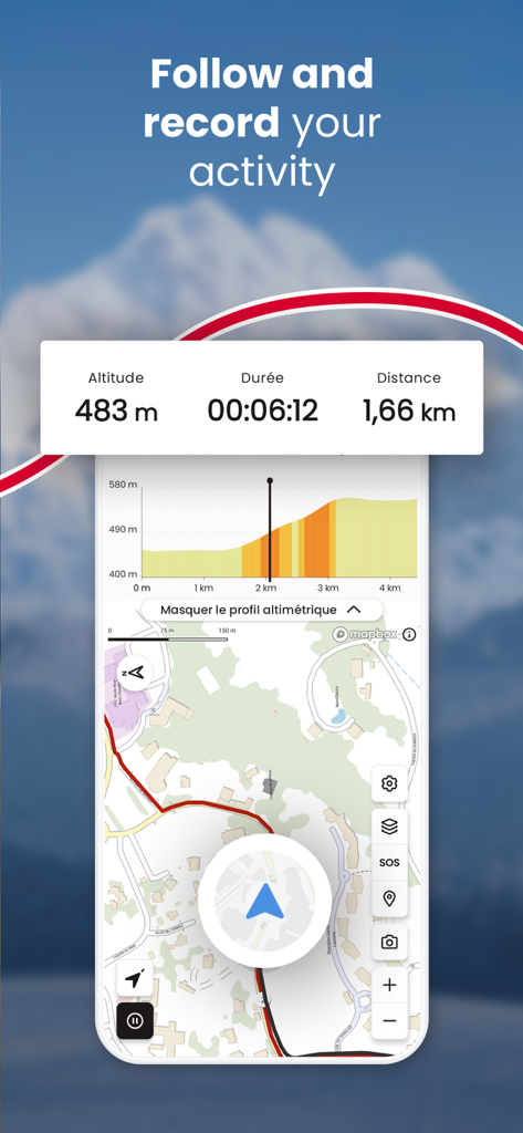
OpenRunner app screen showing live activity tracking with altitude duration distance and a map
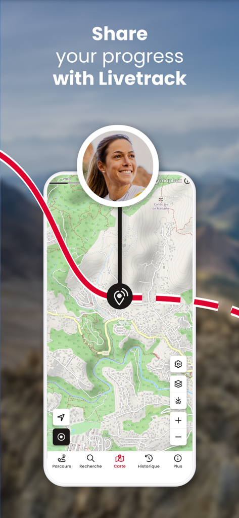
OpenRunner app screen showing the LiveTrack feature for sharing real-time progress on a topographical map.
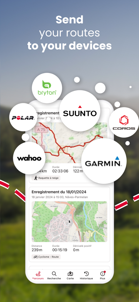
OpenRunner app interface showing route synchronization with GPS brands like Garmin, Suunto, and Wahoo
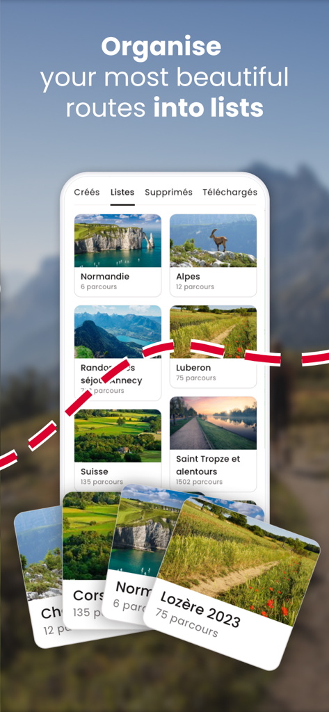
Mobile app interface of OpenRunner showing outdoor routes organized into custom lists like Alps and Normandy.
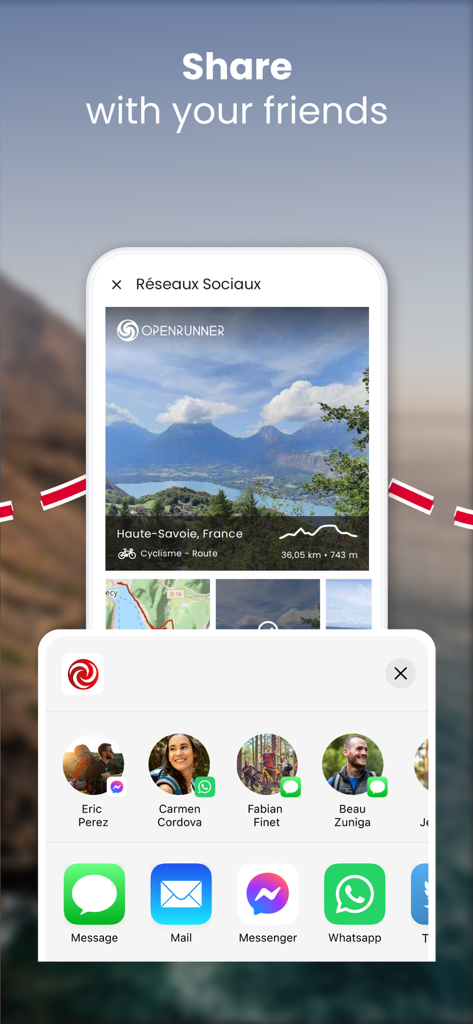
Mobile screen showing the OpenRunner app social sharing feature for a cycling route with messaging and social media icons
Description
Download
More Like This
Apps with similar features and user experience

AllTrails: Hike, Bike & Run
AllTrails, Inc.

Pedometer++
Cross Forward Consulting, LLC

Organic Maps: Offline Map
Organic Maps OU

Gaia GPS: Mobile Trail Maps
Trailbehind, INC.

Offline hiking maps: Mapy.com
Seznam.cz a.s.

Hiking Map Poland
Mapa Turystyczna sp. z o.o.

MapOut
Valnova GmbH

FarOut: Offline GPS Trail Maps
Atlas Guides DE, Inc.

Norgeskart
Norgeskart AS
This page is not an official page of the app or its developer, but an independent editorial publication created for informational and commentary purposes. Unless expressly stated otherwise, neither the app nor its developer is affiliated with, endorsed by, sponsored by, authorized by, or otherwise officially connected with MWM, Apple, Google Play, the app publisher, or the app's developer, and nothing on this page implies that the app was developed using MWM's services. Any trademarks, logos, screenshots, and other content remain the property of their respective owners.